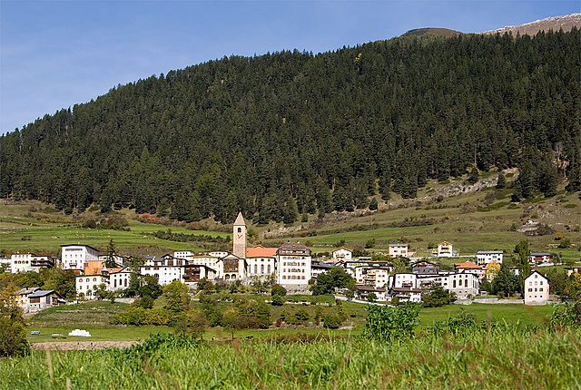
Наудерс (Nauders, Nauders)

 Hiking in Наудерс
Nauders, located in the Tyrol region of Austria, is a fantastic destination for hiking enthusiasts. Nestled near the borders of Italy and Switzerland, it offers breathtaking alpine scenery, diverse trails, and a rich natural environment.
Hiking Trails
Nauders boasts a variety of hiking trails suitable for all experience levels, from leisurely walks to challenging mountain hikes. Some popular trails include:
-
Bergsee Trail: This scenic hike takes you to the beautiful Bergsee lake, which is perfect for a relaxing picnic and offers stunning views of the surrounding mountains.
-
Schöne Aussicht Trail: This moderately challenging trail rewards hikers with panoramic views of the Nauders area and the Ötztal Alps. The trail features lush meadows and vibrant wildflowers in the summer.
-
Vespahütte Trail: A great option for families, this trail leads to a cozy mountain hut where hikers can enjoy traditional Tyrolean cuisine.
-
Tscheyeggal Trail: For a more strenuous hike, this option takes you to higher altitudes with spectacular vistas of the surrounding peaks, perfect for experienced hikers.
Best Time to Hike
The best time to hike in Nauders is during the late spring to early fall months (May to October). During this time, the weather is generally mild, the trails are well-maintained, and wildflowers bloom, creating picturesque landscapes.
Tips for Hiking in Nauders
- Check Weather Conditions: The weather can change rapidly in the mountains; always check the forecast before heading out.
- Pack Essentials: Bring plenty of water, snacks, a map or GPS device, and a first aid kit for safety.
- Wear Appropriate Gear: Good hiking boots and layers of clothing (to adjust to changing temperatures) are crucial for a comfortable experience.
- Leave No Trace: Be respectful of nature by following Leave No Trace principles and sticking to marked trails.
Additional Activities
Along with hiking, Nauders offers activities such as mountain biking, paragliding, and skiing in the winter months. The idyllic landscape also makes it a great place for photography and wildlife observation, with chances to see local fauna such as chamois and marmots.
In summary, Nauders is a wonderful hiking destination with a wide range of trails, breathtaking landscapes, and opportunities for various outdoor activities, making it a must-visit for nature lovers and hiking enthusiasts.
- Страна:

- Почтовый код: 6543
- Телефонный код: 0
- Код автомобильного номера: LA
- Координаты: 46° 52' 0" N, 10° 31' 0" E


- GPS треки (wikiloc): [Ссылка]
- Высота над уровнем моря: 1394 м m
- Площадь: 90.3 кв.км
- Население: 1542
- Веб сайт: http://www.nauders.tirol.gv.at/
- Википедия русская: wiki(ru)
- Википедия английская: wiki(en)
- Википедия национальная: wiki(de)
- Хранилище Wikidata: Wikidata: Q663202
- Катеория в википедии: [Ссылка]
- код Freebase: [/m/02vx_zj]
- код GeoNames: Альт: [2770910]
- код VIAF: Альт: [235072756]
- код GND: Альт: [4117778-2]
- код австрийского муниципалитета: [70615]
Граничит с регионами:


Курон-Веноста
- коммуна Италии
Hiking in Курон-Веноста
Graun im Vinschgau, located in the beautiful Vinschgau Valley of South Tyrol, Italy, is a fantastic destination for hikers. Surrounded by stunning alpine scenery, including the Ortler Alps and the Texel Group Nature Park, it offers a variety of trails suitable for all skill levels. Here are some highlights and tips for hiking in this region:...
- Страна:

- Почтовый код: 39020
- Телефонный код: 0473
- Код автомобильного номера: BZ
- Координаты: 46° 48' 30" N, 10° 32' 34" E
- GPS треки (wikiloc): [Ссылка]
- Высота над уровнем моря: 1520 м m
- Площадь: 209.65 кв.км
- Население: 2381
- Веб сайт: [Ссылка]


Пфундс
Hiking in Пфундс
Pfunds, a charming village located in the Tyrol region of Austria, is an excellent destination for hiking enthusiasts. Nestled in the picturesque Inn Valley, it serves as a gateway to numerous hiking trails that cater to different skill levels, from easy walks to challenging mountain hikes....
- Страна:
- Почтовый код: 6542
- Телефонный код: 05474
- Код автомобильного номера: LA
- Координаты: 46° 58' 0" N, 10° 33' 0" E
- GPS треки (wikiloc): [Ссылка]
- Высота над уровнем моря: 970 м m
- Площадь: 140.4 кв.км
- Население: 2602
- Веб сайт: [Ссылка]

Valsot
Hiking in Valsot
Valsot is a picturesque mountain area located in the Swiss Alps, renowned for its stunning landscapes and extensive network of hiking trails. Here’s an overview of what you can expect when hiking in Valsot:...
- Страна:

- Почтовый код: 7556, 7559
- Телефонный код: 081
- Код автомобильного номера: GR
- Координаты: 46° 50' 0" N, 10° 23' 0" E
- GPS треки (wikiloc): [Ссылка]
- Высота над уровнем моря: 1236 м m
- Площадь: 158.96 кв.км
- Население: 859
- Веб сайт: [Ссылка]