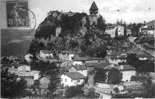
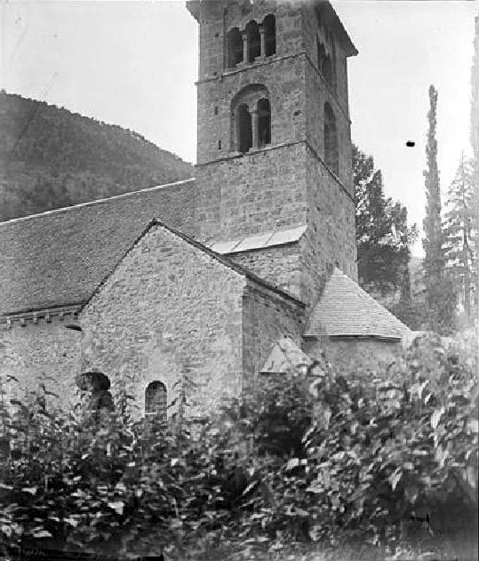
Лавар (Lavars, Lavars)

 Hiking in Лавар
Lavars is a small village located in the Auvergne-Rhône-Alpes region of France, known for its beautiful natural surroundings and potential hiking opportunities. While Lavars itself may not have extensive trails, it serves as a good base for exploring the surrounding areas, particularly the Vercors Regional Natural Park and the Chartreuse Mountains which are within a reasonable distance.
Hiking Opportunities Near Lavars:
-
Vercors Regional Natural Park:
- This park features a network of trails that cater to hikers of all levels. You can find panoramic views, limestone cliffs, and diverse fauna and flora.
- Popular trails include the ascent to the Mont Aiguille, which offers stunning views over the Vercors plateau.
-
Chartreuse Mountains:
- Located east of Lavars, the Chartreuse Mountains offer rugged terrain, deep valleys, and peaceful forests. Notable trails include those leading to the Grande Chartreuse monastery and various peaks such as Chamechaude.
- The trails vary from easy walks to challenging hikes, making it suitable for all hikers.
-
Local Hiking Trails:
- Explore the paths around Lavars itself for less strenuous options. These can often lead you through picturesque countryside and quaint villages, providing a taste of the local culture and scenery.
Tips for Hiking in the Area:
- Map and Navigation: Always have a good map or a GPS device. Trails can sometimes be poorly marked.
- Weather Conditions: Mountain weather can be unpredictable. Check forecasts before heading out and be prepared for changing conditions.
- Gear: Wear appropriate footwear (hiking boots recommended) and carry sufficient water, snacks, and layers of clothing.
- Respect Nature: Follow Leave No Trace principles to help preserve the natural beauty of the area.
Conclusion:
Hiking around Lavars offers a fantastic opportunity to explore the natural beauty of the French countryside and mountains. Whether you're an experienced hiker or a beginner, there are trails that can suit your preferences. Be sure to plan ahead and take the time to enjoy the breathtaking landscapes and serene environment.
- Страна:

- Почтовый код: 38710
- Координаты: 44° 50' 56" N, 5° 40' 21" E


- GPS треки (wikiloc): [Ссылка]
- Площадь: 14.8 кв.км
- Население: 149
- Википедия русская: wiki(ru)
- Википедия английская: wiki(en)
- Википедия национальная: wiki(fr)
- Хранилище Wikidata: Wikidata: Q630715
- Катеория в википедии: [Ссылка]
- код Freebase: [/m/03nvk53]
- код GeoNames: Альт: [6433223]
- номер SIREN: [213802085]
- код BNF: [15258023t]
- код муниципалитета INSEE: 38208
Граничит с регионами:


Клель
- коммуна во Франции
Hiking in Клель
Clelles is a charming village located in the French Alps, particularly known for its stunning landscapes and outdoor activities, making it a great spot for hiking enthusiasts. The area offers a variety of trails suitable for different skill levels, from leisurely walks to more challenging hikes....
- Страна:
- Почтовый код: 38930
- Координаты: 44° 49' 38" N, 5° 37' 23" E
- GPS треки (wikiloc): [Ссылка]
- Площадь: 20.88 кв.км
- Население: 571
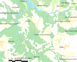
Корнийон-ан-Триев
- коммуна во Франции
Hiking in Корнийон-ан-Триев
Cornillon-en-Trièves is a charming village located in the Trièves region of the French Alps, in the department of Isère. It offers a range of hiking opportunities that showcase the stunning natural beauty of the surrounding landscape, including mountains, forests, and picturesque views of the surrounding valleys....
- Страна:
- Почтовый код: 38710
- Координаты: 44° 49' 46" N, 5° 43' 3" E
- GPS треки (wikiloc): [Ссылка]
- Площадь: 13.92 кв.км
- Население: 169


Перси
Hiking in Перси
Hiking in Percy, Isère, is a wonderful experience for outdoor enthusiasts, as it offers access to breathtaking landscapes and a variety of trails suitable for different skill levels. Located in the Auvergne-Rhône-Alpes region of France, Percy is surrounded by the stunning natural beauty of the Vercors massif and the Chartreuse mountains....
- Страна:
- Почтовый код: 38930
- Координаты: 44° 48' 5" N, 5° 38' 59" E
- GPS треки (wikiloc): [Ссылка]
- Площадь: 15.93 кв.км
- Население: 165
- Веб сайт: [Ссылка]

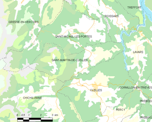
Сен-Мартен-де-Клель
- коммуна во Франции
Hiking in Сен-Мартен-де-Клель
Saint-Martin-de-Clelles is a small village located in the picturesque region of the French Alps, specifically in the department of Isère. This area is known for its stunning natural beauty, making it a great destination for hiking enthusiasts. Here are some highlights and tips about hiking in and around Saint-Martin-de-Clelles:...
- Страна:
- Почтовый код: 38930
- Координаты: 44° 50' 44" N, 5° 37' 18" E
- GPS треки (wikiloc): [Ссылка]
- Площадь: 14.72 кв.км
- Население: 181
- Веб сайт: [Ссылка]

Треффор
- коммуна во Франции
Hiking in Треффор
Treffort is a charming village located in the Auvergne-Rhône-Alpes region of southeastern France. It is surrounded by picturesque landscapes that offer a variety of hiking opportunities. Here’s what you can expect when hiking in and around Treffort:...
- Страна:
- Почтовый код: 38650
- Координаты: 44° 54' 56" N, 5° 39' 29" E
- GPS треки (wikiloc): [Ссылка]
- Высота над уровнем моря: 618 м m
- Площадь: 10.99 кв.км
- Население: 276

Мер-Савель
- коммуна во Франции
Hiking in Мер-Савель
Mayres-Savel, located in the Auvergne-Rhône-Alpes region of France, offers a variety of hiking opportunities that showcase its stunning natural beauty. The region is characterized by rugged landscapes, lush forests, and breathtaking vistas, making it an excellent destination for outdoor enthusiasts....
- Страна:
- Почтовый код: 38350
- Координаты: 44° 52' 28" N, 5° 43' 19" E
- GPS треки (wikiloc): [Ссылка]
- Площадь: 12.51 кв.км
- Население: 119
- Веб сайт: [Ссылка]


Руасар
- коммуна во Франции
Hiking in Руасар
Roissard is a charming village located in the French Alps, specifically in the Isère department, offering stunning natural beauty and a variety of hiking opportunities for outdoor enthusiasts. Here are some key points to consider if you’re looking to hike in and around Roissard:...
- Страна:
- Почтовый код: 38650
- Координаты: 44° 52' 56" N, 5° 38' 23" E
- GPS треки (wikiloc): [Ссылка]
- Площадь: 14.25 кв.км
- Население: 298
- Веб сайт: [Ссылка]