Лантиоль (Lentiol, Lentiol)

- коммуна во Франции
 Hiking in Лантиоль
Lentiol, a beautiful area in the French Alps, is a fantastic destination for hiking enthusiasts. Here are a few key points about hiking in Lentiol:
Stunning Varied Terrain
- Scenery: Lentiol features a mix of lush green valleys, rugged mountain trails, and captivating alpine lakes. You can expect breathtaking views of towering peaks and diverse wildlife.
- Difficulty Levels: There are trails suitable for all skill levels, from gentle walks suitable for families to more challenging climbs for experienced hikers.
Popular Hiking Trails
- Lentiol Ridge Circuit: A moderate loop that provides stunning views of the surrounding region, taking you through picturesque meadows and forests.
- Alpine Lake Trail: This trail leads to a serene alpine lake, perfect for a picnic or simply enjoying the tranquility of nature.
Wildlife and Flora
- Biodiversity: Hikers may encounter a variety of wildlife, including marmots, chamois, and various bird species. The area is also home to unique alpine flora, making it a great place for nature lovers.
- Best Season: The best time to hike is from late spring to early fall, when the trails are clear of snow and the flora is at its peak.
Safety and Preparation
- Gear: Ensure to wear proper hiking boots, and consider bringing trekking poles for steep sections. Layered clothing is recommended for changing weather conditions.
- Hydration and Snacks: Carry sufficient water and high-energy snacks, as some trails can be long and challenging.
Local Tips
- Guided Tours: If you’re unfamiliar with the area, consider hiring a local guide who can offer insights about the trails and the natural environment.
- Maps and Navigation: Always carry a detailed map or GPS device, as some trails can be less clearly marked.
With its stunning landscapes and variety of trails, Lentiol provides a wonderful hiking experience for those looking to explore the beauty of the French Alps. Always remember to plan your hikes according to your skill level and the weather conditions. Happy hiking!
- Страна:

- Почтовый код: 38270
- Координаты: 45° 17' 57" N, 5° 6' 48" E


- GPS треки (wikiloc): [Ссылка]
- Площадь: 7.6 кв.км
- Население: 217
- Википедия русская: wiki(ru)
- Википедия английская: wiki(en)
- Википедия национальная: wiki(fr)
- Хранилище Wikidata: Wikidata: Q1075780
- Катеория в википедии: [Ссылка]
- код Freebase: [/m/03nvk5g]
- код GeoNames: Альт: [6612509]
- номер SIREN: [213802093]
- код BNF: [152580245]
- код муниципалитета INSEE: 38209
Граничит с регионами:


Тодюр
- коммуна во Франции
Hiking in Тодюр
Thodure is a picturesque village located in the southern part of India, specifically in the state of Tamil Nadu. It is known for its serene landscapes, lush greenery, and accessible trails that attract both amateur and seasoned hikers. Here are some key points to consider for hiking in Thodure:...
- Страна:
- Почтовый код: 38260
- Координаты: 45° 19' 0" N, 5° 10' 7" E
- GPS треки (wikiloc): [Ссылка]
- Площадь: 14.43 кв.км
- Население: 745


Марколлен
- коммуна во Франции
Hiking in Марколлен
Marcollin is a charming commune in the Isère department of southeastern France, nestled at the foothills of the Alps. While it may not be as widely recognized as other hiking destinations, it offers beautiful landscapes, scenic views, and a variety of trails that cater to different skill levels....
- Страна:
- Почтовый код: 38270
- Координаты: 45° 18' 20" N, 5° 5' 16" E
- GPS треки (wikiloc): [Ссылка]
- Площадь: 10.69 кв.км
- Население: 661
- Веб сайт: [Ссылка]
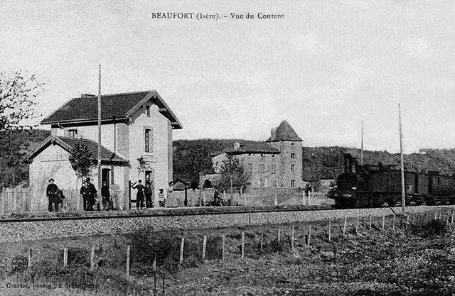

Бофор
- коммуна - Рона — Альпы, Изер, Гренобль
Hiking in Бофор
Beaufort, located in the Isère department of the Auvergne-Rhône-Alpes region in southeastern France, is a charming area known for its stunning alpine scenery and diverse hiking opportunities. Here are some highlights about hiking in this region:...
- Страна:
- Почтовый код: 38270
- Координаты: 45° 19' 35" N, 5° 7' 19" E
- GPS треки (wikiloc): [Ссылка]
- Высота над уровнем моря: 280 м m
- Площадь: 8.69 кв.км
- Население: 564


Lens-Lestang
- коммуна во Франции
Hiking in Lens-Lestang
Lens-Lestang is a charming commune located in the Drôme department of southeastern France. It offers a wonderful opportunity for hiking enthusiasts to explore scenic landscapes, picturesque villages, and diverse ecosystems. Here are some key points to consider when planning a hike in and around Lens-Lestang:...
- Страна:
- Почтовый код: 26210
- Координаты: 45° 17' 30" N, 5° 2' 33" E
- GPS треки (wikiloc): [Ссылка]
- Площадь: 16.41 кв.км
- Население: 837
- Веб сайт: [Ссылка]


Hauterives
- коммуна во Франции
Hiking in Hauterives
Hauterives is a charming village located in the Drôme department of southeastern France, known for its scenic landscapes and rich cultural heritage. While it might not be as well-known as some major hiking destinations, it offers several opportunities for those looking to explore nature and enjoy the outdoors....
- Страна:
- Почтовый код: 26390
- Координаты: 45° 15' 20" N, 5° 1' 35" E
- GPS треки (wikiloc): [Ссылка]
- Площадь: 30.51 кв.км
- Население: 1904


Le Grand-Serre
- коммуна во Франции
Hiking in Le Grand-Serre
Le Grand-Serre is a beautiful hiking destination located in the French Alps, specifically in the department of Isère. This area offers stunning mountain scenery, diverse wildlife, and a variety of trails suitable for different skill levels. Here are some key points to consider when planning a hike in Le Grand-Serre:...
- Страна:
- Почтовый код: 26530
- Координаты: 45° 16' 12" N, 5° 6' 12" E
- GPS треки (wikiloc): [Ссылка]
- Площадь: 24.74 кв.км
- Население: 902