.jpg)
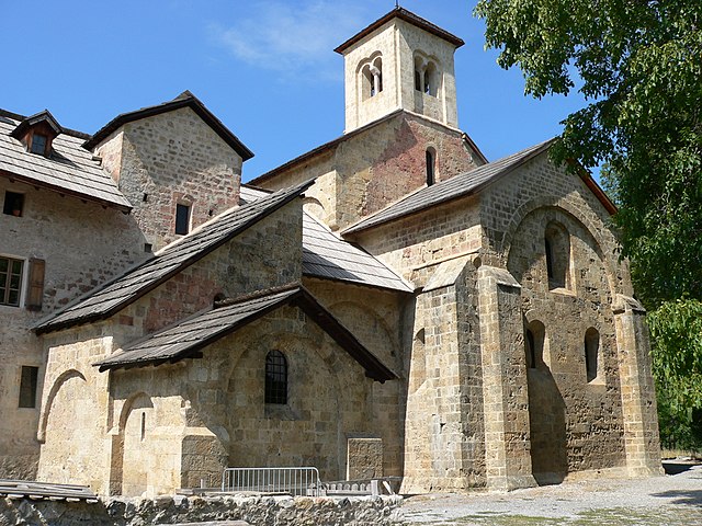
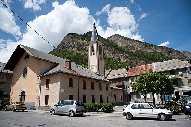
Лез-Ор (Les Orres, Les Orres)
- коммуна во Франции
 Hiking in Лез-Ор
Les Orres, located in the French Alps, is a fantastic destination for hiking enthusiasts. This charming mountain resort offers a variety of trails suitable for all levels, from beginners to experienced hikers. Here’s an overview to help you plan your hiking experience in Les Orres:
Scenery and Wildlife
The region is renowned for its stunning landscapes, featuring panoramic views of the surrounding mountains, lush forests, and beautiful alpine meadows. You may also encounter diverse wildlife, including chamois, marmots, and various bird species.
Hiking Trails
-
Family-friendly Trails: There are easy, well-marked paths that are perfect for families and casual walkers. These trails often connect various points of interest, such as viewpoints or picnic areas.
-
Moderate Trails: If you're looking for a bit more of a challenge, you can find moderate trails that include some elevation gain and rocky sections, leading to breathtaking vistas.
-
Difficult Trails: For experienced hikers, Les Orres offers more demanding routes that take you higher into the mountains, often requiring proper gear and physical fitness. These paths usually reward hikers with stunning views and a sense of accomplishment.
Seasonal Hiking
- Summer: The best time for hiking is during the summer months when the weather is typically warm and pleasant. Snow melts, revealing trails and breathtaking wildflowers.
- Autumn: The fall offers an opportunity to see vibrant autumn colors, making hikes particularly scenic.
Practical Tips
- Maps and Guides: It’s advisable to obtain a map of the area or download hiking apps that provide trail information.
- Hydration and Nutrition: Always carry ample water and snacks, especially on longer hikes.
- Gear: Wear proper hiking boots, and consider bringing trekking poles for added stability. Dress in layers, as mountain weather can change rapidly.
- Safety: Inform someone of your hiking plans and estimated return time, especially if you're heading into less-trafficked areas.
Local Amenities
Les Orres has shops, restaurants, and accommodations which can be useful for planning your hiking trip. You might also find guided hike options and workshops that can enhance your adventure.
Conclusion
Hiking in Les Orres is a unique experience that combines natural beauty with outdoor adventure. Whether you seek relaxation or challenge, there are plenty of options to explore this stunning region. Enjoy your hiking adventure!
- Страна:

- Почтовый код: 05200
- Координаты: 44° 30' 50" N, 6° 33' 3" E


- GPS треки (wikiloc): [Ссылка]
- Высота над уровнем моря: 1460 м m
- Площадь: 74.79 кв.км
- Население: 569
- Веб сайт: http://www.lesorres.com
- Википедия русская: wiki(ru)
- Википедия английская: wiki(en)
- Википедия национальная: wiki(fr)
- Хранилище Wikidata: Wikidata: Q1086670
- Катеория в википедии: [Ссылка]
- код Freebase: [/m/03mfpwr]
- код Freebase: [/m/03mfpwr]
- код GeoNames: Альт: [3000116]
- код GeoNames: Альт: [3000116]
- номер SIREN: [210500989]
- номер SIREN: [210500989]
- код BNF: [12199841f]
- код BNF: [12199841f]
- код VIAF: Альт: [123606586]
- код VIAF: Альт: [123606586]
- код LCNAF: Альт: [nr93019796]
- код LCNAF: Альт: [nr93019796]
- код тезауруса PACTOLS: [pcrtqIl4tAF54t]
- код тезауруса PACTOLS: [pcrtqIl4tAF54t]
- код муниципалитета INSEE: 05098
- код муниципалитета INSEE: 05098
Граничит с регионами:
Кро
- коммуна во Франции
Hiking in Кро
Crots, located in the French Alps within the Hautes-Alpes department, is a beautiful destination for hiking enthusiasts. The area is known for its stunning landscapes, including mountains, valleys, and picturesque villages. If you're planning a hiking trip in Crots, here are some key points to consider:...
- Страна:
- Почтовый код: 05200
- Координаты: 44° 32' 1" N, 6° 28' 16" E
- GPS треки (wikiloc): [Ссылка]
- Высота над уровнем моря: 790 м m
- Площадь: 53.84 кв.км
- Население: 1022

Ле-Тюиль
- коммуна во Франции
Hiking in Ле-Тюиль
Les Thuiles is a picturesque village located in the French region of Provence-Alpes-Côte d'Azur, specifically in the Alpes-de-Haute-Provence department. Hiking in this area offers a wonderful experience, as it is surrounded by stunning natural landscapes, including mountains, valleys, and forests....
- Страна:
- Почтовый код: 04400
- Координаты: 44° 23' 35" N, 6° 34' 16" E
- GPS треки (wikiloc): [Ссылка]
- Площадь: 32.8 кв.км
- Население: 398

Сен-Пон
Hiking in Сен-Пон
Saint-Pons, located in the Alpes-de-Haute-Provence region of France, is a fantastic destination for hiking enthusiasts. Known for its stunning natural scenery, diverse landscapes, and relatively mild climate, it offers a variety of trails suitable for different skill levels. Here are some key features and tips for hiking in this area:...
- Страна:
- Почтовый код: 04400
- Координаты: 44° 23' 32" N, 6° 37' 40" E
- GPS треки (wikiloc): [Ссылка]
- Площадь: 32.06 кв.км
- Население: 647
- Веб сайт: [Ссылка]

Меолан-Ревель
- коммуна во Франции
Hiking in Меолан-Ревель
Méolans-Revel is a charming commune located in the Alpes-de-Haute-Provence region of southeastern France, known for its beautiful landscapes and outdoor recreational opportunities. Here’s an overview of hiking in this area:...
- Страна:
- Почтовый код: 04340
- Координаты: 44° 24' 5" N, 6° 30' 42" E
- GPS треки (wikiloc): [Ссылка]
- Высота над уровнем моря: 1040 м m
- Площадь: 127.74 кв.км
- Население: 337

Сен-Совёр
Hiking in Сен-Совёр
Saint-Sauveur in the Hautes-Alpes region of France is a beautiful destination for hiking enthusiasts. Nestled in the French Alps, it offers stunning landscapes, diverse terrain, and a variety of trails suitable for different skill levels. Here are some key points about hiking in this area:...
- Страна:
- Почтовый код: 05200
- Координаты: 44° 32' 27" N, 6° 31' 13" E
- GPS треки (wikiloc): [Ссылка]
- Площадь: 24.18 кв.км
- Население: 454
Ла-Кондамин-Шатлар
- коммуна во Франции
Hiking in Ла-Кондамин-Шатлар
La Condamine-Châtelard is a picturesque village located in the Alpes-Maritimes region of France, near the Italian border. It's a part of the larger area of the French Alps, known for its stunning natural landscapes and outdoor recreational opportunities, including hiking....
- Страна:
- Почтовый код: 04530
- Координаты: 44° 27' 29" N, 6° 44' 45" E
- GPS треки (wikiloc): [Ссылка]
- Высота над уровнем моря: 1305 м m
- Площадь: 56.08 кв.км
- Население: 172

Баратье
- коммуна во Франции
Hiking in Баратье
Baratier, a small commune located in the French Alps near the Écrins National Park, offers stunning landscapes and a variety of hiking opportunities. Here are some key points to consider when exploring this beautiful area:...
- Страна:
- Почтовый код: 05200
- Координаты: 44° 32' 16" N, 6° 29' 43" E
- GPS треки (wikiloc): [Ссылка]
- Площадь: 15.99 кв.км
- Население: 559

Креву
- коммуна во Франции
Hiking in Креву
Crévoux is a picturesque village located in the French Alps, part of the Hautes-Alpes department, and is often celebrated for its stunning natural beauty and outdoor recreational opportunities, including fantastic hiking trails. Here are some highlights to help you prepare for a hiking adventure in Crévoux:...
- Страна:
- Почтовый код: 05200
- Координаты: 44° 32' 53" N, 6° 36' 26" E
- GPS треки (wikiloc): [Ссылка]
- Площадь: 56.26 кв.км
- Население: 140