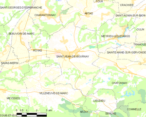
Льёдьё (Lieudieu, Lieudieu)

- коммуна во Франции
 Hiking in Льёдьё
Lieudieu is a scenic area located in the Auvergne-Rhône-Alpes region of France, nestled in the beautiful landscapes of the Alps. Hiking in this region can offer breathtaking views, diverse terrain, and opportunities to explore both nature and local culture.
Hiking Trails
-
Mountain Trails: Lieudieu is situated near various mountain ranges, providing numerous trails suitable for different skill levels. You can enjoy day hikes or more extended treks depending on your experience.
-
Scenic Routes: The trails often lead through picturesque landscapes, including forests, alpine meadows, and views of distant peaks. Look for trails that incorporate lookout points for the best photographic opportunities.
-
Wildlife Observation: As you hike, stay alert for the local wildlife. The area is home to various species of birds, deer, and other alpine animals. Early morning hikes can offer the best chances for sightings.
Preparation
- Weather Considerations: The weather can change quickly in the mountains. Make sure to check forecasts before heading out and dress in layers for comfort.
- Maps and Guides: It’s advisable to carry a physical map or download offline maps due to potential poor cell service. Local tourism offices may have detailed guides to the area’s trails.
- Safety Measures: Always inform someone of your hiking plans and estimated return time. Carry a first aid kit, sufficient water, snacks, and necessary hiking gear.
Getting There
Access to hiking trails in the Lieudieu area can usually be achieved by car. Look for parking areas designated for hikers.
Local Culture
Embrace the local culture by visiting nearby villages or markets. Try local dishes in small restaurants or cafés to fuel up before or after your hikes.
Conclusion
Hiking in Lieudieu is ideal for nature lovers and adventure seekers alike. With its stunning landscapes and well-preserved environment, it’s a fantastic place to explore on foot. Just remember to prepare adequately and respect the natural surroundings during your adventure. Happy hiking!
- Страна:

- Почтовый код: 38440
- Координаты: 45° 27' 30" N, 5° 10' 53" E


- GPS треки (wikiloc): [Ссылка]
- Площадь: 5.94 кв.км
- Население: 341
- Википедия русская: wiki(ru)
- Википедия английская: wiki(en)
- Википедия национальная: wiki(fr)
- Хранилище Wikidata: Wikidata: Q1069460
- Катеория в википедии: [Ссылка]
- код Freebase: [/m/03nvjvg]
- код GeoNames: Альт: [6433226]
- номер SIREN: [213802119]
- код BNF: [15258026v]
- код муниципалитета INSEE: 38211
Граничит с регионами:

Сен-Жан-де-Бурне
- коммуна во Франции
Hiking in Сен-Жан-де-Бурне
Saint-Jean-de-Bournay is a charming commune located in the Isère department of the Auvergne-Rhône-Alpes region in southeastern France. The surrounding area is characterized by diverse landscapes, including low valleys, rolling hills, and scenic views, making it a great destination for hiking enthusiasts....
- Страна:
- Почтовый код: 38440
- Координаты: 45° 30' 8" N, 5° 8' 16" E
- GPS треки (wikiloc): [Ссылка]
- Площадь: 26.87 кв.км
- Население: 4622
- Веб сайт: [Ссылка]


Вильнев-де-Марк
- коммуна во Франции
Hiking in Вильнев-де-Марк
Villeneuve-de-Marc is a charming village located in the Auvergne-Rhône-Alpes region of France. It's situated near the Rhône River and offers a picturesque landscape that is perfect for hiking enthusiasts. Here are some details to help you plan a hiking trip in and around Villeneuve-de-Marc:...
- Страна:
- Почтовый код: 38440
- Координаты: 45° 28' 33" N, 5° 6' 8" E
- GPS треки (wikiloc): [Ссылка]
- Площадь: 26.18 кв.км
- Население: 1140
- Веб сайт: [Ссылка]


Семон
- коммуна во Франции
Hiking in Семон
It seems like there may be a slight misspelling or misunderstanding regarding the location "Semons." If you meant "Semon," "Semon Mountain," or perhaps a different location known for hiking (like the area around Semons or another name similar), please clarify....
- Страна:
- Почтовый код: 38260
- Координаты: 45° 25' 56" N, 5° 11' 41" E
- GPS треки (wikiloc): [Ссылка]
- Площадь: 10.55 кв.км
- Население: 362
- Веб сайт: [Ссылка]

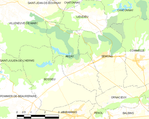
Арзе
- коммуна во Франции
Hiking in Арзе
As of my last update, there's limited information specifically about "Arzay" as a hiking destination. It's possible that you might be referring to a less-known area or there might be a misspelling. However, I can provide general hiking tips and suggestions for exploring regions that might include areas like Arzay if they are situated near popular hiking destinations....
- Страна:
- Почтовый код: 38260
- Координаты: 45° 25' 32" N, 5° 10' 13" E
- GPS треки (wikiloc): [Ссылка]
- Площадь: 9.79 кв.км
- Население: 226


Шатонне
- коммуна во Франции
Hiking in Шатонне
Châtonnay is a charming village located in the Isère department of the Auvergne-Rhône-Alpes region in France, offering beautiful landscapes and a variety of hiking opportunities. While it may not be as well-known as some of the larger national parks or hiking destinations in France, the surrounding areas feature picturesque scenery, including rolling hills, forests, and valleys....
- Страна:
- Почтовый код: 38440
- Координаты: 45° 29' 9" N, 5° 12' 25" E
- GPS треки (wikiloc): [Ссылка]
- Площадь: 31.84 кв.км
- Население: 2070
- Веб сайт: [Ссылка]