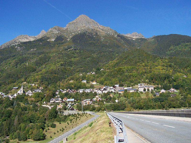
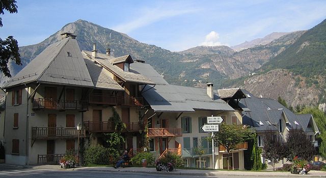
Ливе-э-Гаве (Livet-et-Gavet, Livet-et-Gavet)

- коммуна во Франции
 Hiking in Ливе-э-Гаве
Livet-et-Gavet, located in the Auvergne-Rhône-Alpes region of France, is a picturesque destination for hiking enthusiasts. This area is characterized by its stunning natural landscapes, including lush forests, rivers, and mountainous terrain. Here are some highlights and tips for hiking in Livet-et-Gavet:
Scenic Trails
-
Les Gorges de l'Eau d'Olle: This is a beautiful trail that offers views of the gorges and the rivers, with opportunities to see waterfalls and diverse flora and fauna. The trail can vary in difficulty, so be sure to check the specifics before heading out.
-
Col de la Croix de Fer: This area offers access to several hiking routes, including climbs to higher altitudes for panoramic views of the Alps. It provides a mix of challenging ascents and easier walks.
-
The Vercors Regional Natural Park: While not directly in Livet-et-Gavet, this nearby park offers stunning hiking opportunities with diverse ecosystems, limestone cliffs, and unique geological formations.
Preparing for Your Hike
- Weather: Always check the weather forecast before your hike. Conditions can change rapidly in mountain areas.
- Gear: Wear sturdy hiking boots, and bring layers of clothing to adjust to changing temperatures. A waterproof jacket is a good idea, especially in spring and autumn.
- Navigation: Maps are essential, as well as knowledge of GPS or trail apps, especially if you are venturing off well-marked paths.
Safety Tips
- Stay Hydrated: Bring plenty of water, especially for longer hikes. Consider using a hydration pack for convenience.
- Tell Someone: Inform a friend or family member of your hiking plans and estimated return time.
- Wildlife: Be aware of local wildlife and maintain a safe distance from any animals you encounter.
Local Amenities
- Livet-et-Gavet has small shops and cafes where you can refuel after your hikes. Enjoying some local cuisine, such as cheese and charcuterie from the region, is highly recommended.
Seasons
- Spring and Autumn: These are ideal seasons for hiking, offering mild temperatures and the beauty of blooming flowers or autumn leaves.
- Summer: Although beautiful, be prepared for more crowds on popular trails.
- Winter: Some trails may be covered in snow, and suitable winter gear and experience in snow hiking or snowshoeing are necessary.
Remember to respect nature, stick to marked trails, and enjoy the beautiful surroundings Livet-et-Gavet has to offer!
- Страна:

- Почтовый код: 38220
- Координаты: 45° 5' 28" N, 5° 54' 9" E


- GPS треки (wikiloc): [Ссылка]
- Площадь: 46.54 кв.км
- Население: 1296
- Веб сайт: http://www.mairie-livetgavet.fr
- Википедия русская: wiki(ru)
- Википедия английская: wiki(en)
- Википедия национальная: wiki(fr)
- Хранилище Wikidata: Wikidata: Q964062
- Катеория в википедии: [Ссылка]
- код Freebase: [/m/03nvhn9]
- код GeoNames: Альт: [2998072]
- номер SIREN: [213802127]
- код BNF: [152580276]
- код VIAF: Альт: [125944622]
- код LCNAF: Альт: [nr94019490]
- код муниципалитета INSEE: 38212
Граничит с регионами:


Лавальдан
- коммуна во Франции
Hiking in Лавальдан
Lavaldens is a beautiful destination for hiking enthusiasts, located in the stunning region of the Italian Alps, specifically within the Province of Trento. The area is known for its picturesque landscapes, charming villages, and a variety of trails suitable for different levels of hikers. Here are some key points to consider when hiking in Lavaldens:...
- Страна:
- Почтовый код: 38350
- Координаты: 44° 58' 58" N, 5° 53' 15" E
- GPS треки (wikiloc): [Ссылка]
- Площадь: 41.4 кв.км
- Население: 163


Ревель
Hiking in Ревель
Revel, located in the Isère department of the Auvergne-Rhône-Alpes region in southeastern France, is a fantastic destination for hiking enthusiasts. The area is characterized by its stunning alpine scenery, diverse landscapes, and a variety of trails suitable for different skill levels. Here are some highlights and tips for hiking in Revel:...
- Страна:
- Почтовый код: 38420
- Координаты: 45° 11' 9" N, 5° 52' 5" E
- GPS треки (wikiloc): [Ссылка]
- Площадь: 29.55 кв.км
- Население: 1340
- Веб сайт: [Ссылка]

Аллемон
- коммуна во Франции
Hiking in Аллемон
Allemont is a picturesque village located in the French Alps, specifically in the Isère department. It serves as a gateway to the Vaujany valley and nearby hiking routes in the Oisans region, making it a great base for outdoor enthusiasts. Here are some highlights and considerations for hiking in and around Allemont:...
- Страна:
- Почтовый код: 38114
- Координаты: 45° 7' 49" N, 6° 2' 15" E
- GPS треки (wikiloc): [Ссылка]
- Площадь: 44.75 кв.км
- Население: 1006
- Веб сайт: [Ссылка]

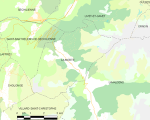
Ла-Морт
- коммуна во Франции
Hiking in Ла-Морт
La Morte, located in the French Alps, is a lesser-known but breathtaking area for hiking enthusiasts. It is characterized by its stunning landscapes, including rugged mountains, lush valleys, and pristine lakes. Here are some key points to consider when hiking in La Morte:...
- Страна:
- Почтовый код: 38350
- Координаты: 45° 1' 47" N, 5° 51' 22" E
- GPS треки (wikiloc): [Ссылка]
- Площадь: 19.45 кв.км
- Население: 133
- Веб сайт: [Ссылка]

Уль
- коммуна во Франции
Hiking in Уль
Oulles is a small, picturesque village located in the French Alps, known for its stunning natural beauty and excellent hiking opportunities. Situated in the Isère department, it offers a variety of trails suitable for different skill levels, making it a great destination for both novice and experienced hikers....
- Страна:
- Почтовый код: 38520
- Координаты: 45° 4' 27" N, 5° 58' 58" E
- GPS треки (wikiloc): [Ссылка]
- Площадь: 11.01 кв.км
- Население: 9
- Веб сайт: [Ссылка]


Сен-Бартельми-де-Сешильенн
- коммуна во Франции
Hiking in Сен-Бартельми-де-Сешильенн
Saint-Barthélemy-de-Séchilienne is a charming commune situated in the Isère department of the Auvergne-Rhône-Alpes region in southeastern France. Nestled in the foothills of the French Alps, this area offers beautiful scenery and a range of hiking opportunities for outdoor enthusiasts. Here's what you can expect when hiking in this region:...
- Страна:
- Почтовый код: 38220
- Координаты: 45° 2' 39" N, 5° 49' 34" E
- GPS треки (wikiloc): [Ссылка]
- Высота над уровнем моря: 450 м m
- Площадь: 12.1 кв.км
- Население: 454

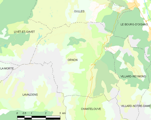
Орнон
Hiking in Орнон
Ornon is a lesser-known area that offers unique hiking opportunities, especially for those seeking a more tranquil outdoor experience. Located in the French Alps, the region is characterized by its stunning landscapes, dense forests, and diverse wildlife....
- Страна:
- Почтовый код: 38520
- Координаты: 45° 2' 28" N, 5° 58' 40" E
- GPS треки (wikiloc): [Ссылка]
- Площадь: 11.6 кв.км
- Население: 133
Ле-Бур-д'Уазан
- коммуна во Франции
Hiking in Ле-Бур-д'Уазан
Le Bourg-d'Oisans is a charming commune located in the French Alps, nestled between the Oisans mountain range and the breathtaking Ecrins National Park. It's an excellent base for those who enjoy hiking, as it offers a variety of trails suitable for all experience levels, from beginner to advanced....
- Страна:
- Почтовый код: 38520
- Координаты: 45° 3' 19" N, 6° 1' 46" E
- GPS треки (wikiloc): [Ссылка]
- Площадь: 35.75 кв.км
- Население: 3239
- Веб сайт: [Ссылка]


Сешильенн
- коммуна во Франции
Hiking in Сешильенн
Séchilienne is a charming village located in the Isère department of the Auvergne-Rhône-Alpes region in southeastern France. Nestled in the mountains, it offers beautiful hiking opportunities with stunning views of the surrounding landscapes....
- Страна:
- Почтовый код: 38220
- Координаты: 45° 3' 17" N, 5° 50' 6" E
- GPS треки (wikiloc): [Ссылка]
- Площадь: 21.47 кв.км
- Население: 1021
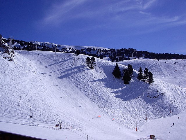

Шанрус
- коммуна во Франции
Hiking in Шанрус
Chamrousse, located in the French Alps, is a fantastic destination for hiking enthusiasts, offering stunning landscapes, a variety of trails, and the opportunity to experience the natural beauty of the region. Here are some key points to consider when planning a hiking trip in Chamrousse:...
- Страна:
- Почтовый код: 38410
- Координаты: 45° 6' 42" N, 5° 52' 30" E
- GPS треки (wikiloc): [Ссылка]
- Высота над уровнем моря: 1660 м m
- Площадь: 13.29 кв.км
- Население: 462
- Веб сайт: [Ссылка]