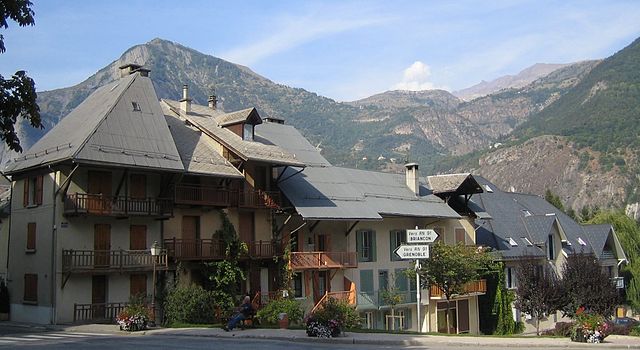
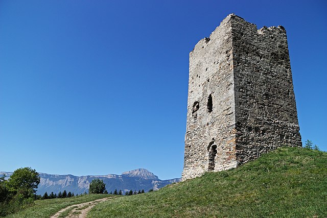
Аллемон (Allemond, Allemond)

- коммуна во Франции
 Hiking in Аллемон
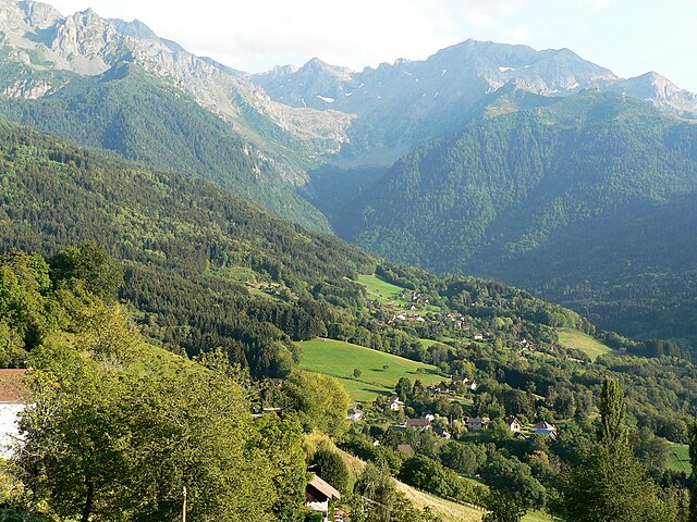
Allemont is a picturesque village located in the French Alps, specifically in the Isère department. It serves as a gateway to the Vaujany valley and nearby hiking routes in the Oisans region, making it a great base for outdoor enthusiasts. Here are some highlights and considerations for hiking in and around Allemont:
Hiking Trails
-
Lac de la Fare: A relatively easy hike leading to a beautiful lake, which is perfect for a relaxing day trip. The trail offers stunning views of the surrounding mountains.
-
Col du Glandon: This hike is more challenging and provides panoramic views of the Alps. It’s a favorite for those looking for a rewarding trek, especially during wildflower blooming in the summer.
-
Vaujany: Accessed via trails from Allemont, Vaujany is known for its hiking paths that cater to various skill levels. The trail up to the Signal de L'Esseillon offers a mix of scenic beauty and diverse terrain.
-
Les Grandes Rousses Massif: For the more adventurous, hikes around this massif provide higher altitude trails with breathtaking vistas, making for unforgettable experiences.
Best Time to Hike
- Spring to Autumn: The best time for hiking in Allemont and the surrounding areas is from late spring to early autumn (approximately May to October), when the weather is generally warm and trails are clear of snow.
Tips for Hiking
- Preparation: Always check local weather conditions and trail statuses before heading out.
- Gear: Ensure you have appropriate hiking gear, including sturdy boots, sufficient water, food supplies, and navigation tools.
- Guides: For those unfamiliar with the area, hiring a local guide can enhance your experience and ensure safety.
- Respect Nature: Follow Leave No Trace principles to help preserve the natural beauty of the region.
Additional Activities
In addition to hiking, Allemont offers opportunities for mountain biking, paragliding, and other Alpine sports, providing a well-rounded outdoor experience.
Overall, Allemont is a fantastic destination for hikers, whether you're looking for leisurely walks or challenging treks in stunning alpine settings.
- Страна:

- Почтовый код: 38114
- Координаты: 45° 7' 49" N, 6° 2' 15" E


- GPS треки (wikiloc): [Ссылка]
- Площадь: 44.75 кв.км
- Население: 1006
- Веб сайт: http://www.allemont.fr
- Википедия русская: wiki(ru)
- Википедия английская: wiki(en)
- Википедия национальная: wiki(fr)
- Хранилище Wikidata: Wikidata: Q1075880
- Катеория в википедии: [Ссылка]
- код Freebase: [/m/03g_7ng]
- код GeoNames: Альт: [6616646]
- номер SIREN: [213800055]
- код BNF: [15257835s]
- код муниципалитета INSEE: 38005
Граничит с регионами:


Ревель
Hiking in Ревель
Revel, located in the Isère department of the Auvergne-Rhône-Alpes region in southeastern France, is a fantastic destination for hiking enthusiasts. The area is characterized by its stunning alpine scenery, diverse landscapes, and a variety of trails suitable for different skill levels. Here are some highlights and tips for hiking in Revel:...
- Страна:
- Почтовый код: 38420
- Координаты: 45° 11' 9" N, 5° 52' 5" E
- GPS треки (wikiloc): [Ссылка]
- Площадь: 29.55 кв.км
- Население: 1340
- Веб сайт: [Ссылка]


Ла-Ферьер
Hiking in Ла-Ферьер
La Ferrière, located in the Isère department in France, is a charming village nestled in the French Alps. It offers a variety of hiking opportunities for both beginners and experienced hikers. The region is known for its stunning landscapes, featuring picturesque valleys, rugged mountain terrain, and lush forests....
- Страна:
- Почтовый код: 38580
- Координаты: 45° 19' 11" N, 6° 5' 14" E
- GPS треки (wikiloc): [Ссылка]
- Площадь: 54.33 кв.км
- Население: 231
- Веб сайт: [Ссылка]
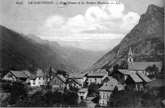

Оз (Изер)
- коммуна во Франции
Hiking in Оз (Изер)
Hiking in Oz, a charming alpine village located in the Isère department of France, offers exhilarating experiences amidst breathtaking scenery. Situated within the Grandes Rousses mountains in the French Alps, Oz is part of the Alpe d'Huez ski area, which transforms into a hiker's paradise during the summer months....
- Страна:
- Почтовый код: 38114
- Координаты: 45° 8' 27" N, 6° 3' 7" E
- GPS треки (wikiloc): [Ссылка]
- Площадь: 16.81 кв.км
- Население: 246
- Веб сайт: [Ссылка]

Saint-Sorlin-d'Arves
- коммуна во Франции
Hiking in Saint-Sorlin-d'Arves
Saint-Sorlin-d'Arves is a beautiful alpine village located in the Savoie region of the French Alps. It is particularly known for its stunning landscapes, diverse wildlife, and a range of hiking trails that cater to various skill levels. Here’s a general overview of what you can expect when hiking in the area:...
- Страна:
- Почтовый код: 73530
- Координаты: 45° 13' 16" N, 6° 14' 5" E
- GPS треки (wikiloc): [Ссылка]
- Площадь: 39 кв.км
- Население: 339
- Веб сайт: [Ссылка]

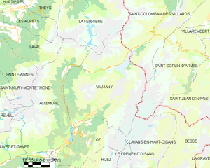
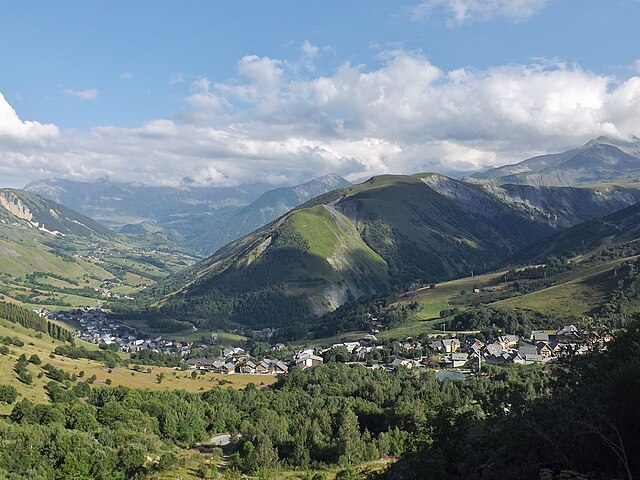
Вожани
- коммуна во Франции
Hiking in Вожани
Vaujany is a charming alpine village located in the French Alps, within the Oisans region, and is part of the larger Alpe d'Huez Grand Domaine Ski area. It's not only a great skiing destination but also an excellent location for hiking, especially during the warmer months when the snow melts and the trails become accessible....
- Страна:
- Почтовый код: 38114
- Координаты: 45° 9' 27" N, 6° 4' 36" E
- GPS треки (wikiloc): [Ссылка]
- Площадь: 64.54 кв.км
- Население: 307
- Веб сайт: [Ссылка]
Ле-Бур-д'Уазан
- коммуна во Франции
Hiking in Ле-Бур-д'Уазан
Le Bourg-d'Oisans is a charming commune located in the French Alps, nestled between the Oisans mountain range and the breathtaking Ecrins National Park. It's an excellent base for those who enjoy hiking, as it offers a variety of trails suitable for all experience levels, from beginner to advanced....
- Страна:
- Почтовый код: 38520
- Координаты: 45° 3' 19" N, 6° 1' 46" E
- GPS треки (wikiloc): [Ссылка]
- Площадь: 35.75 кв.км
- Население: 3239
- Веб сайт: [Ссылка]

Лавальд
Hiking in Лавальд
Laval, located in the Isère department of the Auvergne-Rhône-Alpes region in France, is surrounded by stunning natural landscapes that provide excellent hiking opportunities. Here are some key points about hiking in and around Laval, Isère:...
- Страна:
- Почтовый код: 38190
- Координаты: 45° 15' 11" N, 5° 55' 57" E
- GPS треки (wikiloc): [Ссылка]
- Площадь: 25.33 кв.км
- Население: 988
- Веб сайт: [Ссылка]

Сент-Аньес
Hiking in Сент-Аньес
Sainte-Agnès, located in the Isère department in the Auvergne-Rhône-Alpes region of France, offers a variety of hiking opportunities that showcase stunning alpine scenery, lush meadows, and charming mountain villages. Here are some insights into hiking in this beautiful area:...
- Страна:
- Почтовый код: 38190
- Координаты: 45° 14' 12" N, 5° 55' 16" E
- GPS треки (wikiloc): [Ссылка]
- Площадь: 26.85 кв.км
- Население: 567
- Веб сайт: [Ссылка]


Ливе-э-Гаве
- коммуна во Франции
Hiking in Ливе-э-Гаве
Livet-et-Gavet, located in the Auvergne-Rhône-Alpes region of France, is a picturesque destination for hiking enthusiasts. This area is characterized by its stunning natural landscapes, including lush forests, rivers, and mountainous terrain. Here are some highlights and tips for hiking in Livet-et-Gavet:...
- Страна:
- Почтовый код: 38220
- Координаты: 45° 5' 28" N, 5° 54' 9" E
- GPS треки (wikiloc): [Ссылка]
- Площадь: 46.54 кв.км
- Население: 1296
- Веб сайт: [Ссылка]