
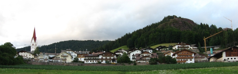
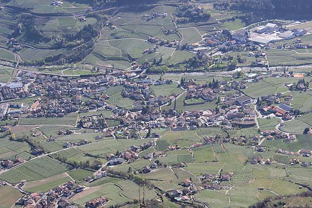
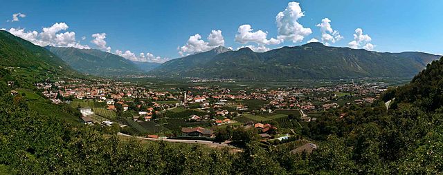
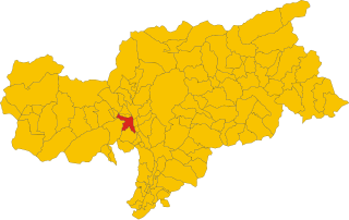
Мерано (Merano, Merano)
.svg)
- коммуна Италии
 Hiking in Мерано
Merano, located in South Tyrol, Italy, is a stunning destination for hiking enthusiasts. Nestled in the mountains, it offers a beautiful combination of alpine scenery, Mediterranean climate, and rich cultural heritage. Here are some highlights about hiking in and around Merano:
Trails and Routes
-
Tappeinerweg: This famous scenic promenade is an easy hike that provides panoramic views of Merano and the surrounding valleys. It’s lined with Mediterranean plants and offers a gentle walk that is accessible for all skill levels.
-
Merano High Route (Meraner Höhenweg): A more challenging multi-day hike that circles the Texelgruppe Nature Park. It offers breathtaking mountain views, diverse flora and fauna, and a chance to explore charming mountain huts along the way.
-
Around the Texel Group: This area offers various trails ranging from easy walks to more demanding hikes. Popular routes include the path to the Unterstell and the hike to the top of the Soprabolzano mountain.
-
Ifinger Mountain: A moderately challenging hike that leads to the summit of Ifinger, where hikers can enjoy spectacular views of the Merano valley and the surrounding peaks.
-
Partschins: Just a short distance from Merano, this area features the famous Partschins waterfall, which can be reached via various trails. The walk to the waterfall is suitable for families and offers beautiful forest scenery.
Best Time to Hike
The best time for hiking in Merano is generally between late spring (May) and early autumn (September), when the weather is mild, and the trails are mostly clear of snow. The spring season also showcases blooming flowers, while autumn offers vibrant autumn foliage.
Difficulty Levels
Merano offers hikes for all skill levels—from easy walks suited for families and beginners to more strenuous mountain trails for experienced hikers. Always check the trail conditions and difficulty ratings before embarking on your hike.
Practical Tips
- Gear Up: Wear appropriate hiking boots and clothing suited for the variable mountain weather. Layering is key.
- Hydration: Carry enough water, especially on more demanding hikes, as some routes can be quite exposed to the sun.
- Maps and Guidance: Consider obtaining local maps or hiking guides, as well as checking the weather and trail conditions. Many trails are well-marked, but having a map is always a good idea.
- Local Cuisine: Don’t miss the opportunity to refuel at local mountain huts (Hütten) where you can enjoy traditional South Tyrolean dishes and stunning views.
Accessibility
Merano is well-connected by public transport, making it easy to reach starting points for hikes. Additionally, many cable cars operate in the area, allowing easy access to higher trails and vantage points.
Hiking in Merano is not only about physical activity; it's also a chance to immerse yourself in the breathtaking landscape, experience local culture, and enjoy the natural beauty of the South Tyrolean Alps. Happy hiking!
- Страна:

- Почтовый код: 39012
- Телефонный код: 0473
- Код автомобильного номера: BZ
- Координаты: 46° 40' 8" N, 11° 9' 50" E


- GPS треки (wikiloc): [Ссылка]
- Высота над уровнем моря: 325 м m
- Площадь: 26.34 кв.км
- Население: 40047
- Веб сайт: http://www.comune.merano.bz.it
- Википедия русская: wiki(ru)
- Википедия английская: wiki(en)
- Википедия национальная: wiki(it)
- Хранилище Wikidata: Wikidata: Q131605
- Галерея изображений в википедии: [Ссылка]
- Катеория в википедии: [Ссылка]
- Карты в википедии: [Ссылка]
- код Freebase: [/m/045fm9]
- код GeoNames: Альт: [6535957]
- код VIAF: Альт: [247628894]
- ID отношения в OpenStreetMap: [47283]
- код GND: Альт: [4038688-0]
- идентификатор местоположения ArchINFORM: [9849]
- код LCNAF: Альт: [n82223407]
- место в MusicBrainz: [dda200c6-ca9c-4be0-94c1-dd57b3e3823d]
- UN/LOCODE: [ITMEN]
- код в энциклопедии «Британника онлайн»: [place/Merano-Italy]
- код в Большой каталанской энциклопедии: [0041995]
- идентификатор HDS: [15288]
- код места в Facebook: [106285616075824]
- код в Большой российской энциклопедии онлайн: [2205200]
- код GAMEO: [Meran (Bolzano-Alto Adige, Italy)]
- идентификатор NE.se: [merano]
- код ISTAT: 021051
- кадастровый код Италии: F132
Граничит с регионами:


Авеленго
- коммуна Италии
Hiking in Авеленго
Hafling, located in the South Tyrol region of northern Italy, is a stunning destination for hikers, known for its breathtaking landscapes, diverse trails, and striking views of the Alps. Nestled in the mountains near Merano, Hafling offers a unique combination of natural beauty and charming village life, making it an excellent spot for outdoor enthusiasts....
- Страна:
- Почтовый код: 39010
- Телефонный код: 0473
- Код автомобильного номера: BZ
- Координаты: 46° 38' 44" N, 11° 13' 27" E
- GPS треки (wikiloc): [Ссылка]
- Высота над уровнем моря: 1290 м m
- Площадь: 27 кв.км
- Население: 763
- Веб сайт: [Ссылка]

Верано
- коммуна в Италии
Hiking in Верано
Vöran, also known as Verano, is a picturesque village located in the South Tyrol region of northern Italy, nestled in the foothills of the Alps. It is a popular destination for hiking enthusiasts due to its stunning natural landscapes, diverse trails, and mild climate....
- Страна:
- Почтовый код: 39010
- Телефонный код: 0473
- Код автомобильного номера: BZ
- Координаты: 46° 36' 17" N, 11° 13' 35" E
- GPS треки (wikiloc): [Ссылка]
- Высота над уровнем моря: 1204 м m
- Площадь: 22.01 кв.км
- Население: 952
- Веб сайт: [Ссылка]


Чермес
- коммуна Италии
Hiking in Чермес
Tscherms, a picturesque village in South Tyrol, Italy, offers a variety of hiking experiences for outdoor enthusiasts. Nestled near the charming town of Merano, it provides access to beautiful trails set against the stunning backdrop of the South Tyrolean Alps....
- Страна:
- Почтовый код: 39010
- Телефонный код: 0473
- Код автомобильного номера: BZ
- Координаты: 46° 37' 58" N, 11° 8' 49" E
- GPS треки (wikiloc): [Ссылка]
- Высота над уровнем моря: 292 м m
- Площадь: 6.62 кв.км
- Население: 1546
- Веб сайт: [Ссылка]

Лагундо
- коммуна Италии
Hiking in Лагундо
Algund, a picturesque village located near Merano in South Tyrol, Italy, is an excellent destination for hiking enthusiasts. It boasts stunning views of the surrounding mountains and valleys, along with diverse trails catering to different skill levels. Here are some highlights of hiking in Algund:...
- Страна:
- Почтовый код: 39022
- Телефонный код: 0473
- Код автомобильного номера: BZ
- Координаты: 46° 41' 0" N, 11° 8' 0" E
- GPS треки (wikiloc): [Ссылка]
- Высота над уровнем моря: 2600 м m
- Площадь: 23.68 кв.км
- Население: 5042
- Веб сайт: [Ссылка]
Лана
- коммуна Италии
Hiking in Лана
Lana, located in South Tyrol, Italy, is a fantastic destination for hiking enthusiasts, offering a diverse range of trails set against stunning alpine scenery. Nestled near the larger town of Merano, Lana provides access to beautiful landscapes, charming villages, and cultural sites....
- Страна:
- Почтовый код: 39011
- Телефонный код: 0473
- Код автомобильного номера: BZ
- Координаты: 46° 37' 0" N, 11° 10' 0" E
- GPS треки (wikiloc): [Ссылка]
- Высота над уровнем моря: 310 м m
- Площадь: 36.12 кв.км
- Население: 12286
- Веб сайт: [Ссылка]
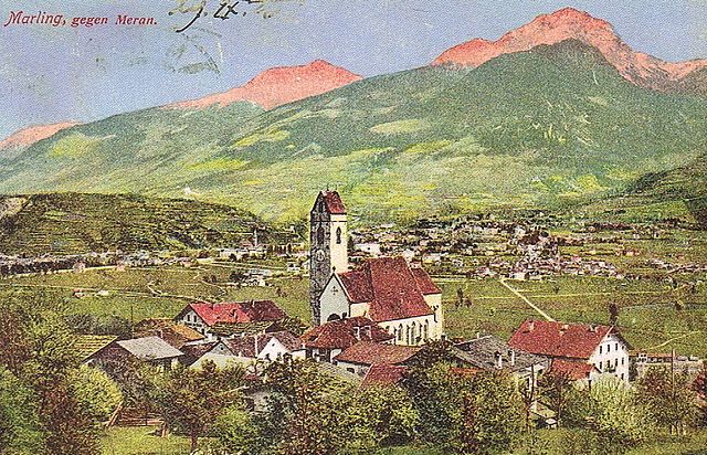

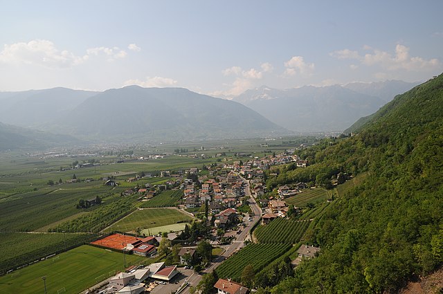
Марленго
- коммуна Италии
Hiking in Марленго
Marling, located in South Tyrol, Italy, is a charming village that offers a plethora of hiking opportunities amidst stunning Alpine scenery. The region is characterized by its mild climate, diverse landscapes, and beautiful panoramic views, making it an ideal destination for both casual walkers and seasoned hikers....
- Страна:
- Почтовый код: 39020
- Телефонный код: 0473
- Код автомобильного номера: BZ
- Координаты: 46° 39' 9" N, 11° 8' 44" E
- GPS треки (wikiloc): [Ссылка]
- Высота над уровнем моря: 363 м m
- Площадь: 12.86 кв.км
- Население: 2710
- Веб сайт: [Ссылка]

Посталь
- коммуна в Италии
Hiking in Посталь
Burgstall is a charming village located in South Tyrol, Italy, known for its picturesque landscapes and proximity to the Alps. Hiking around Burgstall offers a fantastic opportunity to explore the diverse terrain and enjoy stunning views....
- Страна:
- Почтовый код: 39014
- Телефонный код: 0473
- Код автомобильного номера: BZ
- Координаты: 46° 36' 34" N, 11° 11' 35" E
- GPS треки (wikiloc): [Ссылка]
- Высота над уровнем моря: 270 м m
- Площадь: 6.69 кв.км
- Население: 1887
- Веб сайт: [Ссылка]


Тироло
- коммуна в Италии
Hiking in Тироло
Hiking in Tirol (Austria) and South Tyrol (Italy) offers an incredible experience, showcasing stunning landscapes, diverse flora and fauna, and a rich cultural heritage. Here's an overview of what to expect in both regions:...
- Страна:
- Почтовый код: 39019
- Телефонный код: 0473
- Код автомобильного номера: BZ
- Координаты: 46° 41' 28" N, 11° 9' 15" E
- GPS треки (wikiloc): [Ссылка]
- Высота над уровнем моря: 594 м m
- Площадь: 25.62 кв.км
- Население: 2456
- Веб сайт: [Ссылка]


Шена
- коммуна в Италии
Hiking in Шена
Schenna, located near Merano in South Tyrol, Italy, is a great destination for hiking enthusiasts. The region is known for its breathtaking alpine scenery, charming villages, and well-maintained hiking trails suitable for all levels, from beginners to experienced hikers....
- Страна:
- Почтовый код: 39017
- Телефонный код: 0473
- Код автомобильного номера: BZ
- Координаты: 46° 41' 24" N, 11° 11' 11" E
- GPS треки (wikiloc): [Ссылка]
- Высота над уровнем моря: 600 м m
- Площадь: 48.13 кв.км
- Население: 2918
- Веб сайт: [Ссылка]