Монтаньё (Montagnieu, Montagnieu)

 Hiking in Монтаньё
Montagnieu, located in the department of Isère in the Auvergne-Rhône-Alpes region of France, offers a variety of hiking options that showcase the natural beauty of the surrounding landscapes. Here are some key points about hiking in this area:
1.
- Montagnieu is situated near the Chartreuse and Vercors mountain ranges, providing trails that vary in difficulty and scenery. Hikers can enjoy views of rolling hills, dense forests, and impressive rock formations.
2.
- Local Trails: There are numerous well-marked trails suitable for different levels, from easy walks perfect for family outings to more challenging hikes for experienced hikers.
- Long-Distance Hikes: Some trails connect to larger networks, allowing for longer treks. You might find routes that lead to nearby peaks or through charming villages.
3.
- The area is rich in biodiversity, and hikers may encounter various flora and fauna, including wildflowers, birds, and possibly even deer or foxes. This makes it a great spot for nature lovers and photographers.
4.
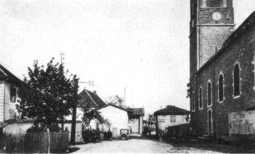
- As you hike in Montagnieu, keep an eye out for historical landmarks and churches that reflect the region's rich heritage. Some trails may even take you through vineyards or past traditional farms.
5.
- The best time for hiking in Montagnieu is typically from late spring to early autumn. Spring offers blooming flowers, summer provides warmth for long hikes, and autumn showcases stunning foliage. Winter hiking can be challenging but is also an option if you're prepared for snow conditions.
6.
- Montagnieu is a small village, so amenities may be limited. It’s advisable to bring enough water, snacks, and a fully charged phone or GPS device. Being prepared also enhances your overall hiking experience.
7.
- Always check the weather before heading out, as conditions can change rapidly in mountainous areas. Make sure to wear appropriate footwear, dress in layers, and inform someone about your hiking plans.
Conclusion
Whether you are a casual walker or an experienced hiker, Montagnieu, Isère provides a beautiful and serene environment to explore the great outdoors. Make sure to respect local guidelines and leave no trace to preserve the area's natural beauty. Happy hiking!
- Страна:

- Почтовый код: 38110
- Координаты: 45° 31' 27" N, 5° 27' 9" E


- GPS треки (wikiloc): [Ссылка]
- Площадь: 8.83 кв.км
- Население: 1023
- Википедия русская: wiki(ru)
- Википедия английская: wiki(en)
- Википедия национальная: wiki(fr)
- Хранилище Wikidata: Wikidata: Q615249
- Катеория в википедии: [Ссылка]
- код Freebase: [/m/03nw79m]
- код GeoNames: Альт: [6613852]
- номер SIREN: [213802465]
- код BNF: [15258058g]
- код VIAF: Альт: [236984365]
- код муниципалитета INSEE: 38246
Граничит с регионами:


Дуассен
- коммуна во Франции
Hiking in Дуассен
Doissin, located in the Auvergne-Rhône-Alpes region of France, is a beautiful spot for hiking enthusiasts. The area is characterized by its picturesque landscapes, including rolling hills, forests, and scenic viewpoints....
- Страна:
- Почтовый код: 38730
- Координаты: 45° 29' 59" N, 5° 25' 25" E
- GPS треки (wikiloc): [Ссылка]
- Площадь: 8.45 кв.км
- Население: 891
- Веб сайт: [Ссылка]


Сен-Дидье-де-ла-Тур
- коммуна во Франции
Hiking in Сен-Дидье-де-ла-Тур
Saint-Didier-de-la-Tour is a charming commune located in the Isère department of the Auvergne-Rhône-Alpes region in southeastern France. The area is characterized by its natural beauty, including rolling hills, lush greenery, and proximity to the mountains, making it a great spot for hiking enthusiasts....
- Страна:
- Почтовый код: 38110
- Координаты: 45° 33' 19" N, 5° 28' 59" E
- GPS треки (wikiloc): [Ссылка]
- Площадь: 14.63 кв.км
- Население: 2003
- Веб сайт: [Ссылка]

Сент-Бландин
- коммуна во Франции
Hiking in Сент-Бландин
Sainte-Blandine, located in the Isère department of the Auvergne-Rhône-Alpes region in southeastern France, is a charming village surrounded by beautiful natural landscapes ideal for hiking enthusiasts. Here are some highlights and tips for hiking in the area:...
- Страна:
- Почтовый код: 38110
- Координаты: 45° 32' 48" N, 5° 26' 26" E
- GPS треки (wikiloc): [Ссылка]
- Площадь: 9.21 кв.км
- Население: 963

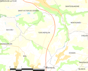
Торшефелон
- коммуна во Франции
Hiking in Торшефелон
Torchefelon is a beautiful destination for hiking, located in the Savoie region of the French Alps. The area is known for its stunning landscapes, with a mix of rugged mountain terrain, lush valleys, and alpine meadows. Here are some highlights and tips for hiking in Torchefelon:...
- Страна:
- Почтовый код: 38690
- Координаты: 45° 31' 13" N, 5° 24' 1" E
- GPS треки (wikiloc): [Ссылка]
- Площадь: 8.68 кв.км
- Население: 708
- Веб сайт: [Ссылка]

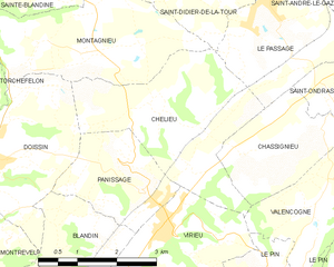
Шельё
- коммуна во Франции
Hiking in Шельё
Chélieu, located in the Isère department of the Auvergne-Rhône-Alpes region in France, offers beautiful landscapes and opportunities for hiking enthusiasts. The area is characterized by its stunning mountainous terrain, with the Chartreuse Mountains nearby providing a range of trails suitable for different skill levels....
- Страна:
- Почтовый код: 38730
- Координаты: 45° 30' 44" N, 5° 28' 33" E
- GPS треки (wikiloc): [Ссылка]
- Высота над уровнем моря: 607 м m
- Площадь: 10.13 кв.км
- Население: 674
- Веб сайт: [Ссылка]