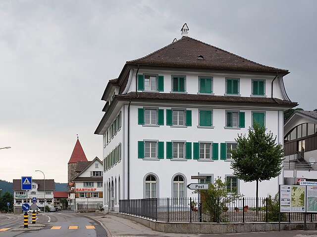
Оберегери (Oberägeri, Oberägeri)

- коммуна в Швейцарии
 Hiking in Оберегери
Oberägeri, located in the Canton of Zug in Switzerland, is a beautiful destination for hiking enthusiasts. Nestled between the Ägeri lake and the surrounding hills, it offers a variety of trails that cater to different skill levels and provide stunning views of the Swiss landscape.
Trail Highlights
-
Ägerisee Circuit: A scenic trail around Lake Ägeri that offers stunning views and pleasant walking paths. The circuit is relatively flat, making it suitable for families and casual hikers.
-
Hiking Trails in the Zugerberg: The Zugerberg mountain area features multiple trails that range from easy walks to more challenging hikes. The views from the higher elevations over the Zug and Ägeri lakes are breathtaking.
-
Hohflue Path: This medium-difficult trail leads you to the Hohflue viewpoint, offering spectacular panoramic views of the surrounding mountains, including the Alps on a clear day.
-
Wildpark Zug Hike: This trail combines nature and wildlife, as it takes you past a local wildlife park. It’s a great family-friendly option where you can also spot deer and other wildlife.
Hiking Tips
-
Best Time to Hike: The best hiking season is from late spring to early autumn (May to October). In winter, some trails may be accessible for snowshoeing or winter hikes, but conditions can vary.
-
Weather Preparedness: Always check the weather forecast before heading out. Swiss weather can be unpredictable, especially in the mountains.
-
Trail Maps: Use local hiking maps or apps, as they provide detailed information about trail conditions and levels of difficulty.
-
Equipment: Wear sturdy hiking boots, and pack layers, snacks, and plenty of water. Depending on the trail, trekking poles might also be helpful.
-
Wildlife Awareness: Respect local wildlife by observing from a distance and not feeding animals.
Local Amenities
Oberägeri offers various amenities for hikers, including restaurants and cafés where you can refuel after your hike. You can also find various accommodations if you wish to extend your stay and explore more trails in the region.
Conclusion
Hiking in Oberägeri is a fantastic way to experience the natural beauty of Switzerland, with diverse trails, stunning views, and the chance to enjoy local wildlife. Whether you're a beginner or an experienced hiker, there’s something for everyone in this picturesque area.
- Страна:

- Почтовый код: 6315
- Телефонный код: 041
- Код автомобильного номера: ZG
- Координаты: 47° 8' 9" N, 8° 36' 49" E


- GPS треки (wikiloc): [Ссылка]
- Высота над уровнем моря: 737 м m
- Площадь: 36.2 кв.км
- Население: 6059
- Веб сайт: http://www.oberaegeri.ch
- Википедия русская: wiki(ru)
- Википедия английская: wiki(en)
- Википедия национальная: wiki(de)
- Хранилище Wikidata: Wikidata: Q65017
- Галерея изображений в википедии: [Ссылка]
- Катеория в википедии: [Ссылка]
- код Freebase: [/m/0716bq]
- код GeoNames: Альт: [8029943]
- код VIAF: Альт: [244722422]
- ID отношения в OpenStreetMap: [1683146]
- идентификатор HDS: [792]
- код швейцарского муниципалитета: [1706]
Граничит с регионами:


Заттель
- коммуна в Швейцарии
Hiking in Заттель
Sattel, located in the canton of Schwyz, is a beautiful hiking destination in Switzerland, known for its stunning landscapes and a range of outdoor activities. Situated between Lake Zug and Lake Lauerz, Sattel offers breathtaking views of the surrounding mountains and valleys....
- Страна:
- Почтовый код: 6417
- Телефонный код: 041
- Код автомобильного номера: SZ
- Координаты: 47° 4' 48" N, 8° 37' 55" E
- GPS треки (wikiloc): [Ссылка]
- Высота над уровнем моря: 780 м m
- Площадь: 17.3 кв.км
- Население: 1946
- Веб сайт: [Ссылка]

Унтерегери
- коммуна в Швейцарии
Hiking in Унтерегери
Unterägeri is a picturesque municipality located in the Canton of Zug, Switzerland, surrounded by stunning landscapes and offering fantastic opportunities for hiking enthusiasts. Here are some highlights and points of interest for hiking in and around Unterägeri:...
- Страна:
- Почтовый код: 6314
- Телефонный код: 041
- Код автомобильного номера: ZG
- Координаты: 47° 7' 14" N, 8° 34' 40" E
- GPS треки (wikiloc): [Ссылка]
- Высота над уровнем моря: 763 м m
- Площадь: 26.7 кв.км
- Население: 8689
- Веб сайт: [Ссылка]

Менцинген
Hiking in Менцинген
Menzingen is a charming municipality located in the Canton of Zug, Switzerland. It is surrounded by beautiful nature and rolling hills, making it an ideal location for hiking enthusiasts. Here are some highlights and tips for hiking in Menzingen:...
- Страна:
- Почтовый код: 6313
- Телефонный код: 041
- Код автомобильного номера: ZG
- Координаты: 47° 10' 12" N, 8° 36' 11" E
- GPS треки (wikiloc): [Ссылка]
- Высота над уровнем моря: 801 м m
- Площадь: 27.50 кв.км
- Население: 4499
- Веб сайт: [Ссылка]


Хюттен
Hiking in Хюттен
Hütten, nestled in the Swiss Alps, is a dream destination for hiking enthusiasts. The region offers stunning views, diverse trails, and a rich cultural heritage associated with the Swiss mountains. Here’s a comprehensive overview of hiking in this picturesque area:...
- Страна:
- Почтовый код: 8825
- Телефонный код: 044
- Код автомобильного номера: ZH
- Координаты: 47° 10' 23" N, 8° 39' 58" E
- GPS треки (wikiloc): [Ссылка]
- Высота над уровнем моря: 741 м m
- Площадь: 7.24 кв.км
- Население: 895
- Веб сайт: [Ссылка]

Ротентурм
- коммуна в Швейцарии
Hiking in Ротентурм
Rothenthurm, located in the Canton of Schwyz in Switzerland, is a beautiful area for hiking, renowned for its stunning landscapes, diverse flora and fauna, and panoramic views of the Swiss Alps. Here are some highlights and tips for hiking in Rothenthurm:...
- Страна:
- Почтовый код: 6418
- Телефонный код: 041
- Код автомобильного номера: SZ
- Координаты: 47° 6' 15" N, 8° 40' 28" E
- GPS треки (wikiloc): [Ссылка]
- Высота над уровнем моря: 925 м m
- Площадь: 22.80 кв.км
- Население: 2395
- Веб сайт: [Ссылка]


Айнзидельн
- коммуна в Швейцарии
Hiking in Айнзидельн
Einsiedeln, located in the Canton of Schwyz in Switzerland, is a beautiful destination for hiking enthusiasts. Nestled in the picturesque alpine landscape, it offers a variety of trails suitable for all levels, from leisurely strolls to more challenging hikes....
- Страна:
- Почтовый код: 8840
- Телефонный код: 055
- Код автомобильного номера: SZ
- Координаты: 47° 7' 40" N, 8° 44' 35" E
- GPS треки (wikiloc): [Ссылка]
- Высота над уровнем моря: 882 м m
- Площадь: 110.40 кв.км
- Население: 15550
- Веб сайт: [Ссылка]


Фойзисберг
- коммуна в Швейцарии
Hiking in Фойзисберг
Feusisberg is a beautiful area located in the Swiss canton of Schwyz, known for its stunning landscapes and excellent hiking opportunities. Here are some key highlights to keep in mind when planning a hiking trip in this region:...
- Страна:
- Почтовый код: 8835
- Телефонный код: 044; 043
- Код автомобильного номера: SZ
- Координаты: 47° 10' 29" N, 8° 43' 53" E
- GPS треки (wikiloc): [Ссылка]
- Высота над уровнем моря: 802 м m
- Площадь: 17.56 кв.км
- Население: 5272
- Веб сайт: [Ссылка]