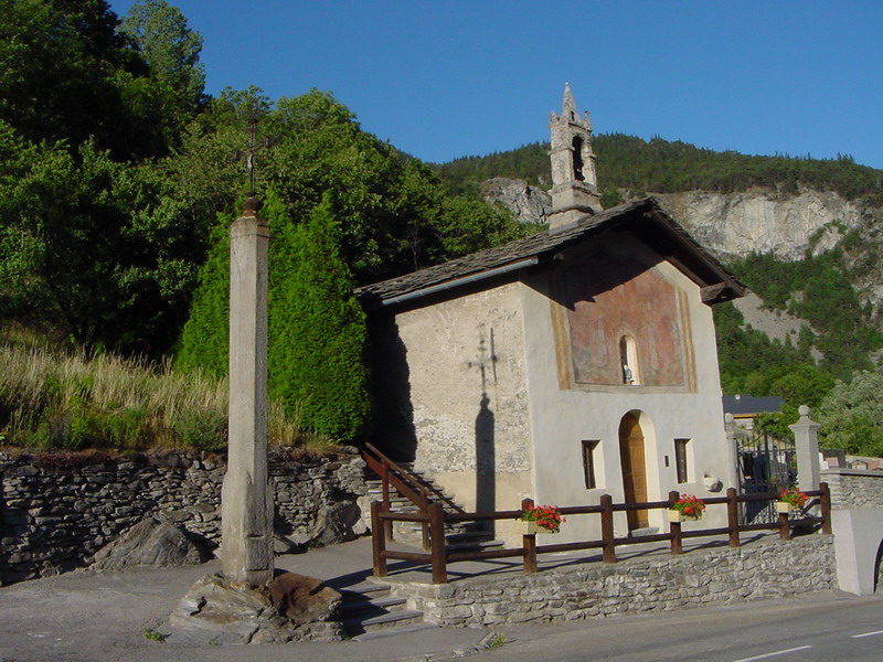
Orelle (Orelle)


- коммуна во Франции
 Hiking in Orelle
Orelle, a picturesque village located in the French Alps, is an excellent destination for hiking enthusiasts. It is situated near the Maurienne Valley and provides access to a variety of trails that cater to all skill levels, from beginners to advanced hikers.
Key Hiking Trails in Orelle:
-
Orelle to Les 3 Vallées: This trail takes you into the world-renowned ski area of Les 3 Vallées, which transforms into a stunning hiking destination during the summer months. You can expect beautiful alpine scenery, wildflowers, and panoramic views of the surrounding peaks.
-
Col de la Chambre: A moderate hike that offers rewarding views of the surrounding mountains. This trail typically takes about 3-4 hours round trip, depending on your pace. It’s a great way to experience the diverse flora and fauna of the region.
-
Lac de la Vieille: For those seeking a more leisurely hike, this trail leads to a lovely alpine lake surrounded by stunning landscapes. The route is well-marked and is suitable for families or beginners.
-
Mont Thabor: For more experienced hikers, the trail to Mont Thabor is a challenging but rewarding adventure. It provides breathtaking views and is usually a full-day excursion.
Best Time to Hike:
The best time to hike in Orelle is during the summer months, from late June to September, when the trails are clear of snow and the weather is generally mild. However, always check local conditions before setting out, as weather can change rapidly in the Alps.
Tips for Hiking in Orelle:
- Equipment: Wear sturdy hiking boots, dress in layers, and carry a daypack with water, snacks, and a map.
- Safety: Always let someone know your hiking plans, and consider carrying a basic first aid kit.
- Leave No Trace: Be sure to follow Leave No Trace principles to help preserve the natural beauty of the area.
Orelle is a fantastic base for those looking to explore the breathtaking landscapes of the Alps while enjoying the serenity of the mountains. Happy hiking!
- Страна:

- Почтовый код: 73140
- Координаты: 45° 12' 33" N, 6° 32' 13" E


- GPS треки (wikiloc): [Ссылка]
- Площадь: 69.25 кв.км
- Население: 352
- Википедия английская: wiki(en)
- Википедия национальная: wiki(fr)
- Хранилище Wikidata: Wikidata: Q752910
- Катеория в википедии: [Ссылка]
- код Freebase: [/m/03npg3f]
- код GeoNames: Альт: [6442845]
- номер SIREN: [217301944]
- код BNF: [15274126k]
- код VIAF: Альт: [245835298]
- код муниципалитета INSEE: 73194
Граничит с регионами:

Saint-André
Hiking in Saint-André
Saint-André, located in the Savoie region of the French Alps, is an excellent destination for hiking enthusiasts. With its stunning alpine scenery, diverse trails, and rich natural biodiversity, the area offers various hiking opportunities suitable for all skill levels....
- Страна:
- Почтовый код: 73500
- Координаты: 45° 12' 4" N, 6° 37' 9" E
- GPS треки (wikiloc): [Ссылка]
- Площадь: 30.84 кв.км
- Население: 476


Freney
- коммуна во Франции
Hiking in Freney
Freney, often associated with the broader region of the French Alps, offers stunning scenery and a variety of hiking opportunities. The area is known for its striking mountain landscapes, glacial lakes, and picturesque valleys. Here are some key highlights and tips for hiking in and around Freney:...
- Страна:
- Почтовый код: 73500
- Координаты: 45° 11' 38" N, 6° 37' 37" E
- GPS треки (wikiloc): [Ссылка]
- Площадь: 11.13 кв.км
- Население: 105
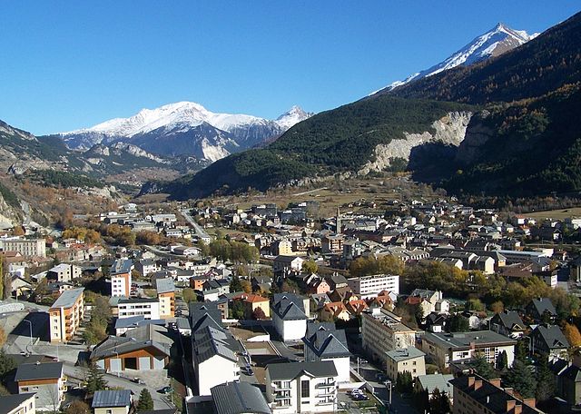

Модан
- коммуна во Франции
Hiking in Модан
Modane is a picturesque town located in the Savoie region of the French Alps, known for its stunning landscapes and proximity to various outdoor activities, including hiking. Here are some key points to consider if you're planning to hike in and around Modane:...
- Страна:
- Почтовый код: 73500
- Координаты: 45° 12' 5" N, 6° 40' 24" E
- GPS треки (wikiloc): [Ссылка]
- Высота над уровнем моря: 1000 м m
- Площадь: 71.04 кв.км
- Население: 3180
- Веб сайт: [Ссылка]

Неваш
- коммуна во Франции
Hiking in Неваш
Névache, located in the Hautes-Alpes region of France, is a beautiful destination for hiking enthusiasts. Nestled in the Écrins National Park, Névache is known for its stunning landscapes, including alpine meadows, rugged mountains, and crystal-clear rivers. Here are some highlights and tips for hiking in the area:...
- Страна:
- Почтовый код: 05100
- Координаты: 45° 1' 7" N, 6° 36' 17" E
- GPS треки (wikiloc): [Ссылка]
- Площадь: 191.93 кв.км
- Население: 359
- Веб сайт: [Ссылка]


Valmeinier
- коммуна во Франции
Hiking in Valmeinier
Valmeinier is a charming mountain resort in the French Alps, located in the Savoie region. It's known for its stunning alpine scenery, making it a fantastic destination for hiking enthusiasts. Here’s what you need to know about hiking in Valmeinier:...
- Страна:
- Почтовый код: 73450
- Координаты: 45° 11' 2" N, 6° 28' 54" E
- GPS треки (wikiloc): [Ссылка]
- Площадь: 54.26 кв.км
- Население: 510
- Веб сайт: [Ссылка]


Сен-Мишель-де-Морьенн
- коммуна во Франции
Hiking in Сен-Мишель-де-Морьенн
Saint-Michel-de-Maurienne is a charming village located in the Savoie region of the French Alps, making it a fantastic base for hiking enthusiasts. The area boasts stunning mountain landscapes, lush valleys, and diverse flora and fauna, which make it ideal for various hiking experiences, from leisurely walks to more challenging treks....
- Страна:
- Почтовый код: 73140
- Координаты: 45° 13' 6" N, 6° 28' 25" E
- GPS треки (wikiloc): [Ссылка]
- Площадь: 36.31 кв.км
- Население: 2472
- Веб сайт: [Ссылка]