Педезина (Pedesina, Pedesina)
.svg)
- коммуна Италии
 Hiking in Педезина
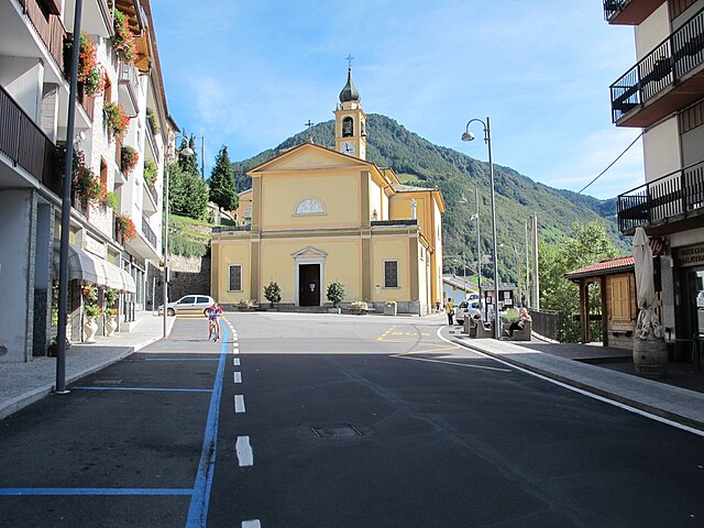
Pedesina is a small and picturesque village located in the Valtellina region of northern Italy, nestled in the Alps. It offers stunning natural beauty and a variety of hiking opportunities for outdoor enthusiasts. Here are some highlights for hiking in and around Pedesina:
Trails and Hiking Options
-
Local Trails: The area around Pedesina features several well-marked trails that range from easy walks to more challenging hikes. Some trails offer breathtaking views of the surrounding mountains, valleys, and traditional Valtellinese landscapes.
-
Sentiero dei Vini: This trail takes you through vineyards and offers a unique perspective on the local wine culture while allowing for some leisurely hiking. It’s perfect for those looking to combine hiking with some wine tasting.
-
Monti della Berna: A hike to the nearby Monti della Berna provides stunning panoramic views of the Valtellina valley. This trail is suitable for experienced hikers and can be challenging, but the views are worth the effort.
-
Alpe Giumello: Accessible from Pedesina, this area offers various hiking paths that lead to alpine meadows and stunning mountain views. It's particularly beautiful in the summer when the wildflowers are in bloom.
-
Val Bregaglia: A short drive from Pedesina, this valley presents a plethora of hiking routes, including paths that lead to waterfalls and scenic viewpoints.
Preparation
-
Maps and Guides: Always carry a detailed map of the hiking trails or consider downloading GPS tracks if you’re hiking in less-known areas.
-
Weather Check: The weather in the Alps can change rapidly; check forecasts and be prepared for varying conditions.
-
Gear: Wear appropriate hiking boots, and carry a backpack with essentials such as water, snacks, a first aid kit, and a rain jacket.
Best Time to Hike
- The best seasons for hiking in Pedesina are late spring through early autumn (May to September) when the weather is milder and trails are more accessible.
Safety Tips
- Inform someone about your hiking plans, especially if you’re going solo.
- Stay on marked trails to preserve the natural environment and ensure safety.
- Pay attention to the elevation changes, as some trails may be strenuous.
Conclusion
Hiking in Pedesina offers a fantastic way to explore the natural beauty of the Italian Alps. Whether you are a seasoned hiker or a casual walker, you’ll find trails that suit your skill level while enjoying the scenic landscapes and cultural richness of the region. Don't forget to take time to appreciate the local cuisine and hospitality after your hikes!
- Страна:

- Почтовый код: 23010
- Телефонный код: 0342
- Код автомобильного номера: SO
- Координаты: 46° 5' 0" N, 9° 33' 0" E


- GPS треки (wikiloc): [Ссылка]
- Высота над уровнем моря: 1032 м m
- Площадь: 6.3 кв.км
- Население: 41
- Веб сайт: http://www.comune.pedesina.so.it
- Википедия русская: wiki(ru)
- Википедия английская: wiki(en)
- Википедия национальная: wiki(it)
- Хранилище Wikidata: Wikidata: Q39060
- Катеория в википедии: [Ссылка]
- код Freebase: [/m/0gj3f0]
- код GeoNames: Альт: [6536127]
- ID отношения в OpenStreetMap: [46825]
- код ISTAT: 014047
- кадастровый код Италии: G410
Граничит с регионами:
Разура
- коммуна Италии
Hiking in Разура
Rasura is a lesser-known but beautiful hiking destination located in the Lombardy region of northern Italy. It offers a unique combination of stunning landscapes, rich history, and cultural experiences. Here’s an overview of what you can expect when hiking in Rasura:...
- Страна:
- Почтовый код: 23010
- Телефонный код: 0342
- Код автомобильного номера: SO
- Координаты: 46° 6' 0" N, 9° 33' 0" E
- GPS треки (wikiloc): [Ссылка]
- Высота над уровнем моря: 762 м m
- Площадь: 6 кв.км
- Население: 291
- Веб сайт: [Ссылка]
Джерола-Альта
- коммуна Италии
Hiking in Джерола-Альта
Gerola Alta is a beautiful destination for hiking enthusiasts, located in the Lombardy region of Italy, specifically in the province of Sondrio. Known for its stunning mountain scenery, this area offers a variety of trails that cater to different skill levels, making it suitable for both novice and experienced hikers....
- Страна:
- Почтовый код: 23010
- Телефонный код: 0342
- Код автомобильного номера: SO
- Координаты: 46° 4' 0" N, 9° 34' 0" E
- GPS треки (wikiloc): [Ссылка]
- Высота над уровнем моря: 1050 м m
- Площадь: 37.43 кв.км
- Население: 174
- Веб сайт: [Ссылка]
Бема
- коммуна Италии
Hiking in Бема
Bema, located in the Lombardy region of Italy, is a beautiful destination for hiking enthusiasts. Nestled in the mountainous area of the Valtellina valley, it offers stunning views, diverse landscapes, and rich flora and fauna. Here are some highlights and tips for hiking in Bema:...
- Страна:
- Почтовый код: 23010
- Телефонный код: 0342
- Код автомобильного номера: SO
- Координаты: 46° 7' 0" N, 9° 34' 0" E
- GPS треки (wikiloc): [Ссылка]
- Высота над уровнем моря: 800 м m
- Площадь: 19.22 кв.км
- Население: 116
- Веб сайт: [Ссылка]


Роголо
- коммуна Италии
Hiking in Роголо
Hiking in Rogolo, a mountain located in the Lombardy region of northern Italy, offers stunning views and a range of trails suitable for different hiking abilities. The area is known for its beautiful landscapes, rich flora and fauna, and the nearby valleys and peaks of the Orobie Alps....
- Страна:
- Почтовый код: 23010
- Телефонный код: 0342
- Код автомобильного номера: SO
- Координаты: 46° 8' 8" N, 9° 29' 14" E
- GPS треки (wikiloc): [Ссылка]
- Высота над уровнем моря: 216 м m
- Площадь: 12.83 кв.км
- Население: 553
- Веб сайт: [Ссылка]

Премана
- коммуна Италии
Hiking in Премана
Premana is a charming town located in the province of Lecco, in the Lombardy region of northern Italy. It's situated in the heart of the Alps, making it an ideal destination for hiking enthusiasts. The surrounding landscape is characterized by breathtaking mountains, lush valleys, and pristine nature, offering a variety of hiking trails suited for all levels of hikers....
- Страна:
- Почтовый код: 23834
- Телефонный код: 0341
- Код автомобильного номера: LC
- Координаты: 46° 3' 7" N, 9° 25' 23" E
- GPS треки (wikiloc): [Ссылка]
- Высота над уровнем моря: 1000 м m
- Площадь: 33.64 кв.км
- Население: 2262
- Веб сайт: [Ссылка]