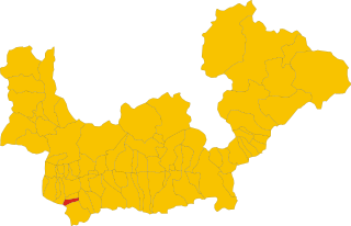
Бема (Bema, Bema)
.svg)
- коммуна Италии
 Hiking in Бема
Bema, located in the Lombardy region of Italy, is a beautiful destination for hiking enthusiasts. Nestled in the mountainous area of the Valtellina valley, it offers stunning views, diverse landscapes, and rich flora and fauna. Here are some highlights and tips for hiking in Bema:
Scenic Trails
-
Sentiero dei Fiori: This trail is known for its rich biodiversity and beautiful wildflowers. It's a well-marked path that offers various vantage points to enjoy the scenery.
-
Valle dei Ratti: A tranquil area where you can hike along the river and enjoy the peaceful surroundings. It's suitable for both novice and experienced hikers.
-
Pathways to the Valtellina: Trails leading to higher altitudes provide breathtaking views of the surrounding valleys and peaks. Check local maps for trail difficulties.
Flora and Fauna
Bema is part of a protected natural area, so you might encounter several species of plants, flowers, and wildlife. Always be respectful of the natural environment and avoid disturbing any wildlife.
Best Time to Hike
Spring and early fall are typically the best times for hiking in Bema. The weather is generally mild, and the landscape is particularly vibrant. Summer can be busy with tourists, while winter is more suited for other activities like skiing.
Preparation Tips
- Gear Up: Wear sturdy hiking boots, and consider bringing trekking poles if you plan to tackle steeper trails.
- Stay Hydrated: Carry enough water, especially on warmer days.
- Map and Compass: While trails are often marked, it’s advisable to have a physical map or GPS, as mobile service can be limited in some areas.
- Local Guides: If you’re unfamiliar with the area, consider hiring a local guide who can enhance your experience with insights about the surroundings.
Accommodations and Amenities
Bema offers a range of accommodations, from hotels to guesthouses. Additionally, local eateries serve traditional Lombardy cuisine, providing a perfect way to refuel after a day of hiking.
Whether you're looking for a peaceful day in nature or challenging your hiking skills, Bema offers a fantastic backdrop for outdoor adventures. Always remember to respect the local environment and regulations during your hikes. Enjoy your time in this beautiful part of Italy!
- Страна:

- Почтовый код: 23010
- Телефонный код: 0342
- Код автомобильного номера: SO
- Координаты: 46° 7' 0" N, 9° 34' 0" E


- GPS треки (wikiloc): [Ссылка]
- Высота над уровнем моря: 800 м m
- Площадь: 19.22 кв.км
- Население: 116
- Веб сайт: http://www.comune.bema.so.it/
- Википедия русская: wiki(ru)
- Википедия английская: wiki(en)
- Википедия национальная: wiki(it)
- Хранилище Wikidata: Wikidata: Q40951
- Катеория в википедии: [Ссылка]
- код Freebase: [/m/0gj2k0]
- код GeoNames: Альт: [6542521]
- код BNF: [16230150s]
- код VIAF: Альт: [137772995]
- ID отношения в OpenStreetMap: [46771]
- код ISTAT: 014006
- кадастровый код Италии: A777
Граничит с регионами:

Педезина
- коммуна Италии
Hiking in Педезина
Pedesina is a small and picturesque village located in the Valtellina region of northern Italy, nestled in the Alps. It offers stunning natural beauty and a variety of hiking opportunities for outdoor enthusiasts. Here are some highlights for hiking in and around Pedesina:...
- Страна:
- Почтовый код: 23010
- Телефонный код: 0342
- Код автомобильного номера: SO
- Координаты: 46° 5' 0" N, 9° 33' 0" E
- GPS треки (wikiloc): [Ссылка]
- Высота над уровнем моря: 1032 м m
- Площадь: 6.3 кв.км
- Население: 41
- Веб сайт: [Ссылка]
Разура
- коммуна Италии
Hiking in Разура
Rasura is a lesser-known but beautiful hiking destination located in the Lombardy region of northern Italy. It offers a unique combination of stunning landscapes, rich history, and cultural experiences. Here’s an overview of what you can expect when hiking in Rasura:...
- Страна:
- Почтовый код: 23010
- Телефонный код: 0342
- Код автомобильного номера: SO
- Координаты: 46° 6' 0" N, 9° 33' 0" E
- GPS треки (wikiloc): [Ссылка]
- Высота над уровнем моря: 762 м m
- Площадь: 6 кв.км
- Население: 291
- Веб сайт: [Ссылка]
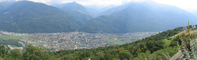

Морбеньо
- коммуна Италии
Hiking in Морбеньо
Morbegno is a charming town in the Valtellina region of northern Italy, nestled among the Alps. It offers a variety of hiking opportunities, suitable for different skill levels, from gentle walks to more challenging treks....
- Страна:
- Почтовый код: 23017
- Телефонный код: 0342
- Код автомобильного номера: SO
- Координаты: 46° 8' 0" N, 9° 34' 0" E
- GPS треки (wikiloc): [Ссылка]
- Высота над уровнем моря: 242 м m
- Площадь: 14.82 кв.км
- Население: 12407
- Веб сайт: [Ссылка]
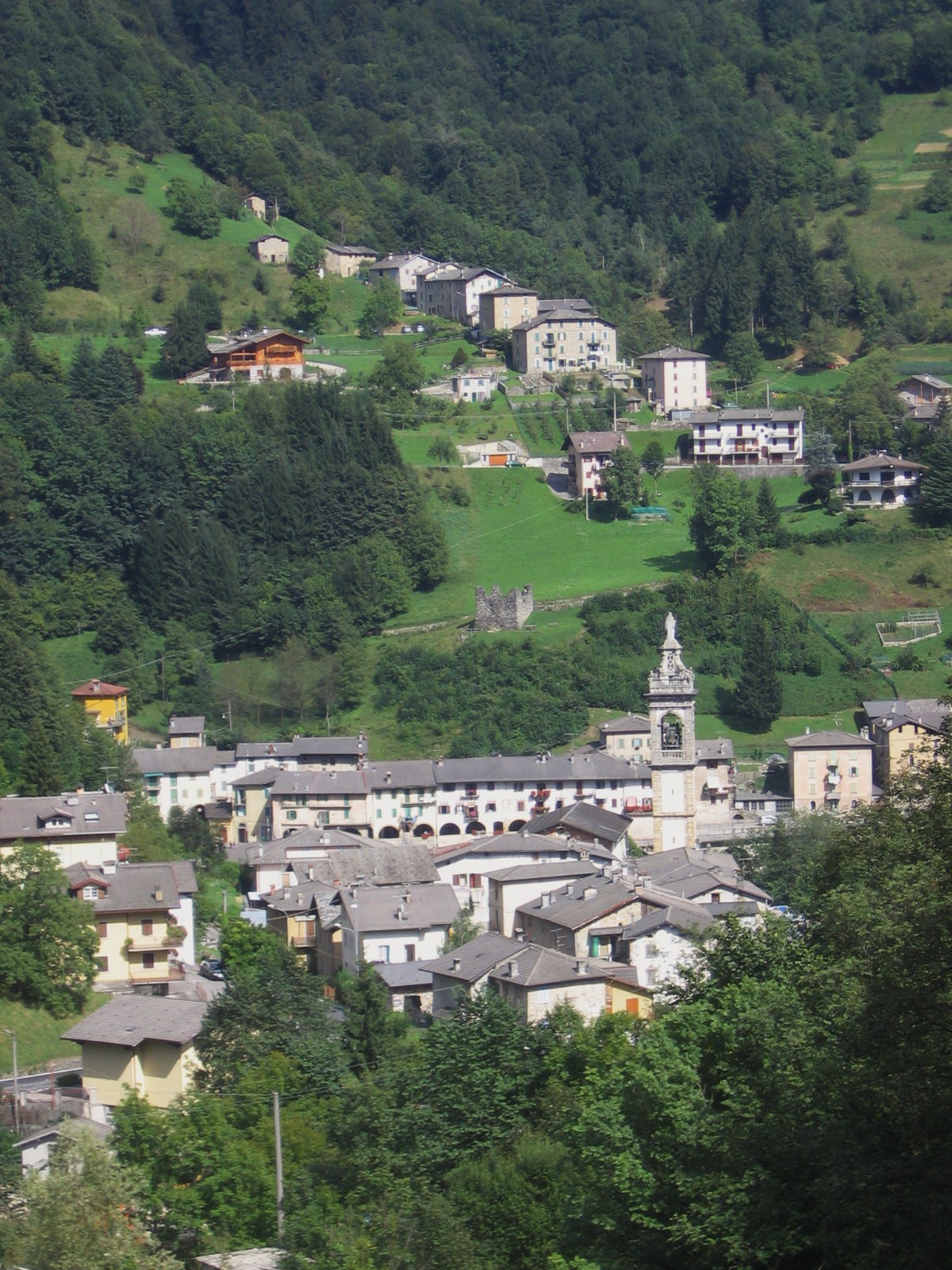
Джерола-Альта
- коммуна Италии
Hiking in Джерола-Альта
Gerola Alta is a beautiful destination for hiking enthusiasts, located in the Lombardy region of Italy, specifically in the province of Sondrio. Known for its stunning mountain scenery, this area offers a variety of trails that cater to different skill levels, making it suitable for both novice and experienced hikers....
- Страна:
- Почтовый код: 23010
- Телефонный код: 0342
- Код автомобильного номера: SO
- Координаты: 46° 4' 0" N, 9° 34' 0" E
- GPS треки (wikiloc): [Ссылка]
- Высота над уровнем моря: 1050 м m
- Площадь: 37.43 кв.км
- Население: 174
- Веб сайт: [Ссылка]


Альбаредо-пер-Сан-Марко
- коммуна Италии
Hiking in Альбаредо-пер-Сан-Марко
Albaredo per San Marco is a charming village located in the province of Sondrio, in the Lombardy region of northern Italy. Nestled within the stunning landscapes of the Valtellina Valley and the surrounding Orobie Alps, it offers a range of beautiful hiking opportunities suitable for various skill levels....
- Страна:
- Почтовый код: 23010
- Телефонный код: 0342
- Код автомобильного номера: SO
- Координаты: 46° 6' 11" N, 9° 35' 26" E
- GPS треки (wikiloc): [Ссылка]
- Высота над уровнем моря: 950 м m
- Площадь: 18.96 кв.км
- Население: 300
- Веб сайт: [Ссылка]
Козьо-Вальтеллино
- коммуна Италии
Hiking in Козьо-Вальтеллино
Cosio Valtellino, located in the province of Sondrio in the Valtellina region of northern Italy, is a hidden gem for hikers and nature enthusiasts. This area offers a variety of trails that cater to different skill levels, showcasing stunning landscapes, rich flora and fauna, and traditional alpine culture....
- Страна:
- Почтовый код: 23013
- Телефонный код: 0342
- Код автомобильного номера: SO
- Координаты: 46° 8' 0" N, 9° 32' 0" E
- GPS треки (wikiloc): [Ссылка]
- Высота над уровнем моря: 231 м m
- Площадь: 23.99 кв.км
- Население: 5512
- Веб сайт: [Ссылка]

Аверара
- коммуна Италии
Hiking in Аверара
Averara is a beautiful destination for hiking enthusiasts, nestled in the Bergamo Alps in the Lombardy region of Italy. This picturesque village offers a range of hiking trails suitable for various skill levels, set against the backdrop of stunning mountain scenery, lush forests, and vibrant flora....
- Страна:
- Почтовый код: 24010
- Телефонный код: 0345
- Код автомобильного номера: BG
- Координаты: 45° 59' 20" N, 9° 37' 53" E
- GPS треки (wikiloc): [Ссылка]
- Высота над уровнем моря: 650 м m
- Площадь: 10.69 кв.км
- Население: 178
- Веб сайт: [Ссылка]