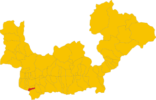
Премана (Premana, Premana)
.svg)
- коммуна Италии
 Hiking in Премана
Premana is a charming town located in the province of Lecco, in the Lombardy region of northern Italy. It's situated in the heart of the Alps, making it an ideal destination for hiking enthusiasts. The surrounding landscape is characterized by breathtaking mountains, lush valleys, and pristine nature, offering a variety of hiking trails suited for all levels of hikers.
Hiking Trails in Premana
-
Sentiero dei Muretti: This trail takes you through beautiful terraced landscapes, showcasing traditional stone walls (muretti) that were built for agricultural purposes. The scenery is stunning, particularly in spring and early summer when wildflowers bloom.
-
Rifugio Lecco: A popular destination for day hikes, this refuge can be reached from various starting points in Premana. The trail offers stunning views of the surrounding mountains and is often frequented by both casual hikers and serious trekkers.
-
Monte Legnoncino: For a more challenging hike, the trail to Monte Legnoncino is an excellent choice. This hike rewards you with panoramic views of the Valsassina valley and surrounding peaks. It's a full-day hike that requires a good level of fitness.
-
Val Varrone: This area offers several trails that explore the scenic beauty of the Varrone Valley. The trails range in difficulty and often lead to picturesque waterfalls and charming alpine landscapes.
-
Pizzo dei Tre Signori: A more challenging ascent, this hike requires good navigation skills and physical fitness. The summit offers breathtaking views of three different valleys: the Valsassina, Val Varrone, and Val Taleggio.
Tips for Hiking in Premana
-
Seasons: The best time for hiking is typically from late spring through early autumn. Summer offers the most favorable weather conditions, but trails can be busy. In late spring, you can enjoy wildflower blooms, while autumn provides stunning fall colors.
-
Preparation: Always check the weather forecast before heading out and be prepared for changing conditions. Wear appropriate footwear, pack sufficient water, snacks, and a first aid kit.
-
Local Insights: Interact with local hikers or guides to learn about hidden gems and lesser-known trails. They can provide valuable insights and tips on the best routes based on your experience level.
-
Stay Safe: Always let someone know your hiking plans, especially for more remote trails. Make sure you have a map or GPS device, and consider downloading hiking apps for offline use.
-
Leave No Trace: Respect the natural environment by following Leave No Trace principles. Carry out all trash and minimize your impact on the trails.
Premana is a fantastic base for exploring the beauty of the Italian Alps, offering a range of trails that cater to both novice and experienced hikers. Happy hiking!
- Страна:

- Почтовый код: 23834
- Телефонный код: 0341
- Код автомобильного номера: LC
- Координаты: 46° 3' 7" N, 9° 25' 23" E


- GPS треки (wikiloc): [Ссылка]
- Высота над уровнем моря: 1000 м m
- Площадь: 33.64 кв.км
- Население: 2262
- Веб сайт: http://www.comune.premana.lc.it/
- Википедия русская: wiki(ru)
- Википедия английская: wiki(en)
- Википедия национальная: wiki(it)
- Хранилище Wikidata: Wikidata: Q42568
- Катеория в википедии: [Ссылка]
- код Freebase: [/m/0gr4g3]
- код GeoNames: Альт: [6539407]
- код BNF: [14490737j]
- код VIAF: Альт: [147771553]
- ID отношения в OpenStreetMap: [46731]
- код LCNAF: Альт: [n82115941]
- код темы Quora: [Premana]
- UN/LOCODE: [ITILP]
- код ISTAT: 097069
- кадастровый код Италии: H028
- LombardiaBeniCulturali toponym ID: 5000281
Граничит с регионами:

Педезина
- коммуна Италии
Hiking in Педезина
Pedesina is a small and picturesque village located in the Valtellina region of northern Italy, nestled in the Alps. It offers stunning natural beauty and a variety of hiking opportunities for outdoor enthusiasts. Here are some highlights for hiking in and around Pedesina:...
- Страна:
- Почтовый код: 23010
- Телефонный код: 0342
- Код автомобильного номера: SO
- Координаты: 46° 5' 0" N, 9° 33' 0" E
- GPS треки (wikiloc): [Ссылка]
- Высота над уровнем моря: 1032 м m
- Площадь: 6.3 кв.км
- Население: 41
- Веб сайт: [Ссылка]
Делебьо
- коммуна Италии
Hiking in Делебьо
Delebio, located in the province of Sondrio in northern Italy, is a charming town that serves as a gateway to the scenic trails of the Valtellina valley and the surrounding Alpine region. The area is known for its stunning landscapes, including mountains, forests, and rivers, which make it an attractive destination for hikers of all levels....
- Страна:
- Почтовый код: 23014
- Телефонный код: 0342
- Код автомобильного номера: SO
- Координаты: 46° 8' 0" N, 9° 28' 0" E
- GPS треки (wikiloc): [Ссылка]
- Высота над уровнем моря: 218 м m
- Площадь: 22.44 кв.км
- Население: 3255
- Веб сайт: [Ссылка]
Джерола-Альта
- коммуна Италии
Hiking in Джерола-Альта
Gerola Alta is a beautiful destination for hiking enthusiasts, located in the Lombardy region of Italy, specifically in the province of Sondrio. Known for its stunning mountain scenery, this area offers a variety of trails that cater to different skill levels, making it suitable for both novice and experienced hikers....
- Страна:
- Почтовый код: 23010
- Телефонный код: 0342
- Код автомобильного номера: SO
- Координаты: 46° 4' 0" N, 9° 34' 0" E
- GPS треки (wikiloc): [Ссылка]
- Высота над уровнем моря: 1050 м m
- Площадь: 37.43 кв.км
- Население: 174
- Веб сайт: [Ссылка]


Роголо
- коммуна Италии
Hiking in Роголо
Hiking in Rogolo, a mountain located in the Lombardy region of northern Italy, offers stunning views and a range of trails suitable for different hiking abilities. The area is known for its beautiful landscapes, rich flora and fauna, and the nearby valleys and peaks of the Orobie Alps....
- Страна:
- Почтовый код: 23010
- Телефонный код: 0342
- Код автомобильного номера: SO
- Координаты: 46° 8' 8" N, 9° 29' 14" E
- GPS треки (wikiloc): [Ссылка]
- Высота над уровнем моря: 216 м m
- Площадь: 12.83 кв.км
- Население: 553
- Веб сайт: [Ссылка]
Казарго
- коммуна Италии
Hiking in Казарго
Casargo is a charming municipality in the province of Lecco, Lombardy, Italy, nestled in the picturesque Valtellina valley and close to the Alps. It offers a variety of hiking opportunities for all levels, with stunning views of mountains, valleys, and scenic landscapes. Here are some highlights for those interested in hiking in Casargo:...
- Страна:
- Почтовый код: 23831
- Телефонный код: 0341
- Код автомобильного номера: LC
- Координаты: 46° 3' 0" N, 9° 23' 0" E
- GPS треки (wikiloc): [Ссылка]
- Высота над уровнем моря: 850 м m
- Площадь: 19.71 кв.км
- Население: 844
- Веб сайт: [Ссылка]


Паньона
- коммуна Италии
Hiking in Паньона
Pagnona, located in the region of Lombardy in Italy, is surrounded by stunning landscapes that make it a charming destination for hiking enthusiasts. The area is characterized by its mountainous terrain, lush green valleys, and picturesque villages, offering a range of hiking trails suitable for different skill levels....
- Страна:
- Почтовый код: 23833
- Телефонный код: 0341
- Код автомобильного номера: LC
- Координаты: 46° 3' 36" N, 9° 24' 7" E
- GPS треки (wikiloc): [Ссылка]
- Высота над уровнем моря: 790 м m
- Площадь: 9.2 кв.км
- Население: 364
- Веб сайт: [Ссылка]
Прималуна
- коммуна Италии
Hiking in Прималуна
Primaluna is a picturesque village located in the heart of the Valsassina valley in Italy, nestled in the foothills of the Alps. It's a great destination for hiking enthusiasts due to its stunning landscapes, charming villages, and rich natural diversity. Here are some highlights for hiking in and around Primaluna:...
- Страна:
- Почтовый код: 23819
- Телефонный код: 0341
- Код автомобильного номера: LC
- Координаты: 45° 58' 0" N, 9° 26' 0" E
- GPS треки (wikiloc): [Ссылка]
- Высота над уровнем моря: 550 м m
- Площадь: 22.43 кв.км
- Население: 2258
- Веб сайт: [Ссылка]


Интробьо
- коммуна Италии
Hiking in Интробьо
Introbio is a picturesque village located in the Valtorta area of Italy, nestled in the Lombardy region. It serves as a gateway to some beautiful hiking trails and offers wonderful nature experiences for outdoor enthusiasts....
- Страна:
- Почтовый код: 23815
- Телефонный код: 0341
- Код автомобильного номера: LC
- Координаты: 45° 58' 0" N, 9° 27' 0" E
- GPS треки (wikiloc): [Ссылка]
- Высота над уровнем моря: 586 м m
- Площадь: 26.03 кв.км
- Население: 1996
- Веб сайт: [Ссылка]