Прюньер (Prunières, Prunières)

 Hiking in Прюньер
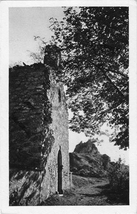
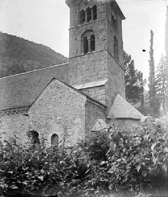
Prunières, located in the Isère department in the Auvergne-Rhône-Alpes region of France, offers a variety of hiking opportunities that allow hikers to enjoy beautiful landscapes, lush forests, and alpine vistas. Here are some highlights about hiking in and around Prunières:
Trail Options
-
Local Trails: Prunières is surrounded by numerous trails suitable for all levels of hikers. You can find easier walks that are family-friendly as well as more challenging routes for experienced hikers.
-
Lake Hiking: The area near Prunières features beautiful lakes, such as Lac de Prunières. Walks around the lake provide stunning views and the opportunity to enjoy waterside scenery and wildlife.
-
Alpine Routes: Venture further into the surrounding regional parks, such as the Écrins National Park, which offers extensive trails with varying levels of difficulty. Many trails here provide breathtaking views of the Alps, glaciers, and rugged mountain terrain.
Natural Attractions
- Scenic Views: The trails often provide panoramic views of the surrounding mountains, valleys, and the charm of rural French landscapes.
- Flora and Fauna: The region is rich in biodiversity, and you may encounter diverse plant species and wildlife, especially in the protected areas.
Preparation
- Weather Conditions: Before you set out, check the weather conditions. The weather in the mountains can change rapidly, so it's important to be prepared for varying conditions.
- Gear: Make sure to wear sturdy hiking boots and bring essential gear, including water, snacks, a map or GPS, and a first-aid kit. It's advisable to have a layered clothing system to accommodate temperature changes.
Safety Tips
- Always let someone know your hiking plans and expected return time.
- Stay on marked trails to protect the environment and ensure your safety.
- If you're unfamiliar with the area, consider joining a local hiking group or hiring a guide for a more enriching experience.
Local Amenities
- Prunières itself may have local shops and accommodations, but for more extensive services, consider nearby towns. This includes options for food, lodging, and tourist information centers.
Conclusion
Hiking in Prunières offers an excellent way to connect with nature while enjoying the beauty of the French Alps. Whether you're looking for a leisurely stroll or a challenging trek, this area has something to offer for everyone. Always ensure to respect local regulations and the natural environment during your hikes. Enjoy your adventure!
- Страна:

- Почтовый код: 38350
- Координаты: 44° 53' 35" N, 5° 45' 47" E


- GPS треки (wikiloc): [Ссылка]
- Площадь: 8.2 кв.км
- Население: 365
- Википедия русская: wiki(ru)
- Википедия английская: wiki(en)
- Википедия национальная: wiki(fr)
- Хранилище Wikidata: Wikidata: Q1151385
- Катеория в википедии: [Ссылка]
- код Freebase: [/m/03g_0xt]
- код GeoNames: Альт: [6433300]
- номер SIREN: [213803265]
- код муниципалитета INSEE: 38326
Граничит с регионами:

Конье
- коммуна во Франции
Hiking in Конье
Cognet is a small area in the Isère department of the Auvergne-Rhône-Alpes region in France, known for its natural beauty and outdoor activities, including hiking. Located at the foot of the Alps, Cognet offers a variety of hiking trails that cater to different skill levels, making it an excellent destination for both novice and experienced hikers....
- Страна:
- Почтовый код: 38350
- Координаты: 44° 52' 52" N, 5° 46' 37" E
- GPS треки (wikiloc): [Ссылка]
- Площадь: 1.8 кв.км
- Население: 44


Сюсвиль
- коммуна во Франции
Hiking in Сюсвиль
Susville, located in the region of Burgundy in France, is surrounded by stunning natural landscapes, making it an excellent destination for hiking enthusiasts. Though it's a smaller town, it offers various trails that cater to different skill levels. Here are some key points to consider for hiking in and around Susville:...
- Страна:
- Почтовый код: 38350
- Координаты: 44° 54' 57" N, 5° 46' 49" E
- GPS треки (wikiloc): [Ссылка]
- Высота над уровнем моря: 910 м m
- Площадь: 9.91 кв.км
- Население: 1314
- Веб сайт: [Ссылка]

Мер-Савель
- коммуна во Франции
Hiking in Мер-Савель
Mayres-Savel, located in the Auvergne-Rhône-Alpes region of France, offers a variety of hiking opportunities that showcase its stunning natural beauty. The region is characterized by rugged landscapes, lush forests, and breathtaking vistas, making it an excellent destination for outdoor enthusiasts....
- Страна:
- Почтовый код: 38350
- Координаты: 44° 52' 28" N, 5° 43' 19" E
- GPS треки (wikiloc): [Ссылка]
- Площадь: 12.51 кв.км
- Население: 119
- Веб сайт: [Ссылка]

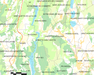
Ла-Мотт-Сен-Мартен
- коммуна во Франции
Hiking in Ла-Мотт-Сен-Мартен
La Motte-Saint-Martin is a charming village located in the Vosges department in northeastern France, surrounded by beautiful natural landscapes that are perfect for hiking enthusiasts. The area is characterized by its rolling hills, lush forests, and scenic views, making it an excellent destination for outdoor activities. Here are some highlights of hiking in and around La Motte-Saint-Martin:...
- Страна:
- Почтовый код: 38770
- Координаты: 44° 57' 1" N, 5° 43' 4" E
- GPS треки (wikiloc): [Ссылка]
- Площадь: 14.64 кв.км
- Население: 432
- Веб сайт: [Ссылка]


Сент-Аре
- коммуна во Франции
Hiking in Сент-Аре
Saint-Arey is a charming village located in the Isère department of the Auvergne-Rhône-Alpes region in southeastern France. Nestled in the picturesque French Alps, it offers beautiful scenery and a variety of hiking opportunities....
- Страна:
- Почтовый код: 38350
- Координаты: 44° 52' 19" N, 5° 44' 2" E
- GPS треки (wikiloc): [Ссылка]
- Площадь: 6.67 кв.км
- Население: 83


Ла-Мюр
- коммуна во Франции
Hiking in Ла-Мюр
La Mure is a charming town situated in the French Alps, known for its breathtaking landscapes and excellent hiking opportunities. Located within the Isère department, it serves as a great starting point for outdoor enthusiasts looking to explore the surrounding mountains and natural parks....
- Страна:
- Почтовый код: 38350
- Координаты: 44° 54' 11" N, 5° 47' 15" E
- GPS треки (wikiloc): [Ссылка]
- Высота над уровнем моря: 886 м m
- Площадь: 8.33 кв.км
- Население: 4992
- Веб сайт: [Ссылка]