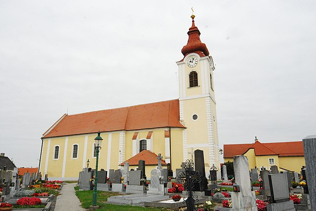
Рабс-ан-дер-Тайя (Raabs an der Thaya, Raabs an der Thaya)
- муниципалитет в Австрии
 Hiking in Рабс-ан-дер-Тайя
Raabs an der Thaya is a picturesque town located in the Waldviertel region of Austria, near the borders with the Czech Republic. The area is known for its stunning natural landscapes, rich history, and outdoor recreational opportunities. Hiking in and around Raabs an der Thaya offers a mix of scenic trails, historical sites, and enchanting views of the Thaya River.
Hiking Trails
-
Thaya River Trail: This is one of the most popular hiking routes, following the Thaya River. It's relatively easy and suitable for all ages. Hikers can enjoy beautiful views of the river and the surrounding forested areas.
-
Historical Trails: There are several trails that lead to historical sites, including the 12th-century castle in Raabs. Exploring these trails allows hikers to combine physical activity with a touch of local culture and history.
-
Nature Trails: The surrounding landscapes are filled with diverse flora and fauna, making it an ideal region for nature enthusiasts. Some trails are designated as nature trails, where you can learn about the local ecosystem.
Preparation and Tips
- Weather Check: The weather in this region can change rapidly, so always check the forecast before heading out.
- Proper Gear: Wear sturdy hiking boots and dress in layers. It's important to have appropriate gear, especially in the cooler months.
- Trail Maps: Carry a detailed map or use a hiking app for navigation, as some trails may not be well-marked.
- Safety Considerations: While hiking is generally safe, make sure to stay on marked trails and inform someone about your hiking plans.
Local Attractions
- Raabs Castle: This historic fortress offers a glimpse into the region's past and provides an excellent viewpoint of the town and river.
- Czech Republic Border: If you’re up for an adventure, there are trails that lead toward the Czech border, allowing for some cross-country hiking experiences.
Conclusion
Hiking in Raabs an der Thaya is a rewarding experience that combines natural beauty, outdoor activity, and cultural exploration. Whether you’re a seasoned hiker or just want to enjoy a leisurely walk, there are trails suitable for everyone in this charming part of Austria.
- Страна:

- Почтовый код: 3820
- Телефонный код: 02846
- Код автомобильного номера: WT
- Координаты: 48° 50' 53" N, 15° 29' 35" E


- GPS треки (wikiloc): [Ссылка]
- Высота над уровнем моря: 410 м m
- Площадь: 134.65 кв.км
- Население: 2651
- Веб сайт: http://www.raabs-thaya.gv.at/
- Википедия русская: wiki(ru)
- Википедия английская: wiki(en)
- Википедия национальная: wiki(de)
- Хранилище Wikidata: Wikidata: Q510604
- Катеория в википедии: [Ссылка]
- код Freebase: [/m/0bzz_q]
- код GeoNames: Альт: [7871922]
- код VIAF: Альт: [170354170]
- код GND: Альт: [4278653-8]
- идентификатор местоположения ArchINFORM: [15933]
- код LCNAF: Альт: [no2011051383]
- код австрийского муниципалитета: [32216]
Граничит с регионами:

Дрозендорф-Циссерсдорф
Hiking in Дрозендорф-Циссерсдорф
Drosendorf-Zissersdorf, located in the Waldviertel region of Austria, offers picturesque landscapes and a range of hiking opportunities that showcase the natural beauty and historical significance of the area. Here are some key points to consider if you’re planning to hike in this region:...
- Страна:
- Почтовый код: 2095
- Телефонный код: 02915
- Код автомобильного номера: HO
- Координаты: 48° 52' 5" N, 15° 37' 1" E
- GPS треки (wikiloc): [Ссылка]
- Высота над уровнем моря: 423 м m
- Площадь: 53.45 кв.км
- Население: 1213
- Веб сайт: [Ссылка]

Гросзигхартс
Hiking in Гросзигхартс
Groß-Siegharts, located in the Waldviertel region of Austria, offers a charming environment for hiking enthusiasts. This area is characterized by its rolling hills, dense forests, and picturesque landscapes, making it an appealing destination for both casual hikers and more experienced adventurers....
- Страна:
- Почтовый код: 3812
- Телефонный код: 02847
- Код автомобильного номера: WT
- Координаты: 48° 47' 0" N, 15° 24' 0" E
- GPS треки (wikiloc): [Ссылка]
- Высота над уровнем моря: 515 м m
- Площадь: 44.27 кв.км
- Население: 2775
- Веб сайт: [Ссылка]

Карлштайн-ан-дер-Тайя
Hiking in Карлштайн-ан-дер-Тайя
Karlstein an der Thaya is a charming village located in Lower Austria, set amidst beautiful natural landscapes and rolling hills. It is situated near the Thaya River and adjacent to the Thayatal National Park, which offers a plethora of opportunities for hiking enthusiasts....
- Страна:
- Почтовый код: 3822
- Телефонный код: 02844
- Код автомобильного номера: WT
- Координаты: 48° 53' 0" N, 15° 24' 0" E
- GPS треки (wikiloc): [Ссылка]
- Высота над уровнем моря: 442 м m
- Площадь: 48.86 кв.км
- Население: 1468
- Веб сайт: [Ссылка]

Лудвайс-Айген
Hiking in Лудвайс-Айген
Ludweis-Aigen, located in Austria, is a beautiful destination for hiking enthusiasts. Nestled in the rolling hills of the region, it offers picturesque landscapes, lush forests, and a variety of trails suited for all skill levels, from beginners to advanced hikers....
- Страна:
- Почтовый код: 3762
- Телефонный код: 02847
- Код автомобильного номера: WT
- Координаты: 48° 46' 0" N, 15° 29' 0" E
- GPS треки (wikiloc): [Ссылка]
- Высота над уровнем моря: 507 м m
- Площадь: 51.18 кв.км
- Население: 914
- Веб сайт: [Ссылка]
Японс
Hiking in Японс
Hiking in Japan offers a diverse range of experiences, thanks to the country's varied landscapes, rich culture, and well-maintained trails. Here are some key points to consider when planning a hiking trip in Japan:...
- Страна:
- Почтовый код: 3763
- Телефонный код: 02914
- Код автомобильного номера: HO
- Координаты: 48° 47' 34" N, 15° 34' 5" E
- GPS треки (wikiloc): [Ссылка]
- Высота над уровнем моря: 525 м m
- Площадь: 29.38 кв.км
- Население: 733
- Веб сайт: [Ссылка]