.jpg)
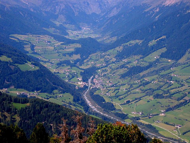
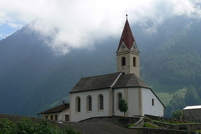
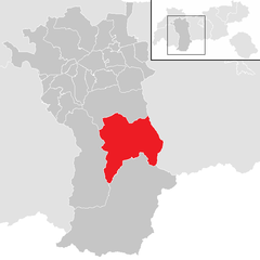
Зёльден (Sölden, Sölden)
 Hiking in Зёльден
Sölden, located in the Ötztal Valley of Tyrol, Austria, is a fantastic destination for hiking enthusiasts. It's known for its stunning alpine scenery, diverse trails, and a wide range of outdoor activities. Here’s what you can expect when hiking in Sölden:
Trails and Terrain
-
Variety of Trails: Sölden offers a variety of hiking trails that cater to different skill levels, from leisurely family walks to challenging mountain hikes. This means you can find routes that suit both beginners and experienced hikers.
-
Popular Hiking Trails:
- Waalwege (Irrigation Trails): These gentle paths follow historical irrigation channels and are perfect for those seeking a leisurely hike with beautiful valley views.
- Zahnberg: This trail offers stunning panoramas and is suitable for intermediate hikers.
- Hochsolden: A more challenging trail that ascends into the higher alpine regions, providing breathtaking views of glaciers and peaks.
-
Elevation Gain: Many trails in Sölden can involve significant elevation gain, so prepare for steep ascents and always check trail descriptions or maps for difficulty levels.
Scenic Highlights
- Glaciers: The nearby Rettenbach and Tiefenbach glaciers offer spectacular views and a chance to observe stunning glacial landscapes.
- Waterfalls and Lakes: Trails often lead to picturesque alpine lakes and waterfalls, perfect for rest stops or photography.
- Wildlife: The region is home to diverse flora and fauna, including marmots, ibexes, and various bird species. Keep your eyes peeled while hiking!
Accessibility
- Gondolas and Lifts: Sölden is well-equipped with cable cars and gondolas that can take you up into the mountains, allowing you to start your hike at higher altitudes, which is especially helpful for reaching some of the more scenic routes without a strenuous initial climb.
Best Time to Hike
- Summer (June to September): This is the best time for hiking, as trails are usually clear of snow. The weather is generally mild and the mountain flora is in full bloom.
Safety and Preparation
- Gear: Make sure to wear proper hiking boots, weather-appropriate clothing, and bring essentials like water, snacks, a map, and a first-aid kit.
- Weather: Mountain weather can change rapidly, so it's wise to check forecasts before heading out and be prepared for possible changes during your hike.
Local Amenities
- Food and Accommodation: Sölden has plenty of hut restaurants along trails, offering local cuisine and refreshments. The village also has a selection of accommodations ranging from hotels to guesthouses.
Conclusion
Hiking in Sölden provides not only an opportunity to explore beautiful landscapes but also a chance to enjoy the rich natural environment of the Austrian Alps. Whether you’re seeking a peaceful stroll or an adventurous high-altitude trek, Sölden has something to offer every hiker. Always remember to respect the area and follow Leave No Trace principles to preserve its beauty for generations to come.
- Страна:

- Почтовый код: 6450
- Телефонный код: 05254
- Код автомобильного номера: IM
- Координаты: 46° 58' 0" N, 11° 0' 0" E


- GPS треки (wikiloc): [Ссылка]
- Высота над уровнем моря: 1368 м m
- Площадь: 466.78 кв.км
- Население: 3145
- Веб сайт: http://www.soelden.tirol.gv.at/
- Википедия русская: wiki(ru)
- Википедия английская: wiki(en)
- Википедия национальная: wiki(de)
- Хранилище Wikidata: Wikidata: Q570486
- Катеория в википедии: [Ссылка]
- код Freebase: [/m/0266twq]
- код GeoNames: Альт: [2764957]
- код VIAF: Альт: [235975389]
- код GND: Альт: [4208193-2]
- идентификатор местоположения ArchINFORM: [10483]
- код австрийского муниципалитета: [70220]
Граничит с регионами:


Курон-Веноста
- коммуна Италии
Hiking in Курон-Веноста
Graun im Vinschgau, located in the beautiful Vinschgau Valley of South Tyrol, Italy, is a fantastic destination for hikers. Surrounded by stunning alpine scenery, including the Ortler Alps and the Texel Group Nature Park, it offers a variety of trails suitable for all skill levels. Here are some highlights and tips for hiking in this region:...
- Страна:

- Почтовый код: 39020
- Телефонный код: 0473
- Код автомобильного номера: BZ
- Координаты: 46° 48' 30" N, 10° 32' 34" E
- GPS треки (wikiloc): [Ссылка]
- Высота над уровнем моря: 1520 м m
- Площадь: 209.65 кв.км
- Население: 2381
- Веб сайт: [Ссылка]


Маллес-Веноста
- коммуна Италии
Hiking in Маллес-Веноста
Mals, located in the Vinschgau Valley in South Tyrol, Italy, is a fantastic spot for hiking enthusiasts. Surrounded by stunning landscapes, picturesque villages, and a rich cultural heritage, it offers a variety of trails suitable for different skill levels....
- Страна:
- Почтовый код: 39024
- Телефонный код: 0473
- Код автомобильного номера: BZ
- Координаты: 46° 41' 16" N, 10° 32' 48" E
- GPS треки (wikiloc): [Ссылка]
- Высота над уровнем моря: 1051 м m
- Площадь: 247.43 кв.км
- Население: 5225
- Веб сайт: [Ссылка]


Мозо-ин-Пассирия
- коммуна Италии
Hiking in Мозо-ин-Пассирия
Moos in Passeier is a picturesque village located in the Passeier Valley of South Tyrol, Italy. It's a great base for hiking enthusiasts who want to explore the stunning natural beauty of the region, which is characterized by majestic mountains, lush meadows, and charming alpine landscapes. Here are some highlights and tips for hiking in and around Moos in Passeier:...
- Страна:
- Почтовый код: 39013
- Телефонный код: 0473
- Код автомобильного номера: BZ
- Координаты: 46° 49' 54" N, 11° 10' 1" E
- GPS треки (wikiloc): [Ссылка]
- Высота над уровнем моря: 1007 м m
- Площадь: 193.53 кв.км
- Население: 2097
- Веб сайт: [Ссылка]

Рачинес
- коммуна в Италии
Hiking in Рачинес
Ratschings, located in the South Tyrol region of northern Italy, is a fantastic destination for hiking enthusiasts. The area is known for its stunning alpine scenery, diverse trails, and a variety of outdoor activities. Here are some highlights of hiking in Ratschings:...
- Страна:
- Почтовый код: 39040
- Телефонный код: 0472
- Код автомобильного номера: BZ
- Координаты: 46° 52' 0" N, 11° 18' 0" E
- GPS треки (wikiloc): [Ссылка]
- Высота над уровнем моря: 976 м m
- Площадь: 203.29 кв.км
- Население: 4471
- Веб сайт: [Ссылка]

Сеналес
- коммуна в Италии
Hiking in Сеналес
Schnals, located in the South Tyrol region of Italy, is a picturesque valley that offers stunning landscapes and diverse hiking opportunities. Nestled in the Ötztal Alps, it is a popular destination for outdoor enthusiasts, especially those who enjoy alpine hiking....
- Страна:
- Почтовый код: 39020
- Телефонный код: 0473
- Код автомобильного номера: BZ
- Координаты: 46° 42' 0" N, 10° 55' 0" E
- GPS треки (wikiloc): [Ссылка]
- Высота над уровнем моря: 1317 м m
- Площадь: 209.84 кв.км
- Население: 1231
- Веб сайт: [Ссылка]

Ленгенфельд
Hiking in Ленгенфельд
Längenfeld is a picturesque village located in the Ötztal Valley of Tyrol, Austria. It is an excellent destination for hikers and outdoor enthusiasts, offering a variety of trails that cater to different skill levels. Here are some key points about hiking in Längenfeld:...
- Страна:
- Почтовый код: 6444
- Телефонный код: 05253
- Код автомобильного номера: IM
- Координаты: 47° 4' 0" N, 10° 58' 0" E
- GPS треки (wikiloc): [Ссылка]
- Высота над уровнем моря: 1179 м m
- Площадь: 195.8 кв.км
- Население: 4611
- Веб сайт: [Ссылка]


Санкт-Леонхард
Hiking in Санкт-Леонхард
Sankt Leonhard im Pitztal is a wonderful destination for hiking enthusiasts, located in the Tyrol region of Austria. This area offers stunning alpine scenery, with a variety of trails suited for different skill levels, making it a great choice for both beginners and experienced hikers....
- Страна:
- Почтовый код: 6481
- Телефонный код: 05413
- Код автомобильного номера: IM
- Координаты: 47° 4' 0" N, 10° 50' 0" E
- GPS треки (wikiloc): [Ссылка]
- Высота над уровнем моря: 1366 м m
- Площадь: 223.4 кв.км
- Население: 1382
- Веб сайт: [Ссылка]