
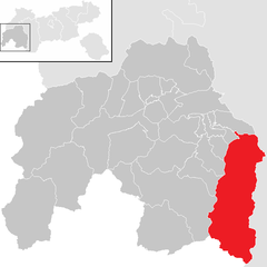
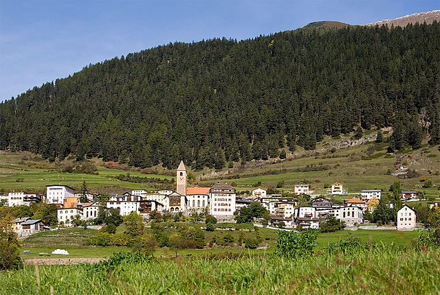
Курон-Веноста (Graun im Vinschgau, Curon Venosta)
.svg)
- коммуна Италии
 Hiking in Курон-Веноста
Graun im Vinschgau, located in the beautiful Vinschgau Valley of South Tyrol, Italy, is a fantastic destination for hikers. Surrounded by stunning alpine scenery, including the Ortler Alps and the Texel Group Nature Park, it offers a variety of trails suitable for all skill levels. Here are some highlights and tips for hiking in this region:
Trail Options
-
Hiking around the Reschensee (Reschen Lake): This picturesque lake offers scenic routes along its shores and up into the surrounding hills, with views of the submerged church tower of Graun emerging from the water.
-
Trails in the Texel Group Nature Park: This protected area features a range of hiking trails through diverse landscapes, from lush meadows to rocky outcrops. Popular routes include hikes to the Zufritt Glacier and the Hochjoch Pass.
-
The Sentiero del Sole (Sun Trail): A medium-difficulty trail that provides panoramic views of the valley and the surrounding mountain ranges. This trail connects various villages and is a great way to explore the region.
-
Family-friendly Walks: There are several easy trails perfect for families, providing gentle hikes with opportunities for picnicking and enjoying nature.
Practical Tips
-
Season: Late spring to early fall (May to October) is the best time for hiking, with well-marked trails and the chance to enjoy wildflowers and wildlife.
-
Gear: Good hiking boots, weather-appropriate clothing, a backpack with essentials (water, snacks, first-aid kit), and trekking poles are recommended.
-
Safety: Always check the weather before heading out and let someone know your hiking plans. Additionally, consider starting earlier in the day to avoid afternoon storms, which can occur in the mountains.
-
Local Amenities: Graun im Vinschgau has accommodations, local restaurants, and shops to stock up on supplies.
-
Cultural Aspects: Don't miss the local culture and cuisine; trying the traditional speck platter or a slice of "Tirtlan" (a local type of pastry) is a must after a day of hiking.
Overall, Graun im Vinschgau is a hidden gem for hikers, offering stunning vistas, varied trails, and a peaceful mountain environment. Enjoy your hiking adventures!
- Страна:

- Почтовый код: 39020
- Телефонный код: 0473
- Код автомобильного номера: BZ
- Координаты: 46° 48' 30" N, 10° 32' 34" E


- GPS треки (wikiloc): [Ссылка]
- Высота над уровнем моря: 1520 м m
- Площадь: 209.65 кв.км
- Население: 2381
- Веб сайт: http://www.gemeinde.graun.bz.it
- Википедия русская: wiki(ru)
- Википедия английская: wiki(en)
- Википедия национальная: wiki(it)
- Хранилище Wikidata: Wikidata: Q380146
- Галерея изображений в википедии: [Ссылка]
- Катеория в википедии: [Ссылка]
- код Freebase: [/m/0g9gl_]
- код GeoNames: Альт: [6535894]
- код VIAF: Альт: [160754397]
- ID отношения в OpenStreetMap: [47325]
- код GND: Альт: [16094929-4]
- код LCNAF: Альт: [n96001041]
- код TGN: [1044449]
- код ISTAT: 021027
- кадастровый код Италии: D222
Граничит с регионами:


Маллес-Веноста
- коммуна Италии
Hiking in Маллес-Веноста
Mals, located in the Vinschgau Valley in South Tyrol, Italy, is a fantastic spot for hiking enthusiasts. Surrounded by stunning landscapes, picturesque villages, and a rich cultural heritage, it offers a variety of trails suitable for different skill levels....
- Страна:
- Почтовый код: 39024
- Телефонный код: 0473
- Код автомобильного номера: BZ
- Координаты: 46° 41' 16" N, 10° 32' 48" E
- GPS треки (wikiloc): [Ссылка]
- Высота над уровнем моря: 1051 м m
- Площадь: 247.43 кв.км
- Население: 5225
- Веб сайт: [Ссылка]

Зёльден
Hiking in Зёльден
Sölden, located in the Ötztal Valley of Tyrol, Austria, is a fantastic destination for hiking enthusiasts. It's known for its stunning alpine scenery, diverse trails, and a wide range of outdoor activities. Here’s what you can expect when hiking in Sölden:...
- Страна:

- Почтовый код: 6450
- Телефонный код: 05254
- Код автомобильного номера: IM
- Координаты: 46° 58' 0" N, 11° 0' 0" E
- GPS треки (wikiloc): [Ссылка]
- Высота над уровнем моря: 1368 м m
- Площадь: 466.78 кв.км
- Население: 3145
- Веб сайт: [Ссылка]

Члин
Hiking in Члин
Tschlin, a picturesque village located in the Swiss Alps, is an excellent destination for hiking enthusiasts. Nestled in the canton of Graubünden near the border with Italy, Tschlin offers a variety of trails that cater to different skill levels and preferences. Here are some key highlights about hiking in Tschlin:...
- Страна:

- Почтовый код: 7559
- Телефонный код: 081
- Код автомобильного номера: GR
- Координаты: 46° 51' 59" N, 10° 25' 0" E
- GPS треки (wikiloc): [Ссылка]
- Высота над уровнем моря: 1553 м m
- Площадь: 74.93 кв.км
- Веб сайт: [Ссылка]


Рамош
Hiking in Рамош
Ramosch is a charming village in the Swiss canton of Graubünden, nestled in the picturesque Lower Engadine Valley. The area is famous for its stunning landscapes, rich cultural heritage, and extensive hiking trails, making it a fantastic destination for hiking enthusiasts....
- Страна:
- Почтовый код: 7556
- Телефонный код: 081
- Код автомобильного номера: GR
- Координаты: 46° 49' 59" N, 10° 23' 0" E
- GPS треки (wikiloc): [Ссылка]
- Высота над уровнем моря: 1236 м m
- Площадь: 84.02 кв.км
- Веб сайт: [Ссылка]


Наудерс
Hiking in Наудерс
Nauders, located in the Tyrol region of Austria, is a fantastic destination for hiking enthusiasts. Nestled near the borders of Italy and Switzerland, it offers breathtaking alpine scenery, diverse trails, and a rich natural environment....
- Страна:
- Почтовый код: 6543
- Телефонный код: 0
- Код автомобильного номера: LA
- Координаты: 46° 52' 0" N, 10° 31' 0" E
- GPS треки (wikiloc): [Ссылка]
- Высота над уровнем моря: 1394 м m
- Площадь: 90.3 кв.км
- Население: 1542
- Веб сайт: [Ссылка]

Каунерталь
Hiking in Каунерталь
Kaunertal is a stunningly beautiful valley located in the Tyrol region of Austria. It is known for its picturesque landscapes, diverse hiking trails, and the spectacular Kaunertaler Glacier. Here’s what you can expect when hiking in Kaunertal:...
- Страна:
- Почтовый код: 6524
- Телефонный код: 05475
- Код автомобильного номера: LA
- Координаты: 47° 2' 0" N, 10° 45' 0" E
- GPS треки (wikiloc): [Ссылка]
- Высота над уровнем моря: 1287 м m
- Площадь: 193.5 кв.км
- Население: 597
- Веб сайт: [Ссылка]


Зент
Hiking in Зент
Sent, a charming village located in the Upper Engadin region of Switzerland, is known for its stunning landscapes, well-marked hiking trails, and rich culture. Here’s an overview of what you can expect when hiking in Sent:...
- Страна:
- Почтовый код: 7554
- Телефонный код: 081
- Код автомобильного номера: GR
- Координаты: 46° 49' 0" N, 10° 20' 0" E
- GPS треки (wikiloc): [Ссылка]
- Высота над уровнем моря: 1440 м m
- Площадь: 111.74 кв.км
- Веб сайт: [Ссылка]


Пфундс
Hiking in Пфундс
Pfunds, a charming village located in the Tyrol region of Austria, is an excellent destination for hiking enthusiasts. Nestled in the picturesque Inn Valley, it serves as a gateway to numerous hiking trails that cater to different skill levels, from easy walks to challenging mountain hikes....
- Страна:
- Почтовый код: 6542
- Телефонный код: 05474
- Код автомобильного номера: LA
- Координаты: 46° 58' 0" N, 10° 33' 0" E
- GPS треки (wikiloc): [Ссылка]
- Высота над уровнем моря: 970 м m
- Площадь: 140.4 кв.км
- Население: 2602
- Веб сайт: [Ссылка]

Valsot
Hiking in Valsot
Valsot is a picturesque mountain area located in the Swiss Alps, renowned for its stunning landscapes and extensive network of hiking trails. Here’s an overview of what you can expect when hiking in Valsot:...
- Страна:
- Почтовый код: 7556, 7559
- Телефонный код: 081
- Код автомобильного номера: GR
- Координаты: 46° 50' 0" N, 10° 23' 0" E
- GPS треки (wikiloc): [Ссылка]
- Высота над уровнем моря: 1236 м m
- Площадь: 158.96 кв.км
- Население: 859
- Веб сайт: [Ссылка]