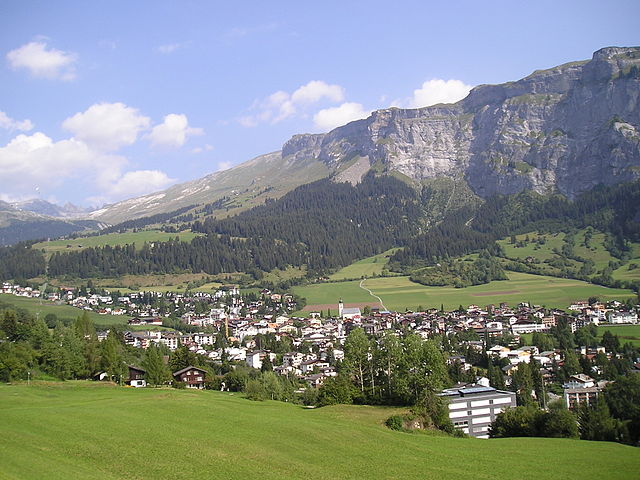
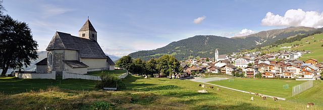
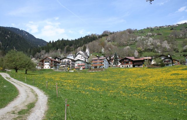
Сагонь (Sagogn, Sagogn)

 Hiking in Сагонь
Sagogn is a charming village located in the Swiss canton of Graubünden, nestled amid stunning alpine scenery. It's an excellent destination for hiking enthusiasts, offering a variety of trails suitable for different skill levels. Here are some key points to consider when hiking in and around Sagogn:
Hiking Trails
-
Accessibility: Several well-marked hiking paths begin in Sagogn, leading into the surrounding mountains and valleys. The trails vary in difficulty, from easy walks suitable for families to more demanding hikes for experienced adventurers.
-
Scenic Views: The hikes around Sagogn provide breathtaking views of the Swiss Alps, lush forests, and picturesque meadows. Keep an eye out for local wildlife, including marmots and various bird species.
-
The Rheinschlucht: This area, also known as the "Swiss Grand Canyon," is a short drive from Sagogn and offers dramatic landscapes and a network of hiking trails suitable for all levels.
-
Flims to Sagogn Trail: A beautiful trail that connects the villages of Flims and Sagogn, featuring stunning views and the chance to explore local flora and fauna.
Practical Tips
- Season: The best time to hike in Sagogn is during late spring through early autumn, although some trails may be accessible year-round, depending on snow conditions.
- Equipment: Ensure you have proper hiking gear, including sturdy hiking boots, weather-appropriate clothing, and plenty of water and snacks.
- Maps and Guides: It's advisable to carry a detailed map or use a hiking app to navigate the trails. Local tourist offices can provide information and resources.
- Safety: Always inform someone of your hiking plans, especially if you're heading out on trails that lead into remote areas. Check weather conditions before heading out and be prepared to turn back if conditions worsen.
Additional Activities
Apart from hiking, Sagogn also offers opportunities for cycling, swimming, and exploring local cultural sites. The area's natural beauty is complemented by opportunities for relaxation at local spas or enjoying Swiss cuisine in nearby restaurants.
Whether you’re an accomplished hiker or a beginner, Sagogn presents a wonderful opportunity to immerse yourself in nature and enjoy the tranquility of the Swiss landscape!
- Страна:

- Почтовый код: 7152
- Телефонный код: 081
- Код автомобильного номера: GR
- Координаты: 46° 47' 32" N, 9° 15' 21" E


- GPS треки (wikiloc): [Ссылка]
- Высота над уровнем моря: 809 м m
- Площадь: 6.92 кв.км
- Население: 686
- Веб сайт: http://www.sagogn.ch
- Википедия русская: wiki(ru)
- Википедия английская: wiki(en)
- Википедия национальная: wiki(de)
- Хранилище Wikidata: Wikidata: Q65684
- Катеория в википедии: [Ссылка]
- код Freebase: [/m/026gn6q]
- код GeoNames: Альт: [7287015]
- код BNF: [11962121t]
- код VIAF: Альт: [237700505]
- ID отношения в OpenStreetMap: [1684148]
- идентификатор HDS: [1444]
- код швейцарского муниципалитета: [3581]
Граничит с регионами:

Флимс
Hiking in Флимс
Flims, located in the Swiss canton of Graubünden, is a fantastic destination for hiking enthusiasts. This picturesque region offers stunning scenery, including impressive rock formations, forests, alpine meadows, and beautiful lakes. Here are some highlights and essential information for hiking in Flims:...
- Страна:
- Почтовый код: 7017
- Телефонный код: 081
- Код автомобильного номера: GR
- Координаты: 46° 49' 59" N, 9° 16' 59" E
- GPS треки (wikiloc): [Ссылка]
- Высота над уровнем моря: 1848 м m
- Площадь: 50.46 кв.км
- Население: 2825
- Веб сайт: [Ссылка]

Фалера
Hiking in Фалера
Falera is a picturesque village in the Swiss Alps, located in the canton of Graubünden. The region is known for its breathtaking landscapes, rich history, and excellent hiking opportunities. Here’s what you should know about hiking in Falera:...
- Страна:
- Почтовый код: 7153
- Телефонный код: 081
- Код автомобильного номера: GR
- Координаты: 46° 49' 38" N, 9° 12' 31" E
- GPS треки (wikiloc): [Ссылка]
- Высота над уровнем моря: 1982 м m
- Площадь: 22.36 кв.км
- Население: 623
- Веб сайт: [Ссылка]

Шлуайн
Hiking in Шлуайн
Schluein is a picturesque village in the Graubünden region of Switzerland, nestled in the scenic Surselva area. It offers a variety of hiking opportunities, with stunning landscapes that include lush valleys, rugged mountains, and serene rivers....
- Страна:
- Почтовый код: 7151
- Телефонный код: 081
- Код автомобильного номера: GR
- Координаты: 46° 46' 59" N, 9° 13' 59" E
- GPS треки (wikiloc): [Ссылка]
- Высота над уровнем моря: 762 м m
- Площадь: 4.79 кв.км
- Население: 623
- Веб сайт: [Ссылка]


Кастриш
Hiking in Кастриш
Castrisch is a small village in the Surselva region of Switzerland, known for its beautiful landscapes and access to various hiking trails. Here are some key points to consider if you're planning a hiking trip in and around Castrisch:...
- Страна:
- Почтовый код: 7126
- Телефонный код: 081
- Код автомобильного номера: GR
- Координаты: 46° 45' 59" N, 9° 13' 0" E
- GPS треки (wikiloc): [Ссылка]
- Высота над уровнем моря: 722 м m
- Площадь: 7.19 кв.км
- Веб сайт: [Ссылка]


Лакс
Hiking in Лакс
Laax, located in the Swiss Alps in the canton of Graubünden, is a fantastic destination for hiking enthusiasts. Known for its breathtaking landscapes, diverse trails, and stunning alpine scenery, Laax offers hiking options for all skill levels. Here are some key aspects to consider if you're planning to hike in Laax:...
- Страна:
- Почтовый код: 7031
- Телефонный код: 081
- Код автомобильного номера: GR
- Координаты: 46° 50' 45" N, 9° 13' 40" E
- GPS треки (wikiloc): [Ссылка]
- Высота над уровнем моря: 1685 м m
- Площадь: 31.68 кв.км
- Население: 1755
- Веб сайт: [Ссылка]