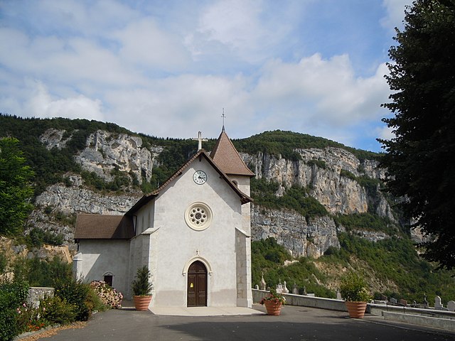
Saint-Genix-sur-Guiers (Saint-Genix-sur-Guiers)

- коммуна во Франции
 Hiking in Saint-Genix-sur-Guiers
Saint-Genix-sur-Guiers is a charming commune located in the Rhône-Alpes region of France, known for its beautiful scenery and access to hiking trails. Nestled at the foot of the Chartreuse Mountains, it offers a variety of outdoor activities, including hiking, with trails that cater to different skill levels.
Hiking Trails
-
Local Trails: The area around Saint-Genix-sur-Guiers features several local trails that can lead you through picturesque landscapes, forests, and along riverbanks. These trails often provide stunning views of the surrounding mountains and the Guiers River.
-
Chartreuse Mountains: Just a short distance away, the Chartreuse Mountains offer more challenging hikes. Trails range from easy walks to more strenuous climbs, with options such as the famous Grand Som or visits to the many mountain lakes.
-
GR Trails: The area also connects to the long-distance GR (Grande Randonnée) trails, which allow for extended hiking if you're looking for a multi-day experience. These trails cross through various landscapes, connecting different villages and natural sites.
Best Times to Hike
- Spring (April to June): The weather is mild, and the flora is in full bloom, making it a picturesque time to hike.
- Autumn (September to October): Expect beautiful fall colors and cooler temperatures, ideal for comfortable hiking.
Preparation Tips
- Gear: Wear sturdy hiking boots and pack layers, as weather conditions can change quickly in the mountains.
- Maps: Carry a detailed local map or a GPS device, especially if venturing onto less marked trails.
- Hydration and Snacks: Always have enough water and high-energy snacks, particularly for longer hikes.
Additional Activities
Besides hiking, the area offers opportunities for cycling, fishing, and enjoying local gastronomy. The nearby villages also provide historical and cultural insights, making for enriching experiences beyond just the trails.
Safety
- Always inform someone of your hiking plans, especially when heading into less populated areas.
- Check local weather forecasts and trail conditions before embarking on your hike.
Enjoy your outdoor adventure in Saint-Genix-sur-Guiers, and make the most of the natural beauty that the region has to offer!
- Страна:

- Почтовый код: 73240
- Координаты: 45° 36' 2" N, 5° 38' 4" E


- GPS треки (wikiloc): [Ссылка]
- Площадь: 12.27 кв.км
- Население: 2384
- Википедия английская: wiki(en)
- Википедия национальная: wiki(fr)
- Хранилище Wikidata: Wikidata: Q591760
- Катеория в википедии: [Ссылка]
- код Freebase: [/m/03npgn7]
- код GeoNames: Альт: [6442870]
- номер SIREN: [217302363]
- код BNF: [152741675]
- код VIAF: Альт: [247380363]
- код тезауруса PACTOLS: [pcrtp8yAzOvFHp]
- код муниципалитета INSEE: 73236
Граничит с регионами:


Аост
Hiking in Аост
Aoste, located in the Isère department of the Auvergne-Rhône-Alpes region in France, is a charming town surrounded by beautiful mountain landscapes, making it a great destination for hiking enthusiasts. The area offers a variety of hiking trails suitable for different skill levels, from leisurely walks to more challenging treks....
- Страна:
- Почтовый код: 38490
- Координаты: 45° 35' 18" N, 5° 36' 32" E
- GPS треки (wikiloc): [Ссылка]
- Площадь: 9.82 кв.км
- Население: 2862
- Веб сайт: [Ссылка]


Романьё
- коммуна во Франции
Hiking in Романьё
Romagnieu is a charming commune located in the Isère department in the Auvergne-Rhône-Alpes region of southeastern France. It’s known for its natural beauty and proximity to hiking opportunities in the surrounding area, particularly due to its location near the Chartreuse Mountains and the Vercors Regional Natural Park....
- Страна:
- Почтовый код: 38480
- Координаты: 45° 34' 12" N, 5° 38' 29" E
- GPS треки (wikiloc): [Ссылка]
- Площадь: 17.11 кв.км
- Население: 1560
- Веб сайт: [Ссылка]

Рошфор
- коммуна во Франции
Hiking in Рошфор
Rochefort is a charming village located in the Savoie region of the French Alps, which is known for its stunning alpine scenery, beautiful landscapes, and fantastic hiking opportunities. Here are some highlights and tips for hiking in and around Rochefort:...
- Страна:
- Почтовый код: 73240
- Координаты: 45° 34' 56" N, 5° 43' 20" E
- GPS треки (wikiloc): [Ссылка]
- Площадь: 5.6 кв.км
- Население: 216

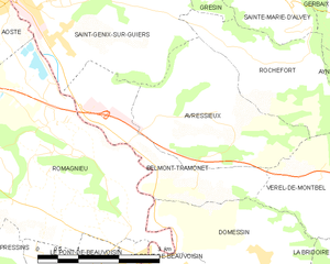
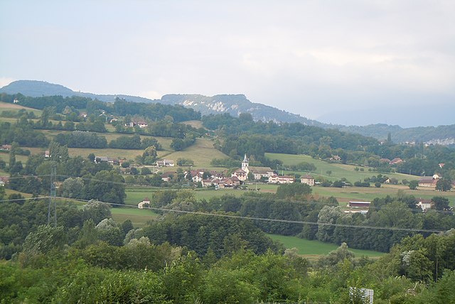
Belmont-Tramonet
- коммуна во Франции
Hiking in Belmont-Tramonet
Belmont-Tramonet is a picturesque municipality located in the Savoie region of France, nestled in the French Alps. It offers stunning views and a variety of hiking opportunities, making it a great destination for outdoor enthusiasts....
- Страна:
- Почтовый код: 73330
- Координаты: 45° 33' 34" N, 5° 40' 46" E
- GPS треки (wikiloc): [Ссылка]
- Площадь: 5.46 кв.км
- Население: 561

Avressieux
- коммуна во Франции
Hiking in Avressieux
Avressieux is a charming village located in the Auvergne-Rhône-Alpes region of France, in the department of Savoie. It is situated at the edge of beautiful natural landscapes, making it an appealing destination for hiking enthusiasts....
- Страна:
- Почтовый код: 73240
- Координаты: 45° 34' 20" N, 5° 41' 41" E
- GPS треки (wikiloc): [Ссылка]
- Площадь: 8.07 кв.км
- Население: 517
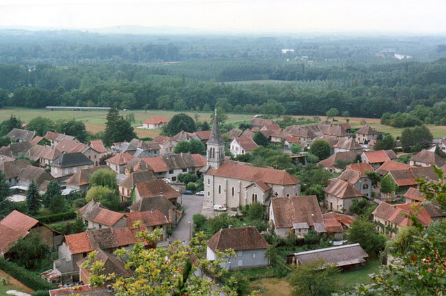
Бренье-Кордон
- коммуна во Франции
Hiking in Бренье-Кордон
Brégnier-Cordon is a charming village located in the Auvergne-Rhône-Alpes region of France, surrounded by stunning natural landscapes, making it an excellent destination for hiking enthusiasts. Here are some key points to consider when hiking in and around Brégnier-Cordon:...
- Страна:
- Почтовый код: 01300
- Координаты: 45° 38' 56" N, 5° 37' 11" E
- GPS треки (wikiloc): [Ссылка]
- Площадь: 11 кв.км
- Население: 856
- Веб сайт: [Ссылка]


Gresin
- коммуна во Франции
Hiking in Gresin
Gresin, located in the Aosta Valley region of Italy, is a wonderful destination for hiking enthusiasts. The area offers stunning mountainous landscapes, lush valleys, and a plethora of trails suitable for various skill levels....
- Страна:
- Почтовый код: 73240
- Координаты: 45° 36' 36" N, 5° 40' 57" E
- GPS треки (wikiloc): [Ссылка]
- Площадь: 5.01 кв.км
- Население: 387


Champagneux
- коммуна во Франции
Hiking in Champagneux
Champagneux is a charming village located in the Savoie region of the French Alps, offering stunning natural landscapes, rich biodiversity, and a variety of hiking trails suitable for different skill levels. Here are some highlights to consider when hiking in Champagneux:...
- Страна:
- Почтовый код: 73240
- Координаты: 45° 37' 44" N, 5° 40' 26" E
- GPS треки (wikiloc): [Ссылка]
- Площадь: 10.68 кв.км
- Население: 679