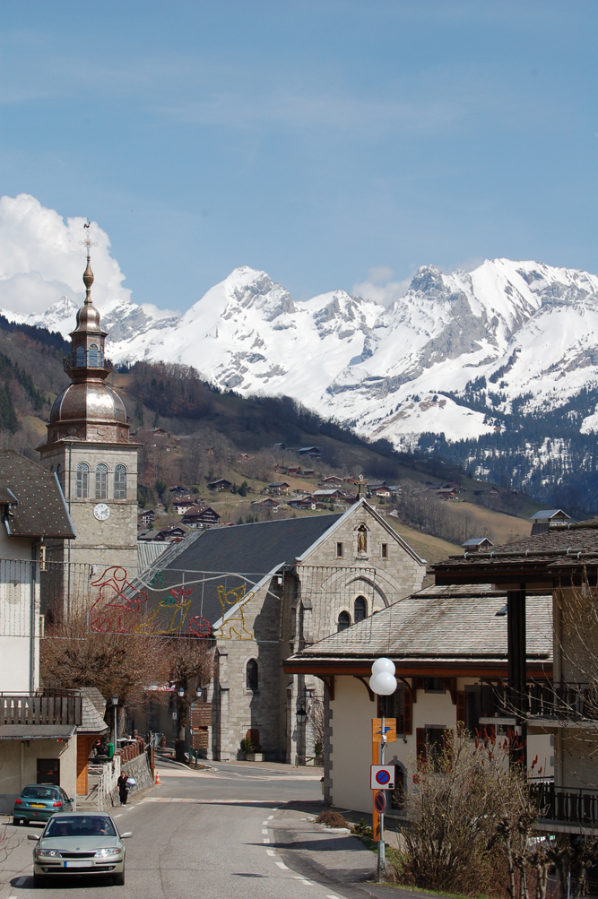
Сен-Жан-де-Сикс (Saint-Jean-de-Sixt, Saint-Jean-de-Sixt)

- коммуна во Франции
 Hiking in Сен-Жан-де-Сикс
Saint-Jean-de-Sixt is a charming village located in the Aravis mountain range in the French Alps, offering a variety of hiking opportunities catering to different experience levels. Here’s what you need to know about hiking in this beautiful area:
Hiking Trails
-
Le Col de la Croix Fry: This popular trail provides stunning panoramic views of the Aravis mountains and is accessible for families. The hike is moderately easy and is well-marked, making it a great option for beginners.
-
La Tournette: For more experienced hikers, the ascent to La Tournette, the highest peak in the Aravis range, can be challenging but rewarding. The trail is steeper and requires good fitness levels, but the vistas from the top are breathtaking.
-
Les Creux: This trail offers a serene hiking experience through pastures and forests. It’s relatively easy and perfect for those looking for a quieter hike with opportunities to see local wildlife.
-
La Clusaz-Balme: A more moderate hike connects to La Clusaz ski resort, which features various routes that are equally beautiful in summer conditions.
Tips for Hiking in the Area
-
Season Considerations: The best time to hike in Saint-Jean-de-Sixt is typically from late spring to early fall (May to September) when the trails are clear of snow.
-
Gear: Always wear appropriate hiking footwear, and consider trekking poles for steeper hikes. Carry enough water and snacks, and don’t forget sunscreen and a hat!
-
Maps and Signage: Trails are generally well-marked, but having a map or a hiking app can help with navigation. Local tourist offices often provide detailed maps.
-
Weather: Mountain weather can change rapidly, so keep an eye on forecasts and be prepared for various conditions.
-
Local Regulations: Respect wildlife, stay on marked trails, and follow any local regulations or guidelines, especially in protected areas.
Other Activities
In addition to hiking, Saint-Jean-de-Sixt offers opportunities for mountain biking, paragliding, and exploring the beautiful alpine scenery. The area is also known for its local culture, cuisine, and welcoming hospitality.
Whether you are an experienced hiker or just starting out, the trails around Saint-Jean-de-Sixt provide a wonderful opportunity to experience the natural beauty of the French Alps. Enjoy your hike!
- Страна:

- Почтовый код: 74450
- Координаты: 45° 55' 23" N, 6° 24' 36" E


- GPS треки (wikiloc): [Ссылка]
- Площадь: 12.21 кв.км
- Население: 1433
- Википедия английская: wiki(en)
- Википедия национальная: wiki(fr)
- Хранилище Wikidata: Wikidata: Q818418
- Катеория в википедии: [Ссылка]
- код Freebase: [/m/06m_8n]
- код GeoNames: Альт: [6443039]
- номер SIREN: [217402395]
- код BNF: [15274494w]
- код муниципалитета INSEE: 74239
Граничит с регионами:


Entremont, Haute-Savoie
- коммуна во Франции
Hiking in Entremont, Haute-Savoie
Entremont, located in the Haute-Savoie region of France, is a beautiful area known for its stunning landscapes and excellent hiking opportunities. Nestled in the French Alps, Entremont offers a variety of trails suitable for hikers of all levels, from beginners to experienced adventurers....
- Страна:
- Почтовый код: 74130
- Координаты: 45° 57' 24" N, 6° 23' 20" E
- GPS треки (wikiloc): [Ссылка]
- Площадь: 18.35 кв.км
- Население: 664
- Веб сайт: [Ссылка]

Le Grand-Bornand
- коммуна во Франции
Hiking in Le Grand-Bornand
Le Grand-Bornand is a picturesque village located in the French Alps, within the Haute-Savoie department. It offers a stunning backdrop of mountains and lush landscapes, making it a popular destination for hiking enthusiasts. Here's what you need to know about hiking in Le Grand-Bornand:...
- Страна:
- Почтовый код: 74450
- Координаты: 45° 56' 31" N, 6° 25' 31" E
- GPS треки (wikiloc): [Ссылка]
- Площадь: 61.42 кв.км
- Население: 2154
- Веб сайт: [Ссылка]


Ла Клюза
- коммуна во Франции
Hiking in Ла Клюза
La Clusaz is a charming alpine village located in the French Alps, known for its skiing in the winter and its stunning hiking trails in the summer. It’s a popular destination for outdoor enthusiasts, offering a variety of hiking experiences suitable for all levels of hikers....
- Страна:
- Почтовый код: 74220
- Координаты: 45° 54' 15" N, 6° 25' 23" E
- GPS треки (wikiloc): [Ссылка]
- Площадь: 40.62 кв.км
- Население: 1770
- Веб сайт: [Ссылка]


Les Villards-sur-Thônes
- коммуна во Франции
Hiking in Les Villards-sur-Thônes
Les Villards-sur-Thônes is a charming village situated in the Haute-Savoie region of the French Alps. It's an excellent base for hiking enthusiasts due to its scenic landscapes, varied terrain, and proximity to the Aravis Mountain range....
- Страна:
- Почтовый код: 74230
- Координаты: 45° 54' 26" N, 6° 21' 57" E
- GPS треки (wikiloc): [Ссылка]
- Площадь: 13.32 кв.км
- Население: 1038