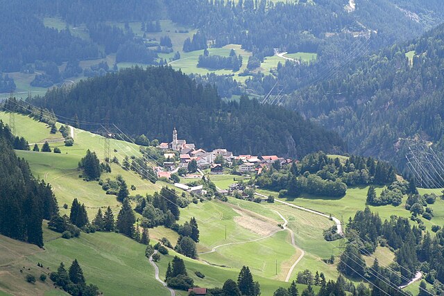
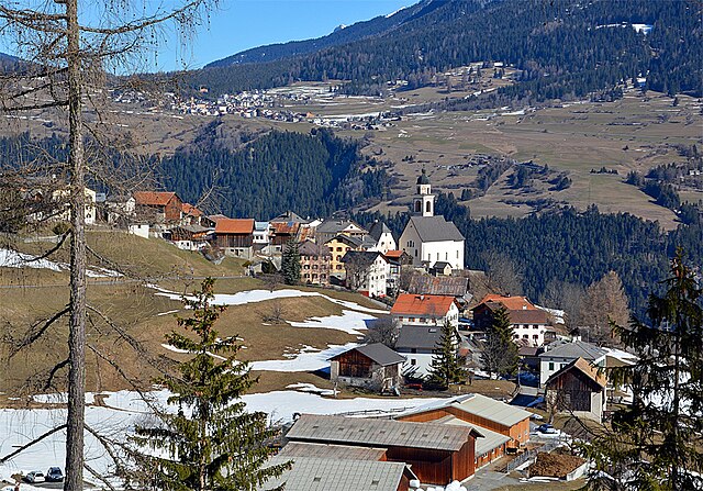
Тифенкастель (Tiefencastel, Tiefencastel)

 Hiking in Тифенкастель
Tiefencastel is a small village located in the beautiful region of Graubünden in Switzerland, known for its stunning landscapes and excellent hiking opportunities. Here’s an overview of what to expect when hiking in and around Tiefencastel:
Trails and Routes
-
Via Engiadina: This long-distance hiking trail passes nearby and offers breathtaking views of the surrounding mountains and valleys. The trail winds through charming villages and lush landscapes.
-
Hiking around the Albula Valley: The area is rich in diverse trails ranging from easy walks to more challenging hikes. The Albula Valley features scenic views, waterfalls, and natural beauty, perfect for nature lovers.
-
Piz Gannaretsch: For those seeking a more challenging trek, consider a hike to Piz Gannaretsch. The trail rewards hikers with panoramic views of the surrounding peaks and valleys.
-
Circular Hiking Trails: There are various circular hiking routes available that start and end in Tiefencastel, allowing for a more relaxed hiking experience while taking in the surroundings.
Difficulty Levels
Hiking trails around Tiefencastel cater to all skill levels, from beginners to experienced hikers. Be sure to check the trail markers and maps for difficulty ratings.
Best Time to Hike
The ideal time for hiking in the Tiefencastel area is during the summer months (June to September) when the weather is generally mild and the trails are clear of snow. However, early autumn can also offer beautiful foliage and pleasant hiking conditions.
Tips for Hiking in the Area
- Check Weather Conditions: The weather can change rapidly in the mountains, so always check the forecast before heading out.
- Dress Appropriately: Wear layers and ensure you have suitable footwear. The terrain can be rugged in places.
- Stay Hydrated and Nourished: Bring sufficient water and snacks to keep your energy levels up during your hike.
- Respect Nature: Follow Leave No Trace principles to help preserve the beauty of the environment.
Conclusion
Tiefencastel is a fantastic destination for hiking enthusiasts, offering a variety of trails that showcase the natural beauty of the Swiss Alps. Whether you’re looking for a leisurely walk or a challenging climb, you’ll find suitable options in this picturesque region. Remember to plan ahead, stay safe, and enjoy the breathtaking scenery!
- Страна:

- Почтовый код: 7450
- Телефонный код: 081
- Код автомобильного номера: GR
- Координаты: 46° 38' 42" N, 9° 36' 47" E


- GPS треки (wikiloc): [Ссылка]
- Высота над уровнем моря: 1716 м m
- Площадь: 14.85 кв.км
- Веб сайт: http://www.tiefencastel.ch
- Википедия русская: wiki(ru)
- Википедия английская: wiki(en)
- Википедия национальная: wiki(de)
- Хранилище Wikidata: Wikidata: Q64328
- Катеория в википедии: [Ссылка]
- код Freebase: [/m/026fzll]
- код GeoNames: Альт: [7287311]
- код VIAF: Альт: [236392252]
- идентификатор местоположения ArchINFORM: [4837]
- идентификатор HDS: [1413]
- код швейцарского муниципалитета: [3505]
- код Цифрового атласа Римской империи: [4634]
- LIR: [182]
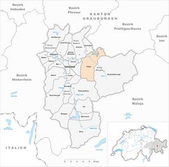
Граничит с регионами:


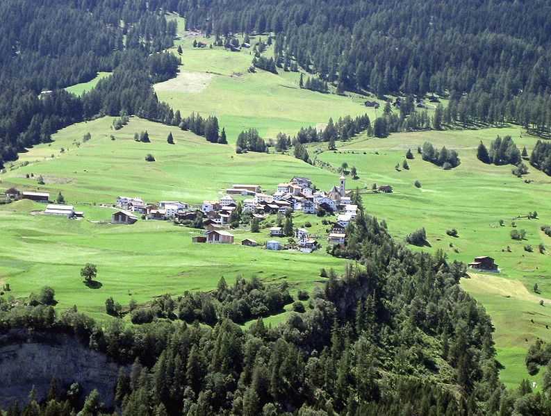
Кунтер
Hiking in Кунтер
Cunter, a small village in the Grisons region of Switzerland, is an excellent destination for hiking enthusiasts. Nestled amidst stunning landscapes, the area offers a variety of trails suitable for different skill levels, from leisurely walks to more challenging hikes....
- Страна:
- Почтовый код: 7452
- Телефонный код: 081
- Код автомобильного номера: GR
- Координаты: 46° 35' 59" N, 9° 34' 59" E
- GPS треки (wikiloc): [Ссылка]
- Высота над уровнем моря: 1182 м m
- Площадь: 7.12 кв.км
- Население: 215
- Веб сайт: [Ссылка]


Альваной
Hiking in Альваной
Alvaneu is a picturesque village in the Swiss canton of Graubünden, known for its stunning natural landscapes and outdoor activities, including hiking. The area offers a variety of trails suitable for different skill levels, making it ideal for both beginners and experienced hikers. Here are some highlights of hiking in Alvaneu:...
- Страна:
- Почтовый код: 7492
- Телефонный код: 081
- Код автомобильного номера: GR
- Координаты: 46° 40' 59" N, 9° 38' 59" E
- GPS треки (wikiloc): [Ссылка]
- Высота над уровнем моря: 1181 м m
- Площадь: 35.68 кв.км
- Веб сайт: [Ссылка]

Альвашайн
Hiking in Альвашайн
Alvaschein is a picturesque village located in the canton of Graubünden in Switzerland, surrounded by stunning alpine landscapes. It serves as an excellent base for hiking enthusiasts looking to explore the natural beauty of the region....
- Страна:
- Почтовый код: 7451
- Телефонный код: 081
- Код автомобильного номера: GR
- Координаты: 46° 39' 59" N, 9° 32' 59" E
- GPS треки (wikiloc): [Ссылка]
- Высота над уровнем моря: 1001 м m
- Площадь: 4.08 кв.км
- Веб сайт: [Ссылка]


Бриенц-Бринцаульс
Hiking in Бриенц-Бринцаульс
Brienz-Brinzauls is a beautiful region in Switzerland known for its stunning landscapes, picturesque villages, and excellent hiking trails. Located in the Graubünden canton, it offers a mix of natural beauty, traditional Alpine architecture, and a variety of outdoor activities....
- Страна:
- Почтовый код: 7084
- Телефонный код: 081
- Код автомобильного номера: GR
- Координаты: 46° 40' 0" N, 9° 35' 59" E
- GPS треки (wikiloc): [Ссылка]
- Высота над уровнем моря: 1144 м m
- Площадь: 13.37 кв.км
- Веб сайт: [Ссылка]


Савоньин
Hiking in Савоньин
Savognin is a picturesque village located in the Surses valley of the Swiss Alps, and it's a fantastic destination for hiking enthusiasts. The region offers a variety of trails that cater to different skill levels, from easy walks suitable for families to more challenging hikes for seasoned adventurers....
- Страна:
- Почтовый код: 7460
- Телефонный код: 081
- Код автомобильного номера: GR
- Координаты: 46° 34' 53" N, 9° 36' 8" E
- GPS треки (wikiloc): [Ссылка]
- Высота над уровнем моря: 1453 м m
- Площадь: 22.24 кв.км
- Веб сайт: [Ссылка]

Штирва
Hiking in Штирва
Stierva, a picturesque village located in the heart of the Swiss Alps, offers a stunning array of hiking opportunities for outdoor enthusiasts. Nestled within the Graubünden region, Stierva is known for its breathtaking landscapes, diverse terrain, and rich natural beauty. Here are some key points to consider when hiking in and around Stierva:...
- Страна:
- Почтовый код: 7459
- Телефонный код: 081
- Код автомобильного номера: GR
- Координаты: 46° 38' 59" N, 9° 32' 0" E
- GPS треки (wikiloc): [Ссылка]
- Высота над уровнем моря: 1375 м m
- Площадь: 10.56 кв.км
- Веб сайт: [Ссылка]


Риом-Парсонц
Hiking in Риом-Парсонц
Riom-Parsonz is a picturesque village located in the canton of Graubünden in Switzerland, known for its stunning natural scenery and excellent hiking opportunities. The region offers a combination of lush valleys, alpine meadows, and striking mountain views, making it a fantastic destination for hikers of all levels....
- Страна:
- Почтовый код: 7464; 7463
- Телефонный код: 081
- Код автомобильного номера: GR
- Координаты: 46° 35' 59" N, 9° 33' 59" E
- GPS треки (wikiloc): [Ссылка]
- Высота над уровнем моря: 1257 м m
- Площадь: 55.97 кв.км
- Веб сайт: [Ссылка]

Мон
- община в Швейцарии, Граубюнден
Hiking in Мон
Hiking in Mon, Switzerland, offers a stunning experience amidst breathtaking alpine scenery. Mon is located in the Valais region, which is known for its majestic mountains, picturesque villages, and rich cultural heritage. Here are some key points to consider when planning a hike in this beautiful region:...
- Страна:
- Почтовый код: 7458
- Телефонный код: 081
- Код автомобильного номера: GR
- Координаты: 46° 39' 0" N, 9° 33' 0" E
- GPS треки (wikiloc): [Ссылка]
- Высота над уровнем моря: 1231 м m
- Площадь: 8.46 кв.км


Сурава
Hiking in Сурава
Surava, located in the beautiful region of the Swiss Alps, is a fantastic destination for hiking enthusiasts. Here are some key points to consider if you're planning a hiking trip in Surava:...
- Страна:
- Почтовый код: 7472
- Телефонный код: 081
- Код автомобильного номера: GR
- Координаты: 46° 39' 25" N, 9° 37' 0" E
- GPS треки (wikiloc): [Ссылка]
- Высота над уровнем моря: 1223 м m
- Площадь: 6.68 кв.км
- Веб сайт: [Ссылка]

Филизур
Hiking in Филизур
Filisur is a picturesque village located in the canton of Graubünden, Switzerland. It is nestled in the Albula Valley and is known for its stunning landscapes, traditional Swiss architecture, and access to numerous hiking trails. Here are some highlights and tips for hiking in and around Filisur:...
- Страна:
- Почтовый код: 7477
- Телефонный код: 081
- Код автомобильного номера: GR
- Координаты: 46° 40' 20" N, 9° 41' 15" E
- GPS треки (wikiloc): [Ссылка]
- Высота над уровнем моря: 1032 м m
- Площадь: 44.58 кв.км
- Население: 434
- Веб сайт: [Ссылка]