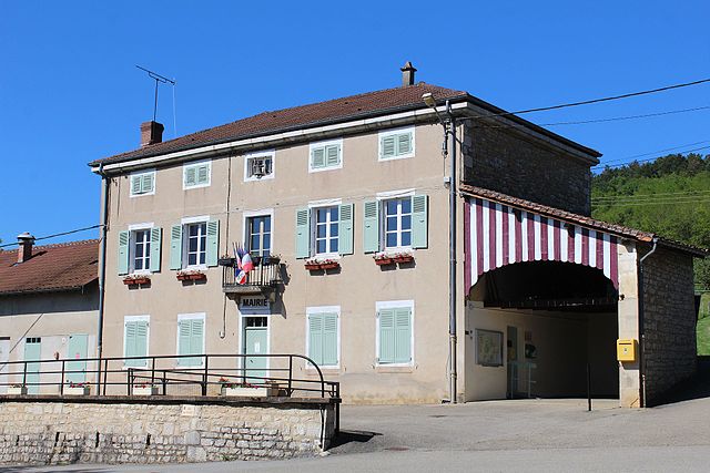
Треффор-Кюизья (Treffort-Cuisiat, Treffort-Cuisiat)
- коммуна во Франции
 Hiking in Треффор-Кюизья
Treffort-Cuisiat, located in the Ain department of the Auvergne-Rhône-Alpes region in southeastern France, is an area that offers diverse and beautiful hiking opportunities. The landscape here is characterized by rolling hills, forests, and picturesque views, making it a great spot for both leisurely walks and more challenging hikes.
Hiking Trails and Options:
-
Local Trails: There are various marked hiking trails in and around Treffort-Cuisiat that cater to different levels of experience. You can find circular trails that allow you to explore the local countryside, with varying distances to suit all hikers.
-
Forests and Nature: The region is adorned with lush woodlands, perfect for enjoying the serene beauty of nature. The forests provide opportunities for wildlife spotting, and the trails often lead you through areas rich in flora and fauna.
-
Scenic Views: Many trails offer stunning panoramic views of the surrounding landscapes, including the Jura mountains and the Bresse region. It's a fantastic area for photography, especially during sunrise or sunset.
-
Cultural Stops: While hiking, you may come across small villages and historical sites that can enrich your experience. Taking breaks in these spots can add a cultural dimension to your hikes.
Tips for Hiking in Treffort-Cuisiat:
- Trail Maps: Make sure to carry a detailed map or have a reliable GPS app that shows local trails. The markings can sometimes be sparse, so it’s good to be prepared.
- Weather Considerations: Check the weather before your hike; the region can experience variable weather, so dress in layers and be prepared for sudden changes.
- Hydration and Snacks: Bring plenty of water and some snacks, especially if you're planning on more extended hikes.
- Respect Nature: Stay on marked trails to minimize your impact on the environment, and remember to take your litter with you.
- Safety: If you're hiking alone, let someone know your plans, and consider carrying a mobile phone in case of emergencies.
Overall, Treffort-Cuisiat is a charming destination for hikers looking to explore the natural beauty and tranquility of the French countryside. Whether you’re a beginner or an experienced hiker, you’re sure to find trails that will make your experience enjoyable.
- Страна:

- Почтовый код: 02220
- Координаты: 46° 16' 17" N, 5° 22' 6" E


- GPS треки (wikiloc): [Ссылка]
- Площадь: 39.41 кв.км
- Население: 1728
- Веб сайт: http://www.treffort-cuisiat.fr
- Википедия русская: wiki(ru)
- Википедия английская: wiki(en)
- Википедия национальная: wiki(fr)
- Хранилище Wikidata: Wikidata: Q733076
- Катеория в википедии: [Ссылка]
- Карты в википедии: [Ссылка]
- код Freebase: [/m/081sg2]
- код Freebase: [/m/081sg2]
- код GeoNames: Альт: [2971974]
- код GeoNames: Альт: [2971974]
- код BNF: [11956506s]
- код BNF: [11956506s]
- код VIAF: Альт: [233876510]
- код VIAF: Альт: [233876510]
- код муниципалитета INSEE: 01426
- код муниципалитета INSEE: 01426
Граничит с регионами:

Шаван-сюр-Сюран
- коммуна во Франции
Hiking in Шаван-сюр-Сюран
Chavannes-sur-Suran is a small commune located in the Jura department of France. It's surrounded by beautiful natural landscapes, making it a great destination for hiking enthusiasts. Here are some points of interest for hiking in this area:...
- Страна:
- Почтовый код: 01250
- Координаты: 46° 15' 48" N, 5° 25' 36" E
- GPS треки (wikiloc): [Ссылка]
- Площадь: 21.5 кв.км
- Население: 656

Пресья
- коммуна во Франции
Hiking in Пресья
Pressiat, located in the Jura region of France, is a lesser-known but beautiful hiking destination. Known for its lush landscapes, rolling hills, and diverse flora and fauna, it's an excellent spot for both novice and experienced hikers....
- Страна:
- Почтовый код: 01370
- Координаты: 46° 19' 23" N, 5° 23' 8" E
- GPS треки (wikiloc): [Ссылка]
- Площадь: 6.01 кв.км
- Население: 243


Bourcia
- коммуна во Франции
Hiking in Bourcia
It seems there may be a slight misunderstanding, as there isn't a well-known hiking region specifically named "Bourcia." However, if you meant a specific location with a similar name, such as a region in a particular country or a lesser-known destination, please clarify....
- Страна:
- Почтовый код: 39320
- Координаты: 46° 21' 13" N, 5° 24' 29" E
- GPS треки (wikiloc): [Ссылка]
- Площадь: 11.13 кв.км
- Население: 117

Симандр-сюр-Сюран
- коммуна во Франции
Hiking in Симандр-сюр-Сюран
Simandre-sur-Suran is a charming commune located in the Ain department of the Auvergne-Rhône-Alpes region in eastern France. While it may not be as well-known for hiking as some other areas, it offers opportunities to explore the beautiful landscapes and natural surroundings typical of rural France....
- Страна:
- Почтовый код: 01250
- Координаты: 46° 13' 31" N, 5° 25' 1" E
- GPS треки (wikiloc): [Ссылка]
- Площадь: 16.3 кв.км
- Население: 683
- Веб сайт: [Ссылка]

Мейонна
- коммуна во Франции
Hiking in Мейонна
Meillonnas is a picturesque village in the Ain department of the Auvergne-Rhône-Alpes region in France. The area is known for its natural beauty, charming countryside, and opportunities for outdoor activities, particularly hiking....
- Страна:
- Почтовый код: 01370
- Координаты: 46° 14' 42" N, 5° 21' 7" E
- GPS треки (wikiloc): [Ссылка]
- Площадь: 17.74 кв.км
- Население: 1316
- Веб сайт: [Ссылка]

Дром
- коммуна во Франции
Hiking in Дром
Drom is a location in Ireland, known for its scenic beauty and diverse hiking opportunities. While it may not be as widely recognized as some of the more famous trails in the country, Drom and its surroundings offer a variety of hiking experiences suitable for different skill levels. Here are some highlights for hiking in the Drom area:...
- Страна:
- Почтовый код: 01250
- Координаты: 46° 13' 3" N, 5° 22' 7" E
- GPS треки (wikiloc): [Ссылка]
- Площадь: 7.78 кв.км
- Население: 219
- Веб сайт: [Ссылка]
Курмангу
- коммуна во Франции
Hiking in Курмангу
Courmangoux, a charming village located in the Ain department of the Auvergne-Rhône-Alpes region in France, is surrounded by natural beauty and offers a variety of hiking opportunities. Here are some aspects to consider when hiking in and around Courmangoux:...
- Страна:
- Почтовый код: 01370
- Координаты: 46° 19' 52" N, 5° 22' 8" E
- GPS треки (wikiloc): [Ссылка]
- Площадь: 14.82 кв.км
- Население: 504
- Веб сайт: [Ссылка]

Сент-Этьен-дю-Буа
- коммуна во Франции
Hiking in Сент-Этьен-дю-Буа
Saint-Étienne-du-Bois, located in the Ain department of the Auvergne-Rhône-Alpes region of France, offers a range of hiking opportunities for outdoor enthusiasts. The region is characterized by its picturesque landscapes, lush forests, and rolling hills, making it an inviting destination for both casual walkers and seasoned hikers....
- Страна:
- Почтовый код: 01370
- Координаты: 46° 17' 17" N, 5° 17' 36" E
- GPS треки (wikiloc): [Ссылка]
- Площадь: 28.38 кв.км
- Население: 2532
- Веб сайт: [Ссылка]