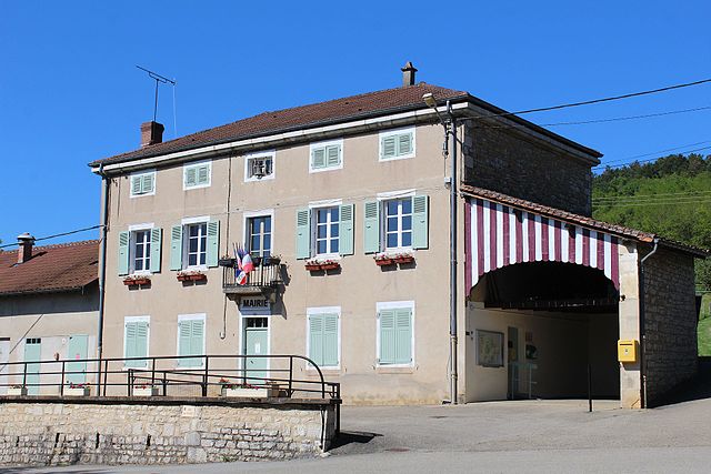
Val-Revermont (Val-Revermont)
 Hiking in Val-Revermont
Val-Revermont is a picturesque region located in the foothills of the Jura Mountains in eastern France, offering an array of hiking opportunities for all skill levels. Known for its stunning landscapes, lush forests, rolling hills, and charming villages, Val-Revermont provides a beautiful setting for outdoor enthusiasts.
Key Features of Hiking in Val-Revermont:
-
Scenic Trails: The region is home to well-marked hiking trails that traverse diverse terrains, including forests, meadows, and rural paths. Many trails offer panoramic views of the surrounding Jura Mountains and the Rhône Valley.
-
Topography: The area consists of gentle hills and valleys, making it suitable for both leisurely walks and more challenging hikes. You can find routes that are accessible for families and beginners as well as more demanding paths for seasoned hikers.
-
Flora and Fauna: As you hike, you'll encounter a variety of plant species and wildlife. The region is rich in biodiversity, and nature lovers can enjoy birdwatching and spotting local wildlife.
-
Cultural Attractions: Along the hiking routes, there are often historical sites and local villages to explore. Consider stopping in quaint towns like Goux, Chavornay, or other localities which offer a glimpse into the area's rural lifestyle.
-
Accessibility: Many trails are easily accessible from the main roads, and there are facilities such as parking areas and information boards at trailheads. Some paths may also connect with public transportation options.
-
Seasonal Hiking: Each season offers a unique hiking experience in Val-Revermont. Spring and summer feature blooming wildflowers, while autumn provides stunning fall foliage. Winter hiking may also be possible in certain areas, but it’s essential to check trail conditions and prepare accordingly.
Tips for Hiking in Val-Revermont:
-
Trail Maps: Always carry a map or a GPS device, as some trails might not be well marked. Many local tourist offices offer free maps and information.
-
Preparation: Wear suitable hiking boots and clothing, and bring plenty of water, snacks, and sun protection. Weather in the Jura can be unpredictable, so consider dressing in layers.
-
Leave No Trace: Respect the natural environment by following the Leave No Trace principles. Stay on marked trails and pack out any waste.
-
Local Resources: Check with local hiking clubs or tourism offices for guided hikes, organized events, or additional information on trail conditions.
In summary, Val-Revermont is an excellent destination for hikers looking to enjoy beautiful natural surroundings while also exploring local culture. Whether you're looking for a serene stroll or a more vigorous hike, this region has something to offer everyone.
- Страна:

- Почтовый код: 01370
- Координаты: 46° 16' 20" N, 5° 22' 12" E


- GPS треки (wikiloc): [Ссылка]
- Площадь: 45.42 кв.км
- Веб сайт: http://val-revermont.fr/
- Википедия английская: wiki(en)
- Википедия национальная: wiki(fr)
- Хранилище Wikidata: Wikidata: Q21912465
- Катеория в википедии: [Ссылка]
- Карты в википедии: [Ссылка]
- код GeoNames: Альт: [6615637]
- номер SIREN: [200057347]
- ID отношения в OpenStreetMap: [5756894]
- код по OpenCorporates: [fr/200057347]
- код муниципалитета INSEE: 01426
Граничит с регионами:

Nivigne et Suran
Hiking in Nivigne et Suran
Nivigne et Suran is a charming commune located in the Jura department of eastern France, known for its beautiful landscapes, lush forests, and the scenic Jura Mountains. Hiking in this area offers a delightful experience for nature enthusiasts and provides various trails suitable for different skill levels....
- Страна:
- Почтовый код: 01250
- Координаты: 46° 15' 51" N, 5° 25' 39" E
- GPS треки (wikiloc): [Ссылка]
- Площадь: 30.98 кв.км
- Население: 800
- Веб сайт: [Ссылка]


Bourcia
- коммуна во Франции
Hiking in Bourcia
It seems there may be a slight misunderstanding, as there isn't a well-known hiking region specifically named "Bourcia." However, if you meant a specific location with a similar name, such as a region in a particular country or a lesser-known destination, please clarify....
- Страна:
- Почтовый код: 39320
- Координаты: 46° 21' 13" N, 5° 24' 29" E
- GPS треки (wikiloc): [Ссылка]
- Площадь: 11.13 кв.км
- Население: 117

Симандр-сюр-Сюран
- коммуна во Франции
Hiking in Симандр-сюр-Сюран
Simandre-sur-Suran is a charming commune located in the Ain department of the Auvergne-Rhône-Alpes region in eastern France. While it may not be as well-known for hiking as some other areas, it offers opportunities to explore the beautiful landscapes and natural surroundings typical of rural France....
- Страна:
- Почтовый код: 01250
- Координаты: 46° 13' 31" N, 5° 25' 1" E
- GPS треки (wikiloc): [Ссылка]
- Площадь: 16.3 кв.км
- Население: 683
- Веб сайт: [Ссылка]

Мейонна
- коммуна во Франции
Hiking in Мейонна
Meillonnas is a picturesque village in the Ain department of the Auvergne-Rhône-Alpes region in France. The area is known for its natural beauty, charming countryside, and opportunities for outdoor activities, particularly hiking....
- Страна:
- Почтовый код: 01370
- Координаты: 46° 14' 42" N, 5° 21' 7" E
- GPS треки (wikiloc): [Ссылка]
- Площадь: 17.74 кв.км
- Население: 1316
- Веб сайт: [Ссылка]

Дром
- коммуна во Франции
Hiking in Дром
Drom is a location in Ireland, known for its scenic beauty and diverse hiking opportunities. While it may not be as widely recognized as some of the more famous trails in the country, Drom and its surroundings offer a variety of hiking experiences suitable for different skill levels. Here are some highlights for hiking in the Drom area:...
- Страна:
- Почтовый код: 01250
- Координаты: 46° 13' 3" N, 5° 22' 7" E
- GPS треки (wikiloc): [Ссылка]
- Площадь: 7.78 кв.км
- Население: 219
- Веб сайт: [Ссылка]
Курмангу
- коммуна во Франции
Hiking in Курмангу
Courmangoux, a charming village located in the Ain department of the Auvergne-Rhône-Alpes region in France, is surrounded by natural beauty and offers a variety of hiking opportunities. Here are some aspects to consider when hiking in and around Courmangoux:...
- Страна:
- Почтовый код: 01370
- Координаты: 46° 19' 52" N, 5° 22' 8" E
- GPS треки (wikiloc): [Ссылка]
- Площадь: 14.82 кв.км
- Население: 504
- Веб сайт: [Ссылка]

Сент-Этьен-дю-Буа
- коммуна во Франции
Hiking in Сент-Этьен-дю-Буа
Saint-Étienne-du-Bois, located in the Ain department of the Auvergne-Rhône-Alpes region of France, offers a range of hiking opportunities for outdoor enthusiasts. The region is characterized by its picturesque landscapes, lush forests, and rolling hills, making it an inviting destination for both casual walkers and seasoned hikers....
- Страна:
- Почтовый код: 01370
- Координаты: 46° 17' 17" N, 5° 17' 36" E
- GPS треки (wikiloc): [Ссылка]
- Площадь: 28.38 кв.км
- Население: 2532
- Веб сайт: [Ссылка]