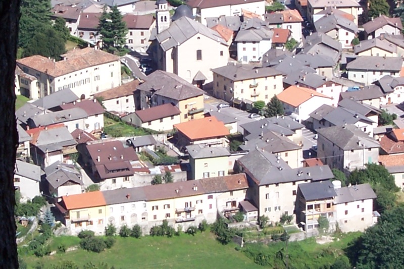
Вальфлориана (Valfloriana, Valfloriana)
%202018.svg)
- коммуна Италии
 Hiking in Вальфлориана
Valfloriana is a picturesque area located in the Trentino region of northern Italy, known for its stunning landscapes, rich biodiversity, and charming villages. Hiking in Valfloriana offers a fantastic experience for outdoor enthusiasts, with a variety of trails suitable for different skill levels.
Hiking Trails
-
Valfloriana Nature Trail: This relatively easy loop takes you through beautiful meadows and forests, providing stunning views of the surrounding mountains. It’s a great option for families and beginners.
-
Pointe di Valsugana Trail: A more challenging hike that rewards adventurous hikers with breathtaking panoramic views. The trail can take several hours and is ideal for experienced walkers.
-
Sentiero del Fiume: This trail follows the river and offers a serene experience, ideal for those who enjoy nature and peace. It’s perfect for birdwatching and enjoying the local flora.
Tips for Hiking in Valfloriana
- Prepare Properly: Always wear appropriate hiking gear, including sturdy shoes, and bring plenty of water and snacks.
- Check Weather Conditions: Mountain weather can change rapidly, so always check the forecast before heading out.
- Respect Nature: Follow the Leave No Trace principles by sticking to marked trails and taking your litter home.
- Wildlife Awareness: Be mindful of local wildlife and maintain a respectful distance if you encounter any animals.
Best Time to Hike
The best time for hiking in Valfloriana is typically from late spring to early autumn (May to October) when the weather is milder, and the trails are more accessible. However, if you plan to hike in the shoulder seasons, be prepared for changing conditions.
Local Attractions
While hiking, don’t miss the opportunity to explore some local villages and sample regional cuisine, including traditional dishes made from local ingredients. The culture and history of the area can enhance your hiking experience.
Conclusion
Hiking in Valfloriana is a rewarding experience for nature lovers and adventure seekers alike. With its diverse trails, stunning scenery, and rich cultural heritage, it’s a wonderful destination for both casual walkers and serious hikers. Make sure to plan ahead and enjoy your time exploring this beautiful part of Italy!
- Страна:

- Почтовый код: 38040
- Телефонный код: 0462
- Код автомобильного номера: TN
- Координаты: 46° 15' 0" N, 11° 21' 0" E


- GPS треки (wikiloc): [Ссылка]
- Высота над уровнем моря: 853 м m
- Площадь: 39.33 кв.км
- Население: 470
- Веб сайт: http://www.comunevalfloriana.it
- Википедия русская: wiki(ru)
- Википедия английская: wiki(en)
- Википедия национальная: wiki(it)
- Хранилище Wikidata: Wikidata: Q327609
- Катеория в википедии: [Ссылка]
- код Freebase: [/m/0gb187]
- код GeoNames: Альт: [6542643]
- ID отношения в OpenStreetMap: [46970]
- код ISTAT: 022209
- кадастровый код Италии: L575
Граничит с регионами:
Кастелло-Молина-ди-Фьемме
- коммуна Италии
Hiking in Кастелло-Молина-ди-Фьемме
Castello-Molina di Fiemme is a picturesque area located in the Val di Fiemme region of the Trentino-Alto Adige/Südtirol in northern Italy. It offers a range of hiking opportunities amid stunning landscapes characterized by lush meadows, dense forests, and impressive mountain scenery that is typical of the Dolomites....
- Страна:
- Почтовый код: 38030
- Телефонный код: 0462
- Код автомобильного номера: TN
- Координаты: 46° 16' 19" N, 11° 25' 2" E
- GPS треки (wikiloc): [Ссылка]
- Высота над уровнем моря: 900 м m
- Площадь: 54.56 кв.км
- Население: 2307
- Веб сайт: [Ссылка]


Лона-Лазес
- коммуна Италии
Hiking in Лона-Лазес
Lona-Lases is a beautiful area in the Aosta Valley region of Italy, known for its breathtaking views and diverse hiking trails. Here are some key points to consider if you're planning a hiking trip to Lona-Lases:...
- Страна:
- Почтовый код: 38040
- Телефонный код: 0461
- Код автомобильного номера: TN
- Координаты: 46° 9' 0" N, 11° 13' 0" E
- GPS треки (wikiloc): [Ссылка]
- Высота над уровнем моря: 639 м m
- Площадь: 11.37 кв.км
- Население: 881
- Веб сайт: [Ссылка]


Базельга-ди-Пине
- коммуна Италии
Hiking in Базельга-ди-Пине
Baselga di Piné is a beautiful destination for hiking enthusiasts, located in the Trentino region of northern Italy. Nestled in the Italian Alps, it offers stunning landscapes, lush forests, serene lakes, and picturesque mountain views. Here are some key points to consider for hiking in Baselga di Piné:...
- Страна:
- Почтовый код: 38042
- Телефонный код: 0461
- Код автомобильного номера: TN
- Координаты: 46° 7' 47" N, 11° 14' 41" E
- GPS треки (wikiloc): [Ссылка]
- Высота над уровнем моря: 964 м m
- Площадь: 41.07 кв.км
- Население: 5075
- Веб сайт: [Ссылка]


Каприана
- коммуна Италии
Hiking in Каприана
Capriana is a beautiful destination in the Trentino region of Italy that offers a variety of hiking opportunities characterized by stunning natural landscapes, rich flora and fauna, and panoramic views of the surrounding mountains and valleys. Here are some key points to consider when planning a hiking excursion in Capriana:...
- Страна:
- Почтовый код: 38030
- Телефонный код: 0462
- Код автомобильного номера: TN
- Координаты: 46° 16' 0" N, 11° 20' 0" E
- GPS треки (wikiloc): [Ссылка]
- Высота над уровнем моря: 1007 м m
- Площадь: 12.82 кв.км
- Население: 589
- Веб сайт: [Ссылка]


Совер
- коммуна Италии
Hiking in Совер
Sover, located in the state of Vermont, offers a variety of hiking opportunities that cater to different skill levels and preferences. Here are some key details about hiking in and around Sover:...
- Страна:
- Почтовый код: 38048
- Телефонный код: 0461
- Код автомобильного номера: TN
- Координаты: 46° 13' 0" N, 11° 19' 0" E
- GPS треки (wikiloc): [Ссылка]
- Высота над уровнем моря: 854 м m
- Площадь: 14.82 кв.км
- Население: 824
- Веб сайт: [Ссылка]

Тельве
- коммуна Италии
Hiking in Тельве
Telve, located in the Trentino region of northern Italy, offers some beautiful hiking opportunities amid the stunning alpine scenery. Nestled near the foothills of the Alps, this area is known for its picturesque landscapes, diverse wildlife, and charming local culture....
- Страна:
- Почтовый код: 38050
- Телефонный код: 0461
- Код автомобильного номера: TN
- Координаты: 46° 4' 0" N, 11° 29' 0" E
- GPS треки (wikiloc): [Ссылка]
- Высота над уровнем моря: 548 м m
- Площадь: 64.75 кв.км
- Население: 2008
- Веб сайт: [Ссылка]


Антериво
- коммуна Италии
Hiking in Антериво
Altrei is a charming village located in the South Tyrol region of northern Italy. It is surrounded by stunning natural landscapes, making it a great destination for hiking enthusiasts. Here are some key points about hiking in Altrei:...
- Страна:
- Почтовый код: 39040
- Телефонный код: 0471
- Код автомобильного номера: BZ
- Координаты: 46° 16' 41" N, 11° 22' 0" E
- GPS треки (wikiloc): [Ссылка]
- Высота над уровнем моря: 1635 м m
- Площадь: 11.06 кв.км
- Население: 396
- Веб сайт: [Ссылка]