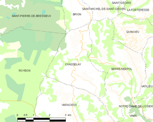
Варасьё (Varacieux, Varacieux)

- коммуна во Франции
 Hiking in Варасьё
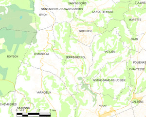
Varacieux is a charming village located in the Auvergne-Rhône-Alpes region of France. While it's a small community, it is surrounded by natural beauty and offers a variety of hiking opportunities that cater to different skill levels.
Hiking Trails:
-
Local Trails: Many trails around Varacieux provide access to stunning panoramic views of the surrounding countryside and the mountains of the Vercors Regional Natural Park. Look for well-marked paths that take you through lush forests, meadows, and alongside rivers.
-
Vercors Regional Natural Park: This nearby park features numerous hiking trails ranging from easy strolls to more challenging hikes. The park is known for its dramatic landscapes, limestone cliffs, and diverse wildlife. Trails like the Grand Veymont or those leading to the famous Gorges de la Bourne are popular among hikers.
-
Cultural Routes: Some trails also incorporate cultural and historical elements, leading hikers to ancient sites, chapels, or traditional farms where you can learn about local heritage.
Best Times to Hike:
- Spring and Fall: These seasons offer mild temperatures and blooming flora, making them ideal for hiking.
- Summer: Although it can be warmer, early mornings or late afternoons are perfect for exploring.
- Winter: Check local conditions if you plan to hike in winter, as some trails may be covered in snow, requiring proper equipment.
Tips for Hiking in Varacieux:
- Local Maps: Always carry a map or a GPS device, as trails can sometimes be poorly marked.
- Proper Gear: Wear sturdy hiking boots, dress in layers, and carry plenty of water and snacks.
- Respect Nature: Follow the Leave No Trace principles to preserve the natural environment.
- Weather Check: Always check the weather forecast before heading out, as conditions can change quickly in mountainous areas.
Local Amenities:
After a day of hiking, you may want to explore Varacieux's local culture, which might include small cafes or restaurants where you can sample regional cuisine or relax while enjoying the views.
Before heading out, it’s a good practice to speak with local hiking clubs or visitor centers for the latest updates on trail conditions and recommendations. Happy hiking!
- Страна:

- Почтовый код: 38470
- Координаты: 45° 13' 55" N, 5° 20' 15" E


- GPS треки (wikiloc): [Ссылка]
- Площадь: 18.48 кв.км
- Население: 879
- Веб сайт: http://varacieux.sud-gresivaudan.org
- Википедия русская: wiki(ru)
- Википедия английская: wiki(en)
- Википедия национальная: wiki(fr)
- Хранилище Wikidata: Wikidata: Q1067711
- Катеория в википедии: [Ссылка]
- код Freebase: [/m/03nvk0n]
- код GeoNames: Альт: [6433439]
- номер SIREN: [213805237]
- код BNF: [15258323n]
- код муниципалитета INSEE: 38523
Граничит с регионами:

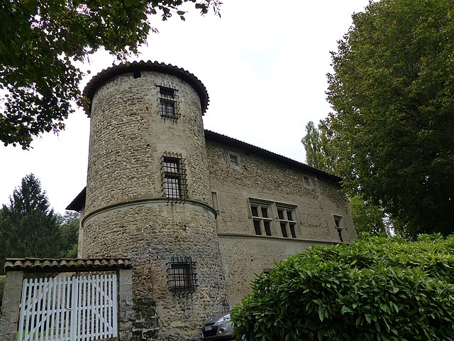
Шасле
- коммуна во Франции
Hiking in Шасле
Chasselay, a small commune in the Isère department in the Auvergne-Rhône-Alpes region of France, offers several opportunities for outdoor enthusiasts, especially those who enjoy hiking. The area is known for its natural beauty, with scenic landscapes that include rolling hills, forests, and panoramic views of the surrounding mountains....
- Страна:
- Почтовый код: 38470
- Координаты: 45° 15' 21" N, 5° 20' 19" E
- GPS треки (wikiloc): [Ссылка]
- Площадь: 9.45 кв.км
- Население: 416
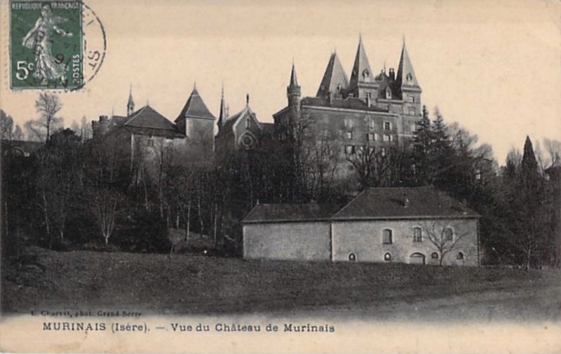

Мюрине
- коммуна во Франции
Hiking in Мюрине
Murinais is a lesser-known destination for hiking enthusiasts, offering beautiful landscapes and a chance to experience nature away from the more crowded trails. While specific information about Murinais might be limited, here are some general tips and highlights you can consider for hiking in such regions:...
- Страна:
- Почтовый код: 38160
- Координаты: 45° 12' 47" N, 5° 18' 54" E
- GPS треки (wikiloc): [Ссылка]
- Площадь: 8.22 кв.км
- Население: 384
- Веб сайт: [Ссылка]

Руабон
- коммуна во Франции
Hiking in Руабон
Roybon, located in the Auvergne-Rhône-Alpes region of France, offers several hiking opportunities for outdoor enthusiasts. The area is characterized by its beautiful landscapes, ranging from forests to rolling hills, making it ideal for both novice and experienced hikers....
- Страна:
- Почтовый код: 38940
- Координаты: 45° 15' 31" N, 5° 14' 39" E
- GPS треки (wikiloc): [Ссылка]
- Площадь: 67.31 кв.км
- Население: 1229
- Веб сайт: [Ссылка]


Вине
- коммуна во Франции
Hiking in Вине
Vinay, located in the Isère department of the Auvergne-Rhône-Alpes region in France, is a charming village surrounded by beautiful natural landscapes, making it a great spot for hiking enthusiasts. Here are a few key points to consider when hiking in and around Vinay:...
- Страна:
- Почтовый код: 38470
- Координаты: 45° 12' 36" N, 5° 24' 13" E
- GPS треки (wikiloc): [Ссылка]
- Площадь: 16.01 кв.км
- Население: 4200
- Веб сайт: [Ссылка]

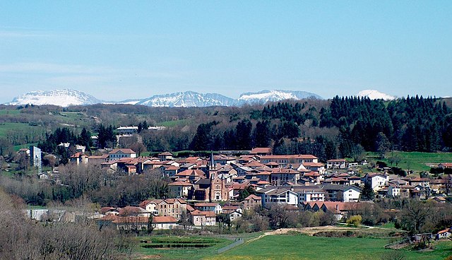
Сен-Веран
Hiking in Сен-Веран
Saint-Vérand is a charming village located in the Isère department of the Auvergne-Rhône-Alpes region in southeastern France. It is nestled in the foothills of the Alps and offers a variety of hiking opportunities that showcase the stunning natural landscapes of the area....
- Страна:
- Почтовый код: 38160
- Координаты: 45° 10' 23" N, 5° 19' 54" E
- GPS треки (wikiloc): [Ссылка]
- Высота над уровнем моря: 290 м m
- Площадь: 17.83 кв.км
- Население: 1727
- Веб сайт: [Ссылка]

Серр-Нерполь
- коммуна во Франции
Hiking in Серр-Нерполь
Serre-Nerpol, located in the French Alps, offers a range of hiking opportunities for enthusiasts of all skill levels. Here are some key highlights and tips for hiking in this beautiful region:...
- Страна:
- Почтовый код: 38470
- Координаты: 45° 15' 29" N, 5° 22' 30" E
- GPS треки (wikiloc): [Ссылка]
- Высота над уровнем моря: 400 м m
- Площадь: 13.16 кв.км
- Население: 293
- Веб сайт: [Ссылка]