Руабон (Roybon, Roybon)

- коммуна во Франции
 Hiking in Руабон
Roybon, located in the Auvergne-Rhône-Alpes region of France, offers several hiking opportunities for outdoor enthusiasts. The area is characterized by its beautiful landscapes, ranging from forests to rolling hills, making it ideal for both novice and experienced hikers.
Hiking Trails:
-
Local Nature Trails: Roybon is surrounded by natural parks and areas that provide well-marked trails. These paths often lead through scenic woodlands and alongside rivers, allowing you to enjoy the tranquility of nature.
-
Nearby Monts du Matin: Just a short drive from Roybon, the Monts du Matin area offers more challenging hikes with stunning views of the surrounding countryside. Trails here can vary in difficulty and provide a chance to see diverse flora and fauna.
-
Lac de Roybon: This lake area is perfect for shorter hikes or leisurely strolls. The paths around the lake are often suitable for families and can be combined with picnicking or swimming in the summer.
Hiking Tips:
- Check the Weather: Before setting out, check the weather conditions for the day as they can change quickly in mountainous areas.
- Pack Essentials: Bring plenty of water, snacks, a map, and a first-aid kit. Good hiking boots and comfortable clothing are also essential.
- Stay on Marked Trails: To protect the environment and ensure your safety, always stick to designated paths.
- Wildlife Awareness: Be mindful of local wildlife and ensure to keep a safe distance.
Best Seasons to Hike:
- Spring and Fall: These seasons often provide the most pleasant weather for hiking, with mild temperatures and beautiful foliage.
- Summer: Early morning or late afternoon hikes can help avoid the heat, and you’ll find many shaded areas.
Nearby Attractions:
After a day of hiking, you might explore local towns or enjoy regional cuisine in heartwarming eateries. The culture and hospitality of the region are additional highlights that enhance your hiking experience in Roybon.
Whether you're looking for a peaceful day hike or a more challenging adventure, Roybon has options that can satisfy a range of hiking preferences.
- Страна:

- Почтовый код: 38940
- Координаты: 45° 15' 31" N, 5° 14' 39" E


- GPS треки (wikiloc): [Ссылка]
- Площадь: 67.31 кв.км
- Население: 1229
- Веб сайт: http://www.roybon.fr
- Википедия русская: wiki(ru)
- Википедия английская: wiki(en)
- Википедия национальная: wiki(fr)
- Хранилище Wikidata: Wikidata: Q631575
- Катеория в википедии: [Ссылка]
- код Freebase: [/m/03nvkzk]
- код GeoNames: Альт: [6433311]
- номер SIREN: [213803471]
- код BNF: [15258158r]
- идентификатор местоположения ArchINFORM: [6807]
- код муниципалитета INSEE: 38347
Граничит с регионами:


Дьоне
- коммуна во Франции
Hiking in Дьоне
Dionay, located in the Auvergne-Rhône-Alpes region of France, is a picturesque area that offers beautiful hiking opportunities, particularly for those who enjoy nature, mountainous landscapes, and the tranquility of the countryside....
- Страна:
- Почтовый код: 38160
- Координаты: 45° 12' 11" N, 5° 13' 11" E
- GPS треки (wikiloc): [Ссылка]
- Площадь: 14.01 кв.км
- Население: 117
- Веб сайт: [Ссылка]

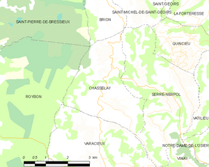
Шасле
- коммуна во Франции
Hiking in Шасле
Chasselay, a small commune in the Isère department in the Auvergne-Rhône-Alpes region of France, offers several opportunities for outdoor enthusiasts, especially those who enjoy hiking. The area is known for its natural beauty, with scenic landscapes that include rolling hills, forests, and panoramic views of the surrounding mountains....
- Страна:
- Почтовый код: 38470
- Координаты: 45° 15' 21" N, 5° 20' 19" E
- GPS треки (wikiloc): [Ссылка]
- Площадь: 9.45 кв.км
- Население: 416


Шевриер
- коммуна во Франции
Hiking in Шевриер
Chevrières is a small village in the Isère department of the Auvergne-Rhône-Alpes region in southeastern France. While it may not be as well-known as some larger hiking destinations, it is surrounded by beautiful landscapes and offers opportunities for outdoor activities, including hiking....
- Страна:
- Почтовый код: 38160
- Координаты: 45° 11' 15" N, 5° 17' 25" E
- GPS треки (wikiloc): [Ссылка]
- Площадь: 16.62 кв.км
- Население: 710
- Веб сайт: [Ссылка]


Бессен
Hiking in Бессен
Bessins, a small village in the scenic region of the French Alps, offers a variety of hiking opportunities for outdoor enthusiasts. While it might not be as widely known as some larger hiking destinations, the area around Bessins is rich in natural beauty, with breathtaking alpine landscapes, lush forests, and clear mountain streams....
- Страна:
- Почтовый код: 38160
- Координаты: 45° 12' 9" N, 5° 15' 53" E
- GPS треки (wikiloc): [Ссылка]
- Площадь: 4.65 кв.км
- Население: 123
- Веб сайт: [Ссылка]


Montrigaud
- коммуна во Франции
Hiking in Montrigaud
Montrigaud is a charming commune located in the Isère department in the Auvergne-Rhône-Alpes region of southeastern France. This area offers various hiking opportunities, particularly for those looking to enjoy scenic views and natural landscapes....
- Страна:
- Почтовый код: 26350
- Координаты: 45° 13' 8" N, 5° 7' 52" E
- GPS треки (wikiloc): [Ссылка]
- Площадь: 28.73 кв.км
- Население: 482


Варасьё
- коммуна во Франции
Hiking in Варасьё
Varacieux is a charming village located in the Auvergne-Rhône-Alpes region of France. While it's a small community, it is surrounded by natural beauty and offers a variety of hiking opportunities that cater to different skill levels....
- Страна:
- Почтовый код: 38470
- Координаты: 45° 13' 55" N, 5° 20' 15" E
- GPS треки (wikiloc): [Ссылка]
- Площадь: 18.48 кв.км
- Население: 879
- Веб сайт: [Ссылка]


Сен-Пьер-де-Бресьё
- коммуна во Франции
Hiking in Сен-Пьер-де-Бресьё
Saint-Pierre-de-Bressieux is a charming commune located in the Isère department of France, nestled in the picturesque region of Auvergne-Rhône-Alpes. Hiking around this area offers beautiful landscapes, varying terrains, and opportunities to explore the local flora and fauna....
- Страна:
- Почтовый код: 38870
- Координаты: 45° 18' 56" N, 5° 17' 7" E
- GPS треки (wikiloc): [Ссылка]
- Площадь: 23.08 кв.км
- Население: 766
- Веб сайт: [Ссылка]

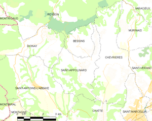
Сент-Апполинар
- коммуна во Франции
Hiking in Сент-Апполинар
Saint-Appolinard is a charming commune located in the Isère department in the Auvergne-Rhône-Alpes region of southeastern France. Known for its picturesque landscapes, it offers a variety of hiking opportunities suitable for different skill levels. Here are some highlights and tips for hiking in the area:...
- Страна:
- Почтовый код: 38160
- Координаты: 45° 11' 20" N, 5° 15' 45" E
- GPS треки (wikiloc): [Ссылка]
- Высота над уровнем моря: 380 м m
- Площадь: 10.76 кв.км
- Население: 400
- Веб сайт: [Ссылка]

Монфалькон
- коммуна во Франции
Hiking in Монфалькон
Montfalcon is a scenic area that offers various hiking opportunities, particularly for those who appreciate nature and outdoor activities. While specific trails and conditions can change, here are some general insights into hiking in Montfalcon:...
- Страна:
- Почтовый код: 38940
- Координаты: 45° 15' 16" N, 5° 10' 18" E
- GPS треки (wikiloc): [Ссылка]
- Площадь: 5.82 кв.км
- Население: 123
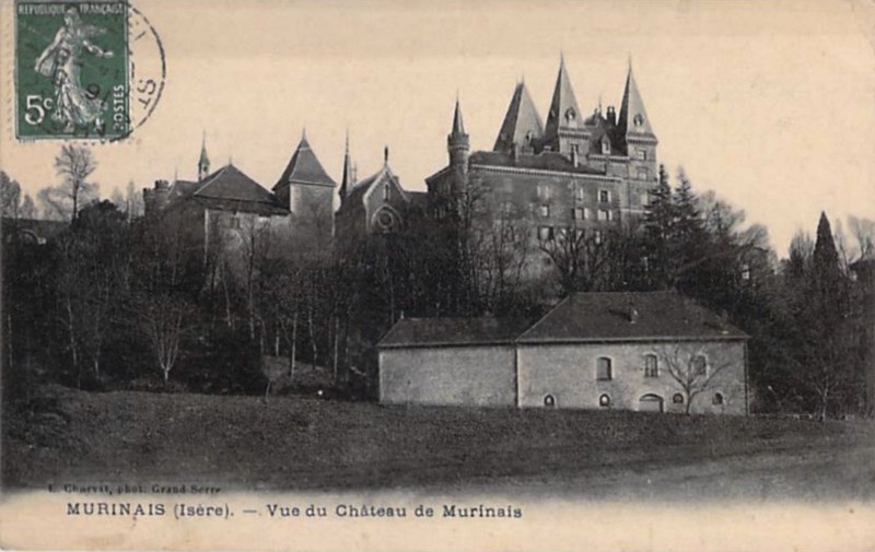

Мюрине
- коммуна во Франции
Hiking in Мюрине
Murinais is a lesser-known destination for hiking enthusiasts, offering beautiful landscapes and a chance to experience nature away from the more crowded trails. While specific information about Murinais might be limited, here are some general tips and highlights you can consider for hiking in such regions:...
- Страна:
- Почтовый код: 38160
- Координаты: 45° 12' 47" N, 5° 18' 54" E
- GPS треки (wikiloc): [Ссылка]
- Площадь: 8.22 кв.км
- Население: 384
- Веб сайт: [Ссылка]


Марнан
- коммуна во Франции
Hiking in Марнан
Marnans, a picturesque area known for its stunning landscapes, offers a variety of hiking opportunities suitable for different skill levels. Whether you are a beginner or an experienced hiker, the region has something for everyone....
- Страна:
- Почтовый код: 38980
- Координаты: 45° 17' 41" N, 5° 14' 14" E
- GPS треки (wikiloc): [Ссылка]
- Площадь: 6.6 кв.км
- Население: 152


Виривиль
- коммуна во Франции
Hiking in Виривиль
Viriville is a charming village located in the Isère department of France, nestled in the breathtaking backdrop of the French Alps. Hiking in this region offers an incredible experience, with its stunning landscapes, diverse flora and fauna, and a variety of trails suitable for different skill levels....
- Страна:
- Почтовый код: 38980
- Координаты: 45° 18' 57" N, 5° 12' 15" E
- GPS треки (wikiloc): [Ссылка]
- Площадь: 30.46 кв.км
- Население: 1634
- Веб сайт: [Ссылка]