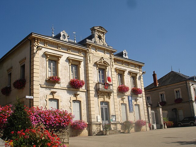
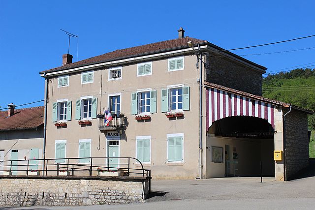
Вильмотье (Villemotier, Villemotier)
- коммуна во Франции
 Hiking in Вильмотье
Villemotier is a charming little village located in the Ain department in the Auvergne-Rhône-Alpes region of France. While it’s not widely known as a major hiking destination, the surrounding countryside offers some lovely opportunities for outdoor exploration and hiking.
Hiking Opportunities:
-
Local Trails: You can find trails that explore the rural landscape, featuring fields, forests, and scenic views of the surrounding hills. These paths are often less traveled, providing a peaceful hiking experience.
-
Nearby Natural Parks: Consider exploring nearby natural parks or protected areas if you are looking for more extensive hiking options. The Bugey region, not too far from Villemotier, offers beautiful mountainous terrain.
-
Cultural Routes: Some local routes may combine hiking with cultural sightseeing, allowing you to discover historical sites and immerse yourself in the local heritage.
Tips for Hiking in Villemotier:
- Map & Guide: Bring a detailed map or use a hiking app to navigate the trails as signage may be limited.
- Local Advice: Check in with local residents or a tourist information center for recommendations on the best trails and current conditions.
- Weather Planning: Be prepared for changing weather conditions. The region can have variable weather, especially in spring and autumn.
- Leave No Trace: As with all hiking, practice Leave No Trace principles to protect the natural beauty of the area.
Equipment:
Ensure you have appropriate footwear, hydration, snacks, and any necessary gear for varying trail conditions.
Conclusion:
Although Villemotier may not be a famous hiking hub, with a spirit of adventure and the right preparation, you can enjoy some relaxing hikes in the beautiful French countryside. Happy hiking!
- Страна:

- Почтовый код: 01270
- Координаты: 46° 20' 46" N, 5° 19' 16" E


- GPS треки (wikiloc): [Ссылка]
- Площадь: 13.86 кв.км
- Население: 669
- Веб сайт: https://www.villemotier.fr
- Википедия русская: wiki(ru)
- Википедия английская: wiki(en)
- Википедия национальная: wiki(fr)
- Хранилище Wikidata: Wikidata: Q840214
- Катеория в википедии: [Ссылка]
- Карты в википедии: [Ссылка]
- код Freebase: [/m/0826sn]
- код Freebase: [/m/0826sn]
- код GeoNames: Альт: [6424733]
- код GeoNames: Альт: [6424733]
- номер SIREN: [210104451]
- номер SIREN: [210104451]
- код муниципалитета INSEE: 01445
- код муниципалитета INSEE: 01445
Граничит с регионами:
Колиньи
- коммуна во Франции
Hiking in Колиньи
Coligny, located in the Ain department in the Auvergne-Rhône-Alpes region of southeastern France, is a charming village that offers a variety of hiking opportunities. The area surrounding Coligny is characterized by beautiful landscapes, rolling hills, and serene natural settings, making it an excellent destination for hikers of all skill levels....
- Страна:
- Почтовый код: 01270
- Координаты: 46° 22' 59" N, 5° 20' 46" E
- GPS треки (wikiloc): [Ссылка]
- Площадь: 16.87 кв.км
- Население: 1193
- Веб сайт: [Ссылка]

Бени
- коммуна во Франции
Hiking in Бени
Bény is a picturesque region that offers a variety of hiking opportunities, typically characterized by its natural beauty, lush landscapes, and diverse trails. While specific trails and hiking conditions can vary, here are some general points to consider when hiking in Bény:...
- Страна:
- Почтовый код: 01370
- Координаты: 46° 19' 10" N, 5° 17' 0" E
- GPS треки (wikiloc): [Ссылка]
- Площадь: 18.25 кв.км
- Население: 747
- Веб сайт: [Ссылка]

Марбо
- коммуна во Франции
- Страна:
- Почтовый код: 01851
- Координаты: 46° 20' 33" N, 5° 15' 30" E
- GPS треки (wikiloc): [Ссылка]
- Площадь: 40.14 кв.км
- Население: 2215
- Веб сайт: [Ссылка]

Салавр
- коммуна во Франции
Hiking in Салавр
Salavre, a beautiful and lesser-known destination, offers stunning natural landscapes perfect for hiking enthusiasts. Located in France, it’s known for its diverse flora and fauna, scenic views, and a range of trails suitable for various skill levels. Here are some highlights and tips for hiking in Salavre:...
- Страна:
- Почтовый код: 01270
- Координаты: 46° 21' 50" N, 5° 20' 46" E
- GPS треки (wikiloc): [Ссылка]
- Площадь: 7.77 кв.км
- Население: 285
- Веб сайт: [Ссылка]

Вержон
- коммуна во Франции
Hiking in Вержон
Verjon is a small commune located in the Rhône department in the Auvergne-Rhône-Alpes region of France. While it may not be as widely known for hiking as larger national parks or mountainous areas, it does offer some opportunities to enjoy the natural landscape, explore rural trails, and experience the beauty of the region....
- Страна:
- Почтовый код: 01270
- Координаты: 46° 20' 45" N, 5° 21' 4" E
- GPS треки (wikiloc): [Ссылка]
- Площадь: 5.11 кв.км
- Население: 262
- Веб сайт: [Ссылка]

Пиражу
- коммуна во Франции
Hiking in Пиражу
Pirajoux, a lesser-known destination, is often celebrated for its natural beauty and diverse hiking opportunities. While detailed information might be limited, the general characteristics of hiking in this area can be outlined as follows:...
- Страна:
- Почтовый код: 01270
- Координаты: 46° 22' 17" N, 5° 17' 57" E
- GPS треки (wikiloc): [Ссылка]
- Площадь: 12.99 кв.км
- Население: 393
- Веб сайт: [Ссылка]
Курмангу
- коммуна во Франции
Hiking in Курмангу
Courmangoux, a charming village located in the Ain department of the Auvergne-Rhône-Alpes region in France, is surrounded by natural beauty and offers a variety of hiking opportunities. Here are some aspects to consider when hiking in and around Courmangoux:...
- Страна:
- Почтовый код: 01370
- Координаты: 46° 19' 52" N, 5° 22' 8" E
- GPS треки (wikiloc): [Ссылка]
- Площадь: 14.82 кв.км
- Население: 504
- Веб сайт: [Ссылка]

Сент-Этьен-дю-Буа
- коммуна во Франции
Hiking in Сент-Этьен-дю-Буа
Saint-Étienne-du-Bois, located in the Ain department of the Auvergne-Rhône-Alpes region of France, offers a range of hiking opportunities for outdoor enthusiasts. The region is characterized by its picturesque landscapes, lush forests, and rolling hills, making it an inviting destination for both casual walkers and seasoned hikers....
- Страна:
- Почтовый код: 01370
- Координаты: 46° 17' 17" N, 5° 17' 36" E
- GPS треки (wikiloc): [Ссылка]
- Площадь: 28.38 кв.км
- Население: 2532
- Веб сайт: [Ссылка]