
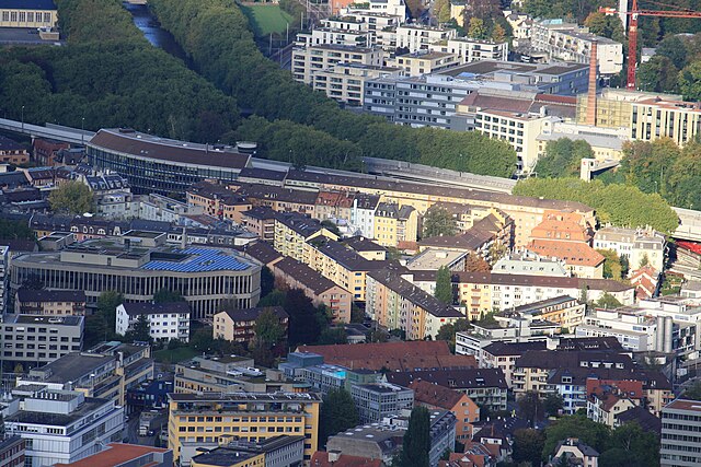
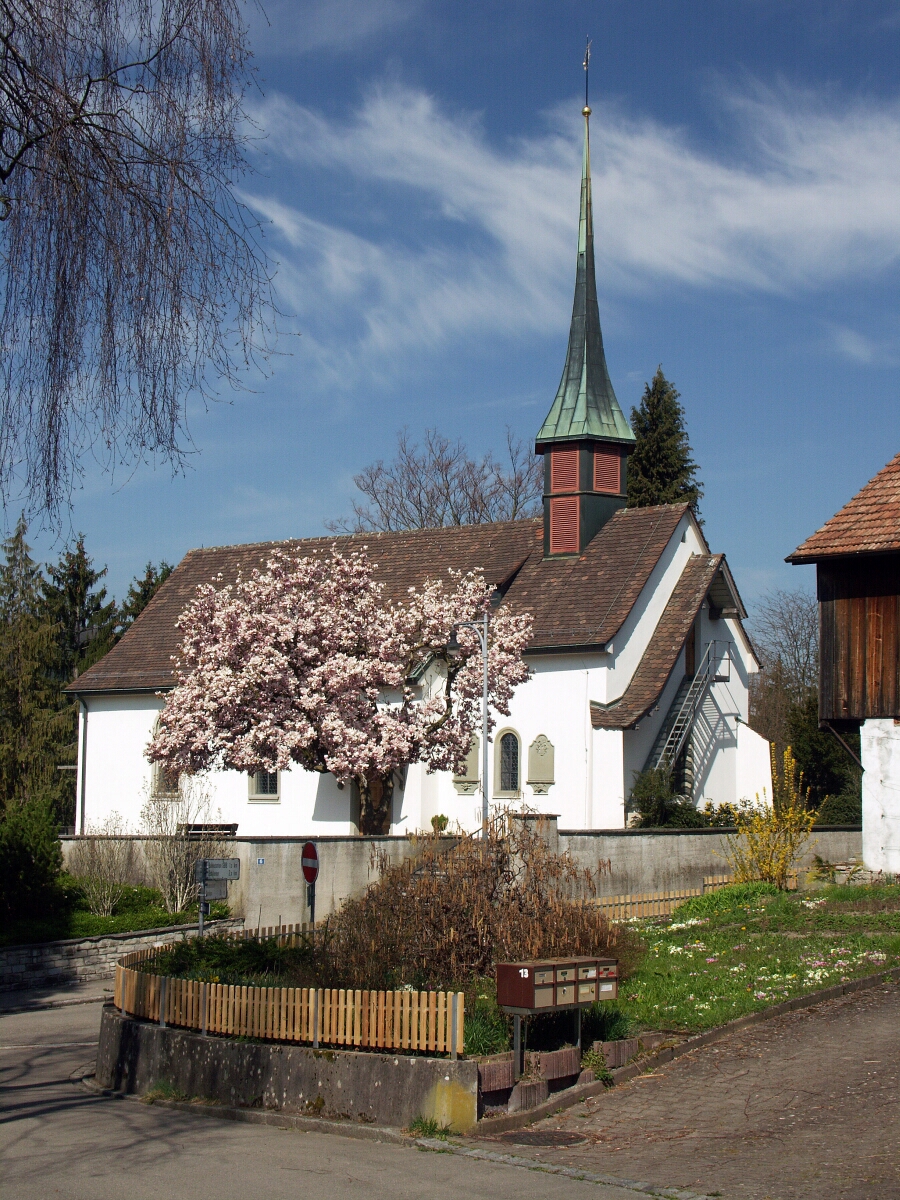
Цюрих (Zürich, Zürich)


- город в Швейцарии
 Hiking in Цюрих
Hiking in Zürich offers a wonderful mix of urban convenience and stunning natural landscapes. The city is situated near the edge of the Swiss Alps, providing easy access to numerous trails that cater to all levels of hikers, from beginners to experienced trekkers.
Popular Hiking Areas Around Zürich:
-
Uetliberg Mountain:
- One of the most popular hiking destinations close to Zürich. The Uetliberg offers panoramic views of the city, Lake Zürich, and the Alps.
- The trail to Uetliberg is well marked, and the hike can take about 1-2 hours from the city center. There are several paths to choose from, including a scenic route through the forest.
-
Zürichsee (Lake Zürich) Trails:
- There are scenic trails along the shores of Lake Zürich, ideal for leisurely hikes. You can walk from Zürich to Rapperswil (about 12 km), enjoying the beautiful lakeside views and charming towns along the way.
- The paths are well maintained and great for a relaxing day out.
-
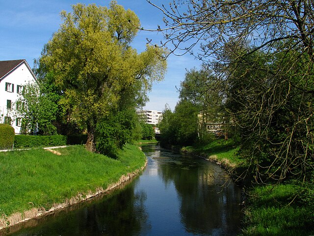
Sihltal:
- Located south of Zürich, Sihltal has beautiful trails that follow the Sihl River. This area features stunning landscapes and is less crowded than Uetliberg.
- A popular route is to hike towards the Sihlwald Nature Reserve, where you'll find various trails and picnic spots.
-
Greifensee:
- A bit further from the city, Greifensee offers a lovely circular trail around the lake, approximately 11 km long. It’s great for a day hike with picturesque scenery, birdwatching opportunities, and quaint villages.
-
Albis Range:
- This area offers a mix of higher elevation hiking with beautiful views. Hikes here can range from easy walks to more challenging trails. The Albis Ridge is especially popular and provides several panoramic viewpoints.
Tips for Hiking in Zürich:
- Public Transport: The public transport system in Zürich is excellent. Trains and trams can take you to trailheads easily, making it very convenient to start your hike.
- Weather: Be aware of the weather conditions as they can change rapidly in the Alps. Check forecasts and always dress in layers.
- Check Trail Conditions: Before heading out, check local resources for trail conditions, especially during winter or after rain.
- Equip Yourself: Wear appropriate footwear and carry enough water and snacks. It’s also good to have a small first-aid kit.
- Respect Nature: Stick to marked trails, follow the Leave No Trace principles, and be mindful of wildlife.
Conclusion:
Hiking in Zürich allows you to experience the beauty of both urban and natural landscapes. Whether you're looking for a short hike or a full-day adventure, the region offers plenty of options to explore while enjoying the stunning Swiss scenery.
- Страна:

- Почтовый код: 8064; 8063; 8057; 8055; 8053; 8052; 8051; 8050; 8049; 8046; 8045; 8044; 8041; 8038; 8037; 8032; 8008; 8006; 8005; 8004; 8003; 8002; 8001; 8000
- Телефонный код: 044; 043
- Код автомобильного номера: ZH
- Координаты: 47° 22' 43" N, 8° 32' 24" E


- GPS треки (wikiloc): [Ссылка]
- Высота над уровнем моря: 408 м m
- Площадь: 87.88 кв.км
- Население: 409241
- Веб сайт: http://www.stadt-zuerich.ch/
- Википедия русская: wiki(ru)
- Википедия английская: wiki(en)
- Википедия национальная: wiki(de)
- Хранилище Wikidata: Wikidata: Q72
- Галерея изображений в википедии: [Ссылка]
- Катеория в википедии: [Ссылка]
- Карты в википедии: [Ссылка]
- код Freebase: [/m/08966]
- код GeoNames: Альт: [7287650]
- код BNF: [12167046v]
- код VIAF: Альт: [185144783004419863241]
- ID отношения в OpenStreetMap: [1682248]
- код GND: Альт: [4068038-1]
- идентификатор местоположения ArchINFORM: [1667]
- код LCNAF: Альт: [n80013637]
- код тезауруса PACTOLS: [pcrtUBX6RY7dTh]
- место в MusicBrainz: [e2bd38a1-c5ad-4dd4-b9a4-0632ff3be7ae]
- WOEID: [784794]
- код темы Quora: [Zürich]
- код TGN: [7007302]
- UN/LOCODE: [CHZRH]
- код SUDOC: [030205484]
- код в энциклопедии «Британника онлайн»: [place/Zurich]
- код в Большой каталанской энциклопедии: [0073462]
- код в Encyclopædia Universalis: [zurich]
- идентификатор HDS: [171]
- EMLO location ID: [2df24ec5-47e7-449b-8e08-cbc6258c6cb0]
- код места в Facebook: [102160693158562]
- код швейцарского муниципалитета: [0261]
- код ISNI: Альт: [0000 0001 2293 7775]
- код NKC: [ge128459]
- dmoz: Альт: [Regional/Europe/Switzerland/Cantons/Zurich/Localities/Zurich/]
- код NLI: [000978219]
- код YSO: [113076]
- код статьи Klexikon: [Zürich]
- код BabelNet: [00082104n]
- код онлайн-версии Энциклопедии Брокгауз: [zurich-20]
- сабреддит: [zurich]
- код GAMEO: [Zürich (Switzerland)]
- идентификатор NE.se: [zurich]
- код Католической энциклопедии: [15770b]
- код US National Archives: 10045180
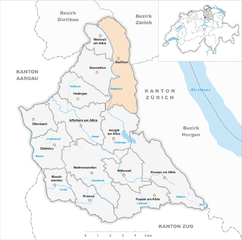
Включает регионы:
Старый город (Цюрих)
Hiking in Старый город (Цюрих)
Altstadt (Old Town) of Zürich is an urban area rather than a traditional hiking destination. However, it offers plenty of walking opportunities and activities that can feel like a hike through its rich history and beautiful landscapes. Here’s what you can expect:...
- Страна:
- Координаты: 47° 22' 13" N, 8° 32' 30" E
- GPS треки (wikiloc): [Ссылка]
- Площадь: 1.8 кв.км


District 7
Hiking in District 7
District 7 in Zürich, also known as the district of Wiedikon, offers a blend of urban and natural landscapes, making it an intriguing area for hiking enthusiasts. While District 7 itself is quite urban, it provides easy access to several nearby hiking trails and recreational areas that can be explored....
- Страна:
- Координаты: 47° 22' 23" N, 8° 34' 49" E
- GPS треки (wikiloc): [Ссылка]
- Высота над уровнем моря: 656 м m
- Площадь: 15 кв.км


Округ 2
- округ города Цюрих
Hiking in Округ 2
District 2 of Zürich, known as Enge, offers a range of outdoor activities, although it’s more urban and residential compared to the natural landscapes surrounding the city. While hiking trails might not be as prominent within the district itself, there are several nearby options that capitalize on Zürich’s picturesque scenery....
- Страна:
- Координаты: 47° 20' 15" N, 8° 31' 15" E
- GPS треки (wikiloc): [Ссылка]
- Высота над уровнем моря: 439 м m
- Площадь: 11.1 кв.км


District 9
Hiking in District 9
District 9 of Zürich, also known as Altstetten, offers a mix of urban and natural landscapes perfect for hiking and outdoor activities. While it may not be renowned for long-distance trails like you would find in the mountains, there are still several options for enjoyable hikes within and around the district....
- Страна:
- Координаты: 47° 22' 55" N, 8° 28' 48" E
- GPS треки (wikiloc): [Ссылка]
- Высота над уровнем моря: 426 м m
- Площадь: 12.1 кв.км


District 6
Hiking in District 6
District 6 in Zürich, also known as Unterstrass, is primarily an urban area known for its residential neighborhoods, green spaces, and cultural spots, rather than extensive hiking trails. However, it does offer some nice opportunities for leisurely walks and short hikes....
- Страна:
- Координаты: 47° 23' 32" N, 8° 32' 37" E
- GPS треки (wikiloc): [Ссылка]
- Высота над уровнем моря: 487 м m
- Площадь: 5.1 кв.км
District 10
Hiking in District 10
District 10, known as Zürich’s “Höngg” district, is a charming area that offers a unique blend of urban and natural landscapes, making it a great choice for hiking enthusiasts. Here are some highlights and suggestions for hiking in this district:...
- Страна:
- Координаты: 47° 24' 27" N, 8° 30' 1" E
- GPS треки (wikiloc): [Ссылка]
- Высота над уровнем моря: 516 м m
- Площадь: 9.09 кв.км
Industriequartier
Hiking in Industriequartier
Industriequartier is a vibrant district in Zurich, known for its mix of industrial architecture, creative spaces, and urban lifestyle. While it may not be a traditional hiking destination like the mountains surrounding Zurich, there are several ways to enjoy the outdoors and explore the area on foot. Here are some tips and activities to consider:...
- Страна:
- Координаты: 47° 23' 15" N, 8° 31' 17" E
- GPS треки (wikiloc): [Ссылка]
- Высота над уровнем моря: 405 м m
- Площадь: 1.99 кв.км


Schwamendingen
Hiking in Schwamendingen
Schwamendingen is a district in Zurich, Switzerland, known for its beautiful landscapes and proximity to nature. While Schwamendingen itself is primarily a residential area, it offers access to several hiking trails and green spaces in the surrounding areas, particularly in the nearby Zurich Oberland and the nearby Uetliberg mountain....
- Страна:
- Код автомобильного номера: ZH
- Координаты: 47° 24' 22" N, 8° 34' 19" E
- GPS треки (wikiloc): [Ссылка]
- Высота над уровнем моря: 435 м m
- Площадь: 5.97 кв.км
- Население: 11209

Видикон
- район Цюриха, Швейцария
Hiking in Видикон
Wiedikon is a charming district in Zurich, Switzerland, known for its proximity to nature, making it a great spot for hiking enthusiasts. Here are some highlights about hiking in and around Wiedikon:...
- Страна:
- Код автомобильного номера: ZH
- Координаты: 47° 22' 0" N, 8° 31' 0" E
- GPS треки (wikiloc): [Ссылка]
- Площадь: 8.65 кв.км


Aussersihl
Hiking in Aussersihl
Aussersihl is a district in Zurich, Switzerland, known for its vibrant culture and urban life rather than extensive hiking opportunities. However, it can serve as a great starting point to access several beautiful hiking areas in the region....
- Страна:
- Код автомобильного номера: ZH
- Координаты: 47° 22' 30" N, 8° 31' 37" E
- GPS треки (wikiloc): [Ссылка]
- Высота над уровнем моря: 416 м m
- Площадь: 2.9 кв.км


Райсбах
Hiking in Райсбах
Riesbach, located in Zurich, Switzerland, is primarily known as a residential and recreational area, with close proximity to Lake Zurich. While Riesbach itself might not have extensive hiking trails, it offers beautiful walking and jogging paths along the lakeshore and park areas, which can provide a pleasant outdoor experience....
- Страна:
- Код автомобильного номера: ZH
- Координаты: 47° 21' 18" N, 8° 33' 40" E
- GPS треки (wikiloc): [Ссылка]
- Площадь: 4.81 кв.км

District 11
Hiking in District 11
District 11, known as Altstetten in Zürich, is primarily an urban area and does not boast extensive hiking trails within its immediate vicinity. However, it is conveniently located near various green spaces and parks, making it possible to enjoy shorter walks or hikes....
- Страна:
- Координаты: 47° 25' 23" N, 8° 31' 17" E
- GPS треки (wikiloc): [Ссылка]
- Площадь: 13.4 кв.км
Граничит с регионами:


Цолликон
- город в Швейцарии, в кантоне Цюрих
Hiking in Цолликон
Hiking in Zollikon, a charming municipality located just outside of Zurich, Switzerland, offers a variety of scenic trails suitable for all levels of hikers. Nestled alongside the shores of Lake Zurich and surrounded by the picturesque Swiss landscape, Zollikon provides beautiful views and a tranquil atmosphere....
- Страна:
- Почтовый код: 8702
- Телефонный код: 043; 044
- Код автомобильного номера: ZH
- Координаты: 47° 20' 36" N, 8° 35' 41" E
- GPS треки (wikiloc): [Ссылка]
- Высота над уровнем моря: 603 м m
- Площадь: 7.84 кв.км
- Население: 12983
- Веб сайт: [Ссылка]


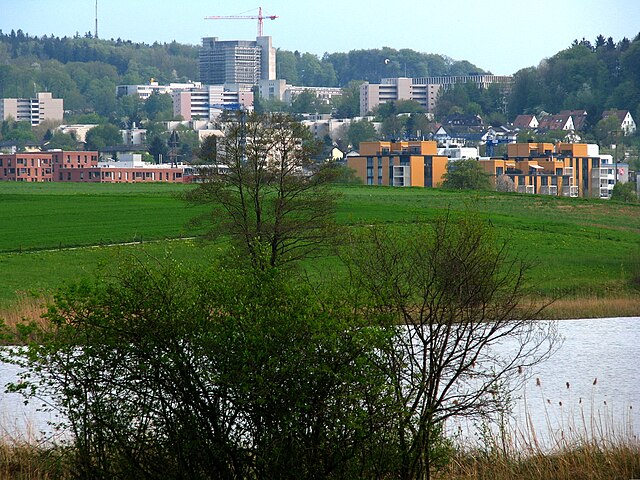
Дюбендорф
Hiking in Дюбендорф
Dübendorf, located in the canton of Zurich, Switzerland, offers a fantastic environment for hiking enthusiasts. Nestled close to the urban area of Zurich, it provides a wonderful balance of nature and accessibility....
- Страна:
- Почтовый код: 8600
- Телефонный код: 044
- Код автомобильного номера: ZH
- Координаты: 47° 23' 26" N, 8° 37' 2" E
- GPS треки (wikiloc): [Ссылка]
- Высота над уровнем моря: 439 м m
- Площадь: 13.61 кв.км
- Население: 28002
- Веб сайт: [Ссылка]


Регенсдорф
Hiking in Регенсдорф
Regensdorf, located in the Canton of Zurich in Switzerland, is a wonderful base for hiking enthusiasts. The surrounding areas offer various trails that cater to different skills and preferences. Here are some highlights for hiking in and around Regensdorf:...
- Страна:
- Почтовый код: 8105
- Телефонный код: 044
- Код автомобильного номера: ZH
- Координаты: 47° 26' 24" N, 8° 28' 17" E
- GPS треки (wikiloc): [Ссылка]
- Высота над уровнем моря: 436 м m
- Площадь: 14.62 кв.км
- Население: 18253
- Веб сайт: [Ссылка]

Опфикон
Hiking in Опфикон
Opfikon, located in the canton of Zurich, Switzerland, is primarily an urban area. While it doesn't have extensive hiking trails directly within its boundaries, it serves as a great starting point for accessing nearby hiking routes in the surrounding region. Here are some key points for hiking in and around Opfikon:...
- Страна:
- Почтовый код: 8152
- Телефонный код: 044
- Код автомобильного номера: ZH
- Координаты: 47° 25' 59" N, 8° 34' 19" E
- GPS треки (wikiloc): [Ссылка]
- Высота над уровнем моря: 438 м m
- Площадь: 5.61 кв.км
- Население: 19864
- Веб сайт: [Ссылка]


Маур
Hiking in Маур
Hiking in Maur, Switzerland, offers a picturesque escape into the Swiss countryside, characterized by lush landscapes, quaint villages, and stunning views of the surrounding Alps....
- Страна:
- Почтовый код: 8124
- Телефонный код: 044
- Код автомобильного номера: ZH
- Координаты: 47° 20' 30" N, 8° 40' 13" E
- GPS треки (wikiloc): [Ссылка]
- Высота над уровнем моря: 478 м m
- Площадь: 18.40 кв.км
- Население: 10148
- Веб сайт: [Ссылка]


Фелланден
Hiking in Фелланден
Fällanden, located in the Canton of Zurich in Switzerland, offers some lovely hiking opportunities, particularly for those looking to enjoy a combination of nature and picturesque views. Here are some key points about hiking in Fällanden:...
- Страна:
- Почтовый код: 8117
- Код автомобильного номера: ZH
- Координаты: 47° 22' 18" N, 8° 38' 24" E
- GPS треки (wikiloc): [Ссылка]
- Высота над уровнем моря: 491 м m
- Площадь: 6.41 кв.км
- Население: 8575
- Веб сайт: [Ссылка]

Шталликон
Hiking in Шталликон
Stallikon is a picturesque municipality located in the Canton of Zurich, Switzerland, known for its beautiful landscapes and numerous hiking trails. Here are some highlights about hiking in Stallikon:...
- Страна:
- Почтовый код: 8143
- Телефонный код: 044
- Код автомобильного номера: ZH
- Координаты: 47° 19' 38" N, 8° 29' 27" E
- GPS треки (wikiloc): [Ссылка]
- Высота над уровнем моря: 534 м m
- Площадь: 12.01 кв.км
- Население: 3687
- Веб сайт: [Ссылка]


Кильхберг
Hiking in Кильхберг
Kilchberg, located on the shores of Lake Zurich, is a charming town that offers beautiful hiking opportunities in the surrounding areas. While Kilchberg itself is relatively small, it serves as a gateway to several scenic trails that take you through picturesque landscapes, forests, and along the lake....
- Страна:
- Почтовый код: 8802
- Телефонный код: 044; 043
- Код автомобильного номера: ZH
- Координаты: 47° 19' 29" N, 8° 32' 57" E
- GPS треки (wikiloc): [Ссылка]
- Высота над уровнем моря: 467 м m
- Площадь: 2.58 кв.км
- Население: 8437
- Веб сайт: [Ссылка]


Уйтикон
Hiking in Уйтикон
Uitikon is a picturesque municipality located just outside of Zurich, Switzerland, making it a great destination for hiking enthusiasts. The area is characterized by its beautiful landscapes, including rolling hills, forests, and views of the surrounding mountains....
- Страна:
- Почтовый код: 8142
- Телефонный код: 044
- Код автомобильного номера: ZH
- Координаты: 47° 22' 1" N, 8° 27' 33" E
- GPS треки (wikiloc): [Ссылка]
- Высота над уровнем моря: 567 м m
- Площадь: 4.38 кв.км
- Население: 4239
- Веб сайт: [Ссылка]


Рюмланг
Hiking in Рюмланг
Rümlang is a charming municipality located in the canton of Zurich, Switzerland. It offers a variety of outdoor activities, including hiking, thanks to its scenic landscapes and proximity to nature....
- Страна:
- Почтовый код: 8153
- Телефонный код: 044
- Код автомобильного номера: ZH
- Координаты: 47° 26' 50" N, 8° 31' 46" E
- GPS треки (wikiloc): [Ссылка]
- Высота над уровнем моря: 449 м m
- Площадь: 12.39 кв.км
- Население: 7929
- Веб сайт: [Ссылка]


Адлисвиль
Hiking in Адлисвиль
Adliswil, located just south of Zurich in Switzerland, offers a variety of hiking opportunities that showcase the beautiful landscapes of the Zurich region. Here are some highlights and tips for hiking in Adliswil:...
- Страна:
- Почтовый код: 8134
- Телефонный код: 043; 044
- Код автомобильного номера: ZH
- Координаты: 47° 18' 34" N, 8° 31' 17" E
- GPS треки (wikiloc): [Ссылка]
- Высота над уровнем моря: 485 м m
- Площадь: 7.79 кв.км
- Население: 18731
- Веб сайт: [Ссылка]

Урдорф
- город Швейцарии
Hiking in Урдорф
Urdorf is a municipality in the canton of Zurich, Switzerland, offering wonderful opportunities for hiking enthusiasts. While Urdorf itself is a bit more urban, it's surrounded by beautiful landscapes ideal for outdoor activities....
- Страна:
- Почтовый код: 8902
- Телефонный код: 044; 043
- Код автомобильного номера: ZH
- Координаты: 47° 23' 12" N, 8° 25' 40" E
- GPS треки (wikiloc): [Ссылка]
- Высота над уровнем моря: 430 м m
- Площадь: 7.62 кв.км
- Население: 9768
- Веб сайт: [Ссылка]


Шлирен
Hiking in Шлирен
Schlieren, a small town located just outside of Zurich, Switzerland, offers a range of outdoor activities, including hiking. While Schlieren itself might not have extensive hiking trails within its immediate vicinity, it serves as an excellent starting point for exploring the surrounding areas....
- Страна:
- Почтовый код: 8952
- Код автомобильного номера: ZH
- Координаты: 47° 23' 42" N, 8° 26' 56" E
- GPS треки (wikiloc): [Ссылка]
- Высота над уровнем моря: 410 м m
- Площадь: 6.38 кв.км
- Население: 18666
- Веб сайт: [Ссылка]


Валлизеллен
Hiking in Валлизеллен
Wallisellen, located in the canton of Zurich in Switzerland, offers beautiful outdoor experiences for hiking enthusiasts. While it is primarily a suburban area, its proximity to the Zurich region and the surrounding natural landscapes makes it an excellent starting point for various hiking adventures....
- Страна:
- Почтовый код: 8304
- Телефонный код: 044
- Код автомобильного номера: ZH
- Координаты: 47° 25' 3" N, 8° 35' 42" E
- GPS треки (wikiloc): [Ссылка]
- Высота над уровнем моря: 452 м m
- Площадь: 6.50 кв.км
- Население: 15855
- Веб сайт: [Ссылка]

Оберенгстринген
Hiking in Оберенгстринген
Oberengstringen is a charming municipality located in the Zurich district of Switzerland, offering a variety of hiking opportunities amidst beautiful landscapes. Here are some key points to consider when hiking in the region:...
- Страна:
- Почтовый код: 8102
- Код автомобильного номера: ZH
- Координаты: 47° 24' 37" N, 8° 27' 58" E
- GPS треки (wikiloc): [Ссылка]
- Высота над уровнем моря: 432 м m
- Площадь: 2.13 кв.км
- Население: 6569
- Веб сайт: [Ссылка]