.png)
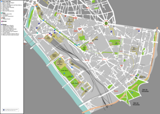
13th arrondissement of Paris (13e arrondissement de Paris)

- one of the 20 administrative districts of Paris, France
- Country:

- Postal Code: 75013
- Coordinates: 48° 49' 56" N, 2° 21' 20" E


- GPS tracks (wikiloc): [Link]
- Area: 7.15 sq km
- Population: 184034
- Web site: http://www.mairie13.paris.fr/mairie13/
- Wikipedia en: wiki(en)
- Wikipedia: wiki(fr)
- Wikidata storage: Wikidata: Q175129
- Wikipedia Commons Category: [Link]
- Wikipedia Commons Maps Category: [Link]
- Freebase ID: [/m/01r5vk]
- GeoNames ID: Alt: [3015772]
- BnF ID: [119379804]
- VIAF ID: Alt: [153480868]
- OSM relation ID: [9530]
- GND ID: Alt: [4481650-9]
- archINFORM location ID: [3735]
- Twitter username: Alt: [mairiedu13]
- ISNI: Alt: [0000 0001 0280 908X]
- INSEE municipality code: 75113
Shares border with regions:

12th arrondissement of Paris
- one of the 20 administrative districts of Paris, France
- Country:
- Postal Code: 75012
- Coordinates: 48° 50' 27" N, 2° 23' 17" E
- GPS tracks (wikiloc): [Link]
- Area: 6.38 sq km
- Population: 144595
- Web site: [Link]


14th arrondissement of Paris
- one of the arrondissements of the capital city of France
- Country:
- Postal Code: 75014
- Coordinates: 48° 49' 59" N, 2° 19' 37" E
- GPS tracks (wikiloc): [Link]
- Area: 5.62 sq km
- Population: 132844
- Web site: [Link]


5th arrondissement of Paris
- one of the 20 administrative districts of Paris, France
- Country:
- Postal Code: 75005
- Coordinates: 48° 50' 50" N, 2° 20' 40" E
- GPS tracks (wikiloc): [Link]
- Area: 2.54 sq km
- Population: 62236
- Web site: [Link]