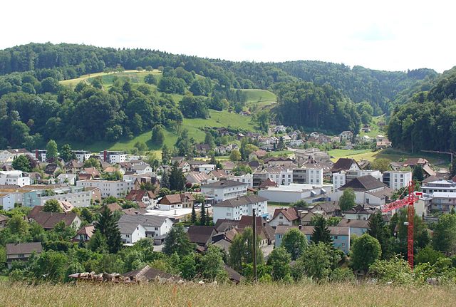
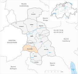
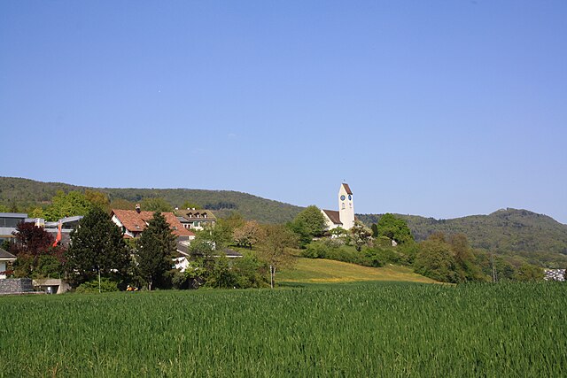
Aarau District (Bezirk Aarau)

- district in Switzerland
 Hiking in Aarau District
Aarau District, located in the canton of Aargau, Switzerland, offers a variety of hiking opportunities for outdoor enthusiasts. Here’s a quick overview of what you can expect when hiking in this beautiful part of Switzerland:
Scenic Trails
-
Nature and Landscapes: The district is known for its picturesque landscapes, featuring rolling hills, lush forests, and well-kept agricultural lands. Trails range from easy walks to more challenging hikes.
-
Cultural Points: Many hiking routes also pass by historical sites and charming villages, allowing hikers to experience the local culture and history. Look for opportunities to explore areas like the old town of Aarau, renowned for its beautiful architecture.
Popular Hiking Routes
-
Aarau to Schöftland: This is a lovely trail that combines nature with views of vineyards and the rolling hills of the region.
-
Reuss Valley Trail: A bit further out, this longer trail follows the Reuss River and offers beautiful vistas, perfect for a full day hike.
-
Bremgarten to Muri: Another picturesque hiking route where you can enjoy the serenity of the countryside, often with scenic views of the river and nearby hills.
Hiking Difficulty
- Variety of Levels: Hiking routes in the Aarau District offer a range of difficulty levels, catering to both beginners and experienced hikers. There are many well-marked trails, making navigation easier.
Tips for Hiking
-
Seasonal Awareness: Depending on the season, conditions can vary significantly, so ensure you check weather forecasts before heading out. Spring and autumn are usually the best times for hiking due to pleasant weather.
-
Equipment: Always wear appropriate footwear and consider bringing trekking poles for more challenging sections. A backpack with water, snacks, and a first-aid kit is advisable.
-
Local Guidelines: Familiarize yourself with local hiking guidelines, especially regarding wildlife and preservation of the natural environment. It’s essential to stick to marked paths to protect the ecosystem.
Accessibility
-
Public Transport: The region is well served by public transport, making it easy to reach various trailheads without the need for a car.
-
Accommodations: There are several options for staying overnight if you wish to extend your hiking experience.
In summary, the Aarau District offers a delightful mix of nature, culture, and accessibility for hikers of all levels. Whether you're in for a leisurely stroll or a more ambitious trek, this area has something to offer everyone. Happy hiking!
- Country:

- Capital: Aarau
- Licence Plate Code: AG
- Coordinates: 47° 23' 0" N, 8° 2' 0" E


- GPS tracks (wikiloc): [Link]
- AboveSeaLevel: 433 м m
- Area: 104.47 sq km
- Wikipedia en: wiki(en)
- Wikipedia: wiki(de)
- Wikidata storage: Wikidata: Q121410
- Wikipedia Commons Category: [Link]
- Freebase ID: [/m/03zvqj]
- GeoNames ID: Alt: [6458846]
- BnF ID: [11948361n]
- archINFORM location ID: [42743]
Includes regions:


Aarau
- capital of Canton Aargau, Switzerland
Hiking in Aarau
Aarau, located in the canton of Aargau, Switzerland, is a fantastic destination for hiking enthusiasts. The region boasts a variety of trails that cater to different skill levels, from easy walks to more challenging hikes. Here are some highlights of hiking in Aarau and its surroundings:...
- Country:
- Postal Code: 5000
- Local Dialing Code: 062
- Licence Plate Code: AG
- Coordinates: 47° 23' 32" N, 8° 2' 41" E
- GPS tracks (wikiloc): [Link]
- AboveSeaLevel: 384 м m
- Area: 12.34 sq km
- Population: 21268
- Web site: [Link]


Unterentfelden
- municipality in Switzerland
Hiking in Unterentfelden
Unterentfelden, a charming municipality in the canton of Aargau, Switzerland, offers several beautiful hiking opportunities that allow you to explore the scenic landscapes, quaint villages, and rich natural surroundings. Here are some highlights about hiking in the area:...
- Country:
- Postal Code: 5035
- Local Dialing Code: 062
- Licence Plate Code: AG
- Coordinates: 47° 22' 9" N, 8° 2' 30" E
- GPS tracks (wikiloc): [Link]
- AboveSeaLevel: 418 м m
- Area: 2.87 sq km
- Population: 4110
- Web site: [Link]

Gränichen
- municipality in Switzerland
Hiking in Gränichen
Gränichen, located in the Canton of Aargau in Switzerland, offers beautiful hiking opportunities that cater to various skill levels. The area is characterized by its picturesque landscapes, rolling hills, and lush greenery, making it an excellent destination for outdoor enthusiasts....
- Country:
- Postal Code: 5722
- Local Dialing Code: 062
- Licence Plate Code: AG
- Coordinates: 47° 21' 6" N, 8° 6' 24" E
- GPS tracks (wikiloc): [Link]
- AboveSeaLevel: 410 м m
- Area: 17.21 sq km
- Population: 7709
- Web site: [Link]


Biberstein
- municipality in Switzerland
Hiking in Biberstein
Biberstein is a charming location that offers various outdoor activities, including hiking. Its picturesque landscapes, featuring rolling hills, forests, and meadows, make it an inviting destination for hikers of all levels. Here are some key points to consider when hiking in Biberstein:...
- Country:
- Postal Code: 5023
- Local Dialing Code: 062
- Licence Plate Code: AG
- Coordinates: 47° 24' 51" N, 8° 4' 54" E
- GPS tracks (wikiloc): [Link]
- AboveSeaLevel: 448 м m
- Area: 4.1 sq km
- Population: 1587
- Web site: [Link]


Buchs
- municipality in the canton of Aargau, Switzerland
Hiking in Buchs
Buchs in Aargau, Switzerland, is a lovely destination for hiking enthusiasts. The region is known for its picturesque landscapes, rolling hills, and well-marked trails, offering a variety of hiking experiences suitable for all skill levels....
- Country:
- Postal Code: 5033
- Local Dialing Code: 062
- Licence Plate Code: AG
- Coordinates: 47° 23' 25" N, 8° 4' 50" E
- GPS tracks (wikiloc): [Link]
- AboveSeaLevel: 386 м m
- Area: 5.36 sq km
- Population: 7922
- Web site: [Link]


Hirschthal
- municipality in the canton of Aargau, Switzerland
Hiking in Hirschthal
Hirschthal, located in the Aargau region of Switzerland, offers beautiful hiking opportunities that allow you to explore its rich natural landscapes. The area boasts a range of trails suitable for various skill levels, making it accessible for both beginners and experienced hikers....
- Country:
- Postal Code: 5042
- Local Dialing Code: 062
- Licence Plate Code: AG
- Coordinates: 47° 19' 14" N, 8° 3' 6" E
- GPS tracks (wikiloc): [Link]
- AboveSeaLevel: 444 м m
- Area: 3.53 sq km
- Population: 1574
- Web site: [Link]


Densbüren
- municipality in Switzerland
Hiking in Densbüren
Densbüren, located in the Canton of Aargau in Switzerland, offers a variety of beautiful hiking trails set against a backdrop of picturesque landscapes, rolling hills, and charming countryside. Here are some highlights about hiking in Densbüren:...
- Country:
- Postal Code: 5026
- Local Dialing Code: 062
- Licence Plate Code: AG
- Coordinates: 47° 27' 19" N, 8° 3' 13" E
- GPS tracks (wikiloc): [Link]
- AboveSeaLevel: 474 м m
- Area: 12.52 sq km
- Population: 726
- Web site: [Link]


Muhen
- municipality in Switzerland
Hiking in Muhen
Muhen, located in the canton of Aargau in Switzerland, is a picturesque village surrounded by beautiful landscapes, making it an excellent destination for hiking enthusiasts. The region offers a variety of trails that cater to different skill levels, from easy walks suitable for families to more challenging hikes for experienced trekkers....
- Country:
- Postal Code: 5037
- Local Dialing Code: 062
- Licence Plate Code: AG
- Coordinates: 47° 19' 59" N, 8° 3' 46" E
- GPS tracks (wikiloc): [Link]
- AboveSeaLevel: 467 м m
- Area: 7.03 sq km
- Population: 3865
- Web site: [Link]

Oberentfelden
- municipality in Switzerland
Hiking in Oberentfelden
Oberentfelden is a charming locale in Switzerland, situated in the canton of Aargau, which offers beautiful landscapes and a variety of hiking opportunities. Here are some highlights and tips for hiking in the area:...
- Country:
- Postal Code: 5036
- Local Dialing Code: 062
- Licence Plate Code: AG
- Coordinates: 47° 21' 15" N, 8° 2' 28" E
- GPS tracks (wikiloc): [Link]
- AboveSeaLevel: 414 м m
- Area: 7.16 sq km
- Population: 8109
- Web site: [Link]

Küttigen
- municipality in Switzerland
Hiking in Küttigen
Küttigen is a charming municipality located in the Aargau canton of Switzerland, known for its picturesque landscapes and access to the surrounding natural environment. While the area may not be as famous for hiking as some of the more prominent Swiss locations, it still offers a variety of trails suited for different skill levels and preferences. Here are a few things to consider when hiking in Küttigen:...
- Country:
- Postal Code: 5024
- Local Dialing Code: 062
- Licence Plate Code: AG
- Coordinates: 47° 25' 13" N, 8° 2' 39" E
- GPS tracks (wikiloc): [Link]
- AboveSeaLevel: 414 м m
- Area: 11.89 sq km
- Population: 6091
- Web site: [Link]


Suhr
- municipality in the canton of Aargau, Switzerland
Hiking in Suhr
Suhr is a charming municipality in the Aargau region of Switzerland, offering a variety of outdoor activities, including hiking. The area boasts picturesque landscapes, gentle hills, and beautiful views, making it an excellent destination for hikers of all levels....
- Country:
- Postal Code: 5034
- Local Dialing Code: 062
- Licence Plate Code: AG
- Coordinates: 47° 22' 29" N, 8° 4' 50" E
- GPS tracks (wikiloc): [Link]
- AboveSeaLevel: 397 м m
- Area: 10.93 sq km
- Population: 10154
- Web site: [Link]


Erlinsbach
- municipality in the canton of Aargau, Switzerland
Hiking in Erlinsbach
Erlinsbach is a charming village located in the canton of Aargau, Switzerland, and it offers some lovely opportunities for hiking enthusiasts. Here are some key points about hiking in this area:...
- Country:
- Postal Code: 5018
- Local Dialing Code: 062
- Licence Plate Code: AG
- Coordinates: 47° 23' 59" N, 8° 0' 45" E
- GPS tracks (wikiloc): [Link]
- AboveSeaLevel: 420 м m
- Area: 9.86 sq km
- Population: 4139
- Web site: [Link]