Aargau (Kanton Aargau)


- canton of Switzerland
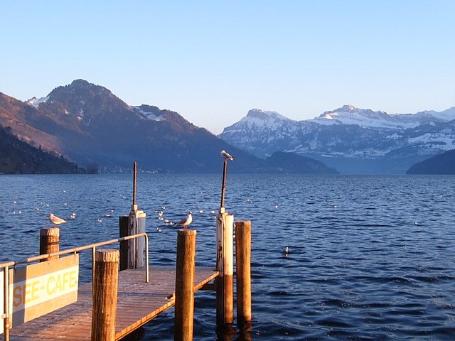
 Hiking in Aargau
The Canton of Aargau, located in Switzerland, offers a variety of hiking opportunities that cater to different skill levels and preferences. Here's an overview of what you can expect when hiking in this beautiful region:
Scenic Landscapes
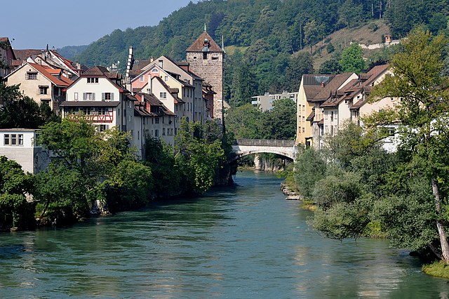
Aargau is characterized by rolling hills, lush forests, and charming small towns. The pathways often meander through vineyards and past rivers, offering picturesque views of the Swiss countryside.
Hiking Trails
- Swiss Hiking Trail Network: Aargau is well integrated into the Swiss hiking trail system, featuring well-marked trails that vary in difficulty.
- Aargau's Regional Trails: Some notable trails include the Aargau Scenic Trail and the Nature Trail along the Aare River. These routes often highlight the region's natural beauty and cultural heritage.
Popular Trails
- Hiking in the Reusstal: This area offers relatively gentle paths along the Reuss River, suitable for families and beginners.
- Mutschellen to Niederglatt: A moderate trail that provides panoramic views of the surrounding hills and valleys.
- Hiking around the Lenzburg Castle: The castle is a popular destination, and the trails leading up to it offer a mix of history and stunning vistas.
Flora and Fauna
The region is home to diverse plant and animal life. Keep an eye out for various species of birds, deer, and unique alpine flora along the trails.
Accessibility
Many of the hiking trails in Aargau are easily accessible by public transportation from major Swiss cities. This makes it convenient for hikers to start their adventures without needing a car.
Seasonal Hikes
- Spring and Summer: Ideal for wildflower hikes and enjoying the lush greenery.
- Fall: Stunning autumn colors make the hikes especially beautiful, especially in forested areas.
- Winter: Some lower trails may be suitable for winter hiking, but snowshoeing and winter sports are also options in select areas.
Safety Tips
- Stay Hydrated: Always carry enough water, especially on longer hikes.
- Dress in Layers: Weather can change quickly, so be prepared for different conditions.
- Trail Etiquette: Follow local guidelines, respect nature, and be courteous to other hikers.
Conclusion
Hiking in the Canton of Aargau provides a rewarding experience for outdoor enthusiasts. Whether you are looking for a leisurely walk or a more challenging trek, you'll find trails that showcase the stunning landscapes and rich culture of this Swiss region. Always check local resources for trail conditions and maps before heading out, and enjoy your adventure!
- Country:

- Capital: Aarau
- Licence Plate Code: AG
- Coordinates: 47° 22' 49" N, 8° 0' 51" E


- GPS tracks (wikiloc): [Link]
- AboveSeaLevel: 382 м m
- Area: 1403.77 sq km
- Population: 568671
- Web site: https://www.ag.ch
- Wikipedia en: wiki(en)
- Wikipedia: wiki(de)
- Wikidata storage: Wikidata: Q11972
- Wikipedia Commons Gallery: [Link]
- Wikipedia Commons Category: [Link]
- Freebase ID: [/m/0zqq]
- GeoNames ID: Alt: [2661876]
- BnF ID: [119340620]
- VIAF ID: Alt: [123736594]
- OSM relation ID: [28020]
- GND ID: Alt: [4000022-9]
- archINFORM location ID: [2679]
- Library of Congress authority ID: Alt: [n80145150]
- MusicBrainz area ID: [a615e69f-02b7-4a46-9d1a-9a7d7523a493]
- Encyclopædia Britannica Online ID: [place/Aargau-canton-Switzerland]
- Gran Enciclopèdia Catalana ID: [0000024]
- HDS ID: [7392]
- ISNI: Alt: [0000 0001 0789 1086]
- NKCR AUT ID: [ge173076]
- NUTS code: [CH033]
- Klexikon article ID: [Aargau]
- Ringgold ID: [60317]
- Global Anabaptist Mennonite Encyclopedia Online ID: [Aargau (Switzerland)]
- STW Thesaurus for Economics ID: [16956-6]
- ISO 3166-2 code: CH-AG
- FIPS 10-4 (countries and regions): SZ01
Includes regions:


Aarau District
- district in Switzerland
Hiking in Aarau District
Aarau District, located in the canton of Aargau, Switzerland, offers a variety of hiking opportunities for outdoor enthusiasts. Here’s a quick overview of what you can expect when hiking in this beautiful part of Switzerland:...
- Country:
- Capital: Aarau
- Licence Plate Code: AG
- Coordinates: 47° 23' 0" N, 8° 2' 0" E
- GPS tracks (wikiloc): [Link]
- AboveSeaLevel: 433 м m
- Area: 104.47 sq km
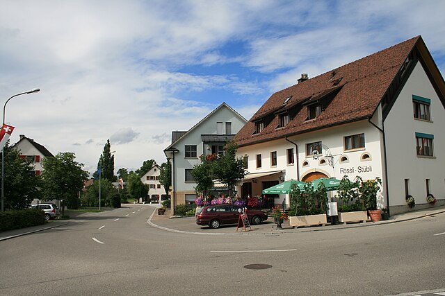
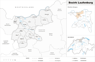
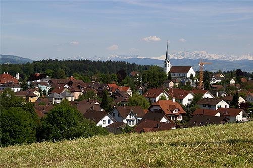
Laufenburg District
- district in Switzerland
Hiking in Laufenburg District
Laufenburg District, located in the canton of Aargau in Switzerland, is a hidden gem for hikers and nature enthusiasts. The area is characterized by its picturesque landscapes, charming small towns, and varied terrain, making it an ideal destination for hiking. Here are some highlights and tips for hiking in the Laufenburg District:...
- Country:
- Licence Plate Code: AG
- Coordinates: 47° 33' 0" N, 8° 3' 0" E
- GPS tracks (wikiloc): [Link]
- AboveSeaLevel: 480 м m
- Area: 125.57 sq km


Bremgarten District
- district in Switzerland
Hiking in Bremgarten District
Hiking in the Bremgarten District, located in the canton of Aargau, Switzerland, offers a wonderful blend of scenic landscapes, rich history, and accessible trails. Here are some highlights and tips for hiking in this beautiful area:...
- Country:
- Capital: Bremgarten
- Licence Plate Code: AG
- Coordinates: 47° 21' 0" N, 8° 20' 0" E
- GPS tracks (wikiloc): [Link]
- AboveSeaLevel: 384 м m
- Area: 117.46 sq km
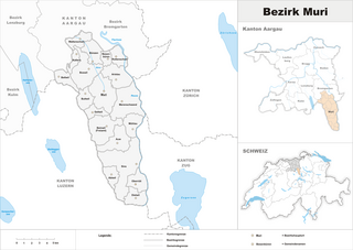
Muri District
- district in Switzerland
Hiking in Muri District
Muri District, located in the Cook Islands, is known for its stunning landscapes, beautiful beaches, and lush tropical vegetation, making it an excellent destination for hiking and outdoor activities....
- Country:
- Capital: Muri
- Licence Plate Code: AG
- Coordinates: 47° 16' 0" N, 8° 20' 0" E
- GPS tracks (wikiloc): [Link]
- AboveSeaLevel: 487 м m
- Area: 138.96 sq km
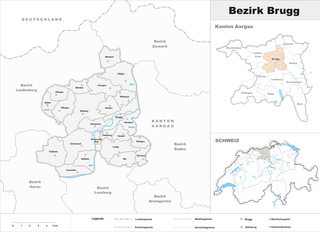
Brugg District
- district in Switzerland
Hiking in Brugg District
Brugg District, located in the canton of Aargau in Switzerland, offers a variety of hiking opportunities that cater to different skill levels and preferences. The region is characterized by beautiful landscapes, including rolling hills, forests, and rivers, making it an ideal destination for nature enthusiasts and hikers....
- Country:
- Capital: Brugg
- Licence Plate Code: AG
- Coordinates: 47° 29' 0" N, 8° 12' 0" E
- GPS tracks (wikiloc): [Link]
- AboveSeaLevel: 360 м m
- Area: 149.31 sq km


Lenzburg District
- district in Switzerland
Hiking in Lenzburg District
Lenzburg District, located in the Aargau canton of Switzerland, boasts a variety of hiking opportunities that cater to all levels of hikers. The region is characterized by its beautiful landscapes, historical sites, and well-maintained trails. Here’s an overview of what you can expect when hiking in Lenzburg District:...
- Country:
- Capital: Lenzburg
- Licence Plate Code: AG
- Coordinates: 47° 23' 0" N, 8° 10' 0" E
- GPS tracks (wikiloc): [Link]
- AboveSeaLevel: 457 м m
- Area: 102.71 sq km


Zurzach District
- district in Switzerland
Hiking in Zurzach District
Zurzach District, located in the canton of Aargau in Switzerland, offers a variety of hiking opportunities that are perfect for both casual walkers and avid hikers. The area is known for its picturesque landscapes, charming villages, and historical sites. Here are some highlights and tips for hiking in the Zurzach District:...
- Country:
- Capital: Bad Zurzach
- Licence Plate Code: AG
- Coordinates: 47° 35' 0" N, 8° 17' 0" E
- GPS tracks (wikiloc): [Link]
- AboveSeaLevel: 349 м m
- Area: 129.99 sq km
- Web site: [Link]


Zofingen District
- district in the canton of Aargau, Switzerland
Hiking in Zofingen District
Zofingen District, located in Switzerland's Aargau region, offers a variety of hiking opportunities amid beautiful landscapes, charming villages, and panoramic views. The district is a great location for both casual walkers and more experienced hikers. Here are some highlights and tips for hiking in the Zofingen District:...
- Country:
- Capital: Zofingen
- Coordinates: 47° 17' 0" N, 7° 56' 0" E
- GPS tracks (wikiloc): [Link]
- AboveSeaLevel: 486 м m
- Area: 142.01 sq km


Baden District
- district in Switzerland
Hiking in Baden District
Baden District, located in the canton of Aargau, Switzerland, is an excellent destination for hiking enthusiasts, offering a mix of natural beauty, historical sites, and well-maintained trails. Here are some highlights:...
- Country:
- Capital: Baden
- Licence Plate Code: AG
- Coordinates: 47° 28' 0" N, 8° 18' 0" E
- GPS tracks (wikiloc): [Link]
- AboveSeaLevel: 478 м m
- Area: 153.07 sq km
- Web site: [Link]

Kulm District
- district in Switzerland
Hiking in Kulm District
Kulm District, located in the heart of Switzerland, offers some spectacular hiking opportunities, thanks to its stunning landscapes and varied terrain. Here are some key features you should know if you’re considering hiking in this area:...
- Country:
- Capital: Unterkulm
- Licence Plate Code: AG
- Coordinates: 47° 18' 0" N, 8° 6' 0" E
- GPS tracks (wikiloc): [Link]
- AboveSeaLevel: 495 м m
- Area: 101.35 sq km


Rheinfelden District
- district in Switzerland
Hiking in Rheinfelden District
Rheinfelden District, straddling the border between Switzerland and Germany, offers a variety of hiking opportunities set against picturesque landscapes alongside the Rhine River. Here are some highlights to consider:...
- Country:
- Capital: Rheinfelden
- Licence Plate Code: AG
- Coordinates: 47° 33' 0" N, 7° 47' 0" E
- GPS tracks (wikiloc): [Link]
- AboveSeaLevel: 358 м m
- Area: 112.09 sq km
Shares border with regions:

canton of Bern
- canton of Switzerland
Hiking in canton of Bern
The Canton of Bern, located in Switzerland, offers some of the most stunning landscapes and diverse trails for hiking enthusiasts. This region boasts a mix of alpine scenery, picturesque villages, and lush valleys, making it an excellent destination for all levels of hikers. Here are some highlights you can expect when hiking in the Canton of Bern:...
- Country:
- Capital: Bern
- Licence Plate Code: BE
- Coordinates: 46° 50' 0" N, 7° 37' 0" E
- GPS tracks (wikiloc): [Link]
- AboveSeaLevel: 542 м m
- Area: 5959 sq km
- Population: 1031126
- Web site: [Link]

Canton of Solothurn
- canton of Switzerland
Hiking in Canton of Solothurn
Hiking in the Canton of Solothurn offers a fantastic blend of natural beauty, historical sites, and picturesque villages. Located in Switzerland, Solothurn is known for its picturesque landscapes, ranging from rolling hills to stunning valleys and the scenic banks of the River Aare....
- Country:
- Capital: Solothurn
- Licence Plate Code: SO
- Coordinates: 47° 9' 0" N, 7° 38' 0" E
- GPS tracks (wikiloc): [Link]
- AboveSeaLevel: 432 м m
- Area: 790.45 sq km
- Web site: [Link]


Canton of Zug
- canton of Switzerland
Hiking in Canton of Zug
Hiking in the Canton of Zug, Switzerland, offers a unique blend of stunning landscapes, quaint villages, and a variety of trails suitable for all levels of hikers. The canton is known for its picturesque lakes, rolling hills, and proximity to the mountains, particularly the nearby Zugerberg and the Rigi massif....
- Country:
- Capital: Zug
- Licence Plate Code: ZG
- Coordinates: 47° 0' 0" N, 8° 31' 0" E
- GPS tracks (wikiloc): [Link]
- AboveSeaLevel: 425 м m
- Area: 238.73 sq km
- Web site: [Link]

canton of Zürich
- canton of Switzerland
Hiking in canton of Zürich
The Canton of Zürich offers a rich variety of hiking opportunities, suitable for all skill levels and preferences. Here are some highlights and tips for hiking in this region:...
- Country:
- Capital: Zürich
- Licence Plate Code: ZH
- Coordinates: 47° 0' 0" N, 9° 0' 0" E
- GPS tracks (wikiloc): [Link]
- AboveSeaLevel: 408 м m
- Area: 1729 sq km
- Population: 1408575
- Web site: [Link]

Canton of Lucerne
- canton of Switzerland
Hiking in Canton of Lucerne
Hiking in the Canton of Lucerne, located in central Switzerland, offers a diverse range of trails that showcase stunning landscapes, picturesque lakes, and the majestic Alps. Here are some highlights and tips for hiking in this beautiful region:...
- Country:
- Capital: Lucerne
- Licence Plate Code: LU
- Coordinates: 47° 5' 0" N, 8° 7' 0" E
- GPS tracks (wikiloc): [Link]
- AboveSeaLevel: 436 м m
- Area: 1493.51 sq km
- Web site: [Link]


Basel-Landschaft
- canton of Switzerland
Hiking in Basel-Landschaft
Hiking in the Canton of Basel-Landschaft, located in Switzerland, offers an excellent opportunity to explore the region's beautiful landscapes, charming villages, and diverse ecosystems. Here are some key points to consider when planning your hike in this area:...
- Country:
- Capital: Liestal
- Licence Plate Code: BL
- Coordinates: 47° 27' 47" N, 7° 45' 21" E
- GPS tracks (wikiloc): [Link]
- AboveSeaLevel: 327 м m
- Area: 517.67 sq km
- Web site: [Link]


Baden-Württemberg
- federal state in the South-West of Germany
Hiking in Baden-Württemberg
Baden-Württemberg, located in southwestern Germany, is a fantastic region for hiking enthusiasts. With its diverse landscapes, from the Black Forest to the Swabian Jura and picturesque vineyards along the Rhine River, the area offers a variety of trails suitable for all skill levels. Here are some highlights:...
- Country:

- Capital: Stuttgart
- Coordinates: 48° 32' 16" N, 9° 2' 28" E
- GPS tracks (wikiloc): [Link]
- AboveSeaLevel: 327 м m
- Area: 35751.65 sq km
- Population: 10703000
- Web site: [Link]