Abriola (Abriola)
.svg)
- Italian comune
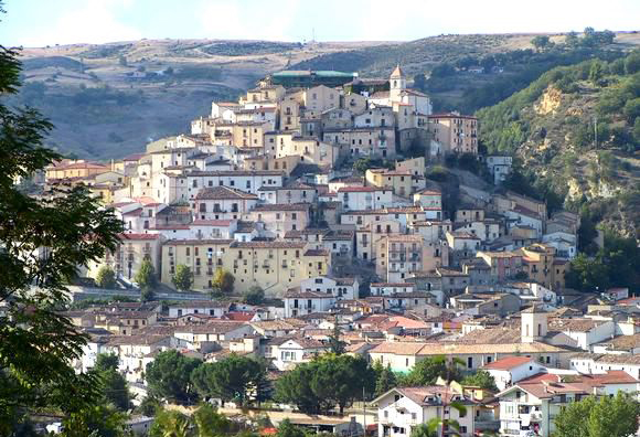
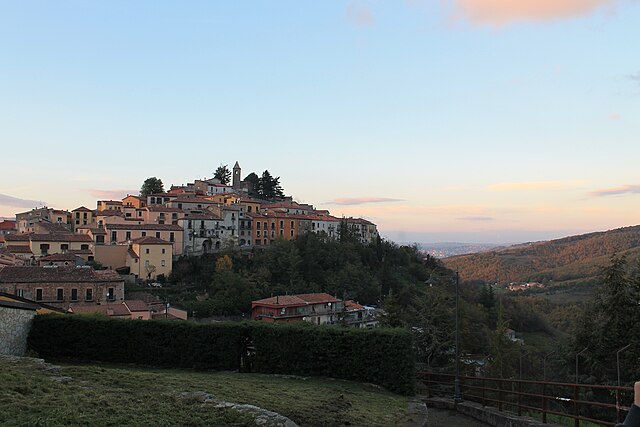
 Hiking in Abriola
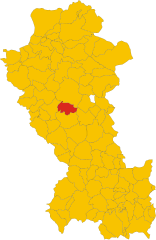
Abriola is a quaint village located in the province of Potenza, in the Basilicata region of southern Italy. It's surrounded by the stunning natural beauty of the Apennine mountains, making it a lovely destination for hiking enthusiasts. Here are some highlights of hiking in and around Abriola:
Scenic Trails
-
Mountain Paths: The area surrounding Abriola features several well-marked trails that cater to different skill levels. You can find routes that offer gentle slopes suitable for beginners, as well as more challenging paths for experienced hikers.
-
Panoramic Views: Many trails lead to viewpoints that offer breathtaking panoramic views of the surrounding mountains and valleys. The sight of the Lucanian Apennines can be particularly rewarding.
-
Natural Reserves: Hikers can explore nearby nature reserves and parks, such as the Parco Nazionale Appennino Lucano Val d'Agri Lagonegrese, which provide a rich variety of flora and fauna, as well as opportunities for birdwatching.
Local Culture
-
Cultural Sites: Along your hikes, you might encounter charming rural architecture, ancient churches, and local farms. It's a wonderful opportunity to experience the local culture.
-
Food and Wine: After a day of hiking, you can enjoy traditional Basilicata cuisine in one of the local restaurants. Don’t miss trying the region's famous products, like lucanica sausage and Aglianico wine.
Tips for Hiking in Abriola
-
Know the Weather: The weather in the Apennines can change rapidly. Make sure to check the forecast before your hike and dress in layers.
-
Stay Hydrated: Always carry enough water, especially during warmer months. Some trails may not have easy access to water sources.
-
Trail Maps: Get a local hiking map or guidebook. Though many trails are marked, having a map can enhance your experience and ensure you stay on track.
-
Wildlife Awareness: Be mindful of the local wildlife; while encounters are rare, some animals may inhabit the area.
-
Safety First: Always let someone know your itinerary, especially if hiking solo. Carry a first-aid kit and know basic outdoor safety skills.
Hiking in Abriola offers a perfect blend of natural beauty, outdoor adventure, and cultural experiences. Whether you're looking for a leisurely walk or a more demanding hike, the lush landscapes and serene atmosphere are sure to leave you with lasting memories.
- Country:

- Postal Code: 85010
- Local Dialing Code: 0971
- Licence Plate Code: PZ
- Coordinates: 40° 31' 0" N, 15° 47' 0" E


- GPS tracks (wikiloc): [Link]
- AboveSeaLevel: 957 м m
- Area: 97.19 sq km
- Population: 1479
- Web site: http://www.comune.abriola.pz.it/
- Wikipedia en: wiki(en)
- Wikipedia: wiki(it)
- Wikidata storage: Wikidata: Q52510
- Wikipedia Commons Category: [Link]
- Freebase ID: [/m/0dp1z5]
- GeoNames ID: Alt: [6537604]
- OSM relation ID: [40552]
- ISTAT ID: 076001
- Italian cadastre code: A013
Shares border with regions:


Anzi, Italy
- Italian comune
Hiking in Anzi, Italy
Anzi is a charming village located in the Basilicata region of southern Italy, nestled in the heart of the Apennine mountains. The area surrounding Anzi offers a variety of hiking opportunities that showcase the stunning landscapes, rich biodiversity, and cultural heritage of Basilicata....
- Country:
- Postal Code: 85010
- Local Dialing Code: 0971
- Licence Plate Code: PZ
- Coordinates: 40° 31' 0" N, 15° 55' 0" E
- GPS tracks (wikiloc): [Link]
- AboveSeaLevel: 1067 м m
- Area: 77.1 sq km
- Population: 1648
- Web site: [Link]

Calvello
- Italian comune
Hiking in Calvello
Calvello is a charming municipality located in the province of Potenza in the Basilicata region of southern Italy. Surrounded by stunning landscapes and rich in natural beauty, hiking in Calvello offers an opportunity to explore diverse terrain, historical sites, and enjoy the serene environment of the Lucanian Apennines....
- Country:
- Postal Code: 85010
- Local Dialing Code: 0971
- Licence Plate Code: PZ
- Coordinates: 40° 29' 0" N, 15° 51' 0" E
- GPS tracks (wikiloc): [Link]
- AboveSeaLevel: 730 м m
- Area: 106.4 sq km
- Population: 1931
- Web site: [Link]


Marsico Nuovo
- Italian comune
Hiking in Marsico Nuovo
Marsico Nuovo is a charming town located in the Basilicata region of southern Italy. Surrounded by the scenic beauty of the Appennino Lucano National Park, it offers excellent opportunities for hiking and outdoor activities. Here are some highlights and tips for hiking in the Marsico Nuovo area:...
- Country:
- Postal Code: 85052
- Local Dialing Code: 80052
- Licence Plate Code: PZ
- Coordinates: 40° 25' 0" N, 15° 44' 0" E
- GPS tracks (wikiloc): [Link]
- AboveSeaLevel: 850 м m
- Area: 100.97 sq km
- Population: 4014
- Web site: [Link]
Pignola
- Italian comune
Hiking in Pignola
Pignola, located in the Basilicata region of southern Italy, offers a range of hiking opportunities amidst its stunning landscapes, rich biodiversity, and charming rural scenery. Here are some key points to consider when hiking in and around Pignola:...
- Country:
- Postal Code: 85010
- Local Dialing Code: 0971
- Licence Plate Code: PZ
- Coordinates: 40° 34' 0" N, 15° 47' 0" E
- GPS tracks (wikiloc): [Link]
- AboveSeaLevel: 926 м m
- Area: 56.24 sq km
- Population: 6908
- Web site: [Link]
Sasso di Castalda
- Italian comune
Hiking in Sasso di Castalda
Sasso di Castalda is a picturesque village located in the Basilicata region of southern Italy, surrounded by the beautiful landscapes of the Apennine mountains. Known for its stunning scenery, Sasso di Castalda offers a variety of hiking trails suitable for different skill levels, making it a great destination for outdoor enthusiasts....
- Country:
- Postal Code: 85050
- Local Dialing Code: 0975
- Licence Plate Code: PZ
- Coordinates: 40° 29' 0" N, 15° 41' 0" E
- GPS tracks (wikiloc): [Link]
- AboveSeaLevel: 949 м m
- Area: 45.43 sq km
- Population: 831
- Web site: [Link]


Tito
- Italian comune
Hiking in Tito
Hiking in Tito, a town situated in the Basilicata region of Italy, offers a wonderful blend of natural beauty, historical sites, and diverse landscapes. Here are some key points to consider:...
- Country:
- Postal Code: 85050
- Local Dialing Code: 0971
- Licence Plate Code: PZ
- Coordinates: 40° 35' 0" N, 15° 41' 0" E
- GPS tracks (wikiloc): [Link]
- AboveSeaLevel: 650 м m
- Area: 71.27 sq km
- Population: 7355
- Web site: [Link]