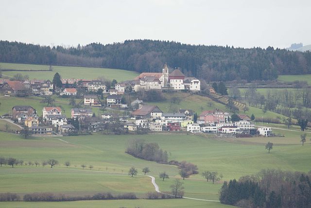
Abtwil (Abtwil AG)
- municipality in the canton Aargau, Switzerland
Abtwil, located in the Canton of Aargau, Switzerland, is a great spot for hiking enthusiasts. The region is characterized by beautiful landscapes, rolling hills, and the scenic views of the surrounding countryside. Here are some highlights and tips for hiking in Abtwil and the nearby areas:
Trails and Routes
- Local Trails: There are a variety of well-marked local hiking trails that cater to different fitness levels. You can find both short walks and longer hikes that range from easy to moderate difficulty.
- Nature Reserves: The area is rich in natural beauty, with opportunities to explore nature reserves and woodlands. These trails often provide a chance to see local flora and fauna.
- Scenic Lookouts: Many trails leading out of Abtwil offer breathtaking views across the Aargau countryside. Look for elevated paths that give you panoramic perspectives.
Hiking Tips
- Map and Navigation: Make sure to have a hiking map or GPS device, as some trails may not have extensive signage.
- Weather Check: Always check the local weather forecast before heading out, as conditions can change quickly in the fall and spring months.
- Sustainability: Follow Leave No Trace principles. Be respectful of nature by staying on marked trails and carrying out any waste.
Nearby Attractions
- Bad Zurzach and Aguana: A short hike away, you can visit rejuvenating spa towns. Consider combining a beautiful hike with some time for relaxation.
- Historical Sites: The region is steeped in history, so you might encounter old churches, castles, or ruins along some routes.
Community and Resources
- Local Hiking Clubs: Engaging with local hiking groups can enhance your experience. They often organize group hikes, which can be a great way to meet other hiking enthusiasts.
- Visitor Information: Check in at local tourist offices for the latest trail conditions, maps, and recommendations on must-see sites.
Overall, hiking in Abtwil offers a peaceful and picturesque outdoor experience. Whether you’re seeking a leisurely walk or a more challenging trek, you’re sure to enjoy the natural beauty of Aargau.
- Country:

- Postal Code: 5646
- Local Dialing Code: 041
- Licence Plate Code: AG
- Coordinates: 47° 10' 34" N, 8° 21' 20" E


- GPS tracks (wikiloc): [Link]
- AboveSeaLevel: 536 м m
- Area: 4.14 sq km
- Population: 976
- Web site: http://www.abtwilag.ch
- Wikipedia en: wiki(en)
- Wikipedia: wiki(de)
- Wikidata storage: Wikidata: Q69219
- Wikipedia Commons Category: [Link]
- Freebase ID: [/m/0flrqd]
- GeoNames ID: Alt: [7285017]
- VIAF ID: Alt: [234151564]
- OSM relation ID: [1684253]
- archINFORM location ID: [4001]
- HDS ID: [1776]
- Swiss municipality code: [4221]
Shares border with regions:


Sins
- municipality in Switzerland
Sins, located in the canton of Aargau in Switzerland, is a charming village that serves as a great starting point for hiking enthusiasts. The surrounding region is characterized by rolling hills, lush meadows, and forests, providing a variety of trails that cater to different skill levels....
- Country:

- Postal Code: 5643
- Local Dialing Code: 041
- Licence Plate Code: AG
- Coordinates: 47° 11' 29" N, 8° 23' 49" E


- GPS tracks (wikiloc): [Link]
- AboveSeaLevel: 410 м m
- Area: 20.28 sq km
- Population: 4315
- Web site: [Link]


Hohenrain
- municipality in the canton of Lucerne, Switzerland
Hohenrain is a scenic village located in the canton of Lucerne, Switzerland. It offers a delightful backdrop for hiking enthusiasts, with its picturesque landscapes, rolling hills, and views of the Swiss Alps. Here are some highlights about hiking in and around Hohenrain:...
- Country:

- Postal Code: 6276
- Local Dialing Code: 041
- Licence Plate Code: LU
- Coordinates: 47° 10' 51" N, 8° 19' 4" E


- GPS tracks (wikiloc): [Link]
- AboveSeaLevel: 604 м m
- Area: 23.52 sq km
- Population: 2474
- Web site: [Link]

