Adast (Adast)

- commune in Hautes-Pyrénées, France
- Country:

- Postal Code: 65260
- Coordinates: 42° 58' 25" N, 0° 4' 40" E


- GPS tracks (wikiloc): [Link]
- Area: 1.05 sq km
- Population: 288
- Wikipedia en: wiki(en)
- Wikipedia: wiki(fr)
- Wikidata storage: Wikidata: Q352654
- Wikipedia Commons Category: [Link]
- Freebase ID: [/m/03nv1x1]
- Freebase ID: [/m/03nv1x1]
- GeoNames ID: Alt: [6452457]
- GeoNames ID: Alt: [6452457]
- SIREN number: [216500017]
- SIREN number: [216500017]
- BnF ID: [152703830]
- BnF ID: [152703830]
- INSEE municipality code: 65001
- INSEE municipality code: 65001
Shares border with regions:


Préchac
- commune in Hautes-Pyrénées, France
- Country:
- Postal Code: 65400
- Coordinates: 42° 59' 32" N, 0° 4' 23" E
- GPS tracks (wikiloc): [Link]
- AboveSeaLevel: 448 м m
- Area: 1.59 sq km
- Population: 227


Beaucens
- commune in Hautes-Pyrénées, France
- Country:
- Postal Code: 65400
- Coordinates: 42° 58' 35" N, 0° 3' 39" E
- GPS tracks (wikiloc): [Link]
- Area: 36.82 sq km
- Population: 405

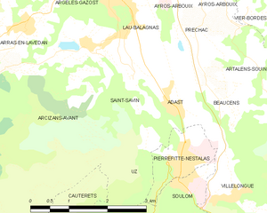
Saint-Savin
- commune in Hautes-Pyrénées, France
- Country:
- Postal Code: 65400
- Coordinates: 42° 58' 47" N, 0° 5' 26" E
- GPS tracks (wikiloc): [Link]
- Area: 3.86 sq km
- Population: 378
- Web site: [Link]


Pierrefitte-Nestalas
- commune in Hautes-Pyrénées, France
- Country:
- Postal Code: 65260
- Coordinates: 42° 57' 40" N, 0° 4' 25" E
- GPS tracks (wikiloc): [Link]
- Area: 1.76 sq km
- Population: 1171