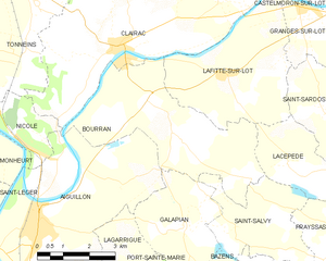
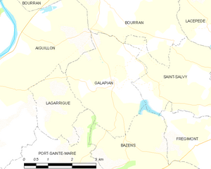
Aiguillon (Aiguillon)
- commune in Lot-et-Garonne, France
- Country:

- Postal Code: 47190
- Coordinates: 44° 18' 2" N, 0° 20' 15" E


- GPS tracks (wikiloc): [Link]
- Area: 28.28 sq km
- Population: 4346
- Web site: http://www.ville-aiguillon.eu
- Wikipedia en: wiki(en)
- Wikipedia: wiki(fr)
- Wikidata storage: Wikidata: Q404783
- Wikipedia Commons Category: [Link]
- Freebase ID: [/m/045xtx]
- GeoNames ID: Alt: [6452345]
- SIREN number: [214700049]
- BnF ID: [15261085w]
- VIAF ID: Alt: [246983445]
- Library of Congress authority ID: Alt: [n2001080255]
- PACTOLS thesaurus ID: [pcrtdEP37K8UAT]
- MusicBrainz area ID: [655de92f-b784-49a9-b6df-f717a98305cd]
- SUDOC authorities ID: [034265805]
- INSEE municipality code: 47004
Shares border with regions:


Bourran
- commune in Lot-et-Garonne, France
- Country:

- Postal Code: 47320
- Coordinates: 44° 20' 33" N, 0° 23' 37" E


- GPS tracks (wikiloc): [Link]
- Area: 18.16 sq km
- Population: 607


Port-Sainte-Marie
- commune in Lot-et-Garonne, France
- Country:

- Postal Code: 47130
- Coordinates: 44° 15' 2" N, 0° 23' 50" E


- GPS tracks (wikiloc): [Link]
- Area: 18.94 sq km
- Population: 1936
- Web site: [Link]


Galapian
- commune in Lot-et-Garonne, France
- Country:

- Postal Code: 47190
- Coordinates: 44° 17' 56" N, 0° 24' 49" E


- GPS tracks (wikiloc): [Link]
- Area: 9.25 sq km
- Population: 329


Nicole
- commune in Lot-et-Garonne, France
- Country:

- Postal Code: 47190
- Coordinates: 44° 19' 29" N, 0° 20' 10" E


- GPS tracks (wikiloc): [Link]
- Area: 4.78 sq km
- Population: 249


Saint-Léger
- commune in Lot-et-Garonne, France
- Country:

- Postal Code: 47160
- Coordinates: 44° 17' 21" N, 0° 19' 6" E


- GPS tracks (wikiloc): [Link]
- Area: 5.79 sq km
- Population: 149
Thouars-sur-Garonne
- commune in Lot-et-Garonne, France
- Country:

- Postal Code: 47230
- Coordinates: 44° 15' 9" N, 0° 20' 8" E


- GPS tracks (wikiloc): [Link]
- Area: 4.03 sq km
- Population: 209


Lagarrigue
- commune in Lot-et-Garonne, France
- Country:

- Postal Code: 47190
- Coordinates: 44° 17' 49" N, 0° 22' 45" E


- GPS tracks (wikiloc): [Link]
- Area: 4.38 sq km
- Population: 285


Buzet-sur-Baïse
- commune in Lot-et-Garonne, France
- Country:

- Postal Code: 47160
- Coordinates: 44° 15' 29" N, 0° 17' 57" E


- GPS tracks (wikiloc): [Link]
- Area: 21.15 sq km
- Population: 1308
- Web site: [Link]


Monheurt
- commune in Lot-et-Garonne, France
- Country:

- Postal Code: 47160
- Coordinates: 44° 20' 25" N, 0° 18' 27" E


- GPS tracks (wikiloc): [Link]
- Area: 11.44 sq km
- Population: 198
- Web site: [Link]
