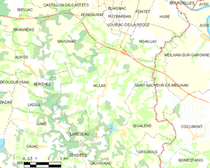
Aillas (Aillas)
- commune in Gironde, France
- Country:

- Postal Code: 33124
- Coordinates: 44° 28' 27" N, 0° 4' 27" E


- GPS tracks (wikiloc): [Link]
- Area: 35.13 sq km
- Population: 811
- Wikipedia en: wiki(en)
- Wikipedia: wiki(fr)
- Wikidata storage: Wikidata: Q273699
- Wikipedia Commons Category: [Link]
- Freebase ID: [/m/03mhdls]
- GeoNames ID: Alt: [3038448]
- SIREN number: [213300023]
- BnF ID: [152560569]
- INSEE municipality code: 33002
Shares border with regions:


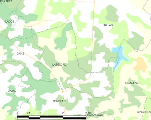
Labescau
- commune in Gironde, France
- Country:

- Postal Code: 33690
- Coordinates: 44° 26' 39" N, 0° 5' 20" E


- GPS tracks (wikiloc): [Link]
- Area: 5.99 sq km
- Population: 105
- Web site: [Link]


Noaillac
- commune in Gironde, France
- Country:

- Postal Code: 33190
- Coordinates: 44° 30' 58" N, 0° 0' 40" E


- GPS tracks (wikiloc): [Link]
- AboveSeaLevel: 45 м m
- Area: 7.94 sq km
- Population: 439


Sigalens
- commune in Gironde, France
- Country:

- Postal Code: 33690
- Coordinates: 44° 26' 57" N, 0° 2' 43" E


- GPS tracks (wikiloc): [Link]
- Area: 18.33 sq km
- Population: 379
- Web site: [Link]


Saint-Sauveur-de-Meilhan
- commune in Lot-et-Garonne, France
- Country:

- Postal Code: 47180
- Coordinates: 44° 28' 54" N, 0° 0' 8" E


- GPS tracks (wikiloc): [Link]
- Area: 7.03 sq km
- Population: 333
- Web site: [Link]


Loupiac-de-la-Réole
- commune in Gironde, France
- Country:

- Postal Code: 33190
- Coordinates: 44° 32' 44" N, 0° 2' 30" E


- GPS tracks (wikiloc): [Link]
- Area: 5.32 sq km
- Population: 494


Lados
- commune in Gironde, France
- Country:

- Postal Code: 33124
- Coordinates: 44° 28' 3" N, 0° 8' 51" E


- GPS tracks (wikiloc): [Link]
- Area: 6.49 sq km
- Population: 173


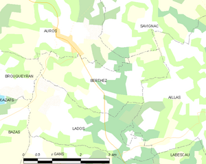
Berthez
- commune in Gironde, France
- Country:

- Postal Code: 33124
- Coordinates: 44° 29' 6" N, 0° 8' 7" E


- GPS tracks (wikiloc): [Link]
- Area: 6.03 sq km
- Population: 270


Savignac
- commune in Gironde, France
- Country:

- Postal Code: 33124
- Coordinates: 44° 31' 22" N, 0° 6' 32" E


- GPS tracks (wikiloc): [Link]
- Area: 17.02 sq km
- Population: 635
- Web site: [Link]


Puybarban
- commune in Gironde, France
- Country:

- Postal Code: 33190
- Coordinates: 44° 33' 10" N, 0° 4' 29" E


- GPS tracks (wikiloc): [Link]
- Area: 5.58 sq km
- Population: 415


Pondaurat
- commune in Gironde, France
- Country:

- Postal Code: 33190
- Coordinates: 44° 32' 13" N, 0° 5' 17" E


- GPS tracks (wikiloc): [Link]
- Area: 8.74 sq km
- Population: 480
- Web site: [Link]
