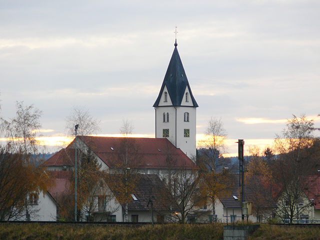
Aitrach (Aitrach)

- municipality in Germany
 Hiking in Aitrach
Aitrach, a picturesque region in Germany, offers a variety of hiking opportunities thanks to its beautiful landscapes, quaint villages, and well-marked trails suitable for all levels of hikers. Here are some key highlights for those looking to explore this area:
Scenic Trails
-
Trails for All Levels: Aitrach provides trails that cater to beginners, families, and experienced hikers. You can find easy walking paths as well as more challenging hikes that lead you through lush forests and rolling hills.
-
Nature Experiences: The surrounding area is rich in flora and fauna. Hikers might encounter diverse wildlife, especially in protected areas where nature thrives.
-
Local Landmarks: Many trails offer access to historical sites, including old churches, ruins, and charming village centers, making the hikes not just about the physical journey but also about cultural discovery.
Planning Your Hike
-
Maps and Useful Apps: It's advisable to carry a detailed map of the trails or use hiking apps for GPS guidance. Local visitor centers can provide maps and additional information.
-
Weather Considerations: Always check the weather before heading out. The region can experience rapid changes in weather, so pack accordingly with waterproof gear if necessary.
-
Safety Precautions: Stay hydrated, wear appropriate footwear, and let someone know your hiking plans, especially if you're venturing into more remote areas.
Enjoying the Experience
-
Photography: The natural beauty of Aitrach makes it a great spot for photography. Bring your camera to capture the stunning landscapes.
-
Local Cuisine: After a long hike, consider visiting a local restaurant or café to enjoy some regional specialties. Many local eateries focus on Bavarian cuisine.
-
Group Hikes: If you're new to hiking or exploring the area, consider joining a guided hike or walking group to meet new people and gain insights from local guides.
Hiking in Aitrach can be both an enjoyable and fulfilling experience, combining physical activity with the relaxation and beauty of nature. Always respect nature and follow the Leave No Trace principles to help preserve the area for future hikers. Enjoy your adventure!
- Country:

- Postal Code: 88319
- Local Dialing Code: 07565
- Coordinates: 47° 56' 24" N, 10° 5' 24" E


- GPS tracks (wikiloc): [Link]
- AboveSeaLevel: 596 м m
- Area: 30.2 sq km
- Population: 2526
- Web site: http://www.aitrach.de
- Wikipedia en: wiki(en)
- Wikipedia: wiki(de)
- Wikidata storage: Wikidata: Q410980
- Wikipedia Commons Category: [Link]
- Freebase ID: [/m/02p_vy8]
- GeoNames ID: Alt: [2958798]
- VIAF ID: Alt: [248710459]
- OSM relation ID: [2806736]
- GND ID: Alt: [4441017-7]
- Historical Gazetteer (GOV) ID: [AITACHJN57BW]
- German municipality key: 08436004
Shares border with regions:


Tannheim
- municipality in Baden-Württemberg, Germany
Hiking in Tannheim
Tannheim is a stunning hiking destination located in the Tannheim Valley in Austria, near the border with Germany. The area is known for its picturesque landscapes, charming villages, and numerous hiking trails that cater to all levels of hikers. Here are some highlights and tips for hiking in Tannheim:...
- Country:
- Postal Code: 88459
- Local Dialing Code: 08395
- Licence Plate Code: BC
- Coordinates: 48° 0' 0" N, 10° 4' 59" E
- GPS tracks (wikiloc): [Link]
- AboveSeaLevel: 585 м m
- Area: 27.69 sq km
- Population: 2453
- Web site: [Link]

Aichstetten
- municipality in Germany
Hiking in Aichstetten
Aichstetten is a picturesque village located in the Allgäu region of Bavaria, Germany, known for its beautiful landscapes and outdoor activities, including hiking. The area around Aichstetten offers a variety of hiking trails that cater to different skill levels, making it a great destination for both beginners and experienced hikers....
- Country:
- Postal Code: 88317
- Local Dialing Code: 07565
- Coordinates: 47° 53' 35" N, 10° 4' 42" E
- GPS tracks (wikiloc): [Link]
- AboveSeaLevel: 616 м m
- Area: 33.75 sq km
- Population: 2819
- Web site: [Link]


Bad Wurzach
- municipality in Germany
Hiking in Bad Wurzach
Bad Wurzach, located in Bavaria, Germany, offers a variety of hiking opportunities, set against the backdrop of its picturesque landscapes and rich natural beauty. The region is known for its extensive woodlands, wetlands, and rolling hills, making it a great destination for both novice and experienced hikers....
- Country:
- Postal Code: 88410
- Local Dialing Code: 07564
- Licence Plate Code: RV
- Coordinates: 47° 54' 30" N, 9° 53' 40" E
- GPS tracks (wikiloc): [Link]
- AboveSeaLevel: 651 м m
- Area: 182.26 sq km
- Population: 14662
- Web site: [Link]


Rot an der Rot
- municipality in Baden-Württemberg, Germany
Hiking in Rot an der Rot
Rot an der Rot, located in the Baden-Württemberg region of Germany, is a beautiful area that offers various hiking opportunities amidst scenic landscapes. The region features rolling hills, picturesque villages, and wooded areas that provide a peaceful backdrop for hikers....
- Country:
- Postal Code: 88430
- Local Dialing Code: 08395
- Licence Plate Code: BC
- Coordinates: 48° 1' 0" N, 10° 2' 0" E
- GPS tracks (wikiloc): [Link]
- AboveSeaLevel: 595 м m
- Area: 63.44 sq km
- Population: 4424
- Web site: [Link]

Kronburg
- municipality of Germany
Hiking in Kronburg
Kronburg is a picturesque area that offers a variety of hiking opportunities, making it an excellent destination for both casual walkers and experienced hikers. Nestled in scenic surroundings, it features trails that can range from easy strolls to more challenging hikes, depending on your abilities and interests....
- Country:
- Postal Code: 87758
- Local Dialing Code: 08394
- Licence Plate Code: MN
- Coordinates: 47° 55' 0" N, 10° 10' 0" E
- GPS tracks (wikiloc): [Link]
- AboveSeaLevel: 744 м m
- Area: 20.26 sq km
- Population: 1398
- Web site: [Link]

Lautrach
- municipality of Germany
Hiking in Lautrach
Lautrach is a charming village located in the Allgäu region of Bavaria, Germany. While it may not be one of the most widely known hiking destinations, it offers a variety of beautiful trails suitable for different skill levels. Here are some key points to consider when hiking in and around Lautrach:...
- Country:
- Postal Code: 87763
- Local Dialing Code: 08394
- Licence Plate Code: MN
- Coordinates: 47° 54' 0" N, 10° 8' 0" E
- GPS tracks (wikiloc): [Link]
- AboveSeaLevel: 631 м m
- Area: 8.07 sq km
- Population: 1085
- Web site: [Link]