Landkreis Ravensburg (Landkreis Ravensburg)
- district of Baden-Württemberg, Germany
 Hiking in Landkreis Ravensburg
Ravensburg district, located in the state of Baden-Württemberg in Germany, offers a diverse range of hiking opportunities for both casual walkers and experienced hikers. The region is characterized by its beautiful landscapes, rolling hills, and picturesque villages. Here are some highlights and tips for hiking in Ravensburg:
Scenic Trails
-
Swabian Jura (Schwäbische Alb): This mountain range offers stunning views and a variety of trails that wind through forests, meadows, and limestone cliffs. The area is rich in natural beauty and geological formations.
-
Lake Constance (Bodensee): The southern boundary of the Ravensburg district features beautiful shores and walking paths around the lake. You can enjoy waterfront views and charming towns like Meersburg and Friedrichshafen.
-
Oberschwaben: This area offers scenic trails that connect charming villages and give hikers a taste of local culture and history. The hiking routes often pass through agricultural landscapes and historic sites.
-
Danube Valley: Some trails explore the Danube River valley, offering serene waterways, forests, and opportunities for birdwatching.
Popular Hiking Routes
- The Alemannic Way (Alemannenweg): A long-distance trail that runs through the region, showcasing the historical and cultural heritage of the area.
- The Hohenzollern Trail: This route leads you to impressive castles and ruins that are scattered throughout the district.
- Local Nature Trails: Many smaller trails specifically designed for day hikes or family outings can be found, often starting from towns like Ravensburg or Weingarten.
Practical Tips
- Difficulty Levels: Trails vary in difficulty, so be sure to choose a route that matches your fitness level. Some trails are suitable for families with children, while others are more challenging.
- Trail Markings: Most hiking paths are well-marked with signs and trail blazes, making navigation easier. However, a map or hiking app can be useful.
- Weather Considerations: The weather in the region can change, particularly in the mountains, so dress in layers and be prepared for rain.
- Local Amenities: Many towns along hiking routes have accommodations, dining options, and rest areas, making it easy to plan your hike.
- Wildlife Watch: Keep an eye out for local wildlife, including deer, various bird species, and even rare plants, particularly in protected areas.
Overall, Ravensburg district is a fantastic destination for hiking enthusiasts, offering a mix of natural beauty, cultural experiences, and a variety of trails for all skill levels. Enjoy your hike!
- Country:

- Capital: Ravensburg
- Licence Plate Code: RV
- Coordinates: 47° 49' 12" N, 9° 48' 0" E


- GPS tracks (wikiloc): [Link]
- AboveSeaLevel: 698 м m
- Area: 1631.81 sq km
- Population: 272425
- Web site: http://www.landkreis-ravensburg.de
- Wikipedia en: wiki(en)
- Wikipedia: wiki(de)
- Wikidata storage: Wikidata: Q8225
- Wikipedia Commons Category: [Link]
- Wikipedia Commons Maps Category: [Link]
- Freebase ID: [/m/01ks2w]
- GeoNames ID: Alt: [3220791]
- VIAF ID: Alt: [140824408]
- OSM relation ID: [2808774]
- GND ID: Alt: [4048635-7]
- archINFORM location ID: [2575]
- Library of Congress authority ID: Alt: [n88080041]
- TGN ID: [7077327]
- NUTS code: [DE148]
- German district key: 08436
Includes regions:
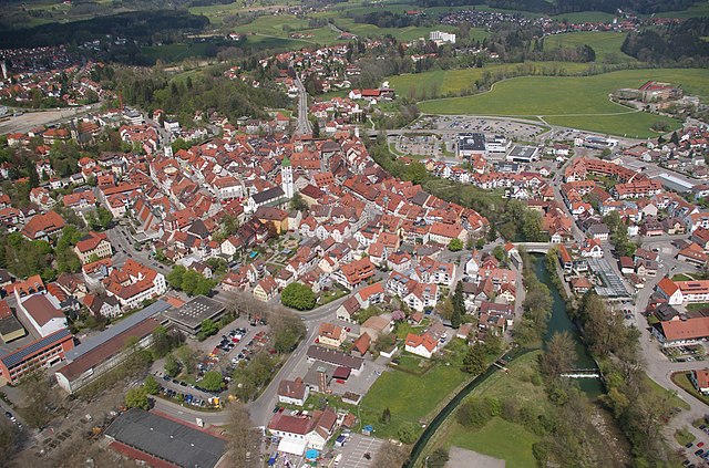

Wangen im Allgäu
- municipality in Germany
Wangen im Allgäu is a beautiful town located in the Allgäu region of Bavaria, Germany. This area is known for its picturesque landscapes, rolling hills, and lush forests, making it an excellent spot for hiking enthusiasts....
- Postal Code: 88239
- Local Dialing Code: 07522
- Licence Plate Code: RV
- Coordinates: 47° 41' 9" N, 9° 50' 3" E


- GPS tracks (wikiloc): [Link]
- AboveSeaLevel: 556 м m
- Area: 101.29 sq km
- Population: 26679
- Web site: [Link]


Altshausen
- municipality in Germany
Altshausen, a charming small town located in the state of Baden-Württemberg, Germany, offers a variety of picturesque hiking opportunities, particularly for those who enjoy the scenic landscapes of the Swabian Jura. Here are some key features and tips for hiking in and around Altshausen:...
- Country:

- Postal Code: 88361
- Local Dialing Code: 07584
- Licence Plate Code: RV
- Coordinates: 47° 55' 53" N, 9° 32' 39" E


- GPS tracks (wikiloc): [Link]
- AboveSeaLevel: 594 м m
- Area: 20.48 sq km
- Population: 4003
- Web site: [Link]


Eichstegen
- municipality in Germany
Eichstegen is a picturesque area in Germany known for its beautiful landscapes and opportunities for hiking. Nestled in the Black Forest region, it offers a variety of trails suitable for hikers of different skill levels. Here are some aspects to consider if you're planning a hike in Eichstegen:...
- Country:

- Postal Code: 88361
- Local Dialing Code: 07584
- Licence Plate Code: RV
- Coordinates: 47° 56' 0" N, 9° 30' 0" E


- GPS tracks (wikiloc): [Link]
- AboveSeaLevel: 609 м m
- Area: 14.25 sq km
- Population: 506
- Web site: [Link]


Achberg
- municipality in Germany
Achberg is a picturesque village located in southern Germany near Lake Constance, and it's surrounded by beautiful landscapes that make it a fantastic spot for hiking enthusiasts. Here’s what you can expect when hiking in Achberg:...
- Country:

- Postal Code: 88147
- Local Dialing Code: 08380
- Licence Plate Code: RV
- Coordinates: 47° 36' 54" N, 9° 43' 1" E


- GPS tracks (wikiloc): [Link]
- AboveSeaLevel: 528 м m
- Area: 12.92 sq km
- Population: 1700
- Web site: [Link]
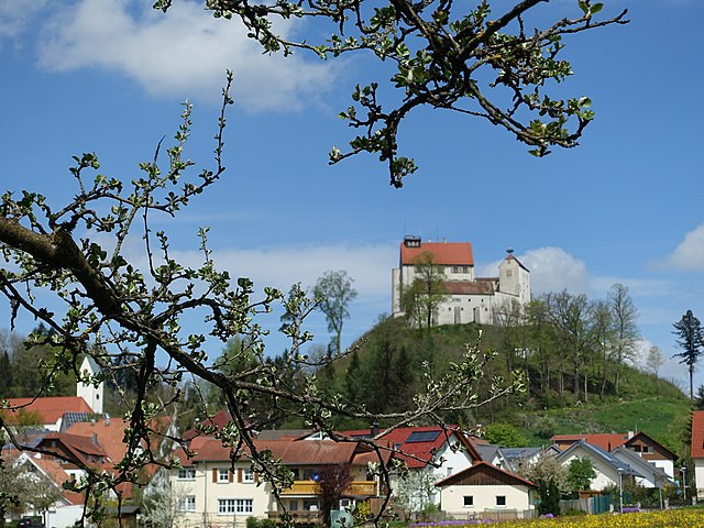

Waldburg
- municipality in the Ravensburg district of Baden-Württemberg, Germany
Waldburg is a picturesque region in Germany known for its beautiful landscapes, historical sites, and outdoor activities, including hiking. While Waldburg itself might not be as well-known as some larger hiking destinations, it can offer a serene environment and various trails for outdoor enthusiasts....
- Country:

- Postal Code: 88289
- Local Dialing Code: 07529
- Licence Plate Code: RV
- Coordinates: 47° 45' 25" N, 9° 42' 46" E


- GPS tracks (wikiloc): [Link]
- AboveSeaLevel: 723 м m
- Area: 22.7 sq km
- Population: 3149
- Web site: [Link]
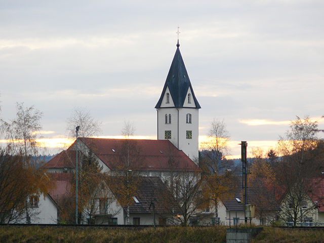

Aichstetten
- municipality in Germany
Aichstetten is a picturesque village located in the Allgäu region of Bavaria, Germany, known for its beautiful landscapes and outdoor activities, including hiking. The area around Aichstetten offers a variety of hiking trails that cater to different skill levels, making it a great destination for both beginners and experienced hikers....
- Country:

- Postal Code: 88317
- Local Dialing Code: 07565
- Coordinates: 47° 53' 35" N, 10° 4' 42" E


- GPS tracks (wikiloc): [Link]
- AboveSeaLevel: 616 м m
- Area: 33.75 sq km
- Population: 2819
- Web site: [Link]


Aitrach
- municipality in Germany
Aitrach, a picturesque region in Germany, offers a variety of hiking opportunities thanks to its beautiful landscapes, quaint villages, and well-marked trails suitable for all levels of hikers. Here are some key highlights for those looking to explore this area:...
- Country:

- Postal Code: 88319
- Local Dialing Code: 07565
- Coordinates: 47° 56' 24" N, 10° 5' 24" E


- GPS tracks (wikiloc): [Link]
- AboveSeaLevel: 596 м m
- Area: 30.2 sq km
- Population: 2526
- Web site: [Link]
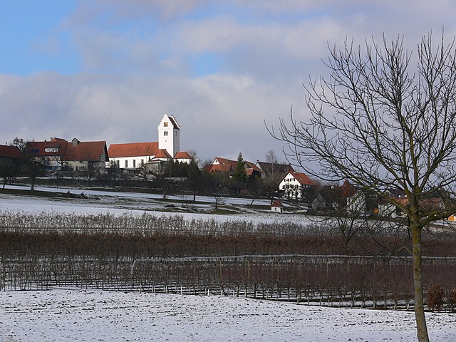

Wolpertswende
- municipality in Germany
Wolpertswende is a charming village located in the Baden-Württemberg region of Germany. It offers a variety of hiking opportunities in a picturesque landscape characterized by rolling hills, forests, and picturesque countryside. Here are some highlights if you’re considering a hike in this area:...
- Country:

- Postal Code: 88284
- Local Dialing Code: 07502
- Licence Plate Code: RV
- Coordinates: 47° 54' 0" N, 9° 37' 0" E


- GPS tracks (wikiloc): [Link]
- AboveSeaLevel: 569 м m
- Area: 26.35 sq km
- Population: 4027
- Web site: [Link]


Amtzell
- municipality in Germany
Amtzell is a charming village located in Baden-Württemberg, Germany. Nestled near the scenic landscape of the Allgäu region, it offers a variety of hiking opportunities that showcase the stunning natural beauty of the area....
- Country:

- Postal Code: 88279
- Local Dialing Code: 07520
- Licence Plate Code: RV
- Coordinates: 47° 42' 46" N, 9° 45' 44" E


- GPS tracks (wikiloc): [Link]
- AboveSeaLevel: 601 м m
- Area: 30.57 sq km
- Population: 4133
- Web site: [Link]


Aulendorf
- municipality in Germany
Aulendorf is a charming town located in the Baden-Württemberg region of Germany, surrounded by beautiful landscapes that make it a great destination for hiking enthusiasts. Here are some key aspects of hiking in and around Aulendorf:...
- Country:

- Postal Code: 88326
- Local Dialing Code: 07525
- Licence Plate Code: RV
- Coordinates: 47° 57' 15" N, 9° 38' 20" E


- GPS tracks (wikiloc): [Link]
- AboveSeaLevel: 576 м m
- Area: 52.34 sq km
- Population: 9988
- Web site: [Link]


Bad Wurzach
- municipality in Germany
Bad Wurzach, located in Bavaria, Germany, offers a variety of hiking opportunities, set against the backdrop of its picturesque landscapes and rich natural beauty. The region is known for its extensive woodlands, wetlands, and rolling hills, making it a great destination for both novice and experienced hikers....
- Country:

- Postal Code: 88410
- Local Dialing Code: 07564
- Licence Plate Code: RV
- Coordinates: 47° 54' 30" N, 9° 53' 40" E


- GPS tracks (wikiloc): [Link]
- AboveSeaLevel: 651 м m
- Area: 182.26 sq km
- Population: 14662
- Web site: [Link]


Isny im Allgäu
- municipality in Germany
Isny im Allgäu, located in the Allgäu region of Bavaria, Germany, is a charming town surrounded by picturesque landscapes, making it a fantastic destination for hiking enthusiasts. The area is characterized by rolling hills, dense forests, and stunning views of the Alps, offering a variety of trails suitable for different skill levels....
- Country:

- Postal Code: 88316
- Local Dialing Code: 07562
- Licence Plate Code: RV
- Coordinates: 47° 41' 31" N, 10° 2' 22" E


- GPS tracks (wikiloc): [Link]
- AboveSeaLevel: 704 м m
- Area: 85.37 sq km
- Population: 13847
- Web site: [Link]


Bad Waldsee
- town in Upper Swabia in Baden-Württemberg, Germany
Bad Waldsee, located in the scenic region of Baden-Württemberg, Germany, is a charming town known for its beautiful landscapes and outdoor activities, including hiking. Here are some highlights and tips for hiking in and around Bad Waldsee:...
- Country:

- Postal Code: 88339
- Local Dialing Code: 07524
- Licence Plate Code: RV
- Coordinates: 47° 55' 16" N, 9° 45' 7" E


- GPS tracks (wikiloc): [Link]
- AboveSeaLevel: 588 м m
- Area: 108.54 sq km
- Population: 20011
- Web site: [Link]


Baindt
- municipality in Germany
Baindt, a small town in the Baden-Württemberg region of Germany, is surrounded by beautiful scenery and offers various hiking opportunities. Here are some highlights you can expect when hiking in and around Baindt:...
- Country:

- Postal Code: 88255
- Local Dialing Code: 07502
- Licence Plate Code: RV
- Coordinates: 47° 50' 29" N, 9° 39' 43" E


- GPS tracks (wikiloc): [Link]
- AboveSeaLevel: 483 м m
- Area: 23.07 sq km
- Population: 5209
- Web site: [Link]


Bodnegg
- municipality in Germany
Bodnegg is a charming village located in the Baden-Württemberg region of Germany, near Lake Constance. It offers some beautiful hiking opportunities amid picturesque landscapes, rolling hills, and tranquil countryside. Here are some highlights for hiking in and around Bodnegg:...
- Country:

- Postal Code: 88285
- Local Dialing Code: 07520
- Licence Plate Code: RV
- Coordinates: 47° 43' 0" N, 9° 41' 0" E


- GPS tracks (wikiloc): [Link]
- AboveSeaLevel: 597 м m
- Area: 24.57 sq km
- Population: 3208
- Web site: [Link]


Wolfegg
- municipality in Germany
Wolfegg, a picturesque town in Bavaria, Germany, is a charming destination for hiking enthusiasts. Located in the Allgäu region, it offers a variety of scenic trails that cater to different skill levels....
- Country:

- Postal Code: 88364
- Local Dialing Code: 07527
- Licence Plate Code: RV
- Coordinates: 47° 49' 10" N, 9° 47' 38" E


- GPS tracks (wikiloc): [Link]
- AboveSeaLevel: 678 м m
- Area: 39.5 sq km
- Population: 3678
- Web site: [Link]


Fleischwangen
- municipality in Germany
Fleischwangen is a small municipality located in the state of Baden-Württemberg, Germany. It's an area known for its picturesque landscapes, serene forests, and charming rural setting, making it a lovely destination for hiking enthusiasts....
- Country:

- Postal Code: 88373
- Local Dialing Code: 07505
- Licence Plate Code: RV
- Coordinates: 47° 53' 0" N, 9° 29' 0" E


- GPS tracks (wikiloc): [Link]
- AboveSeaLevel: 634 м m
- Area: 5.80 sq km
- Population: 684
- Web site: [Link]


Bergatreute
- municipality in Germany
Bergatreute is a small village located in Baden-Württemberg, Germany, and while it may not be as well-known as some larger hiking destinations, it offers a peaceful setting with access to beautiful landscapes and rural trails. The region is characterized by its rolling hills, lush forests, and scenic vistas, making it a great spot for hikers looking for a quieter experience....
- Country:

- Postal Code: 88368
- Local Dialing Code: 07527
- Licence Plate Code: RV
- Coordinates: 47° 51' 2" N, 9° 44' 52" E


- GPS tracks (wikiloc): [Link]
- AboveSeaLevel: 606 м m
- Area: 23.16 sq km
- Population: 3123
- Web site: [Link]
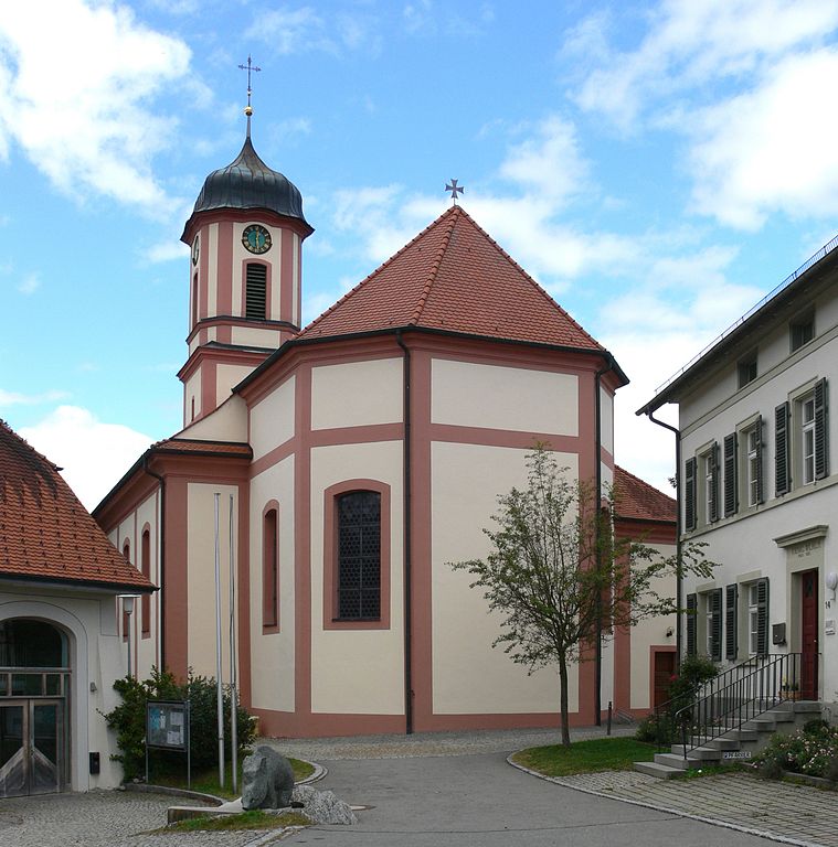

Ebersbach-Musbach
- municipality in the district of Ravensburg, Baden-Württemberg, Germany
Ebersbach-Musbach is a scenic area located in the state of Baden-Württemberg, Germany. Known for its picturesque landscapes, it offers various hiking opportunities that cater to different skill levels. Here are some highlights of hiking in this region:...
- Country:

- Postal Code: 88371
- Local Dialing Code: 07584
- Licence Plate Code: RV
- Coordinates: 47° 58' 0" N, 9° 35' 0" E


- GPS tracks (wikiloc): [Link]
- AboveSeaLevel: 599 м m
- Area: 26.86 sq km
- Population: 1695
- Web site: [Link]


Fronreute
- municipality in Baden-Württemberg, Germany
Fronreute, located in the state of Baden-Württemberg in Germany, is a charming area with access to beautiful landscapes and outdoor activities, including hiking. Here are some key points about hiking in Fronreute:...
- Country:

- Postal Code: 88273
- Local Dialing Code: 07505; 07502
- Licence Plate Code: RV
- Coordinates: 47° 51' 32" N, 9° 31' 13" E


- GPS tracks (wikiloc): [Link]
- AboveSeaLevel: 594 м m
- Area: 48.08 sq km
- Population: 4710
- Web site: [Link]
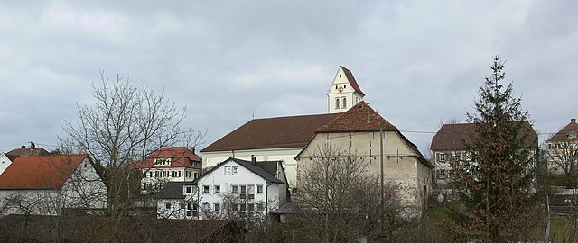

Ebenweiler
- municipality in Germany
Ebenweiler, a picturesque village located in the southern part of Germany, is surrounded by beautiful landscapes that offer great opportunities for hiking. Here are some key points to consider if you’re planning a hiking trip in and around Ebenweiler:...
- Country:

- Postal Code: 88370
- Local Dialing Code: 07584
- Licence Plate Code: RV
- Coordinates: 47° 54' 0" N, 9° 31' 0" E


- GPS tracks (wikiloc): [Link]
- AboveSeaLevel: 595 м m
- Area: 10.13 sq km
- Population: 1213
- Web site: [Link]


Grünkraut
- municipality in Germany
Grünkraut, located in the Baden-Württemberg region of Germany, is an excellent destination for hiking enthusiasts. Nestled amidst the beautiful landscapes of the Swabian Jura and surrounded by lush forests, hills, and panoramic views, it offers various trails suitable for different skill levels....
- Country:

- Postal Code: 88287
- Local Dialing Code: 0751
- Licence Plate Code: RV
- Coordinates: 47° 45' 0" N, 9° 39' 0" E


- GPS tracks (wikiloc): [Link]
- AboveSeaLevel: 601 м m
- Area: 17.16 sq km
- Population: 3014
- Web site: [Link]


Unterwaldhausen
- municipality in Germany
Unterwaldhausen is a picturesque area that can offer a variety of hiking experiences surrounded by natural beauty. While specific trails might vary, here are some general tips and insights about hiking in areas like Unterwaldhausen:...
- Country:

- Postal Code: 88379
- Local Dialing Code: 07587
- Licence Plate Code: RV
- Coordinates: 47° 54' 7" N, 9° 28' 14" E


- GPS tracks (wikiloc): [Link]
- AboveSeaLevel: 636 м m
- Area: 4.11 sq km
- Population: 281
- Web site: [Link]

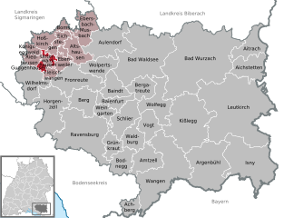
Guggenhausen
- municipality in Germany
Guggenhausen is a lesser-known but beautiful hiking destination that offers a variety of trails suitable for different skill levels. Here are some details about hiking in the area:...
- Country:

- Postal Code: 88379
- Local Dialing Code: 07503
- Licence Plate Code: RV
- Coordinates: 47° 54' 0" N, 9° 27' 0" E


- GPS tracks (wikiloc): [Link]
- AboveSeaLevel: 622 м m
- Area: 8.25 sq km
- Population: 181
- Web site: [Link]


Horgenzell
- municipality in Germany
Horgenzell, a small municipality in Germany’s Baden-Württemberg region, offers a charming environment for hiking enthusiasts. Nestled within picturesque landscapes, it features various trails that appeal to different skill levels. Here’s an overview of what to expect when hiking in Horgenzell:...
- Country:

- Postal Code: 88263
- Local Dialing Code: 07504
- Licence Plate Code: RV
- Coordinates: 47° 48' 0" N, 9° 30' 0" E


- GPS tracks (wikiloc): [Link]
- AboveSeaLevel: 605 м m
- Area: 56.16 sq km
- Population: 5140
- Web site: [Link]


Argenbühl
- municipality in Germany
Argenbühl is a picturesque municipality located in the Allgäu region of Bavaria, Germany. Known for its stunning landscapes, rich nature, and charming villages, it offers various hiking opportunities for outdoor enthusiasts of all levels....
- Country:

- Postal Code: 88260
- Local Dialing Code: 07566
- Licence Plate Code: RV
- Coordinates: 47° 41' 17" N, 9° 57' 33" E


- GPS tracks (wikiloc): [Link]
- AboveSeaLevel: 685 м m
- Area: 76.37 sq km
- Population: 6171
- Web site: [Link]


Leutkirch im Allgäu
- municipality in Germany
Leutkirch im Allgäu is a charming town located in the Allgäu region of Bavaria, Germany, and it offers a wonderful array of hiking opportunities. Here are some highlights and tips for hiking in this picturesque area:...
- Country:

- Postal Code: 88299
- Local Dialing Code: 07561
- Licence Plate Code: RV
- Coordinates: 47° 49' 32" N, 10° 1' 20" E


- GPS tracks (wikiloc): [Link]
- AboveSeaLevel: 654 м m
- Area: 174.96 sq km
- Population: 22406
- Web site: [Link]
Hoßkirch
- municipality in Germany
Hoßkirch is a small municipality located in Baden-Württemberg, Germany, nestled near the picturesque landscapes of the Swabian Alps and surrounded by beautiful countryside. While it may not be a widely recognized hiking destination, it offers several opportunities for outdoor enthusiasts to explore the natural beauty of the region....
- Country:

- Postal Code: 88374
- Local Dialing Code: 07587
- Licence Plate Code: RV
- Coordinates: 47° 57' 0" N, 9° 27' 0" E


- GPS tracks (wikiloc): [Link]
- AboveSeaLevel: 635 м m
- Area: 15.81 sq km
- Population: 753
- Web site: [Link]


Berg
- municipality in Germany
Berg, a district in the state of Baden-Württemberg, offers a variety of scenic hiking opportunities suitable for different skill levels. Here are some key points to consider when planning a hiking trip in this region:...
- Country:

- Postal Code: 88276
- Local Dialing Code: 0751
- Licence Plate Code: RV
- Coordinates: 47° 48' 43" N, 9° 36' 1" E


- GPS tracks (wikiloc): [Link]
- AboveSeaLevel: 456 м m
- Area: 28.41 sq km
- Population: 4096
- Web site: [Link]


Königseggwald
- municipality in Germany
Königseggwald is a picturesque area located in the Baden-Württemberg region of Germany, known for its lush forests and beautiful landscapes, making it a fantastic destination for hiking enthusiasts. Here’s a guide to hiking in Königseggwald:...
- Country:

- Postal Code: 88376
- Local Dialing Code: 07587
- Licence Plate Code: RV
- Coordinates: 47° 55' 45" N, 9° 25' 16" E


- GPS tracks (wikiloc): [Link]
- AboveSeaLevel: 638 м m
- Area: 6.85 sq km
- Population: 666
- Web site: [Link]
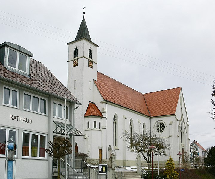
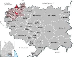
Boms
- municipality in Germany
Boms, which is likely referring to a specific region or area (potentially in South Korea), offers unique hiking experiences that showcase beautiful landscapes, diverse flora, and panoramic views. While I may not have specific details about Boms, I can provide guidance on general considerations for hiking in mountainous or hilly areas, as well as tips for enjoying your hike....
- Country:

- Postal Code: 88361
- Local Dialing Code: 07581
- Licence Plate Code: RV
- Coordinates: 47° 58' 35" N, 9° 30' 59" E


- GPS tracks (wikiloc): [Link]
- AboveSeaLevel: 615 м m
- Area: 9.56 sq km
- Population: 636
- Web site: [Link]


Riedhausen
- municipality in Germany
Riedhausen, located in Germany, offers some scenic hiking opportunities, particularly for those looking to explore the natural beauty of the region. While it may not be as widely known as some other German hiking destinations, it is surrounded by lush landscapes and charming countryside....
- Country:

- Postal Code: 88377
- Local Dialing Code: 07587
- Licence Plate Code: RV
- Coordinates: 47° 54' 36" N, 9° 25' 46" E


- GPS tracks (wikiloc): [Link]
- AboveSeaLevel: 631 м m
- Area: 8.41 sq km
- Population: 630
- Web site: [Link]


Wilhelmsdorf
- municipality in Baden-Württemberg, Germany
Wilhelmsdorf is a charming village located in Baden-Württemberg, Germany, surrounded by picturesque nature that makes it a great destination for hiking enthusiasts. Here are some highlights and tips for hiking in and around Wilhelmsdorf:...
- Country:

- Postal Code: 88271
- Local Dialing Code: 07503
- Licence Plate Code: RV
- Coordinates: 47° 51' 54" N, 9° 25' 39" E


- GPS tracks (wikiloc): [Link]
- AboveSeaLevel: 616 м m
- Area: 38.1 sq km
- Population: 4868
- Web site: [Link]


Weingarten
- town in the valley of the Schussen River, in the district of Ravensburg, Baden-Württemberg, Germany
Weingarten, located in the state of Baden-Württemberg, Germany, offers a pleasant hiking experience in a region known for its natural beauty and rich cultural history. While Weingarten itself is a small town, it is situated near the picturesque landscapes of the Swabian Alps and the extensive forests that characterize much of southwestern Germany....
- Country:

- Postal Code: 88250
- Local Dialing Code: 0751
- Licence Plate Code: RV
- Coordinates: 47° 48' 28" N, 9° 38' 30" E


- GPS tracks (wikiloc): [Link]
- AboveSeaLevel: 485 м m
- Area: 12.17 sq km
- Population: 23881
- Web site: [Link]


Baienfurt
- municipality in Germany
Baienfurt is a small town located in the state of Baden-Württemberg, Germany, near the city of Ravensburg. While it may not be as widely known as major hiking destinations, the surrounding region offers several opportunities for outdoor enthusiasts to explore....
- Country:

- Postal Code: 88255
- Local Dialing Code: 0751
- Licence Plate Code: RV
- Coordinates: 47° 49' 37" N, 9° 39' 6" E


- GPS tracks (wikiloc): [Link]
- AboveSeaLevel: 459 м m
- Area: 16.01 sq km
- Population: 7052
- Web site: [Link]


Schlier
- municipality in Germany
Schlier, located in the beautiful landscape of Bavaria, Germany, offers a variety of hiking trails suitable for different skill levels. Nestled near the picturesque Schliersee lake and surrounded by the scenic mountains of the Alps, it provides a captivating environment for outdoor enthusiasts....
- Country:

- Postal Code: 88281
- Local Dialing Code: 07529
- Licence Plate Code: RV
- Coordinates: 47° 46' 11" N, 9° 40' 27" E


- GPS tracks (wikiloc): [Link]
- AboveSeaLevel: 596 м m
- Area: 32.6 sq km
- Population: 3817
- Web site: [Link]


Ravensburg
- town in Upper Swabia, Germany
Ravensburg, a charming town in southern Germany, is surrounded by beautiful landscapes that offer a variety of hiking opportunities. Nestled in the foothills of the Swabian Jura and near the shores of Lake Constance, the region boasts diverse trails suitable for hikers of all levels. Here are some highlights and tips for hiking in and around Ravensburg:...
- Country:

- Postal Code: 88212–88214
- Local Dialing Code: 0751
- Licence Plate Code: RV
- Coordinates: 47° 46' 59" N, 9° 36' 41" E


- GPS tracks (wikiloc): [Link]
- AboveSeaLevel: 450 м m
- Area: 92.05 sq km
- Population: 49830
- Web site: [Link]


Kißlegg
- municipality in Germany
Kißlegg, located in the Allgäu region of Germany, offers a variety of hiking opportunities in a picturesque setting known for its lush landscapes, rolling hills, and charming villages. Here are some key points to consider if you're planning to hike in Kißlegg:...
- Country:

- Postal Code: 88353
- Local Dialing Code: 07563
- Licence Plate Code: RV
- Coordinates: 47° 47' 20" N, 9° 53' 2" E


- GPS tracks (wikiloc): [Link]
- AboveSeaLevel: 661 м m
- Area: 92.40 sq km
- Population: 8914
- Web site: [Link]


Vogt
- municipality in the district of Ravensburg, Baden-Württemberg, Germany
Vogt, located in the Baden-Württemberg region of Germany, offers a picturesque setting for hiking enthusiasts with its beautiful landscapes and scenic trails. Nestled in the rolling hills of the Swabian Jura, Vogt is surrounded by lush forests, meadows, and charming villages, providing ample opportunities for outdoor adventures....
- Country:

- Postal Code: 88267
- Local Dialing Code: 07529
- Licence Plate Code: RV
- Coordinates: 47° 46' 33" N, 9° 46' 1" E


- GPS tracks (wikiloc): [Link]
- AboveSeaLevel: 681 м m
- Area: 22.31 sq km
- Population: 4578
- Web site: [Link]
Shares border with regions:
Lindau
- rural district in Bavaria, Germany
Lindau, located in southern Germany on the shores of Lake Constance (Bodensee), offers a beautiful setting for hiking enthusiasts. The district encompasses a variety of natural landscapes, including picturesque lake views, rolling hills, lush forests, and charming villages. Here are some highlights for hiking in Lindau:...
- Country:

- Capital: Lindau
- Licence Plate Code: LI
- Coordinates: 47° 36' 0" N, 9° 51' 36" E


- GPS tracks (wikiloc): [Link]
- AboveSeaLevel: 496 м m
- Area: 323.00 sq km
- Population: 69522
- Web site: [Link]
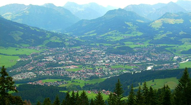

Oberallgäu
- district in Bavaria, Germany
Oberallgäu, located in Bavaria, Germany, is a stunning region known for its breathtaking landscapes, rolling hills, and majestic Alps. It offers a wide range of hiking opportunities suitable for all levels of experience, from leisurely walks to challenging mountain ascents. Here are some highlights and tips for hiking in Oberallgäu:...
- Country:

- Capital: Sonthofen
- Licence Plate Code: OA
- Coordinates: 47° 34' 48" N, 10° 15' 0" E


- GPS tracks (wikiloc): [Link]
- AboveSeaLevel: 711 м m
- Area: 1528.00 sq km
- Population: 128665
- Web site: [Link]


Unterallgäu
- district in Bavaria, Germany
Unterallgäu is a beautiful region in Bavaria, Germany, known for its picturesque landscapes, charming villages, and extensive hiking trails. Located in the Allgäu, it's characterized by rolling hills, lush meadows, and stunning views of the Alpine foothills. Here are some highlights if you're considering hiking in Unterallgäu:...
- Country:

- Capital: Mindelheim
- Licence Plate Code: MN
- Coordinates: 48° 0' 0" N, 10° 30' 0" E


- GPS tracks (wikiloc): [Link]
- Area: 1230.24 sq km
- Population: 115770
- Web site: [Link]


Memmingen
- town in Bavaria, Germany
Memmingen, located in Bavaria, Germany, is surrounded by picturesque landscapes and offers various hiking opportunities. Here’s an overview of what you can expect when hiking in and around Memmingen:...
- Country:

- Postal Code: 87700
- Local Dialing Code: 08331
- Licence Plate Code: MM
- Coordinates: 47° 59' 16" N, 10° 10' 52" E


- GPS tracks (wikiloc): [Link]
- AboveSeaLevel: 601 м m
- Area: 70 sq km
- Population: 42841
- Web site: [Link]


Biberach district
- district in Baden-Württemberg, Germany
Biberach district, located in Baden-Württemberg, Germany, is an excellent destination for hikers, offering a blend of picturesque landscapes, cultural heritage, and diverse trails suitable for all skill levels....
- Country:

- Capital: Biberach an der Riss
- Licence Plate Code: BC
- Coordinates: 48° 4' 48" N, 9° 49' 48" E


- GPS tracks (wikiloc): [Link]
- AboveSeaLevel: 581 м m
- Area: 1409.82 sq km
- Population: 194019
- Web site: [Link]


Bodenseekreis
- district of Baden-Württemberg, Germany
Bodenseekreis, located in the Baden-Württemberg region of Germany, is known for its stunning landscapes, charming towns, and proximity to Lake Constance (Bodensee). Hiking in this area can be a delightful experience due to its varied terrain, beautiful views, and a range of trails suitable for different skill levels. Here are some highlights and tips for hiking in Bodenseekreis:...
- Country:

- Capital: Friedrichshafen
- Licence Plate Code: FN
- Coordinates: 47° 44' 0" N, 9° 23' 0" E


- GPS tracks (wikiloc): [Link]
- AboveSeaLevel: 490 м m
- Area: 664.64 sq km
- Population: 205843
- Web site: [Link]
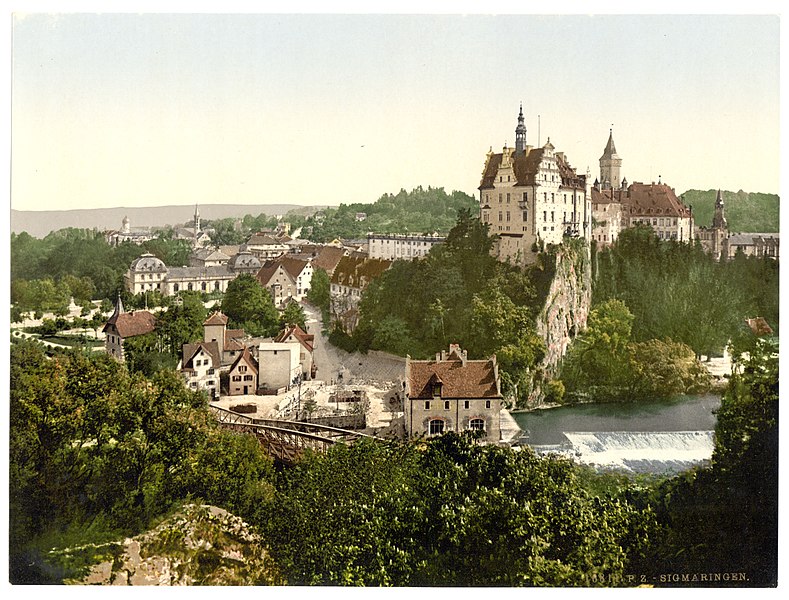

Landkreis Sigmaringen
- district of Baden-Württemberg, Germany
 Hiking in Landkreis Sigmaringen
Sigmaringen, located in the southwestern part of Germany in the state of Baden-Württemberg, offers a beautiful and diverse landscape for hiking enthusiasts. The region is characterized by its stunning natural scenery, which includes rolling hills, dense forests, and picturesque valleys along the Danube River. Here are some highlights for hiking in the Sigmaringen district:...
- Country:

- Capital: Sigmaringen
- Licence Plate Code: SIG
- Coordinates: 48° 4' 48" N, 9° 10' 12" E


- GPS tracks (wikiloc): [Link]
- AboveSeaLevel: 626 м m
- Area: 1204.36 sq km
- Population: 127272
- Web site: [Link]
