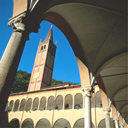
Albignasego (Albignasego)
.svg)
- Italian comune
 Hiking in Albignasego
Albignasego is a municipality in the province of Padua, Italy, located in the Veneto region. While it may not be as widely recognized for hiking as some other areas in the Italian Alps or Apennines, there are still opportunities for outdoor activities and enjoying nature in the surrounding landscapes.
Hiking Opportunities Near Albignasego:
-
Local Trails: Albignasego and its surroundings feature various walking and biking paths. These routes often meander through picturesque countryside, vineyards, and even historical sites, providing a peaceful setting for nature lovers.
-
Colli Euganei Regional Park: Just a short drive from Albignasego, you'll find the Colli Euganei Regional Park. This park offers more established hiking trails that wind through rolling hills, woodlands, and scenic viewpoints. You can explore trails like the loop around Mount Venda or visit the charming towns situated within the park.
-
Historical Routes: In the area, you can explore paths that connect to historical landmarks and local vineyards. These routes often provide a combination of cultural and natural experiences, allowing you to take in the local heritage while enjoying the outdoors.
-
Nearby Hill Stations: If you're willing to travel a bit further, the nearby regions such as the Venetian Prealps and the Dolomites offer breathtaking alpine hiking trails, characterized by stunning views, challenging terrain, and varied difficulty levels.
Tips for Hiking in the Region:
-
Maps and Guides: Consider obtaining local hiking maps or guides that can provide information on trail difficulty, length, and points of interest.
-
Weather Considerations: The weather can change quickly, so it's essential to check forecasts and be prepared for changes in conditions.
-
Appropriate Gear: Wear comfortable clothing and sturdy footwear suitable for hiking. Bring enough water, snacks, and a small first aid kit.
-
Wildlife Awareness: While exploring nature, be mindful of the local wildlife and plants. Avoid disturbing natural habitats.
-
Leave No Trace: Respect the environment by following Leave No Trace principles, keeping the trails clean, and respecting the natural surroundings.
Conclusion:
While Albignasego may not be a primary hiking destination, its proximity to beautiful natural areas and parks makes it a great starting point for outdoor enthusiasts seeking to explore the scenic landscapes of the Veneto region. Whether it’s a short stroll through the countryside or a more extensive hike in the Colli Euganei, you can enjoy the tranquility and beauty that this lovely area has to offer.
- Country:

- Postal Code: 35020
- Local Dialing Code: 049
- Licence Plate Code: PD
- Coordinates: 45° 21' 0" N, 11° 52' 0" E


- GPS tracks (wikiloc): [Link]
- AboveSeaLevel: 11 м m
- Area: 21.16 sq km
- Population: 26071
- Web site: http://www.comune.albignasego.pd.it/
- Wikipedia en: wiki(en)
- Wikipedia: wiki(it)
- Wikidata storage: Wikidata: Q34596
- Wikipedia Commons Category: [Link]
- Freebase ID: [/m/0gk3sz]
- GeoNames ID: Alt: [6538325]
- VIAF ID: Alt: [157069363]
- OSM relation ID: [44744]
- UN/LOCODE: [ITABG]
- ISTAT ID: 028003
- Italian cadastre code: A161
Shares border with regions:
Casalserugo
- Italian comune
Hiking in Casalserugo
Casalserugo is a small town in the Veneto region of Italy, located near the city of Padua. While it may not be a well-known hiking destination, the surrounding areas offer various opportunities for outdoor activities, including hiking....
- Country:
- Postal Code: 35020
- Local Dialing Code: 049
- Licence Plate Code: PD
- Coordinates: 45° 19' 0" N, 11° 55' 0" E
- GPS tracks (wikiloc): [Link]
- AboveSeaLevel: 8 м m
- Area: 15.5 sq km
- Population: 5360
- Web site: [Link]
Maserà di Padova
- Italian comune
Hiking in Maserà di Padova
Maserà di Padova, a small town located in the province of Padua in northern Italy, offers a variety of outdoor activities, including hiking. The area boasts a mix of natural beauty and cultural heritage, making it an appealing destination for hikers....
- Country:
- Postal Code: 35020
- Local Dialing Code: 049
- Licence Plate Code: PD
- Coordinates: 45° 19' 0" N, 11° 52' 0" E
- GPS tracks (wikiloc): [Link]
- AboveSeaLevel: 9 м m
- Area: 17.58 sq km
- Population: 9127
- Web site: [Link]

Ponte San Nicolò
- Italian comune
Hiking in Ponte San Nicolò
Ponte San Nicolò, located in the Veneto region of Italy, is a charming town that serves as a gateway to various natural attractions and hiking opportunities. While the town itself is relatively small, it offers easy access to the surrounding landscapes, including the beautiful Euganean Hills (Colli Euganei) and the River Bacchiglione....
- Country:
- Postal Code: 35020
- Local Dialing Code: 049
- Licence Plate Code: PD
- Coordinates: 45° 22' 0" N, 11° 56' 0" E
- GPS tracks (wikiloc): [Link]
- AboveSeaLevel: 12 м m
- Area: 13.52 sq km
- Population: 13508
- Web site: [Link]
Abano Terme
- Italian municipality
Hiking in Abano Terme
Abano Terme, located in the Euganean Hills of northern Italy, is known for its thermal baths and beautiful natural surroundings. While it might not be as renowned for hiking as some other areas in Italy, it does offer several opportunities for walking and exploring the lush landscapes of the Euganean Hills Regional Park. Here are some highlights for hiking in and around Abano Terme:...
- Country:
- Postal Code: 35031
- Local Dialing Code: 049
- Licence Plate Code: PD
- Coordinates: 45° 21' 43" N, 11° 47' 33" E
- GPS tracks (wikiloc): [Link]
- AboveSeaLevel: 14 м m
- Area: 21.41 sq km
- Population: 9950
- Web site: [Link]

Padua
- capital of the province Padua, Veneto, Italy
Hiking in Padua
Padua, located in the Veneto region of Italy, is not typically known as a primary hiking destination, but it does offer several opportunities for outdoor enthusiasts to explore the surrounding natural beauty. Here are some popular hiking options and tips for hiking around Padua:...
- Country:
- Postal Code: 35121–35143
- Local Dialing Code: 049
- Licence Plate Code: PD
- Coordinates: 45° 24' 23" N, 11° 52' 40" E
- GPS tracks (wikiloc): [Link]
- AboveSeaLevel: 27 м m
- Area: 93.03 sq km
- Population: 211560
- Web site: [Link]