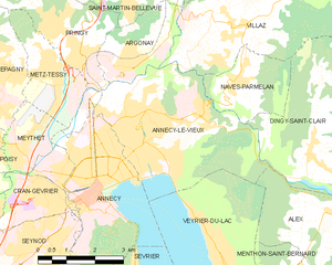
Alex (Alex)

- commune in Haute-Savoie, France
 Hiking in Alex
Alex is a charming village located in the Haute-Savoie region of the Auvergne-Rhône-Alpes in southeastern France. Nestled in the beautiful French Alps, it serves as a great starting point for various hiking adventures, offering stunning views and diverse landscapes. Here are some highlights about hiking in and around Alex:
1.
- The area around Alex features breathtaking panoramas of the surrounding mountains and valleys. From higher trails, you can enjoy views of the Mont-Blanc range and Lake Annecy.
2.
- There are several hiking trails available in the vicinity, catering to various skill levels. Some popular routes include:
- Circuit du Mont Veyrier: A moderately challenging hike offering fantastic views of Lake Annecy.
- Col de la Forclaz: An excellent trail for those seeking both adventure and spectacular scenery.
- Les Sentiers du Lac d’Annecy: These are easier paths suitable for families, allowing you to walk along the lake and enjoy the beautiful beaches.
3.
- The region is rich in biodiversity. As you hike, keep an eye out for local wildlife like chamois and numerous bird species, as well as an array of wildflowers during spring and summer.
4.
- Summer: Ideal for hiking due to mild weather and lush landscapes.
- Autumn: Offers stunning foliage and a cooler climate perfect for hiking without the summer crowds.
- Winter: While the snowy conditions may limit hiking in some areas, there are opportunities for snowshoeing and winter trekking.
5.
- While hiking in Alex, you can experience the local culture, including traditional Savoyard cuisine. Don't miss the chance to try local specialties such as tartiflette and raclette after a day on the trails.
6.
- Alex is easily accessible by car or public transport from cities like Annecy. The proximity to Lake Annecy adds another dimension to your visit, making it easy to combine hiking with water activities.
7.
- As with any hiking adventure, be sure to prepare adequately. Check trail conditions, weather forecasts, and pack necessary supplies like water, snacks, a first-aid kit, and a map or GPS device.
Whether you are looking for a leisurely stroll or a challenging trek, the hiking options around Alex in Haute-Savoie promise to deliver unforgettable experiences amidst stunning alpine scenery.
- Country:

- Postal Code: 74290
- Coordinates: 45° 53' 20" N, 6° 14' 18" E


- GPS tracks (wikiloc): [Link]
- Area: 17.02 sq km
- Population: 1031
- Wikipedia en: wiki(en)
- Wikipedia: wiki(fr)
- Wikidata storage: Wikidata: Q686737
- Wikipedia Commons Category: [Link]
- Freebase ID: [/m/04m4v4]
- GeoNames ID: Alt: [6452512]
- SIREN number: [217400035]
- BnF ID: [152742632]
- GND ID: Alt: [10189845-9]
- WOEID: [575703]
- INSEE municipality code: 74003
Shares border with regions:


Bluffy
- commune in Haute-Savoie, France
Hiking in Bluffy
Bluffy, located in the Haute-Savoie region of the French Alps, is known for its stunning landscapes and excellent hiking opportunities. The area offers a variety of trails, suitable for different skill levels, from leisurely walks to more challenging treks. Here are some highlights and tips for hiking in Bluffy:...
- Country:
- Postal Code: 74290
- Coordinates: 45° 52' 7" N, 6° 13' 5" E
- GPS tracks (wikiloc): [Link]
- Area: 3.74 sq km
- Population: 395
- Web site: [Link]

Annecy-le-Vieux
- former commune in Haute-Savoie, France
Hiking in Annecy-le-Vieux
Annecy-le-Vieux, located near the picturesque town of Annecy in the French Alps, offers a beautiful setting for hiking enthusiasts. This area is known for its stunning landscapes, crystal-clear Lake Annecy, and the surrounding mountains....
- Country:
- Postal Code: 74940
- Coordinates: 45° 55' 9" N, 6° 8' 31" E
- GPS tracks (wikiloc): [Link]
- Area: 17.01 sq km
- Population: 19990
- Web site: [Link]


Veyrier-du-Lac
- commune in Haute-Savoie, France
Hiking in Veyrier-du-Lac
Veyrier-du-Lac, located in the Haute-Savoie region of France, is a beautiful lakeside village situated along the eastern shore of Lake Annecy. It offers stunning natural landscapes, making it an excellent destination for hiking enthusiasts....
- Country:
- Postal Code: 74290
- Coordinates: 45° 52' 53" N, 6° 10' 38" E
- GPS tracks (wikiloc): [Link]
- Area: 8.21 sq km
- Population: 2308
- Web site: [Link]

Dingy-Saint-Clair
- commune in Haute-Savoie, France
Hiking in Dingy-Saint-Clair
Dingy-Saint-Clair is a charming commune in the Haute-Savoie region of the French Alps, known for its beautiful landscapes and outdoor activities, including hiking. Here are some key points to consider if you're planning to hike in this area:...
- Country:
- Postal Code: 74230
- Coordinates: 45° 54' 42" N, 6° 13' 20" E
- GPS tracks (wikiloc): [Link]
- Area: 34.12 sq km
- Population: 1395


La Balme-de-Thuy
- commune in Haute-Savoie, France
Hiking in La Balme-de-Thuy
La Balme-de-Thuy is a picturesque village located in the Haute-Savoie region of the French Alps, known for its beautiful landscapes and outdoor activities, particularly hiking. Here are some key points about hiking in La Balme-de-Thuy:...
- Country:
- Postal Code: 74230
- Coordinates: 45° 54' 2" N, 6° 16' 34" E
- GPS tracks (wikiloc): [Link]
- Area: 17.79 sq km
- Population: 444


Thônes
- commune in Haute-Savoie, France
Hiking in Thônes
Thônes is a charming town located in the Haute-Savoie region of the French Alps. It's a great base for hiking enthusiasts, offering stunning mountain scenery, diverse trails, and access to both the Aravis mountain range and the surrounding areas. Here are some highlights about hiking in Thônes:...
- Country:
- Postal Code: 74230
- Coordinates: 45° 52' 56" N, 6° 19' 32" E
- GPS tracks (wikiloc): [Link]
- Area: 52.33 sq km
- Population: 6549
- Web site: [Link]


Menthon-Saint-Bernard
- commune in Haute-Savoie, France
Hiking in Menthon-Saint-Bernard
Menthon-Saint-Bernard is a picturesque village located on the shores of Lake Annecy in the French Alps, known for its stunning natural scenery and outdoor activities, particularly hiking. Here are some highlights about hiking in this beautiful region:...
- Country:
- Postal Code: 74290
- Coordinates: 45° 51' 38" N, 6° 11' 41" E
- GPS tracks (wikiloc): [Link]
- Area: 4.51 sq km
- Population: 1898