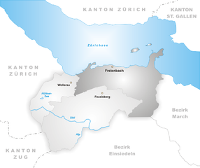
Altendorf (Altendorf SZ)

- municipality in the canton of Schwyz, Switzerland
 Hiking in Altendorf
Altendorf, located in the canton of Schwyz in Switzerland, is a picturesque village that offers a serene hiking experience with stunning views of the surrounding landscapes, including Lake Zurich and the Swiss Alps. Here are some highlights and suggestions for hiking in and around Altendorf:
Hiking Trails
-
Pfaffikersee Trail: This is a gentle, lakeside path that allows for easy walking and is great for families. The area around the lake is beautiful, especially during spring and summer when the flora is in full bloom.
-
Uznach Trail: This trail offers a slightly more challenging hike, providing rewarding views of the region's hills and valleys. You can experience the breathtaking scenery that Schwyz has to offer.
-
Bachtel Mountain: For a more strenuous hike, consider trekking up to Bachtel. The trail offers stunning panoramic views at the summit, and on a clear day, you can see as far as the Eiger, Mönch, and Jungfrau.
-
Trail to the Wildspitz: This hike takes you to the top of Wildspitz, offering beautiful views over Lake Zurich and the surrounding mountains. The ascent can be somewhat steep, but the vistas make it worth the effort.
Preparation and Tips
- Weather: Always check the weather conditions before heading out. The weather can change rapidly in the mountains.
- Footwear: Ensure you wear sturdy hiking boots to provide support and protection on rugged paths.
- Safety: Carry a map or a GPS device, and let someone know your hiking plans, especially if you're venturing into less populated areas.
- Hydration and Snacks: Bring enough water and high-energy snacks to keep your energy levels up during the hike.
Other Activities
If you're interested in more than just hiking, consider exploring the local culture. Altendorf has charming restaurants, and you might also find opportunities for bird watching or visiting nearby historical sites.
Transportation
Getting to Altendorf is relatively easy by public transportation; check local schedules for trains and buses. If you're driving, there are parking facilities available.
Altendorf provides a peaceful escape for hikers of all levels, making it a great destination for nature lovers and outdoor adventurers. Enjoy your hike!
- Country:

- Postal Code: 8852
- Local Dialing Code: 055
- Licence Plate Code: SZ
- Coordinates: 47° 11' 32" N, 8° 49' 48" E


- GPS tracks (wikiloc): [Link]
- AboveSeaLevel: 421 м m
- Area: 20.50 sq km
- Population: 6926
- Web site: http://www.altendorf.ch
- Wikipedia en: wiki(en)
- Wikipedia: wiki(de)
- Wikidata storage: Wikidata: Q69625
- Wikipedia Commons Category: [Link]
- Freebase ID: [/m/0fwh6r]
- GeoNames ID: Alt: [7285058]
- OSM relation ID: [1683056]
- HDS ID: [716]
- Swiss municipality code: [1341]
Shares border with regions:


Galgenen
- municipality in Switzerland
Hiking in Galgenen
Galgenen is a charming municipality located in the Canton of Schwyz, Switzerland, and it offers several beautiful hiking opportunities amidst picturesque landscapes. The region is characterized by its rolling hills, lush forests, and stunning views of the surrounding mountains and lakes, making it an excellent destination for hikers of all levels....
- Country:
- Postal Code: 8854
- Local Dialing Code: 055
- Licence Plate Code: SZ
- Coordinates: 47° 10' 56" N, 8° 52' 30" E
- GPS tracks (wikiloc): [Link]
- AboveSeaLevel: 425 м m
- Area: 13.3 sq km
- Population: 5231
- Web site: [Link]


Vorderthal
- municipality in Switzerland
Hiking in Vorderthal
Vorderthal, located in the heart of the Swiss Alps, is a beautiful destination for hiking enthusiasts. This picturesque village offers access to several trails that showcase the stunning natural beauty of the surrounding landscapes, including lush meadows, dense forests, and impressive mountain views....
- Country:
- Postal Code: 8857
- Local Dialing Code: 055
- Licence Plate Code: SZ
- Coordinates: 47° 7' 35" N, 8° 53' 21" E
- GPS tracks (wikiloc): [Link]
- AboveSeaLevel: 744 м m
- Area: 28.0 sq km
- Population: 1025
- Web site: [Link]


Lachen
- municipality in the canton of Schwyz, Switzerland
Hiking in Lachen
Lachen, Switzerland, is a picturesque town located on the shores of Lake Zurich in the Zurich region. It’s not only known for its charming lakeside views, but also for its access to a range of hiking opportunities in the surrounding areas. Here are some highlights of hiking in and around Lachen:...
- Country:
- Postal Code: 8853
- Local Dialing Code: 055
- Licence Plate Code: SZ
- Coordinates: 47° 11' 28" N, 8° 51' 24" E
- GPS tracks (wikiloc): [Link]
- AboveSeaLevel: 408 м m
- Area: 5.19 sq km
- Population: 8617
- Web site: [Link]


Einsiedeln
- municipality in Switzerland
Hiking in Einsiedeln
Einsiedeln, located in the Canton of Schwyz in Switzerland, is a beautiful destination for hiking enthusiasts. Nestled in the picturesque alpine landscape, it offers a variety of trails suitable for all levels, from leisurely strolls to more challenging hikes....
- Country:
- Postal Code: 8840
- Local Dialing Code: 055
- Licence Plate Code: SZ
- Coordinates: 47° 7' 40" N, 8° 44' 35" E
- GPS tracks (wikiloc): [Link]
- AboveSeaLevel: 882 м m
- Area: 110.40 sq km
- Population: 15550
- Web site: [Link]


Rapperswil-Jona
- municipality in the canton of St. Gallen, Switzerland
Hiking in Rapperswil-Jona
Rapperswil-Jona is a picturesque town located at the northern end of Lake Zurich in Switzerland, known for its charming old town, scenic lakeside promenades, and surrounded by beautiful natural landscapes. The area offers a variety of hiking opportunities, suitable for different skill levels. Here are some highlights:...
- Country:
- Postal Code: 8640, 8645, 8646, 8715
- Local Dialing Code: 055
- Licence Plate Code: SG
- Coordinates: 47° 13' 43" N, 8° 49' 54" E
- GPS tracks (wikiloc): [Link]
- AboveSeaLevel: 409 м m
- Area: 22.17 sq km
- Population: 26989
- Web site: [Link]

Freienbach
- municipality in the canton of Schwyz, Switzerland
Hiking in Freienbach
Freienbach, located in the canton of Schwyz in Switzerland, offers beautiful hiking opportunities with stunning views of Lake Zurich and the surrounding mountains. Here are some highlights and tips for hiking in the area:...
- Country:
- Postal Code: 8807
- Local Dialing Code: 055
- Licence Plate Code: SZ
- Coordinates: 47° 11' 45" N, 8° 46' 16" E
- GPS tracks (wikiloc): [Link]
- AboveSeaLevel: 463 м m
- Area: 20.30 sq km
- Population: 16269
- Web site: [Link]