Schwyz (Kanton Schwyz)


- canton of Switzerland
 Hiking in Schwyz
Hiking in the Canton of Schwyz in Switzerland offers a fantastic blend of stunning landscapes, rich cultural history, and well-maintained trails. The region features a variety of terrains, including mountains, lakes, and picturesque villages, making it a great destination for both novice and experienced hikers.
Popular Hiking Areas:
-
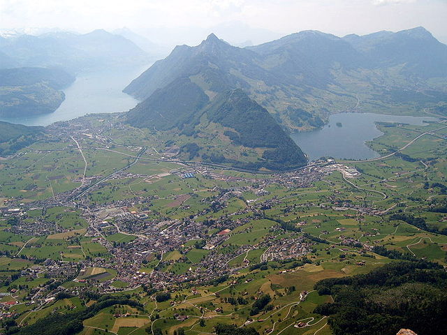
Mythen Region:
- The iconic Mythen mountains are a highlight. The trails here offer panoramic views and varying levels of difficulty. The hike to the summit of Gross Mythen is particularly popular and provides rewarding views of the surrounding landscape.
-
Lake Zurich and Lake Lauerz:
- The paths around these lakes are more leisurely and ideal for families. You can enjoy pleasant lakeside walks with paths suitable for beginners.
-
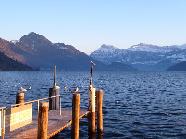
Rigi and Zwiesel:
- Known as the "Queen of the Mountains," Rigi offers numerous hiking trails with breathtaking views over the Swiss Alps and lakes. Trails vary from easy walks to more challenging routes.
-
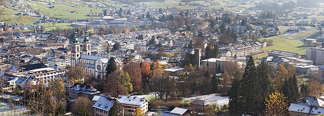
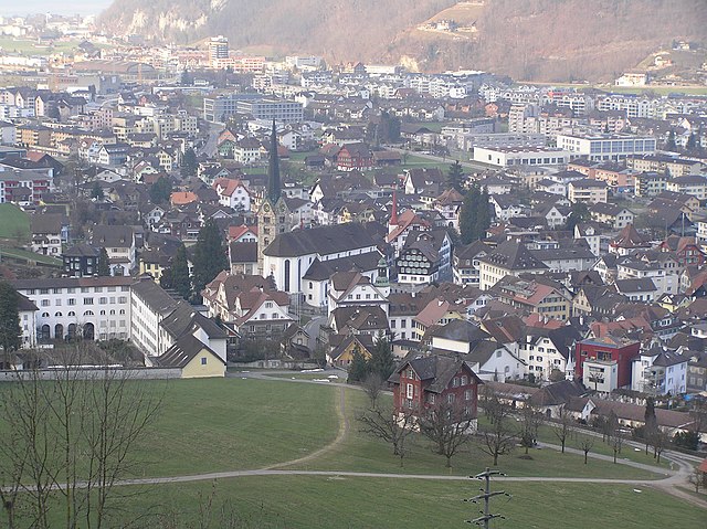
Schwyz Valley:
- The valley offers scenic hikes that often include historical sights, like the birthplace of the Swiss Confederation. Explore trails that meander through lush fields and charming villages.
-
Küsnachter Tobel:
- This gorge features more strenous paths leading to unique rock formations and landscape layouts, perfect for those looking for a more adventurous trek.
Tips for Hiking in Schwyz:
-
Weather Preparedness: The weather can change rapidly in the mountains, so always check forecasts and dress in layers.
-
Trail Markings: The hiking trails are well-marked, following the Swiss hiking trail system (with red and white markers for mountain trails), making navigation straightforward.
-
Equipment: Proper hiking boots are essential, and trekking poles can provide extra support, especially in steep or uneven terrain.
-
Local Guidelines: Respect nature and remain on marked paths. It’s important to understand local rules regarding wildlife and plant life.
-
Hydration and Nourishment: Carry enough water and snacks. There are some mountain huts along popular trails where you can also rest and enjoy local Swiss cuisine.
Best Time to Hike:
The best seasons for hiking in the Canton of Schwyz are typically late spring to early autumn (May to October). Some trails may still be snowy in early spring, while autumn offers a beautiful display of fall colors.
Whether you're looking for challenging ascents, family-friendly strolls, or cultural exploration, the Canton of Schwyz has a lot to offer hikers of all skill levels!
- Country:

- Capital: Schwyz
- Licence Plate Code: SZ
- Coordinates: 47° 4' 0" N, 8° 45' 0" E


- GPS tracks (wikiloc): [Link]
- AboveSeaLevel: 516 м m
- Area: 907.88 sq km
- Population: 155863
- Web site: http://www.sz.ch
- Wikipedia en: wiki(en)
- Wikipedia: wiki(de)
- Wikidata storage: Wikidata: Q12433
- Wikipedia Commons Gallery: [Link]
- Wikipedia Commons Category: [Link]
- Freebase ID: [/m/016tds]
- GeoNames ID: Alt: [2658664]
- BnF ID: [120709591]
- VIAF ID: Alt: [134271490]
- GND ID: Alt: [4054019-4]
- archINFORM location ID: [2914]
- Library of Congress authority ID: Alt: [n80093609]
- MusicBrainz area ID: [796fd82b-30f6-4568-822a-d002e1316354]
- Quora topic ID: [Canton-of-Schwyz]
- Encyclopædia Britannica Online ID: [place/Schwyz-canton-Switzerland]
- HDS ID: [7385]
- ISNI: Alt: [0000 0001 1011 2653]
- NKCR AUT ID: [ge114365]
- NUTS code: [CH063]
- Klexikon article ID: [Schwyz]
- Ringgold ID: [172510]
- STW Thesaurus for Economics ID: [16973-6]
- ISO 3166-2 code: CH-SZ
- FIPS 10-4 (countries and regions): SZ17
Includes regions:


March District
- district in Switzerland
Hiking in March District
Hiking in the March District, like in many regions, can offer a variety of experiences depending on the specific area you're interested in. While the specifics can vary, I can offer some general guidance on what to expect and consider when hiking in that time of year....
- Country:
- Licence Plate Code: SZ
- Coordinates: 47° 11' 0" N, 8° 51' 0" E
- GPS tracks (wikiloc): [Link]
- AboveSeaLevel: 765 м m
- Area: 191.4 sq km
- Web site: [Link]

Schwyz District
- district in Switzerland
Hiking in Schwyz District
Schwyz District, located in central Switzerland, is a fantastic destination for hiking enthusiasts. Known for its stunning landscapes, charming villages, and rich history, this region offers a variety of trails suited for all levels of hikers....
- Country:
- Capital: Schwyz
- Licence Plate Code: SZ
- Coordinates: 47° 1' 0" N, 8° 39' 0" E
- GPS tracks (wikiloc): [Link]
- AboveSeaLevel: 476 м m
- Area: 506.4 sq km
- Web site: [Link]


Höfe District
- district in Switzerland
Hiking in Höfe District
The Höfe District, located in Switzerland, offers a variety of hiking opportunities that showcase the beautiful landscapes of the region. While the specific trails may vary depending on factors like weather conditions and seasonal accessibility, here are a few highlights about hiking in this picturesque area:...
- Country:
- Capital: Wollerau
- Licence Plate Code: SZ
- Coordinates: 47° 11' 0" N, 8° 43' 0" E
- GPS tracks (wikiloc): [Link]
- AboveSeaLevel: 584 м m
- Area: 44.4 sq km
- Web site: [Link]


Gersau District
- district in Switzerland
Hiking in Gersau District
Bezirk Gersau is a charming area in Switzerland, located near Lake Lucerne. It offers a range of stunning hikes that cater to different skill levels, providing breathtaking views of the surrounding mountains and the lake....
- Country:
- Capital: Gersau
- Licence Plate Code: SZ
- Coordinates: 46° 59' 29" N, 8° 31' 29" E
- GPS tracks (wikiloc): [Link]
- AboveSeaLevel: 1112 м m
- Area: 23.7 sq km


Küssnacht District
Hiking in Küssnacht District
Bezirk Küssnacht, located in the central part of Switzerland, offers a variety of stunning hiking trails suitable for all levels of hikers. Nestled by the shores of Lake Zug and surrounded by the majestic Swiss Alps, this region boasts breathtaking views, diverse landscapes, and rich natural beauty....
- Country:
- Capital: Küssnacht
- Licence Plate Code: SZ
- Coordinates: 47° 4' 59" N, 8° 26' 28" E
- GPS tracks (wikiloc): [Link]
- AboveSeaLevel: 447 м m
- Area: 36.2 sq km
- Web site: [Link]


Einsiedeln District
- district in Switzerland
Hiking in Einsiedeln District
Bezirk Einsiedeln, located in the canton of Schwyz in Switzerland, is a fantastic destination for hiking enthusiasts. This region is known for its stunning landscapes, lush forests, rolling hills, and picturesque alpine views. Here’s what you need to know about hiking in Bezirk Einsiedeln:...
- Country:
- Capital: Einsiedeln
- Licence Plate Code: SZ
- Coordinates: 47° 7' 0" N, 8° 44' 0" E
- GPS tracks (wikiloc): [Link]
- AboveSeaLevel: 980 м m
- Area: 110.4 sq km
- Web site: [Link]
Shares border with regions:
Glarus
- canton of Switzerland
Hiking in Glarus
The Canton of Glarus, located in central Switzerland, is a stunning destination for hikers, offering a variety of trails that cater to different skill levels. Nestled between the rugged Alps and picturesque valleys, the region is known for its breathtaking landscapes, diverse flora and fauna, and charming villages....
- Country:
- Capital: Glarus
- Licence Plate Code: GL
- Coordinates: 46° 59' 0" N, 9° 4' 0" E
- GPS tracks (wikiloc): [Link]
- AboveSeaLevel: 472 м m
- Area: 685.3 sq km
- Population: 40000
- Web site: [Link]


Canton of Zug
- canton of Switzerland
Hiking in Canton of Zug
Hiking in the Canton of Zug, Switzerland, offers a unique blend of stunning landscapes, quaint villages, and a variety of trails suitable for all levels of hikers. The canton is known for its picturesque lakes, rolling hills, and proximity to the mountains, particularly the nearby Zugerberg and the Rigi massif....
- Country:
- Capital: Zug
- Licence Plate Code: ZG
- Coordinates: 47° 0' 0" N, 8° 31' 0" E
- GPS tracks (wikiloc): [Link]
- AboveSeaLevel: 425 м m
- Area: 238.73 sq km
- Web site: [Link]

canton of Zürich
- canton of Switzerland
Hiking in canton of Zürich
The Canton of Zürich offers a rich variety of hiking opportunities, suitable for all skill levels and preferences. Here are some highlights and tips for hiking in this region:...
- Country:
- Capital: Zürich
- Licence Plate Code: ZH
- Coordinates: 47° 0' 0" N, 9° 0' 0" E
- GPS tracks (wikiloc): [Link]
- AboveSeaLevel: 408 м m
- Area: 1729 sq km
- Population: 1408575
- Web site: [Link]

Canton of Lucerne
- canton of Switzerland
Hiking in Canton of Lucerne
Hiking in the Canton of Lucerne, located in central Switzerland, offers a diverse range of trails that showcase stunning landscapes, picturesque lakes, and the majestic Alps. Here are some highlights and tips for hiking in this beautiful region:...
- Country:
- Capital: Lucerne
- Licence Plate Code: LU
- Coordinates: 47° 5' 0" N, 8° 7' 0" E
- GPS tracks (wikiloc): [Link]
- AboveSeaLevel: 436 м m
- Area: 1493.51 sq km
- Web site: [Link]


Uri
- canton of Switzerland
Hiking in Uri
The Canton of Uri, situated in central Switzerland, offers stunning landscapes and a range of hiking opportunities for all skill levels. Here’s a general overview of hiking in this picturesque region:...
- Country:
- Capital: Altdorf
- Licence Plate Code: UR
- Coordinates: 46° 47' 0" N, 8° 37' 0" E
- GPS tracks (wikiloc): [Link]
- AboveSeaLevel: 447 м m
- Area: 1076.57 sq km
- Population: 36145
- Web site: [Link]

Obwalden
- canton of Switzerland
Hiking in Obwalden
The Canton of Obwalden, located in central Switzerland, is a spectacular area for hiking, characterized by its stunning Alpine landscapes, lush green valleys, and clear lakes. Here are some key highlights and tips for hiking in this beautiful canton:...
- Country:
- Capital: Sarnen
- Licence Plate Code: OW
- Coordinates: 46° 52' 0" N, 8° 2' 0" E
- GPS tracks (wikiloc): [Link]
- AboveSeaLevel: 473 м m
- Area: 490.58 sq km
- Population: 37378
- Web site: [Link]

Nidwalden
- canton of Switzerland
Hiking in Nidwalden
The Canton of Nidwalden, located in central Switzerland, is a true paradise for hikers, offering breathtaking landscapes, diverse trails, and stunning vistas of the surrounding mountains and lakes. Here are some highlights and points of interest for hiking in this beautiful region:...
- Country:
- Capital: Stans
- Licence Plate Code: NW
- Coordinates: 46° 56' 0" N, 8° 4' 0" E
- GPS tracks (wikiloc): [Link]
- AboveSeaLevel: 454 м m
- Area: 275.85 sq km
- Web site: [Link]


Canton of St. Gallen
- canton of Switzerland
Hiking in Canton of St. Gallen
The Canton of St. Gallen, located in eastern Switzerland, is a fantastic destination for hiking enthusiasts, boasting a diverse range of trails that cater to various skill levels and interests. Here's an overview of what you can expect:...
- Country:
- Capital: St. Gallen
- Licence Plate Code: SG
- Coordinates: 47° 20' 0" N, 9° 10' 0" E
- GPS tracks (wikiloc): [Link]
- AboveSeaLevel: 668 м m
- Area: 2030.75 sq km
- Population: 75538
- Web site: [Link]