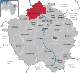
Altenmedingen (Altenmedingen)
- municipality of Germany
Altenmedingen is a small village in Lower Saxony, Germany, surrounded by picturesque landscapes that offer a variety of hiking opportunities. The region is characterized by its tranquil countryside, forests, fields, and nearby rivers, providing a serene environment for outdoor enthusiasts.
Hiking Trails
-
Local Trails: The area around Altenmedingen features several well-marked trails that range from easy walks to moderate hikes. You can enjoy peaceful strolls through the woods or more challenging paths that may lead you through scenic viewpoints.
-
Lüneburg Heath (Lüneburger Heide): Located nearby, this is one of the largest heathlands in Germany and offers fantastic hiking opportunities. The heath is particularly beautiful during the late summer when the heather blooms, creating a sea of purple.
-
Nature Reserves: There are various nature reserves in the vicinity, offering trails where you can immerse yourself in local flora and fauna. Birdwatching and photography can be particularly rewarding.
Tips for Hiking in Altenmedingen
- Maps and Guides: Always carry a local map or download a reliable hiking app to help navigate trails, as cell service may be limited in rural areas.
- Weather Conditions: Check the weather forecast before heading out, as conditions can change rapidly, especially in transitional seasons.
- Footwear: Wear appropriate hiking shoes that provide good support, especially if you plan to explore more rugged trails.
- Stay Hydrated: Bring enough water and snacks, particularly for longer hikes. There may not be facilities along the trails.
- Respect Nature: Follow the Leave No Trace principles to ensure that the natural beauty of Altenmedingen is preserved for future visitors.
Local Amenities
While Altenmedingen itself may have limited amenities, nearby towns like Uelzen provide options for accommodations, restaurants, and other services for hikers looking to explore the region further.
Conclusion
Hiking in Altenmedingen offers a blend of tranquility and natural beauty, perfect for both casual walkers and dedicated hikers. Whether you're exploring local trails or venturing into the nearby Lüneburg Heath, you're sure to enjoy the peaceful landscapes of Lower Saxony.
- Country:

- Postal Code: 29575
- Local Dialing Code: 05807
- Licence Plate Code: UE
- Coordinates: 53° 7' 50" N, 10° 36' 6" E


- GPS tracks (wikiloc): [Link]
- AboveSeaLevel: 52 м m
- Area: 48.09 sq km
- Population: 1489
- Web site: http://www.altenmedingen.de/
- Wikipedia en: wiki(en)
- Wikipedia: wiki(de)
- Wikidata storage: Wikidata: Q437426
- Wikipedia Commons Category: [Link]
- Freebase ID: [/m/02r_hym]
- Freebase ID: [/m/02r_hym]
- Freebase ID: [/m/02r_hym]
- Freebase ID: [/m/02r_hym]
- GeoNames ID: Alt: [2957538]
- GeoNames ID: Alt: [2957538]
- GeoNames ID: Alt: [2957538]
- GeoNames ID: Alt: [2957538]
- VIAF ID: Alt: [133205416]
- VIAF ID: Alt: [133205416]
- VIAF ID: Alt: [133205416]
- VIAF ID: Alt: [133205416]
- OSM relation ID: [1460228]
- OSM relation ID: [1460228]
- OSM relation ID: [1460228]
- OSM relation ID: [1460228]
- GND ID: Alt: [2109765-3]
- GND ID: Alt: [2109765-3]
- GND ID: Alt: [2109765-3]
- GND ID: Alt: [2109765-3]
- MusicBrainz area ID: [69fb7c62-2165-4e0d-a533-c25b2aca0e6b]
- MusicBrainz area ID: [69fb7c62-2165-4e0d-a533-c25b2aca0e6b]
- MusicBrainz area ID: [69fb7c62-2165-4e0d-a533-c25b2aca0e6b]
- MusicBrainz area ID: [69fb7c62-2165-4e0d-a533-c25b2aca0e6b]
- Historical Gazetteer (GOV) ID: [ALTGE1JO53HD]
- Historical Gazetteer (GOV) ID: [ALTGE1JO53HD]
- Historical Gazetteer (GOV) ID: [ALTGE1JO53HD]
- Historical Gazetteer (GOV) ID: [ALTGE1JO53HD]
- German municipality key: 03360001
- German municipality key: 03360001
- German municipality key: 03360001
- German municipality key: 03360001
Shares border with regions:


Bienenbüttel
- municipality of Germany
Bienenbüttel is a small town located in Lower Saxony, Germany, known for its picturesque landscapes and proximity to beautiful natural areas. While the town itself may not be a hiker's mecca, it is surrounded by a variety of trails and opportunities for outdoor enthusiasts. Here’s an overview of what you can expect when hiking in and around Bienenbüttel:...
- Country:

- Postal Code: 29553
- Local Dialing Code: 05823
- Licence Plate Code: UE
- Coordinates: 53° 8' 30" N, 10° 29' 12" E


- GPS tracks (wikiloc): [Link]
- AboveSeaLevel: 30 м m
- Area: 99 sq km
- Population: 6731
- Web site: [Link]
Vastorf
- municipality of Germany
Vastorf is a small village located in Lower Saxony, Germany, and while it may not be as well-known as some larger hiking destinations, there are opportunities for enjoyable outdoor activities in the surrounding areas....
- Country:

- Postal Code: 21397
- Local Dialing Code: 04137
- Licence Plate Code: LG
- Coordinates: 53° 11' 53" N, 10° 32' 44" E


- GPS tracks (wikiloc): [Link]
- AboveSeaLevel: 62 м m
- Area: 21.85 sq km
- Population: 831
- Web site: [Link]


Jelmstorf
- municipality of Germany
Jelmstorf is a small village located near the city of Lüneburg in Lower Saxony, Germany. While it may not be as famous for hiking as some other areas in Germany, it does offer a variety of outdoor activities and natural scenery that can be enjoyed by hikers....
- Country:

- Postal Code: 29585
- Local Dialing Code: 05821
- Licence Plate Code: UE
- Coordinates: 53° 6' 5" N, 10° 31' 21" E


- GPS tracks (wikiloc): [Link]
- AboveSeaLevel: 48 м m
- Area: 13.71 sq km
- Population: 770
- Web site: [Link]

