
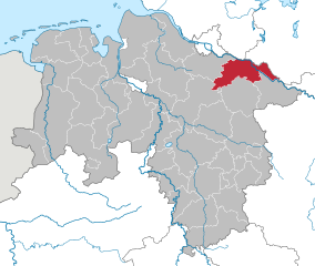
Lower Saxony (Niedersachsen)


- state of Germany
 Hiking in Lower Saxony
Lower Saxony, located in northwestern Germany, offers a diverse range of hiking opportunities appealing to both novice and experienced hikers. Here are some of the highlights of hiking in Lower Saxony:
1.
- Harz National Park: This mountainous region provides various trails with stunning views, including the highest peak in northern Germany, the Brocken. The Harz is known for its dense forests, unique rock formations, and rich wildlife.
- Lüneburg Heath (Lüneburger Heide): Famous for its purple heather landscapes, this area features flat terrains and well-marked trails. It’s particularly picturesque in late summer when the heather blooms.
- Wadden Sea (Wattenmeer): A UNESCO World Heritage site, the Wadden Sea can be explored through mudflat hiking, particularly on the islands of Sylt, Föhr, and Amrum.
2.
- Harzer-Hexen-Stieg: This long-distance trail runs approximately 100 kilometers from the town of Osterode to Thale. It passes through the enchanting forests and over stunning ridges of the Harz.
- Lüneburg Heath Trail: This trail network offers various routes through the heath and surrounding areas, allowing for both short and long hikes.
- Moorland Trails: There are numerous pathways in and around the moors that present unique scenery and wildlife.
3.
Many of the hiking routes in Lower Saxony can also be enjoyed by cyclists, making it a great region for those who enjoy combining both activities. Cycle paths often run parallel to hiking trails.
4.
Most trails in Lower Saxony are well-marked, with signage in both German and English. Many areas also offer maps and guides, enhancing the experience for visitors.
5.
Hiking in Lower Saxony often leads hikers through quaint villages, historical towns, and regions rich in culture such as Lüneburg and Göttingen. Along the trails, you can find opportunities to engage in local traditions, try regional cuisine, and visit historic landmarks.
6.
The weather can be variable, especially in mountainous areas. Always check the forecast and prepare accordingly, as conditions can change quickly.
7.
- Stay on marked paths: To protect the natural environment and ensure your safety.
- Bring adequate gear: Good hiking boots, sufficient water, and snacks are essential.
- Notify someone of your plans: Especially for longer hikes in remote areas.
Conclusion
Hiking in Lower Saxony offers a rich combination of nature, culture, and history, with trails that cater to all levels of fitness and experience. Whether you’re looking to explore lush forests, heath landscapes, or coastal areas, Lower Saxony has something special to offer. Make sure to plan your hikes accordingly, taking into account local conditions and regulations. Enjoy your hike!
- Country:

- Capital: Hanover
- Coordinates: 52° 45' 22" N, 9° 23' 35" E


- GPS tracks (wikiloc): [Link]
- AboveSeaLevel: 13 м m
- Area: 47614.07 sq km
- Population: 7945685
- Web site: http://www.niedersachsen.de/
- Wikipedia en: wiki(en)
- Wikipedia: wiki(de)
- Wikidata storage: Wikidata: Q1197
- Wikipedia Commons Gallery: [Link]
- Wikipedia Commons Category: [Link]
- Wikipedia Commons Maps Category: [Link]
- Freebase ID: [/m/04p0c]
- GeoNames ID: Alt: [2862926]
- BnF ID: [119343248]
- VIAF ID: Alt: [140653681]
- OSM relation ID: [62771]
- GND ID: Alt: [4042226-4]
- archINFORM location ID: [2865]
- Library of Congress authority ID: Alt: [n82051164]
- PACTOLS thesaurus ID: [pcrt0BE8kbdEt9]
- MusicBrainz area ID: [2978b457-3c4a-4a34-8b3c-d35e4804c42b]
- Quora topic ID: [Lower-Saxony]
- TGN ID: [7003676]
- Encyclopædia Britannica Online ID: [place/Lower-Saxony]
- Encyclopædia Universalis ID: [basse-saxe]
- NKCR AUT ID: [ge129048]
- DMOZ ID: Alt: [Regional/Europe/Germany/States/Lower_Saxony/]
- National Library of Israel ID: [000992253]
- NUTS code: [DE9]
- Klexikon article ID: [Niedersachsen]
- BabelNet ID: [00052201n]
- STW Thesaurus for Economics ID: [16896-5]
- SELIBR ID: [155186]
- ISO 3166-2 code: DE-NI
- German regional key: 03
- FIPS 10-4 (countries and regions): GM06
- GACS ID: 7282
- ITU/ISO/IEC object identifier: 2.16.276.1.5
Includes regions:
Verwaltungsbezirk Oldenburg
- former district of Lower Saxony, Germany
Hiking in Verwaltungsbezirk Oldenburg
Verwaltungsbezirk Oldenburg, located in Lower Saxony, Germany, offers a variety of hiking opportunities that can appeal to different skill levels and preferences, thanks to its diverse landscapes, cultural sites, and natural parks....
- Country:
Verwaltungsbezirk Brunswick
- former district of Pussia and Lower Saxony, Germany
Hiking in Verwaltungsbezirk Brunswick
Verwaltungsbezirk Brunswick, or the Brunswick district in Lower Saxony, Germany, offers diverse hiking opportunities, ranging from scenic woodland paths to historical trails and picturesque landscapes. Here are some highlights for hiking in this area:...
- Country:
- Coordinates: 52° 10' 12" N, 10° 30' 0" E
- GPS tracks (wikiloc): [Link]

Osnabrück Government Region
- former district of Pussia and Lower Saxony, Germany
Hiking in Osnabrück Government Region
Regierungsbezirk Osnabrück, located in Lower Saxony, Germany, is a beautiful region known for its stunning landscapes, rich history, and variety of hiking opportunities. Here are some highlights regarding hiking in this area:...
- Country:


Brunswick
- city in Lower Saxony, Germany
Hiking in Brunswick
Braunschweig, located in Lower Saxony, Germany, offers a variety of hiking options that allow you to explore its natural beauty, historical sites, and charming landscapes. Here's an overview of what you can expect when hiking in and around Braunschweig:...
- Country:
- Postal Code: 38114; 38126; 38100; 38100–38126
- Local Dialing Code: 05341; 0531; 05309; 05307; 05300
- Licence Plate Code: BS
- Coordinates: 52° 16' 9" N, 10° 31' 16" E
- GPS tracks (wikiloc): [Link]
- AboveSeaLevel: 75 м m
- Area: 192.70 sq km
- Population: 248667
- Web site: [Link]


Osnabrück
- German city
Hiking in Osnabrück
Osnabrück, located in Lower Saxony, Germany, is a fantastic destination for hiking enthusiasts. The region is characterized by its varied landscapes, including forests, hills, and meadows, making it ideal for both casual walkers and more experienced hikers....
- Country:
- Postal Code: 49074–49090
- Local Dialing Code: 05407; 05406; 05402; 0541
- Licence Plate Code: OS
- Coordinates: 52° 16' 44" N, 8° 2' 35" E
- GPS tracks (wikiloc): [Link]
- AboveSeaLevel: 63 м m
- Area: 119.8 sq km
- Population: 164070
- Web site: [Link]


Oldenburg
- town in Lower Saxony, Germany
Hiking in Oldenburg
Oldenburg, located in Lower Saxony, Germany, offers a variety of hiking opportunities that cater to different skill levels and preferences. The region is known for its beautiful landscapes, parks, and diverse ecosystems. Here are some highlights and tips for hiking in and around Oldenburg:...
- Country:
- Postal Code: 26001–26135
- Local Dialing Code: 0441
- Licence Plate Code: OL
- Coordinates: 53° 8' 38" N, 8° 12' 50" E
- GPS tracks (wikiloc): [Link]
- AboveSeaLevel: 4 м m
- Area: 103.09 sq km
- Population: 165711
- Web site: [Link]


Wolfsburg
- German city
Hiking in Wolfsburg
Wolfsburg, located in Lower Saxony, Germany, is primarily known for its automobile industry, particularly as the headquarters of Volkswagen. However, it also offers some opportunities for hiking and enjoying nature, especially in nearby natural parks and areas....
- Country:
- Postal Code: 38448; 38446; 38444; 38442; 38440
- Local Dialing Code: 05308; 05367; 05366; 05365; 05363; 05362; 05361
- Licence Plate Code: WOB
- Coordinates: 52° 25' 23" N, 10° 47' 14" E
- GPS tracks (wikiloc): [Link]
- AboveSeaLevel: 63 м m
- Area: 204.61 sq km
- Population: 123909
- Web site: [Link]
Brunswick Government Region
- former entity of Lower Saxony, Germany
Hiking in Brunswick Government Region
Braunschweig, located in Lower Saxony, Germany, offers a variety of scenic hiking opportunities that cater to all skill levels. The region is characterized by its beautiful landscapes, rich history, and accessible trails. Here are some highlights for hiking in and around Braunschweig:...
- Country:
- Coordinates: 52° 10' 12" N, 10° 30' 0" E
- GPS tracks (wikiloc): [Link]


Lüneburg Government Region
- former district of Pussia and Lower Saxony, Germany
Hiking in Lüneburg Government Region
Lüneburg, located in Lower Saxony, Germany, is an excellent destination for hiking enthusiasts. The region is known for its picturesque landscapes, historical towns, and a variety of hiking trails suitable for all skill levels....

Salzgitter
- independent city in southeast Lower Saxony, Germany
Hiking in Salzgitter
Salzgitter, located in Lower Saxony, Germany, offers a variety of hiking opportunities amidst its scenic landscapes. This region is characterized by rolling hills, forests, and lakes, making it a great destination for nature lovers and hikers of all skill levels. Here are some highlights for hiking in Salzgitter:...
- Country:
- Postal Code: 38239; 38229; 38228; 38259; 38226
- Local Dialing Code: 05339; 05300; 05341
- Licence Plate Code: SZ
- Coordinates: 52° 9' 13" N, 10° 24' 21" E
- GPS tracks (wikiloc): [Link]
- AboveSeaLevel: 90 м m
- Area: 224.49 sq km
- Population: 104614
- Web site: [Link]


Wilhelmshaven
- city in Lower Saxony, Germany
Hiking in Wilhelmshaven
Wilhelmshaven, located on the North Sea coast of Germany, is primarily known for its port and naval history, but it also offers some great opportunities for outdoor activities, including hiking. While it may not be as mountainous or rugged as other regions, there are still a variety of scenic areas and walking paths that can be explored. Here are some highlights for hiking in and around Wilhelmshaven:...
- Country:
- Postal Code: 26382; 26388; 26386; 26389; 26384
- Local Dialing Code: 04421
- Licence Plate Code: WHV
- Coordinates: 53° 31' 0" N, 8° 8' 0" E
- GPS tracks (wikiloc): [Link]
- AboveSeaLevel: 2 м m
- Area: 107.07 sq km
- Population: 76201
- Web site: [Link]


Delmenhorst
- city in Lower Saxony, Germany
Hiking in Delmenhorst
Delmenhorst is a town located in Lower Saxony, Germany, near Bremen. While it may not be as widely known for hiking as some other regions, it offers several opportunities for outdoor walking and nature exploration. Here are some insights about hiking in and around Delmenhorst:...
- Country:
- Postal Code: 27749–27755
- Local Dialing Code: 04221
- Licence Plate Code: DEL
- Coordinates: 53° 3' 2" N, 8° 37' 54" E
- GPS tracks (wikiloc): [Link]
- AboveSeaLevel: 7 м m
- Area: 62.45 sq km
- Population: 77045
- Web site: [Link]
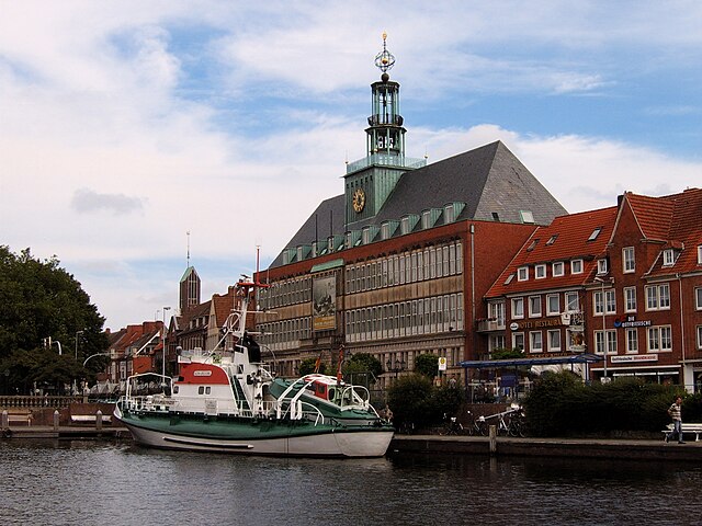

Emden
- biggest city in East Friesland, Lower Saxony, Germany
Hiking in Emden
Emden, located in the northern part of Germany in the state of Lower Saxony, is not predominantly known for mountainous hiking trails but offers some charming walking and hiking opportunities. Here are some aspects to consider for hiking in and around Emden:...
- Country:
- Postal Code: 26725; 26723; 26721
- Local Dialing Code: 04924; 04927; 04921
- Licence Plate Code: EMD
- Coordinates: 53° 22' 1" N, 7° 12' 22" E
- GPS tracks (wikiloc): [Link]
- AboveSeaLevel: 1 м m
- Area: 112.34 sq km
- Population: 50486
- Web site: [Link]
Weser-Ems Government Region
- former district of Lower Saxony, Germany
Hiking in Weser-Ems Government Region
Weser-Ems, located in the northwestern part of Germany, is a fantastic region for hiking enthusiasts. It features a diverse landscape that includes lush forests, scenic waterways, charming villages, and rolling hills. Here are some highlights and tips for hiking in the Weser-Ems region:...
- Country:
- Coordinates: 53° 2' 28" N, 8° 52' 49" E
- GPS tracks (wikiloc): [Link]
Hanover Government Region
- former district of Pussia and Lower Saxony, Germany
Hiking in Hanover Government Region
Hanover, located in Lower Saxony, Germany, offers a variety of hiking opportunities suitable for different skill levels. The region is known for its beautiful landscapes, forests, and parks, providing a great backdrop for outdoor activities....
- Coordinates: 52° 22' 0" N, 9° 44' 0" E
- GPS tracks (wikiloc): [Link]
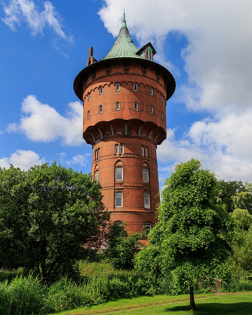

Cuxhaven
- German district of Lower Saxony
Hiking in Cuxhaven
Cuxhaven, located in Lower Saxony, Germany, offers a unique hiking experience with its combination of coastal landscapes, nature reserves, and historical sites. Here are some highlights of hiking in the Cuxhaven district:...
- Country:
- Capital: Cuxhaven
- Licence Plate Code: CUX
- Coordinates: 53° 40' 12" N, 8° 49' 48" E
- GPS tracks (wikiloc): [Link]
- AboveSeaLevel: 5 м m
- Area: 2057.78 sq km
- Population: 198670
- Web site: [Link]


Stade
- German district of Lower Saxony
Hiking in Stade
Stade, located in Lower Saxony, Germany, offers a range of hiking opportunities that allow you to explore its picturesque natural landscapes, historical sites, and charming small towns. Here are some highlights for hiking in the Stade district:...
- Country:
- Licence Plate Code: STD
- Coordinates: 53° 34' 48" N, 9° 25' 12" E
- GPS tracks (wikiloc): [Link]
- AboveSeaLevel: 1 м m
- Area: 1266.00 sq km
- Population: 201638
- Web site: [Link]


Harburg
- German district in Lower Saxony
Hiking in Harburg
Harburg, a district in the southern part of Hamburg, Germany, offers various hiking opportunities that allow you to explore the beautiful natural landscapes and scenic views of the region. Here are some key points about hiking in Harburg:...
- Country:
- Capital: Winsen
- Licence Plate Code: WL
- Coordinates: 53° 19' 43" N, 9° 58' 11" E
- GPS tracks (wikiloc): [Link]
- AboveSeaLevel: 49 м m
- Population: 250326
- Web site: [Link]
Lüneburg
- German district of Lower Saxony
Hiking in Lüneburg
Lüneburg district, located in Lower Saxony, Germany, is a wonderful area for hiking enthusiasts. The region is known for its scenic landscapes, featuring rolling hills, forests, rivers, and charming villages. Here are some highlights for hiking in Lüneburg:...
- Country:
- Capital: Lüneburg
- Licence Plate Code: LG
- Coordinates: 53° 15' 0" N, 10° 30' 0" E
- GPS tracks (wikiloc): [Link]
- AboveSeaLevel: 8 м m
- Area: 1323.10 sq km
- Population: 181605
- Web site: [Link]

Lüchow-Dannenberg District
- German district in Lower Saxony
Hiking in Lüchow-Dannenberg District
Lüchow-Dannenberg, located in lower Saxony, Germany, offers a distinctive blend of natural beauty, cultural heritage, and a variety of outdoor activities, making it an excellent region for hiking enthusiasts....
- Country:
- Capital: Lüchow
- Licence Plate Code: DAN
- Coordinates: 53° 0' 0" N, 11° 10' 12" E
- GPS tracks (wikiloc): [Link]
- AboveSeaLevel: 13 м m
- Area: 1220.00 sq km
- Population: 48825
- Web site: [Link]
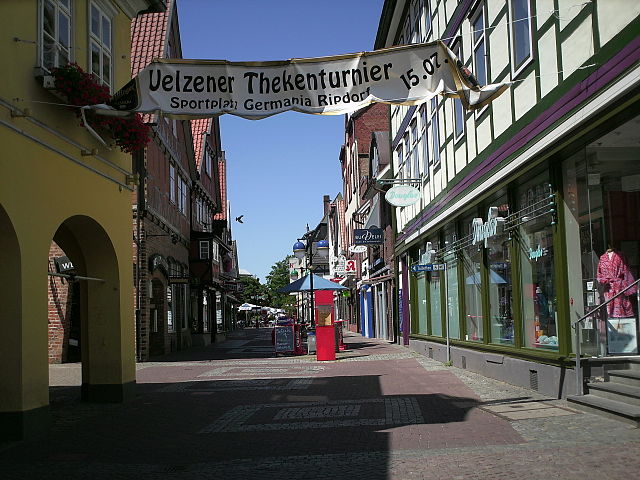

Uelzen District
- German district in Lower Saxony
Hiking in Uelzen District
Uelzen District in Lower Saxony, Germany, offers a variety of hiking opportunities for outdoor enthusiasts. While it might not be as widely known for hiking as some other regions, it provides beautiful natural scenery, charming villages, and historical sites to explore. Here are some aspects to consider for hiking in Uelzen:...
- Country:
- Licence Plate Code: UE
- Coordinates: 53° 0' 0" N, 10° 34' 48" E
- GPS tracks (wikiloc): [Link]
- AboveSeaLevel: 32 м m
- Area: 1454.00 sq km
- Population: 92961
- Web site: [Link]
Celle
- German district of Lower Saxony
Hiking in Celle
Celle district, located in Lower Saxony, Germany, offers a variety of hiking opportunities surrounded by beautiful landscapes, historic towns, and natural parks. Here are some highlights for hiking enthusiasts in the area:...
- Country:
- Licence Plate Code: CE
- Coordinates: 52° 34' 48" N, 10° 4' 48" E
- GPS tracks (wikiloc): [Link]
- AboveSeaLevel: 59 м m
- Area: 1554.00 sq km
- Population: 178370
- Web site: [Link]


Heidekreis
- district in Lower Saxony, Germany
Hiking in Heidekreis
Heidekreis, located in Lower Saxony, Germany, offers a variety of hiking opportunities amidst beautiful natural landscapes. The region is characterized by its mix of heathlands, forests, and moorlands, making it an attractive destination for outdoor enthusiasts....
- Country:
- Capital: Bad Fallingbostel
- Licence Plate Code: HK
- Coordinates: 52° 55' 12" N, 9° 45' 0" E
- GPS tracks (wikiloc): [Link]
- AboveSeaLevel: 64 м m
- Area: 1873.50 sq km
- Population: 139641
- Web site: [Link]


Rotenburg (Wümme)
- German district in Lower Saxony
Hiking in Rotenburg (Wümme)
Rotenburg (district), located in Lower Saxony, Germany, offers various hiking opportunities, particularly for those interested in exploring scenic landscapes and natural beauty. Here are some highlights and suggestions for hiking in this region:...
- Country:
- Licence Plate Code: ROW; BRV
- Coordinates: 53° 15' 0" N, 9° 19' 48" E
- GPS tracks (wikiloc): [Link]
- AboveSeaLevel: 28 м m
- Population: 163372
- Web site: [Link]


Osterholz
- district in Lower Saxony, Germany
Hiking in Osterholz
Osterholz, located in Lower Saxony, Germany, offers a variety of hiking opportunities for outdoor enthusiasts. The region is characterized by its beautiful landscapes, including forests, heathlands, and rivers, providing a picturesque setting for hikers. Here are some highlights and tips for hiking in Osterholz:...
- Country:
- Capital: Osterholz-Scharmbeck
- Licence Plate Code: OHZ
- Coordinates: 53° 15' 0" N, 8° 49' 48" E
- GPS tracks (wikiloc): [Link]
- AboveSeaLevel: 3 м m
- Area: 650.73 sq km
- Population: 112695
- Web site: [Link]


Verden
- district in Lower Saxony, Germany
Hiking in Verden
Verden, located in Lower Saxony, Germany, is an area that offers various outdoor activities, including hiking. The district is characterized by its lush landscapes, woodlands, and scenic countryside, making it a pleasant spot for nature lovers and hikers alike....
- Country:
- Licence Plate Code: VER
- Coordinates: 53° 0' 0" N, 9° 10' 12" E
- GPS tracks (wikiloc): [Link]
- AboveSeaLevel: 23 м m
- Area: 787.70 sq km
- Population: 135842
- Web site: [Link]

Aurich
- district in Lower Saxony, Germany
Hiking in Aurich
Aurich, located in the East Frisian region of Lower Saxony, Germany, is not as mountainous as other hiking destinations but offers a unique and picturesque setting for those who enjoy walking and exploring nature. Here are some aspects to consider when hiking in the Aurich district:...
- Country:
- Licence Plate Code: AUR; NOR
- Coordinates: 53° 30' 0" N, 7° 19' 48" E
- GPS tracks (wikiloc): [Link]
- AboveSeaLevel: 2 м m
- Area: 1287.00 sq km
- Population: 190066
- Web site: [Link]

Wittmund
- district in Lower Saxony, Germany
Hiking in Wittmund
Wittmund is a district in Lower Saxony, Germany, known for its picturesque landscapes, charming villages, and proximity to the North Sea. While it isn't famous for extensive hiking trails like some other regions in Germany, there are still plenty of opportunities for outdoor enthusiasts to explore the natural beauty of this area....
- Country:
- Licence Plate Code: WTM
- Coordinates: 53° 34' 48" N, 7° 45' 0" E
- GPS tracks (wikiloc): [Link]
- AboveSeaLevel: 1 м m
- Area: 656.65 sq km
- Population: 56881
- Web site: [Link]


Friesland
- district of Germany
Hiking in Friesland
Friesland, a province in the northern Netherlands, offers a unique and beautiful landscape for hiking enthusiasts. Known for its picturesque lake districts, lush meadows, and iconic windmills, Friesland combines natural beauty with cultural heritage....
- Country:
- Licence Plate Code: FRI
- Coordinates: 53° 30' 0" N, 8° 0' 0" E
- GPS tracks (wikiloc): [Link]
- Area: 608.00 sq km
- Population: 97900
- Web site: [Link]


Leer
- district in Lower Saxony, Germany
Hiking in Leer
Leer is a district located in the Lower Saxony region of Germany, and it offers a variety of opportunities for hiking enthusiasts. The landscape is characterized by flat terrain, picturesque wetlands, canals, and rivers, making it a unique area for outdoor activities....
- Country:
- Licence Plate Code: LER
- Coordinates: 53° 15' 0" N, 7° 30' 0" E
- GPS tracks (wikiloc): [Link]
- AboveSeaLevel: 1 м m
- Area: 1086.00 sq km
- Population: 168253
- Web site: [Link]

Emsland
- district in Lower Saxony, Germany
Hiking in Emsland
Emsland, located in Lower Saxony, Germany, is a fantastic region for hiking enthusiasts. Known for its wide-open landscapes and rich natural beauty, Emsland offers a variety of trails that cater to hikers of all levels....
- Country:
- Capital: Meppen
- Licence Plate Code: EL
- Coordinates: 52° 40' 12" N, 7° 15' 0" E
- GPS tracks (wikiloc): [Link]
- AboveSeaLevel: 25 м m
- Area: 2882.07 sq km
- Population: 321391
- Web site: [Link]


County of Bentheim
- district in Lower Saxony, Germany
Hiking in County of Bentheim
The County of Bentheim is located in the northwest of Germany, near the border with the Netherlands. It's known for its picturesque landscapes, charming villages, and rich cultural heritage, which makes it a wonderful location for hiking enthusiasts. Here’s an overview of what you can expect while hiking in this beautiful district:...
- Country:
- Capital: Nordhorn
- Licence Plate Code: NOH
- Coordinates: 52° 25' 12" N, 7° 4' 48" E
- GPS tracks (wikiloc): [Link]
- AboveSeaLevel: 17 м m
- Area: 981.00 sq km
- Population: 135770
- Web site: [Link]

Osnabrück
- district in Lower Saxony, Germany
Hiking in Osnabrück
Osnabrück district, located in Lower Saxony, Germany, offers a variety of hiking opportunities that cater to different skill levels and preferences. The region is characterized by its rolling hills, lush forests, and picturesque landscapes, making it an appealing destination for outdoor enthusiasts....
- Country:
- Capital: Osnabrück
- Licence Plate Code: OS
- Coordinates: 52° 19' 48" N, 8° 10' 12" E
- GPS tracks (wikiloc): [Link]
- AboveSeaLevel: 57 м m
- Area: 2122.00 sq km
- Population: 354807
- Web site: [Link]


Vechta
- district in Lower Saxony, Germany
Hiking in Vechta
Vechta is a district located in Lower Saxony, Germany, known for its picturesque landscapes and rural charm. While it may not be as mountainous as other regions in Germany, it offers several opportunities for hiking, especially for those who enjoy gentle walks through nature....
- Country:
- Licence Plate Code: VEC
- Coordinates: 52° 40' 12" N, 8° 15' 0" E
- GPS tracks (wikiloc): [Link]
- AboveSeaLevel: 27 м m
- Area: 813.00 sq km
- Population: 139671
- Web site: [Link]


Cloppenburg
- district in Lower Saxony, Germany
Hiking in Cloppenburg
Cloppenburg district, located in Lower Saxony, Germany, offers a variety of picturesque landscapes and natural beauty, making it a great destination for hiking enthusiasts. Here are some highlights and tips for hiking in the region:...
- Country:
- Capital: Cloppenburg
- Licence Plate Code: CLP
- Coordinates: 52° 49' 48" N, 8° 0' 0" E
- GPS tracks (wikiloc): [Link]
- AboveSeaLevel: 27 м m
- Area: 1418.00 sq km
- Population: 165930
- Web site: [Link]

Ammerland
- district in Lower Saxony, Germany
Hiking in Ammerland
Ammerland, located in Lower Saxony, Germany, is a scenic region known for its beautiful landscapes, lush greenery, and peaceful lakes. While it may not be as mountainous as other regions in Germany, it offers a variety of trails that are perfect for hiking enthusiasts of all levels. Here are some key aspects to consider when hiking in Ammerland:...
- Country:
- Licence Plate Code: WST
- Coordinates: 53° 15' 0" N, 7° 55' 12" E
- GPS tracks (wikiloc): [Link]
- AboveSeaLevel: 7 м m
- Area: 728.00 sq km
- Population: 122698
- Web site: [Link]


Wesermarsch
- district in Lower Saxony, Germany
Hiking in Wesermarsch
Wesermarsch is a fascinating region in Lower Saxony, Germany, known for its flat landscapes, unique marsh ecosystems, and rich cultural heritage. While it may not be as mountainous as other hiking destinations, it offers a variety of hiking trails suitable for all levels, especially for those who enjoy tranquil walks in nature and picturesque views....
- Country:
- Capital: Brake
- Licence Plate Code: BRA
- Coordinates: 53° 19' 48" N, 8° 19' 48" E
- GPS tracks (wikiloc): [Link]
- Area: 821.87 sq km
- Population: 89282
- Web site: [Link]


Oldenburg
- district of Lower Saxony, Germany
Hiking in Oldenburg
Oldenburg District, located in Lower Saxony, Germany, offers a variety of landscapes and trails suitable for hiking enthusiasts. While it may not be as mountainous as other regions in Germany, its scenic countryside, woodlands, and lakes provide a wonderful backdrop for outdoor activities....
- Country:
- Licence Plate Code: OL
- Coordinates: 53° 0' 0" N, 8° 25' 12" E
- GPS tracks (wikiloc): [Link]
- AboveSeaLevel: 25 м m
- Area: 1063.00 sq km
- Population: 129484
- Web site: [Link]


Diepholz
- district in Lower Saxony, Germany
Hiking in Diepholz
Diepholz is a district located in Lower Saxony, Germany, known for its scenic landscapes and outdoor recreational opportunities, including hiking. Here are some insights about hiking in and around Diepholz:...
- Country:
- Licence Plate Code: SY; DH
- Coordinates: 52° 40' 12" N, 8° 34' 48" E
- GPS tracks (wikiloc): [Link]
- AboveSeaLevel: 52 м m
- Area: 1987.00 sq km
- Population: 209671
- Web site: [Link]


Nienburg/Weser
- district in Lower Saxony, Germany
Hiking in Nienburg/Weser
Nienburg (district) in Lower Saxony, Germany, offers a range of outdoor activities, including hiking, which can be enjoyed in its scenic landscapes. While the region isn't known for high mountains, it features beautiful rolling hills, tranquil rivers, and charming villages, making it an excellent area for hiking enthusiasts who appreciate more gentle terrains and lush nature....
- Country:
- Licence Plate Code: NI
- Coordinates: 52° 40' 12" N, 9° 10' 12" E
- GPS tracks (wikiloc): [Link]
- AboveSeaLevel: 21 м m
- Area: 1399.00 sq km
- Population: 121503
- Web site: [Link]

Hanover region
- district in Lower Saxony, Germany
Hiking in Hanover region
The Hanover Region, located in Lower Saxony, Germany, offers a variety of hiking opportunities for both beginners and experienced hikers alike. With its mix of natural landscapes, historical sites, and well-maintained trails, the region is a great destination for outdoor enthusiasts....
- Country:
- Capital: Hanover
- Licence Plate Code: H
- Coordinates: 52° 25' 12" N, 9° 43' 12" E
- GPS tracks (wikiloc): [Link]
- AboveSeaLevel: 55 м m
- Area: 2291 sq km
- Population: 1149594
- Web site: [Link]
Schaumburg
- district in Lower Saxony, Germany
Hiking in Schaumburg
Schaumburg, located in northeastern Illinois, offers some enjoyable options for hiking, despite being a suburban area primarily known for its shopping and amenities. Here are a few notable spots you can explore:...
- Country:
- Licence Plate Code: SHG; RI
- Coordinates: 52° 15' 0" N, 9° 10' 12" E
- GPS tracks (wikiloc): [Link]
- AboveSeaLevel: 84 м m
- Area: 676.00 sq km
- Population: 157616
- Web site: [Link]


Hamelin-Pyrmont
- district in Lower Saxony, Germany
Hiking in Hamelin-Pyrmont
Hameln-Pyrmont, located in the Lower Saxony region of Germany, is a fantastic destination for hikers, offering a combination of beautiful landscapes, historical sites, and diverse trails. Here’s a detailed overview of what you can expect when hiking in this area:...
- Country:
- Capital: Hamelin
- Licence Plate Code: HM
- Coordinates: 52° 4' 48" N, 9° 19' 48" E
- GPS tracks (wikiloc): [Link]
- AboveSeaLevel: 91 м m
- Area: 796.00 sq km
- Population: 148265
- Web site: [Link]


Holzminden
- district in Lower Saxony, Germany
Hiking in Holzminden
Holzminden is a picturesque district in Lower Saxony, Germany, characterized by its stunning landscapes, lush forests, and scenic river valleys. It’s an excellent destination for hiking enthusiasts of all levels. Here are some highlights about hiking in Holzminden:...
- Country:
- Licence Plate Code: HOL
- Coordinates: 51° 49' 48" N, 9° 30' 0" E
- GPS tracks (wikiloc): [Link]
- AboveSeaLevel: 177 м m
- Area: 692.00 sq km
- Population: 71510
- Web site: [Link]
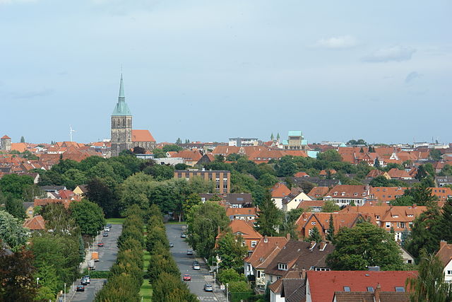

Hildesheim
- district in Lower Saxony, Germany
Hiking in Hildesheim
Hildesheim is a beautiful district in Lower Saxony, Germany, known for its rich cultural heritage and scenic landscapes. While it may not be as famous for hiking as some other regions in Germany, there are still several great options for hikers of various skill levels....
- Country:
- Capital: Hildesheim
- Licence Plate Code: HI; ALF
- Coordinates: 52° 4' 48" N, 9° 55' 12" E
- GPS tracks (wikiloc): [Link]
- AboveSeaLevel: 80 м m
- Area: 1206.00 sq km
- Population: 277300
- Web site: [Link]


Northeim
- district in Lower Saxony, Germany
Hiking in Northeim
Northeim is a lovely district located in Lower Saxony, Germany, known for its scenic landscapes and variety of hiking opportunities. The region is characterized by a mix of forests, hills, and rivers, making it a great destination for outdoor enthusiasts....
- Country:
- Licence Plate Code: NOM; GAN; EIN
- Coordinates: 51° 45' 0" N, 9° 49' 48" E
- GPS tracks (wikiloc): [Link]
- AboveSeaLevel: 149 м m
- Area: 1267.00 sq km
- Population: 133610
- Web site: [Link]


Göttingen district
- district in Lower Saxony, Germany
Hiking in Göttingen district
Göttingen, located in Lower Saxony, Germany, is surrounded by a variety of beautiful landscapes that are perfect for hiking enthusiasts. The district offers a mix of wooded areas, rolling hills, and scenic vistas, making it an excellent destination for hikers of all levels. Here are some highlights of hiking in the Göttingen district:...
- Country:
- Capital: Göttingen
- Licence Plate Code: GÖ; OHA; HMÜ; DUD
- Coordinates: 51° 30' 0" N, 9° 55' 12" E
- GPS tracks (wikiloc): [Link]
- AboveSeaLevel: 155 м m
- Area: 1117.00 sq km
- Population: 327065
- Web site: [Link]


Goslar
- district in Lower Saxony, Germany
Hiking in Goslar
Goslar, located in Lower Saxony, Germany, is a beautiful area that offers a variety of hiking opportunities, particularly due to its proximity to the Harz Mountains. The district is known for its picturesque landscapes, medieval architecture, and rich history. Here are some highlights and suggestions for hiking in the Goslar district:...
- Country:
- Capital: Goslar
- Licence Plate Code: GS; CLZ; BRL
- Coordinates: 51° 54' 38" N, 10° 25' 16" E
- GPS tracks (wikiloc): [Link]
- AboveSeaLevel: 263 м m
- Area: 965.07 sq km
- Population: 137979
- Web site: [Link]
Wolfenbüttel
- district in southeastern Lower Saxony, Germany
Hiking in Wolfenbüttel
Wolfenbüttel is a beautiful district located in Lower Saxony, Germany, known for its picturesque landscapes, historic towns, and a variety of outdoor activities, including hiking. Here are some key points about hiking in the Wolfenbüttel district:...
- Country:
- Licence Plate Code: WF
- Coordinates: 52° 10' 0" N, 10° 35' 0" E
- GPS tracks (wikiloc): [Link]
- AboveSeaLevel: 87 м m
- Area: 722.33 sq km
- Population: 120904
- Web site: [Link]

Peine
- district of Lower Saxony, Germany
Hiking in Peine
Peine is a district located in Lower Saxony, Germany, and it offers various outdoor activities, including hiking. The region is known for its beautiful landscapes, with a mix of forests, meadows, and picturesque villages. Here are some key points about hiking in the Peine district:...
- Country:
- Capital: Peine
- Licence Plate Code: PE
- Coordinates: 52° 19' 48" N, 10° 15' 0" E
- GPS tracks (wikiloc): [Link]
- AboveSeaLevel: 66 м m
- Area: 535.00 sq km
- Population: 132979
- Web site: [Link]

Helmstedt
- district of Lower Saxony, Germany
Hiking in Helmstedt
Helmstedt is a district located in Lower Saxony, Germany, and is known for its beautiful natural landscapes and varied hiking opportunities. The region combines cultural heritage with outdoor activities, making it an appealing destination for hikers of all skill levels. Here are some highlights and features of hiking in Helmstedt:...
- Country:
- Licence Plate Code: HE
- Coordinates: 52° 15' 0" N, 10° 55' 12" E
- GPS tracks (wikiloc): [Link]
- AboveSeaLevel: 142 м m
- Area: 674.00 sq km
- Population: 92079
- Web site: [Link]


Gifhorn
- district of Lower Saxony, Germany
Hiking in Gifhorn
Gifhorn, located in Lower Saxony, Germany, is surrounded by beautiful landscapes that offer a variety of hiking opportunities. The district is characterized by its picturesque lakes, forests, and gentle hills, making it an attractive destination for hikers of all skill levels....
- Country:
- Capital: Gifhorn
- Licence Plate Code: GF
- Coordinates: 52° 29' 0" N, 10° 33' 0" E
- GPS tracks (wikiloc): [Link]
- AboveSeaLevel: 63 м m
- Area: 1563.00 sq km
- Population: 174749
- Web site: [Link]


Hildesheim Government Region
- former district of Pussia and Lower Saxony, Germany
Hiking in Hildesheim Government Region
Regierungsbezirk Hildesheim, located in Lower Saxony, Germany, offers a variety of hiking opportunities set against picturesque landscapes, including rolling hills, dense forests, and charming villages. Here are some highlights and tips for hiking in this region:...
- Country:
Aurich Government Region
- former district of Pussia and Lower Saxony, Germany
Hiking in Aurich Government Region
Regierungsbezirk Aurich, located in the northeastern part of Lower Saxony, Germany, offers a variety of hiking opportunities that showcase its unique landscapes, cultural heritage, and natural beauty. Here are some highlights for hiking in this region:...
- Country:


Stade Government Region
- former district of Pussia and Lower Saxony, Germany
Hiking in Stade Government Region
Stade, located in the Lower Saxony region of Germany, offers several options for hiking enthusiasts. The area is characterized by its beautiful landscapes, tranquil countryside, and scenic trails. Here are some highlights and tips for hiking in the Stade region:...
- Capital: Stade
Shares border with regions:


Hamburg
- city in Germany, city state and federal state
Hiking in Hamburg
Hiking in and around Hamburg offers a unique blend of urban landscapes and natural scenery. While Hamburg is primarily known for its rich maritime history and vibrant city life, nearby areas provide some excellent opportunities for hiking enthusiasts....
- Country:
- Postal Code: 22041–22769; 20095–21149
- Local Dialing Code: 04721; 040
- Licence Plate Code: HH
- Coordinates: 53° 33' 0" N, 10° 0' 0" E
- GPS tracks (wikiloc): [Link]
- AboveSeaLevel: 6 м m
- Area: 755.30 sq km
- Population: 1834244
- Web site: [Link]


Schleswig-Holstein
- state in Northern Germany
Hiking in Schleswig-Holstein
Schleswig-Holstein, located in northern Germany, offers a unique and diverse hiking experience, combining coastal landscapes, rolling hills, lakes, and expansive fields. Here are some highlights and tips for hiking in the region:...
- Country:
- Capital: Kiel
- Coordinates: 54° 28' 12" N, 9° 30' 51" E
- GPS tracks (wikiloc): [Link]
- AboveSeaLevel: 12 м m
- Area: 15804.28 sq km
- Population: 2889821
- Web site: [Link]

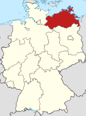
Mecklenburg-Vorpommern
- state of Germany
Hiking in Mecklenburg-Vorpommern
Mecklenburg-Vorpommern, a picturesque state in northeastern Germany, offers a wealth of hiking opportunities for enthusiasts of all levels. This region is known for its diverse landscapes, which include vast forests, serene lakes, and a stunning coastline along the Baltic Sea. Here are some highlights and tips for hiking in this beautiful area:...
- Country:
- Capital: Schwerin
- Coordinates: 53° 37' 0" N, 12° 42' 0" E
- GPS tracks (wikiloc): [Link]
- AboveSeaLevel: 0 м m
- Area: 23174.0 sq km
- Population: 1596500
- Web site: [Link]
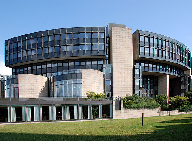

North Rhine-Westphalia
- state of Germany
Hiking in North Rhine-Westphalia
North Rhine-Westphalia (NRW) is a fantastic region for hiking enthusiasts, offering a diverse range of landscapes, trails, and experiences. Here’s what you can expect when hiking in this beautiful German state:...
- Country:
- Capital: Düsseldorf
- Coordinates: 51° 28' 0" N, 7° 33' 0" E
- GPS tracks (wikiloc): [Link]
- AboveSeaLevel: 45 м m
- Area: 34112.52 sq km
- Population: 17572000
- Web site: [Link]


Hesse
- state in Germany
Hiking in Hesse
Hesse, located in central Germany, offers a diverse range of hiking opportunities, thanks to its varied landscapes that include forests, hills, and charming villages. Here are some highlights of hiking in the region:...
- Country:
- Capital: Wiesbaden
- Coordinates: 50° 39' 58" N, 8° 35' 28" E
- GPS tracks (wikiloc): [Link]
- AboveSeaLevel: 264 м m
- Area: 21100.0 sq km
- Population: 6045425
- Web site: [Link]


Thuringia
- state of Germany
Hiking in Thuringia
Thuringia, located in central Germany, is an excellent destination for hiking enthusiasts. Known for its diverse landscapes, lush forests, historical sites, and picturesque villages, Thuringia offers numerous trails that cater to different skill levels and interests. Here are some highlights and tips for hiking in the region:...
- Country:
- Capital: Erfurt
- Coordinates: 50° 51' 40" N, 11° 3' 7" E
- GPS tracks (wikiloc): [Link]
- AboveSeaLevel: 266 м m
- Area: 16171.0 sq km
- Population: 2161000
- Web site: [Link]


Saxony-Anhalt
- state of Germany
Hiking in Saxony-Anhalt
Saxony-Anhalt, located in central Germany, offers a diverse range of hiking trails and natural landscapes that cater to outdoor enthusiasts. Here are some key highlights for hiking in this region:...
- Country:
- Capital: Magdeburg
- Coordinates: 51° 58' 16" N, 11° 28' 12" E
- GPS tracks (wikiloc): [Link]
- AboveSeaLevel: 51 м m
- Area: 20451.58 sq km
- Population: 2245470
- Web site: [Link]


Brandenburg
- state of Germany
Hiking in Brandenburg
Brandenburg, a state in northeastern Germany, is an excellent destination for hiking enthusiasts. It's known for its diverse landscapes, which include vast forests, serene lakes, and rolling hills. Here are some key highlights and tips for hiking in Brandenburg:...
- Country:
- Capital: Potsdam
- Coordinates: 52° 21' 43" N, 13° 0' 29" E
- GPS tracks (wikiloc): [Link]
- AboveSeaLevel: 0 м m
- Area: 29478.63 sq km
- Population: 2449193
- Web site: [Link]
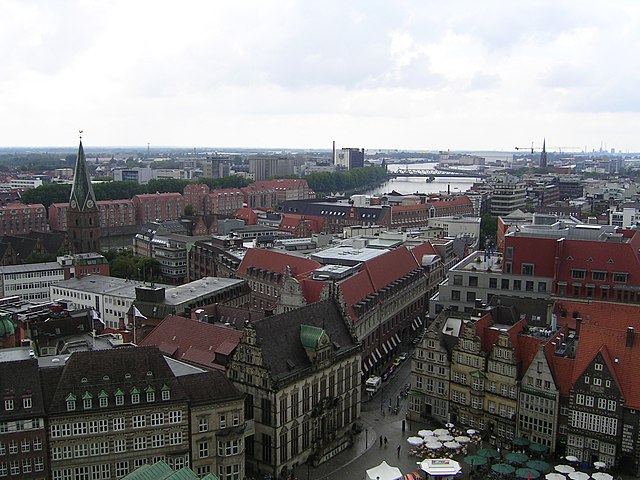

Bremen
- federated state of Germany
Hiking in Bremen
Bremen, located in northwestern Germany, is not typically known for rugged hiking trails like some other regions in Germany. However, it offers a variety of scenic spots and walking paths that can provide a delightful experience for hikers and nature enthusiasts. Here are some highlights of hiking and walking opportunities in the Bremen state:...
- Country:
- Capital: Bremen
- Licence Plate Code: HB
- Coordinates: 53° 20' 50" N, 8° 35' 29" E
- GPS tracks (wikiloc): [Link]
- AboveSeaLevel: 0 м m
- Area: 419.38 sq km
- Population: 661000
- Web site: [Link]