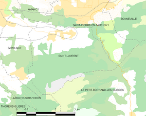
Amancy (Amancy)

- commune in Haute-Savoie, France
 Hiking in Amancy
Amancy, located in the Haute-Savoie region of France, is a lesser-known but beautiful destination for hiking enthusiasts. Nestled near the stunning landscapes of the French Alps, it offers a variety of trails that cater to hikers of different skill levels.
Hiking Trails:
-
Lac de la Thuile: A popular hike that provides stunning views of the surrounding mountains and the picturesque lake. The trail is moderate and is ideal for families or those looking for a leisurely hike.
-
Col des Aravis: This trail offers breathtaking panoramic views and can be a bit challenging. It's best suited for experienced hikers, especially when weather conditions change rapidly in the mountains.
-
Sentier de la Cascade: A shorter, more relaxed hike that leads to a beautiful waterfall. It's a great option for beginners or those looking to enjoy a scenic spot without a strenuous trek.
Tips for Hiking in Amancy:
- Check the Weather: Mountain weather can be unpredictable. Always check forecasts before heading out and be prepared for sudden changes.
- Dress Appropriately: Wear layered clothing suitable for varying temperatures, sturdy hiking boots, and bring rain gear just in case.
- Stay Hydrated and Nourished: Always carry water and snacks to keep your energy up during your hike.
- Respect Nature: Stay on marked trails, carry out what you bring in, and observe wildlife from a distance.
Best Times to Hike:
Spring and early fall are particularly lovely for hiking in Amancy. The weather is generally mild, and the trails are typically less crowded. Summer can be warm but offers lush greenery and blooming wildflowers, while autumn presents stunning foliage.
Overall, hiking in Amancy allows you to experience the beauty of the French Alps in a more tranquil setting compared to more crowded areas. Always remember to hike safely and enjoy the breathtaking views!
- Country:

- Postal Code: 74800
- Coordinates: 46° 4' 27" N, 6° 19' 45" E


- GPS tracks (wikiloc): [Link]
- Area: 8.62 sq km
- Population: 2492
- Web site: http://www.amancy.fr/
- Wikipedia en: wiki(en)
- Wikipedia: wiki(fr)
- Wikidata storage: Wikidata: Q453682
- Wikipedia Commons Category: [Link]
- Freebase ID: [/m/03ntxdq]
- GeoNames ID: Alt: [6452516]
- SIREN number: [217400076]
- BnF ID: [15274267f]
- INSEE municipality code: 74007
Shares border with regions:


La Roche-sur-Foron
- commune in Haute-Savoie, France
Hiking in La Roche-sur-Foron
La Roche-sur-Foron, located in the Haute-Savoie region of France, is a beautiful area for hiking enthusiasts. Nestled at the foothills of the Alps, it offers a variety of landscapes, from lush green valleys to rocky trails with breathtaking views of the surrounding mountains....
- Country:
- Postal Code: 74800
- Coordinates: 46° 4' 1" N, 6° 18' 43" E
- GPS tracks (wikiloc): [Link]
- Area: 17.94 sq km
- Population: 11659
- Web site: [Link]


Saint-Pierre-en-Faucigny
- commune in Haute-Savoie, France
Hiking in Saint-Pierre-en-Faucigny
Saint-Pierre-en-Faucigny is a picturesque commune located in the Haute-Savoie region of France, nestled in the foothills of the French Alps. The area is known for its stunning natural beauty, making it an excellent destination for hiking enthusiasts....
- Country:
- Postal Code: 74800
- Coordinates: 46° 3' 35" N, 6° 22' 21" E
- GPS tracks (wikiloc): [Link]
- Area: 14.91 sq km
- Population: 6241
- Web site: [Link]

Saint-Laurent, Haute-Savoie
- commune in Haute-Savoie, France
Hiking in Saint-Laurent, Haute-Savoie
Hiking in Saint-Laurent, located in the Haute-Savoie region of the French Alps, offers a stunning array of options for outdoor enthusiasts. This area is known for its breathtaking landscapes, charming alpine villages, and diverse trails that cater to hikers of all skill levels....
- Country:
- Postal Code: 74800
- Coordinates: 46° 2' 48" N, 6° 21' 33" E
- GPS tracks (wikiloc): [Link]
- Area: 10.96 sq km
- Population: 818


Arenthon
- commune in Haute-Savoie, France
Hiking in Arenthon
Arenthon, located in the Haute-Savoie region of France, offers beautiful hiking opportunities amidst stunning alpine scenery. The area is characterized by lush green valleys, picturesque lakes, and views of the surrounding mountains, including the Mont Blanc range....
- Country:
- Postal Code: 74800
- Coordinates: 46° 6' 21" N, 6° 19' 58" E
- GPS tracks (wikiloc): [Link]
- Area: 11.47 sq km
- Population: 1606


Cornier
- commune in Haute-Savoie, France
Hiking in Cornier
It seems there might be a small typo in your request, as there isn't a well-known hiking region called "Cornier." However, if you meant "Cornwall," I can provide information about hiking in that area. If there's a different location you were referring to, please let me know!...
- Country:
- Postal Code: 74800
- Coordinates: 46° 5' 34" N, 6° 17' 59" E
- GPS tracks (wikiloc): [Link]
- Area: 6.78 sq km
- Population: 1276
- Web site: [Link]


Saint-Sixt
- commune in Haute-Savoie, France
Hiking in Saint-Sixt
Saint-Sixt is a charming commune located in the Haute-Savoie region of the Auvergne-Rhône-Alpes in southeastern France. It offers a range of hiking opportunities for both beginners and experienced hikers, with stunning landscapes and diverse natural environments to explore. Here are some highlights about hiking in the area:...
- Country:
- Postal Code: 74800
- Coordinates: 46° 3' 10" N, 6° 19' 46" E
- GPS tracks (wikiloc): [Link]
- Area: 5.21 sq km
- Population: 996