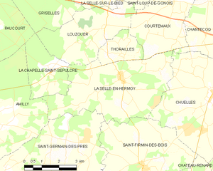
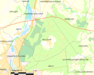
Amilly (Amilly)
- commune in Loiret, France
- Country:

- Postal Code: 45200
- Coordinates: 47° 58' 23" N, 2° 46' 13" E


- GPS tracks (wikiloc): [Link]
- Area: 40.26 sq km
- Population: 12680
- Web site: http://www.amilly.com
- Wikipedia en: wiki(en)
- Wikipedia: wiki(fr)
- Wikidata storage: Wikidata: Q1384976
- Wikipedia Commons Category: [Link]
- Freebase ID: [/m/03qd5r1]
- GeoNames ID: Alt: [6616820]
- SIREN number: [214500043]
- BnF ID: [15260397g]
- GND ID: Alt: [4753489-8]
- PACTOLS thesaurus ID: [pcrt1pSxGibLeo]
- INSEE municipality code: 45004
Shares border with regions:


La Chapelle-Saint-Sépulcre
- commune in Loiret, France
- Country:

- Postal Code: 45210
- Coordinates: 48° 1' 4" N, 2° 50' 40" E


- GPS tracks (wikiloc): [Link]
- Area: 6.21 sq km
- Population: 244


Châlette-sur-Loing
- commune in Loiret, France
- Country:

- Postal Code: 45120
- Coordinates: 48° 0' 42" N, 2° 44' 9" E


- GPS tracks (wikiloc): [Link]
- Area: 13.13 sq km
- Population: 12790
- Web site: [Link]


Villemandeur
- commune in Loiret, France
- Country:

- Postal Code: 45700
- Coordinates: 47° 59' 25" N, 2° 42' 34" E


- GPS tracks (wikiloc): [Link]
- Area: 11.46 sq km
- Population: 6952
- Web site: [Link]


La Selle-en-Hermoy
- commune in Loiret, France
- Country:

- Postal Code: 45210
- Coordinates: 48° 0' 39" N, 2° 53' 39" E


- GPS tracks (wikiloc): [Link]
- Area: 19.56 sq km
- Population: 843


Mormant-sur-Vernisson
- commune in Loiret, France
- Country:

- Postal Code: 45700
- Coordinates: 47° 56' 50" N, 2° 44' 15" E


- GPS tracks (wikiloc): [Link]
- Area: 10.92 sq km
- Population: 111


Saint-Germain-des-Prés
- commune in Loiret, France
- Country:

- Postal Code: 45220
- Coordinates: 47° 57' 12" N, 2° 50' 50" E


- GPS tracks (wikiloc): [Link]
- Area: 26.18 sq km
- Population: 1904
- Web site: [Link]


Montargis
- commune in Loiret, France
- Country:

- Postal Code: 45200
- Coordinates: 47° 59' 49" N, 2° 43' 57" E


- GPS tracks (wikiloc): [Link]
- AboveSeaLevel: 85 м m
- Area: 4.46 sq km
- Population: 14254
- Web site: [Link]


Conflans-sur-Loing
- commune in Loiret, France
- Country:

- Postal Code: 45700
- Coordinates: 47° 57' 9" N, 2° 47' 21" E


- GPS tracks (wikiloc): [Link]
- Area: 9.14 sq km
- Population: 369


Paucourt
- commune in Loiret, France
- Country:

- Postal Code: 45200
- Coordinates: 48° 2' 9" N, 2° 47' 39" E


- GPS tracks (wikiloc): [Link]
- Area: 20.2 sq km
- Population: 900
- Web site: [Link]
