Paucourt (Paucourt)
- commune in Loiret, France
- Country:

- Postal Code: 45200
- Coordinates: 48° 2' 9" N, 2° 47' 39" E


- GPS tracks (wikiloc): [Link]
- Area: 20.2 sq km
- Population: 900
- Web site: http://ricjasforetmontargis.wifeo.com/paucourt-accueil.php
- Wikipedia en: wiki(en)
- Wikipedia: wiki(fr)
- Wikidata storage: Wikidata: Q968909
- Wikipedia Commons Category: [Link]
- Freebase ID: [/m/03nwhv8]
- GeoNames ID: Alt: [6434687]
- SIREN number: [214502494]
- BnF ID: [15260641p]
- PACTOLS thesaurus ID: [pcrtGHTbbMyxKs]
- INSEE municipality code: 45249
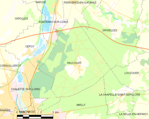
Shares border with regions:


Fontenay-sur-Loing
- commune in Loiret, France
- Country:

- Postal Code: 45210
- Coordinates: 48° 6' 15" N, 2° 46' 27" E


- GPS tracks (wikiloc): [Link]
- Area: 9.73 sq km
- Population: 1730
- Web site: [Link]


La Chapelle-Saint-Sépulcre
- commune in Loiret, France
- Country:

- Postal Code: 45210
- Coordinates: 48° 1' 4" N, 2° 50' 40" E


- GPS tracks (wikiloc): [Link]
- Area: 6.21 sq km
- Population: 244


Châlette-sur-Loing
- commune in Loiret, France
- Country:

- Postal Code: 45120
- Coordinates: 48° 0' 42" N, 2° 44' 9" E


- GPS tracks (wikiloc): [Link]
- Area: 13.13 sq km
- Population: 12790
- Web site: [Link]


Amilly
- commune in Loiret, France
- Country:

- Postal Code: 45200
- Coordinates: 47° 58' 23" N, 2° 46' 13" E


- GPS tracks (wikiloc): [Link]
- Area: 40.26 sq km
- Population: 12680
- Web site: [Link]


Griselles
- commune in Loiret, France
- Country:

- Postal Code: 45210
- Coordinates: 48° 4' 43" N, 2° 49' 45" E


- GPS tracks (wikiloc): [Link]
- Area: 30.32 sq km
- Population: 804


Ferrières-en-Gâtinais
- commune in Loiret, France
- Country:

- Postal Code: 45210
- Coordinates: 48° 5' 25" N, 2° 47' 23" E


- GPS tracks (wikiloc): [Link]
- Area: 27.32 sq km
- Population: 3646
- Web site: [Link]


Cepoy
- commune in Loiret, France
- Country:

- Postal Code: 45120
- Coordinates: 48° 2' 47" N, 2° 44' 13" E


- GPS tracks (wikiloc): [Link]
- Area: 8.52 sq km
- Population: 2354
- Web site: [Link]
