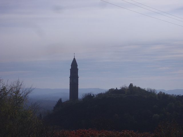
Andrate (Andrate)

- Italian comune
 Hiking in Andrate
Andrate is a charming town located in the Piedmont region of Italy, nestled in the foothills of the Alps. It offers a variety of hiking opportunities for both beginners and experienced hikers, with trails that showcase stunning landscapes, lush forests, and panoramic views of the surrounding mountains.
Popular Hiking Trails in Andrate:
-
Sentiero del Lago di Campagna: This is a scenic trail that leads to the beautiful Lake Campagna. It's suitable for families and offers a relatively gentle hike, making it accessible for hikers of all skill levels. Along the way, you'll find picturesque views and opportunities for birdwatching.
-
Trail to the Colle della Serra: This trail is a bit more challenging and is ideal for experienced hikers. It offers breathtaking views of the surrounding Alpine peaks and takes you through diverse landscapes, including dense forest and rocky outcrops.
-
Parco Naturale dei Laghi di Avigliana: While not directly in Andrate, this nearby natural park offers extensive hiking trails around the Avigliana Lakes. It’s perfect for those looking to explore natural beauty, with opportunities for picnicking and wildlife spotting.
Hiking Tips:
-
Check the Weather: The weather in the mountains can change quickly. Be sure to check the forecast before heading out and dress accordingly.
-
Stay Hydrated: Carry enough water, especially during warmer months, and take regular breaks to stay hydrated.
-
Wear Proper Footwear: Hiking boots with good grip are essential, as many trails can be rocky or uneven.
-
Local Maps: It's advisable to carry a detailed map of the area or a GPS device, as trail markers can be sparse in some regions.
-
Respect Nature: Follow the Leave No Trace principles by staying on marked trails, taking your trash with you, and respecting wildlife.
Additional Information:
-
Guided Tours: If you're unfamiliar with the area, consider joining a guided hiking tour to learn more about the local flora and fauna from an experienced guide.
-
Cultural Aspects: Don't miss the opportunity to explore Andrate itself, which features quaint architecture and local food specialties. It's also a great way to experience the culture of the Piedmont region.
Overall, hiking in Andrate provides a fantastic way to enjoy the natural beauty of the Italian Alps while immersing yourself in the local culture. Whether you’re looking for a leisurely walk or a challenging trek, Andrate has something to offer for every nature enthusiast!
- Country:

- Postal Code: 10010
- Local Dialing Code: 0125
- Licence Plate Code: TO
- Coordinates: 45° 32' 0" N, 7° 52' 0" E


- GPS tracks (wikiloc): [Link]
- AboveSeaLevel: 820 м m
- Area: 9.31 sq km
- Population: 494
- Web site: http://www.comune.andrate.to.it/
- Wikipedia en: wiki(en)
- Wikipedia: wiki(it)
- Wikidata storage: Wikidata: Q9003
- Wikipedia Commons Gallery: [Link]
- Wikipedia Commons Category: [Link]
- Freebase ID: [/m/0g353r]
- GeoNames ID: Alt: [6537008]
- OSM relation ID: [45236]
- MusicBrainz area ID: [55341eac-183c-4ce8-8136-80a821f137d1]
- TGN ID: [1043215]
- ISTAT ID: 001010
- Italian cadastre code: A282
Shares border with regions:


Settimo Vittone
- Italian comune
Hiking in Settimo Vittone
Settimo Vittone is a charming village located in the Aosta Valley region of Italy, nestled in the foothills of the Alps. It offers a variety of hiking opportunities that cater to different skill levels and preferences. Here are some highlights and tips for hiking in and around Settimo Vittone:...
- Country:
- Postal Code: 10010
- Local Dialing Code: 0125
- Licence Plate Code: TO
- Coordinates: 45° 33' 0" N, 7° 50' 0" E
- GPS tracks (wikiloc): [Link]
- AboveSeaLevel: 280 м m
- Area: 23.26 sq km
- Population: 1546
- Web site: [Link]
Donato, Piedmont
- Italian comune
Hiking in Donato, Piedmont
Donato, located in the Piedmont region of Italy, is a charming destination for hiking enthusiasts. Here are some key points about hiking in the area:...
- Country:
- Postal Code: 13893
- Local Dialing Code: 015
- Licence Plate Code: BI
- Coordinates: 45° 32' 0" N, 7° 52' 0" E
- GPS tracks (wikiloc): [Link]
- AboveSeaLevel: 711 м m
- Area: 12.07 sq km
- Population: 707
- Web site: [Link]


Borgofranco d'Ivrea
- Italian comune
Hiking in Borgofranco d'Ivrea
Borgofranco d'Ivrea, located in the province of Turin in the Piedmont region of Italy, offers some beautiful hiking opportunities, especially for those looking to explore the scenic beauty of the Canavese region. Here are some highlights and tips about hiking in this area:...
- Country:
- Postal Code: 10013
- Local Dialing Code: 0125
- Licence Plate Code: TO
- Coordinates: 45° 31' 0" N, 7° 52' 0" E
- GPS tracks (wikiloc): [Link]
- AboveSeaLevel: 253 м m
- Area: 13.42 sq km
- Population: 3690
- Web site: [Link]

Chiaverano
- Italian comune
Hiking in Chiaverano
Chiaverano is a charming town located in the Canavese region of northern Italy, close to the foothills of the Alps. This area offers a blend of natural beauty, cultural heritage, and a variety of hiking opportunities for enthusiasts of all levels....
- Country:
- Postal Code: 10010
- Local Dialing Code: 0125
- Licence Plate Code: TO
- Coordinates: 45° 30' 0" N, 7° 54' 0" E
- GPS tracks (wikiloc): [Link]
- AboveSeaLevel: 329 м m
- Area: 12.02 sq km
- Population: 2073
- Web site: [Link]


Nomaglio
- Italian comune
Hiking in Nomaglio
Nomaglio is a beautiful municipality located in the Piemonte region of Italy, particularly within the Aosta Valley area. It is known for its stunning landscapes, characterized by rolling hills, lush forests, and panoramic views of the surrounding mountains. Hiking in Nomaglio offers a fantastic opportunity to explore its natural beauty and enjoy outdoor activities....
- Country:
- Postal Code: 10010
- Local Dialing Code: 0125
- Licence Plate Code: TO
- Coordinates: 45° 32' 0" N, 7° 52' 0" E
- GPS tracks (wikiloc): [Link]
- AboveSeaLevel: 575 м m
- Area: 3.07 sq km
- Population: 281
- Web site: [Link]