Ansost (Ansost)

- commune in Hautes-Pyrénées, France
- Country:

- Postal Code: 65140
- Coordinates: 43° 25' 59" N, 0° 6' 39" E


- GPS tracks (wikiloc): [Link]
- Area: 2.2 sq km
- Population: 56
- Wikipedia en: wiki(en)
- Wikipedia: wiki(fr)
- Wikidata storage: Wikidata: Q780055
- Wikipedia Commons Category: [Link]
- Freebase ID: [/m/03nv2ck]
- Freebase ID: [/m/03nv2ck]
- GeoNames ID: Alt: [6613073]
- GeoNames ID: Alt: [6613073]
- SIREN number: [216500132]
- SIREN number: [216500132]
- BnF ID: [152703950]
- BnF ID: [152703950]
- INSEE municipality code: 65013
- INSEE municipality code: 65013
Shares border with regions:


Monfaucon
- commune in Hautes-Pyrénées, France
- Country:
- Postal Code: 65140
- Coordinates: 43° 27' 7" N, 0° 6' 58" E
- GPS tracks (wikiloc): [Link]
- Area: 10.38 sq km
- Population: 215


Liac
- commune in Hautes-Pyrénées, France
- Country:
- Postal Code: 65140
- Coordinates: 43° 24' 52" N, 0° 5' 56" E
- GPS tracks (wikiloc): [Link]
- Area: 4.17 sq km
- Population: 199


Ségalas
- commune in Hautes-Pyrénées, France
- Country:
- Postal Code: 65140
- Coordinates: 43° 24' 30" N, 0° 7' 41" E
- GPS tracks (wikiloc): [Link]
- Area: 5.97 sq km
- Population: 84

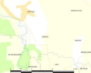
Gensac
- commune in Hautes-Pyrénées, France
- Country:
- Postal Code: 65140
- Coordinates: 43° 25' 55" N, 0° 5' 3" E
- GPS tracks (wikiloc): [Link]
- AboveSeaLevel: 197 м m
- Area: 3.44 sq km
- Population: 109


Barbachen
- commune in Hautes-Pyrénées, France
- Country:
- Postal Code: 65140
- Coordinates: 43° 26' 2" N, 0° 7' 32" E
- GPS tracks (wikiloc): [Link]
- Area: 3.04 sq km
- Population: 55